Tags
Burr Trail, Capitol Reef National Park, Grand Staircase/Escalante National Monument, LDS, Mormon Tabernacle Choir, Provo, Salt Lake City, Scenic Byway 12, Utah
The US Department of Transportation, Federal Highway Administration lists Utah Route 12 as one of America’s Scenic Byways. We had begun our traverse of the 124 mile long route with Bryce Canyon located at mile marker 13 (see the last post) and were now ready to continue on.
After Bryce, Route 12 slides in and out of Grand Staircase-Escalante National Monument. We stopped at the Escalante Heritage Center which has an interesting display about not only the town of Escalante but the 1880 Mormon pioneer expedition from Escalante to Bluff, Utah referred to as the Hole in the Rock Expedition.

This is a painting depicting the descent through Hole In The Rock that the Mormon pioneers blasted and built creating the gap that allowed them to continue on their way to Bluff, Utah. No one was lost. It was an incredible feat.
At mile marker 70 we stopped and marveled at the slick rock at Head of the Rocks Overlook.

The term, slick rock is attributed to cowboys because shod horses hooves would slip on the bare rock and sometimes they would go down. Crossing, particularly when wet, is very precarious whether on horseback or in a wagon.

The CCC spent 5 years building a road through here parts of which are now RT. 12. It’s known as the Million Dollar Highway because of the backbreaking labor and tons of dynamite used to blast through the slickrock terrain.
Just about five more miles down the road we stopped to enjoy the amazing views over the deep canyon of the Escalante River and a bit further on, down into Calf Creek where I hope to someday hike up to the falls.
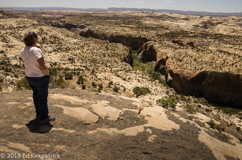
The trail Marti hopes to hike someday is visible in the bottom of the canyon.
I had done my research as well as I could and assured Ed we could and should leave Scenic 12 and do the Burr Trail Road which crosses Grand Staircase-Escalante to Capitol Reef National Park. So at Boulder (AKA Boulder Town), we turned onto Burr Trail Rd where just a few miles in there was the 7 site BLM (Bureau of Land Management) Deer Creek Campground. Technically (according to their listing) we wouldn’t fit, but hey, it’s us so we “pushed and shoved” and JUST fit into spot #5 🙂
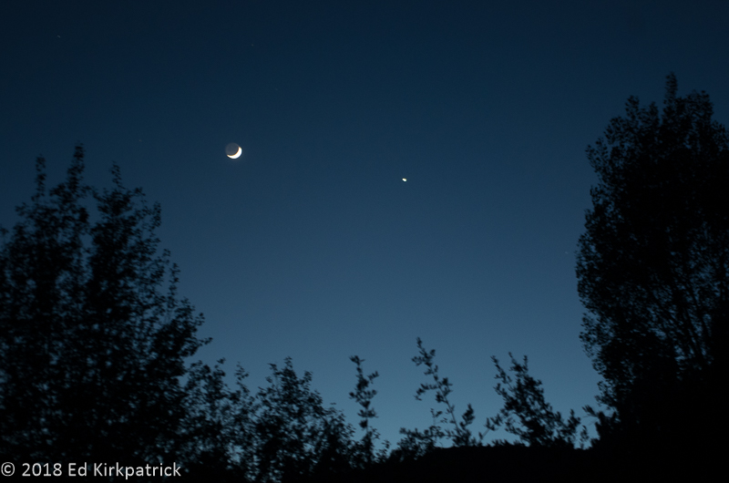
The Moon and Venus delighted us that evening but the mosquitos soon drove us back inside. The creek was right behind us.
What a wonderful road! Paved and basically empty of other vehicles Burr Trail Rd heads down through The Gulch into beautiful Long Canyon.

Top of the Gulch headed down into Long Canyon on the Burr Trail road.
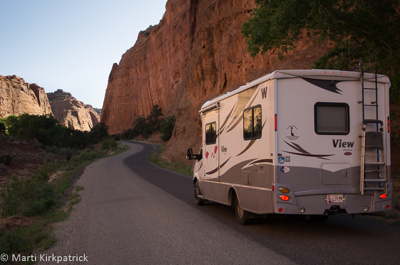
Down inside the wonderful Long Canyon.
We saw an opening in the cliffs and stopped to walk back a short slot canyon. Meeting a couple on the way out we were told it was called Singing Canyon which fit the effects we’d discovered already 🙂
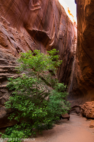
Headed back into the slot of Singing Canyon.

… looking back out to Long Canyon. Ed had lots of fun chatting with the Goddess Echo.

The landscape opens up outside of Long Canyon.

The Henry Mountains and the Water Pocket Fold before them as we cross into Capitol Reef National Park where the Burr Trail road turns to dirt.
Coming out of the canyon it’s not much farther to the border between GS-ENM and CRNP where the pavement stops. The dirt road looked good and a nice Canadian couple we had chatted with the night before had said the entire road was fine, and well…it is us… so we continued on.
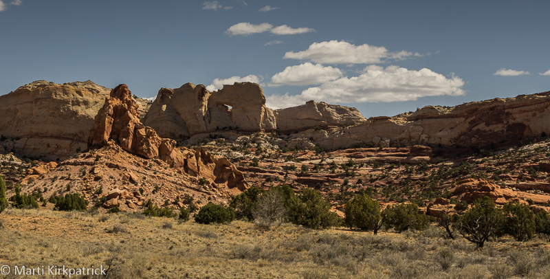
Today the hole in Peek-a-boo Rock is kept company by a sunspot of light. 🙂

This should have been our first clue things were going to go downhill from here.
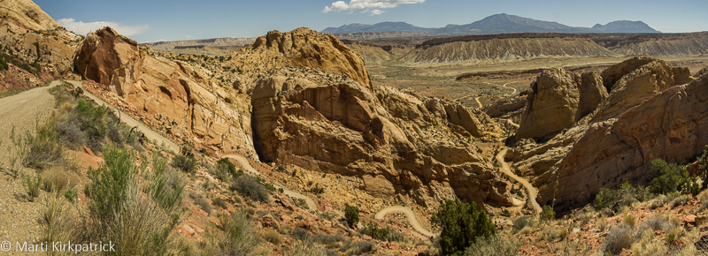
800 feet down in just 1/2 a mile on slippery gravel and Marti had every confidence in Ed. Of course, we didn’t know he had a detached retina in his right eye… just knew that things were not as clear as they might have been.
At the bottom of the Burr Trail Switchbacks, one can go left (Notom) or right (Bullfrog) on the Notom – Bullfrog Rd. The Burr Trail continues right towards Bullfrog and Lake Powell and most folks actually go this way. We went left because the road would eventually take us to where we wanted to be for the night. If one looks at the various websites both official and personal the road is “well maintained”, “only accessible by passenger cars”, “VERY rough”, “not recommended for RV’s”, and “impassable when wet”.

We had a spectacular day for this drive but as can so often happen…
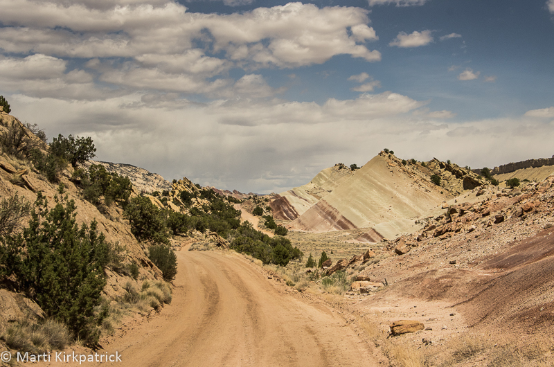
…the clouds suddenly appeared ominous from the West and the road was, to put it politely, crap. Ed cursed the Canadian fellow many times but Marti thinks he was mistaken and had turned the other way to Bullfrog. We still had over 30 miles to go.
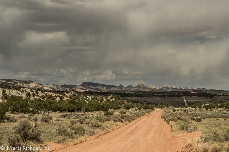
And the storm continued to build. Marti kept wanting to stop. Ed, remembering the “impassable when wet” part, was thinking about how much trouble we would be in if it actually started to rain.
Out of the backcountry of Notom Road and on Rt. 24 the RV campgrounds in the towns of Fruita and Torrey were full but a nice lady at one told us about tiny Sunglow Campground in the Fishlake National Forest a few miles further west near Bicknell.

Sunglow Campground. We made it!
Happily, we did manage to get the nowhere near level, but very nice, second to the last spot. The last spot was taken by a couple of delightful Dutch kids, Christine, a gastroenterologist and Jacob-Jan, a physicist. We really enjoyed talking with them over a couple of beers the two nights we were camped here.
Next morning we wanted to finish up the bit of the road we’d skipped doing the Burr Trail and so headed back towards Torrey and south on Scenic 12.

Rt. 12 south heading for Boulder Mountain and the Dixie National Forest.
Here the road climbs Boulder Mountain in Dixie National Forest and because of the extra altitude, 9,606’ at the top of the road (the actual top is 11,313’) and the pine and aspen this area has an entirely different landscape…

At the summit, the forest opens up and the view back to Boulder, Burr Trail Road and Long Canyon is spectacular.
Bright and early the next morning we packed up and headed back down to Fruita and the visitor center.

The Fluted Wall on Rt. 24 west of Fruita, Utah.
This is the most known/visited part of Capitol Reel and from here we did the paved Scenic Drive.

EPH Hanks Tower at the end of the paved road on Scenic Drive.
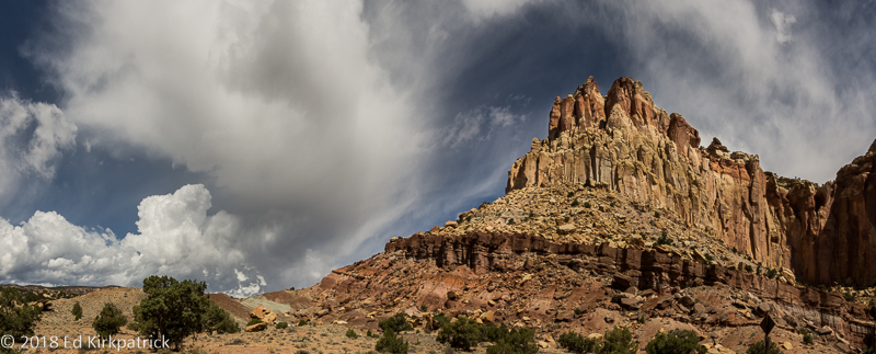
This particular morning the clouds and approaching storm were almost more spectacular than the landscape.

Scenic Drive in Capitol Reef National Park.
It was on this drive that Ed admitted his eye/vision was pretty bad and the better part of discretion was to head for Provo and Salt Lake City where there would be eye specialists.

And that is what we did. Through the rain and the clouds across Utah on Rt. 89 to Provo. Just an incredibly beautiful state. In fact, just put the entire state on your MVL, (Must Visit List).
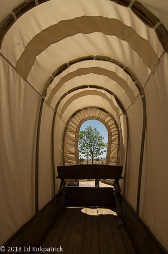
Inside a Mormon wagon. Can you imagine traveling through this part of the world with this view?
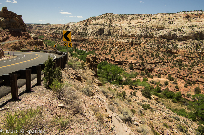
Scenic 12 outside of Escalante, Utah.

Marti calls these green river snakes.
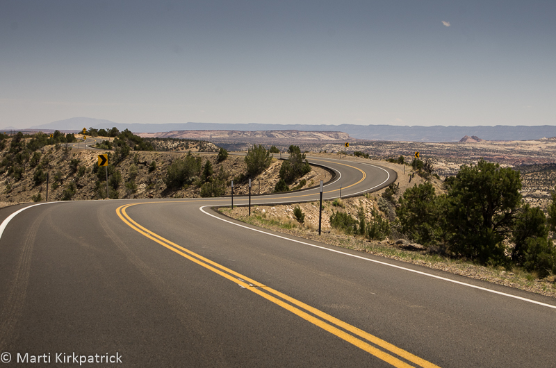
The Hogback at MM80 on Scenic 12. You will note the lack of shoulder or railing.
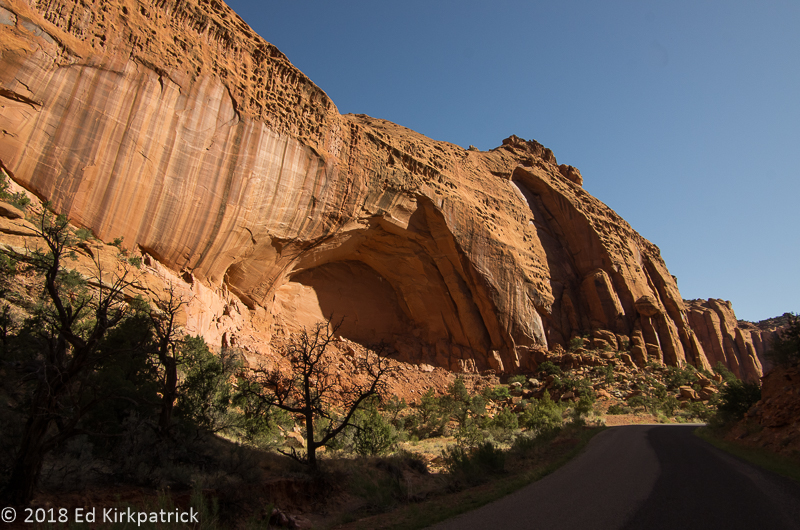
Inside Long Canyon.
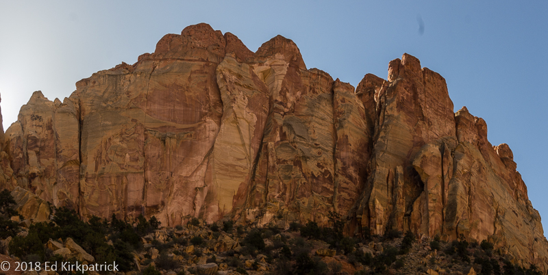
Geological canvas abstract painting.

Notice how the aspens are at all different stages of leafing out. That’s because each grove is a single organism connected by roots underground and consequently each grove has its own timeline for waking up.
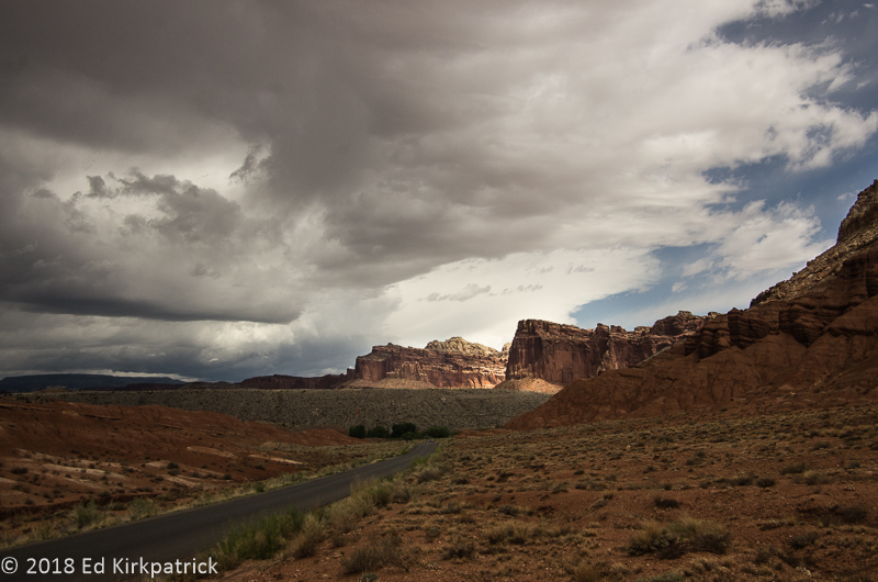
Heading back up the Scenic Road to leave for Provo… It started raining just as we left the park and rained all the way across the state.

After Ed’s eye surgery, we went up to Salt Lake City for two weeks. The streetcar stop was right outside the KOA so going in to Temple Square and city center was very easy. This is the Mormon Temple reflected in the pool in the gardens.

Thursday evenings the Mormon Tabernacle Choir’s rehearsal is free and open to the public. We had a lovely dinner at Caffe Molise then walked over and thoroughly enjoyed this amazing choir. Marti says if we lived here she would be here every Thursday.

Not a headache. Not disgusted, but under doctor’s orders to rest his eye by looking down for a while. All in all, we really liked Salt Lake City not to mention beautiful Utah. We will be back!


Each time that I read your well written articles on your travels my horizons are expanded exponentially. I love your photography and the tid bits of trivia that you add. For examble I had no idea about the Aspens unique root system. Some of those stems looked ominous. Glad all went well and thanks for sharing your fascinating adventure!
LikeLike
Thank you James! Marti researches and writes, I photograph, as Marti says, sometimes she gets some good shots and we edit the post together. We love that you enjoy it so much. It makes the work worthwhile.
LikeLike
Wow!…Ed and Marti…you have us looking at RV’s with these incredible journals! Thanks…you need to get to Michigan – some of the prettiest places on Earth are in Northern West MI…
On Tue, Jul 24, 2018 at 5:40 PM Whack-A-Mole Wheels wrote:
> Ed and Marti Kirkpatrick posted: “The US Department of Transportation, > Federal Highway Administration lists Utah Route 12 as one of America’s > Scenic Byways. We had begun our traverse of the 124 mile long route with > Bryce Canyon located at mile marker 13 (see the last post) and were now ” >
LikeLike
Again, love the scenery but you two are braver then us…..Hope Ed your eye is better. take care…
LikeLike
Your reports from the open country are so evocative; you bring the vastness and beauty of the west into a revealing perspective for us, your followers along your journey of discovery. Health and happiness (and a few beers) all around. Thank you guys for sharing your adventures!
LikeLike
I wish you would give me an “30 day advance notice” so I could join you for a few days somewhere…..Heck, I’ll bring wine and vodka.
LikeLike
Hey! Wonderful writing as usual and the pictures aren’t bad either. Can you please add Mike to your Blog List? His email address is goshenbudo@gmail.com. Thanks and keeps on Truckin! Love you both. BooBoo and Mike
Sent from my iPad
>
LikeLike
I must say seeing all your photos draws me in! You two are truly living a dream! Enjoy every minute and thank you for sharing with us! XO
LikeLike
Loved seeing all of the photos showing your adventures. Keep having fun. We are nearing the end of a fabulous journey in Iceland. Margaret
Sent from my iPhone
>
LikeLike
WOW! What a great segment of your never ending fabulous journey….you all are amazing!! Thanks for sharing.
LikeLike
Always love to read about your travels, Ed and Marti, and love the breathtaking photographs. We considered doing what you’re doing when we retired, but opted for beach life in Wilmington, NC, instead. (We did visit the Hoover Dam and Grand Canyon this summer.) We admire what you’re doing so much. Hope your eye is doing well, Ed! Please visit us if you come down this way. The ocean hear is lovely.
Marlene (AT&T/Sterling)
LikeLike
The ocean here!
LikeLike
Wow…great !!👍👍👍👍👍
LikeLike