Tags
Antelope Flats, Bison, Geysers, Grand Teton National Park, Jackson Hole, Tatonka, Wyoming, Yellowstone National Park
OKEY DOKEY, after Dinosaur National Monument the plan was to finally go to this Fall’s main destination of Moab, Utah for Arches and Canyonlands and points south. The route I had worked out included a slight bump over to Grand Junction, Colorado to do the Colorado National Monument Rim Rock Drive. I had just finished jotting down route numbers and potential campsites when my dear husband says, “Uh oh! I just looked at the weather and it’s gonna be 90 plus degrees in Grand Junction!! I think we should go north!”
“OKEY DOKEY,” says I, “where’d you have in mind?”
“I don’t know” says he.
“Well, what the heck, you’ve still not seen the Tetons or Yellowstone and maybe the crowds are just bad, not horrible, whatdaya think? It will certainly not be 90 degrees!”
“Sure, why not?” was Ed’s answer. Soooooo, I plotted a route north 😊
With a stop in Vernal, Utah to do laundry at West End Laundromat & Cleaners (highly recommended), we headed north on US RT. 191 which goes through Ashley National Forest and close to Flaming Gorge National Recreation Area where we’re into Wyoming again. This bit of 191 is lovely and has the unique and fun benefit of posted signs denoting the geological layer and the type of fossils associated with that time period.
To stay with 191 North you have to pop on Interstate 80 East for a bit, then back onto 191 where the pretty countryside becomes barren, flat and windy. Eventually, however there are mountains in the distance and their snowcapped beauty is welcomed. Just south of Boulder, WY near the Wind River Mountains we stopped for the night at Highline Trail RV Park where we dry camped as the park was full (mostly permanent/workers but clean, nice and recommended).

Pretty evening at Highline Trail RV Park.
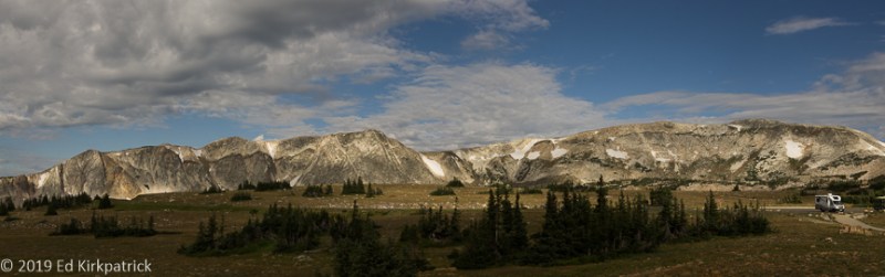
The next morning, Ed got his temperature change….it was 48* in the rig! OKEY DOKEY, where’s my fleece 😉 Pretty quickly as we headed north into Bridger – Teton National Forest it really becomes lovely especially when the road starts to follow the Hoback River.
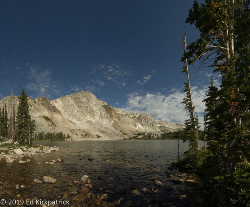
I have mentioned in other blog postings memories of my family’s trip west in 1962. The Grand Tetons were one of the spots I have held dear in my mind’s eye from that 5 week vacation and I had been feeling some trepidation about seeing these special places years later when everything is so crowded. Of course, the first place one comes to on US191 is Jackson, the sort of ski-town-touristy place Ed and I generally avoid. It was PACKED and as we continued on I had all fingers crossed. Sure enough, just as I remember, as we came up the valley, one can’t see the mountains……until one can, and there they are in all their glory!
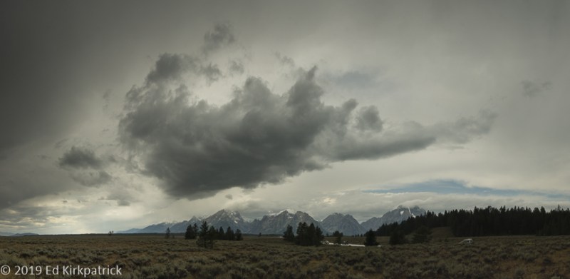
Le Grand Teton and Ed’s right, a stormy sky makes for nice pictures.
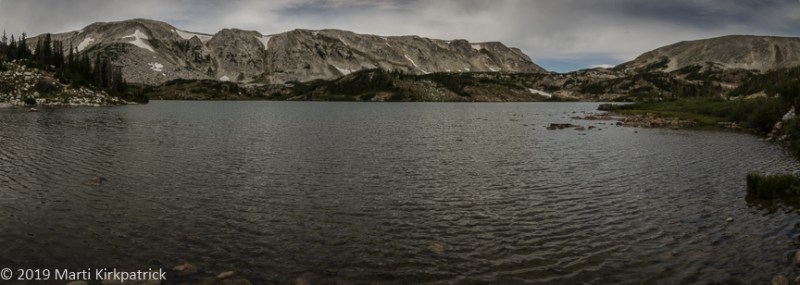
The Colter Bay National Park Service Campground is at the northern end of Grand Teton National Park, and being first come, first served it was our only shot at staying because as expected everything reservable, campground or lodge was booked. We headed straight there and yippee, got a very nice spot. Next up, late lunch at the John Colter Ranch House Restaurant next to the campground. We highly recommend this place, very good food, and the best breakfast potatoes I’ve ever had!
The weather was not ideal, but we never let that stop us as we went on out for a drive, and guess what we found…

Tatonka! Isn’t he handsome?
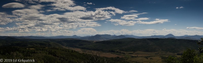
Next day the weather was really crappy rainy again so we headed out of the park and up US 26/287 into Bridger Teton National Forest.

At about 8200 feet, the rain turned slushy. At 8400 feet it was snowing hard and sticking. We decided to turn around.

…and back down at the Tetons, it was just dreary but dramatic.
Not wanting to stop I suggested we drive the 31 miles on up to Yellowstone. We stopped at Grant Campground where the very nice lady searched and found a single night cancellation for a single site for the next night! I booked it, and we headed back to GT and the Ranch House for dinner.
After rain off and on all night we woke to some sun and headed off for Yellowstone where we checked into the campground before heading to Old Faithful.
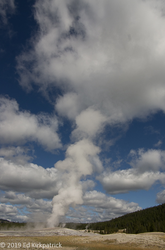
Old Faithful was on time and considerably more crowded that when Marti was here in 1962. After watching Old Faithful, we headed up the path of the Upper Geyser Basin.

Molten rock or magma may be as close as three to eight miles underground and this magma provides the first ingredient for these thermal features – heat. Water provided by rain and snow is the second. It seeps down several thousand feet where it is heated. The third ingredient is the underground cracks that provide a natural “plumbing” system. The superheated water rising through these cracks produces hot springs and geysers.

Grand Geyser is in our opinion considerably more magnificent than Old Faithful. Grand is the tallest predictable geyser in the world. A classic fountain geyser, an eruption can last nine to twelve minutes and reach heights of 200 feet.
After a long day, back at the campground, where, with lots of careful back & forth and a pile of LEGO blocks we got level and settled in for Happy Hour. 😊
The next morning we packed up and got up the road early because our only hope for a campsite was to be in line for the first-come, first-served Norris Campground where sites are often gone by 9AM or sooner. Once again, yippee, we got a site (and it only took 6 blocks high on the right and 5 high on the left to level)!
Today’s hikes were at the Norris Geyser Basin where we did both Back Basin and Porcelain Basin.

Norris Geyser Basin is the hottest, oldest, and most dynamic of Yellowstone’s thermal areas. The highest temperature yet recorded in any geothermal area in Yellowstone was measured in a scientific drill hole at Norris: 459°F just 1,087 feet below the surface! (NPS)
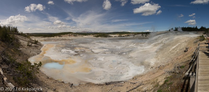
Porcelain Basin at Norris Basin. The murky blue pools are saturated with silica, the primary component of glass. The thermal waters here have the highest concentration of silica in Yellowstone Park.
NOTE: Yellowstone’s roads form a basic, irregular 8 with the top circle being smaller than the bottom circle. There are 5 “arm” roads that come into the “8”, being the South (from Grand Teton NP), West, North, Northeast, and East entrances.
From Norris Campground the next day’s drive was north to Mammoth Hot Springs. where parking is a bit of a joke, but after driving around a bit we did finally find a spot.
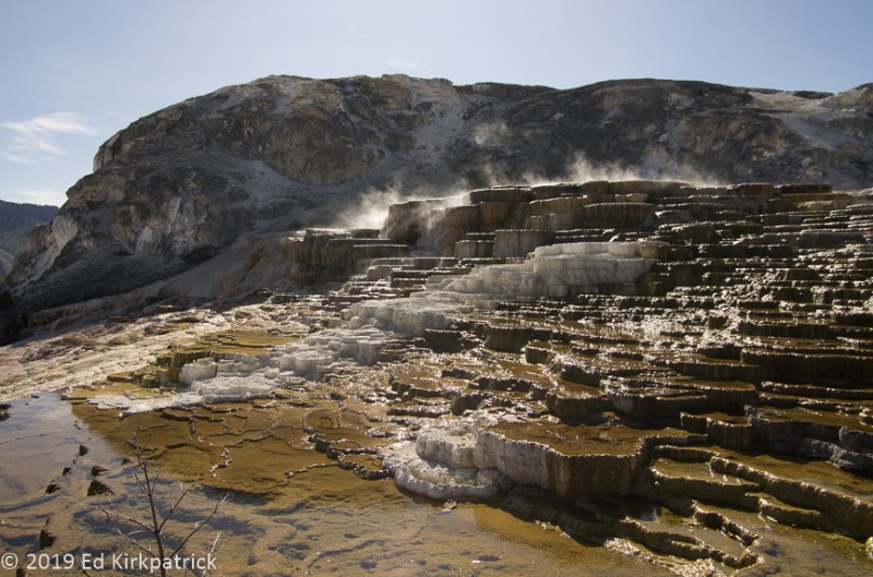
At Mammoth Hot Springs the hot water dissolves carbon dioxide forming a weak solution of carbonic acid (the same stuff that makes your soda pop fizzy). This solution rises through the limestone dissolving the calcium carbonate which is the primary component of limestone. At the surface, that calcium carbonate is deposited as travertine which is the rock that forms the terraces you see here.

The terraces here at Mammoth are shaped by the volume of water and the slope of the ground. Building up rapidly, travertine causes the features to change quickly and constantly.
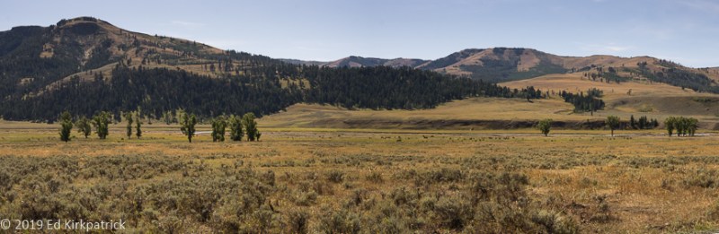
After enjoying the Hot Springs we continued on around clockwise to go out the Northeast arm into the Lamar Valley which is famous for its wildlife viewing and fishing in the Lamar River.
Lamar Valley where there are vast herds of Bison.
Backtracking out of Lamar we continued on clockwise through beautiful countryside on our way back to Norris.
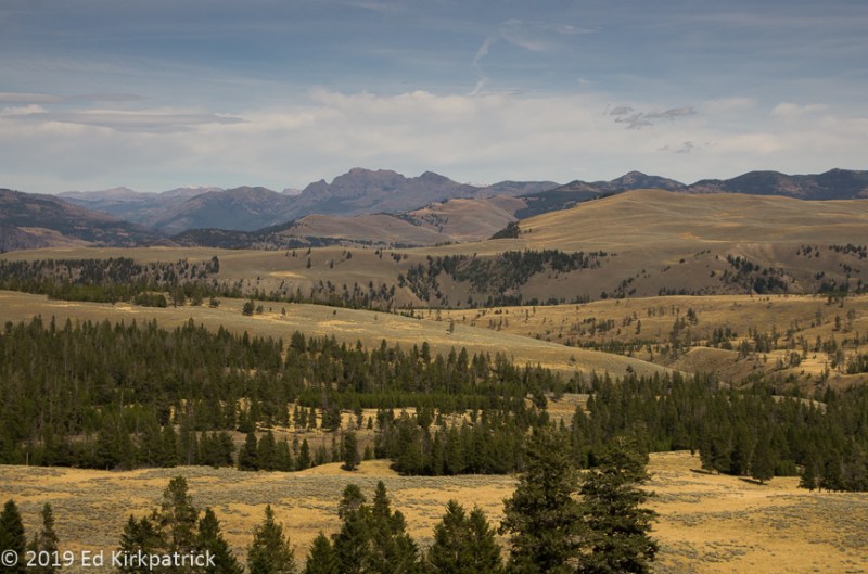
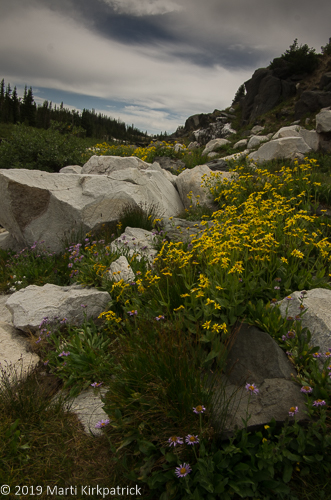
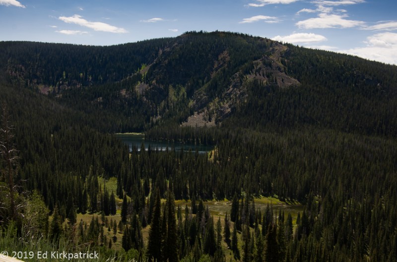
Away from hot springs and geysers, Yellowstone is even more stunningly beautiful.
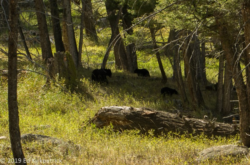
A black bear sow and her two cubs causing a traffic jam alongside the road. We also saw a mama grizzly and her second year cub but so far away we didn’t bother to take a picture.
In the morning we headed back south to Grand Teton where it was Sunday with beautiful weather and hence CROWDS and NO PARKING ☹. Not to worry, we drove out Antelope Flats to Gros Ventre Road where we found the Gros Ventre Slide!

Grand Teton in the sunshine out on Antelope Flats where the view with this old farmstead gives scale to the peaks and the way they just come straight up out of the plain.
On June 23, 1925, hurling down the slope at 50 mph, the mile-wide Gros Ventre Slide carried 50,000,000 cubic yards of debris down the mountain and then another 300 feet up the opposite slope. The Slide blocked the Gros Ventre River, and formed a five-mile long body of water. The rest of the story about the dam collapse and the destruction of the little town of Kelly can be found at this link. Be sure to read this.
OKEY DOKEY! It was crowded and we cannot begin to imagine what it’s like during the summer, but it was wonderful to see both of these amazing places. Absolutely put them on your MVL (Must Visit List) BUT, especially if traveling in your RV, bring your sense of humor, your patience and leveling blocks. OH, and do it on the shoulder months!
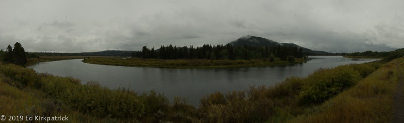
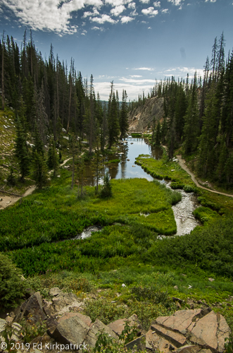
The Snake River and the Grand Tetons which are not visible.

Thermophiles, microorganisms ( algae, bacteria, and archaea) that thrive in hot temperatures give color to the water flowing over the rock. Different temps allow different thermophiles creating different colors. In 1966 a bacterium was discovered in a Yellowstone hot spring which contributed to DNA “fingerprinting” used in criminal and medical research.
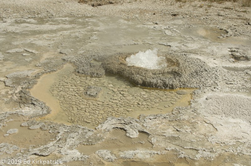
Beach Spring boiling furiously in Upper Geyser basin above Old Faithful.
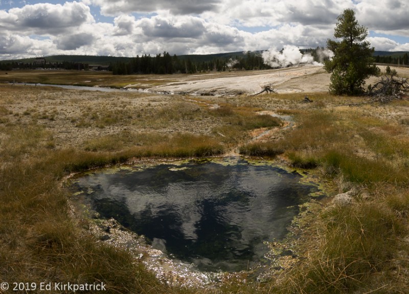
Upper Geyser Basin.

Spasmodic Geyser… We didn’t name it. It did not spasm while we were there.

At Grand Geyser, the spray and mist lays silica on the nearby trees which seeps into them killing the tree but preserving the wood.
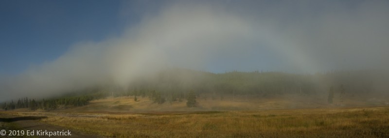
A rainbow forms in the steamy morning mist from the fumaroles in this Yellowstone meadow.
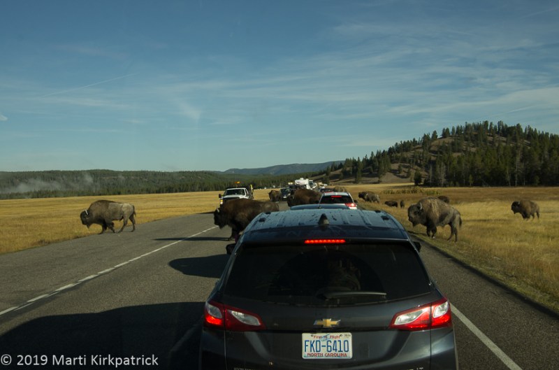
Yellowstone traffic jam and they are in charge and don’t care how long you have to wait.

Nymph Lake.

Travertine ridges at Mammoth Hot Springs.
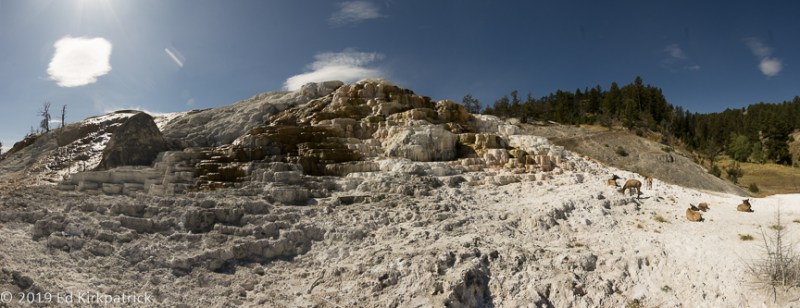
Elk in repose at Mammoth Hot Springs.

In the Lamar Valley, it’s a good idea to watch where you walk. Marti disavows this picture.

Waterfalls on the Yellowstone River at Calcite Springs.
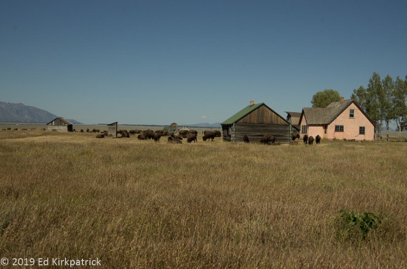
Backyard bison at Mormon Row on Antelope Flats.

The Grand Teton from an Aspen alley on Gros Ventre Road.

And that’s all folks! Bye bye!