
Tags
Alpine Texas, Big Bend National Park, Boquillas Mexico, Chisos Mountain Lodge, Davis Mountains, Ft. Davis Texas, Marathon Texas, Marfa Texas
UP FRONT WARNING…This is a LONG post but Ed’s photos are worth it!
In our travels we have often crossed & visited in Texas, and if you’ve ever done this you know how long the crossing can take 🙂 but we’ve not made it down to Big Bend until this April. Tucked down in the very bottom southwestern toe it’s a place you go to rather than happen through.
Coming from the east and with our timing putting us in the area headed into a weekend we decided to stay on US 90 over to ST RT 118 and Davis Mountain State Park for the night. Being noon when we came to the little town of Marathon we stopped for lunch at Oasis Café. Angie does her serious magic in the kitchen and Phoebe, who also does movie-extra work, is the fun waitress, hostess, cashier etc. Put this place on your MVL (Must Visit List) YUMMERS! Oh and come HUNGRY!
Davis Mountain State Park is nice enough although we did have to do some serious leveling. The drive around the Davis Mountains on 118 both to the park and beyond is lovely.
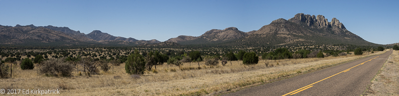
We asked some guys on the side of the road at a driveway but they didn’t know the name of the mountain either… pretty though. Basically, it’s the backside of Ft. Davis mountains.
We also walked the old Fort Davis National Historic Site which as one of the last and best remaining frontier forts was interesting. From 1854 to 1861 troops spent most of their time pursuing Comanches, Apaches and Kiowas and after the Civil War in 1867 until 1885 Buffalo Soldiers served here with distinction.
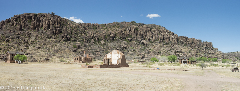
Ft. Davis was sited here because this is a box canyon that provided better defense and had water.
Oh and after you get all that exercise walking the fort stop at Caboose Ice Cream across the street, 2 scoops is almost more than one can eat 🙂
There are 3 paved roads into Big Bend National Park all going south from US 90: coming from the east, US 385 from Marathon (90 miles), State 118 from Alpine (81 miles) and from Marfa US 67 (129 miles).
Side note: Alpine is the biggest town and home to Museum of the Big Bend on the campus of Sul Ross State University. Go! It’s small and involves lots of reading but covers from fossil prehistory to today and is very interesting.
Actually, 67 goes to Presidio on the Texas-Mexico border where you hang a left onto 170 which goes to Big Bend Ranch State Park and then eventually to the bottom of 118 and Big Bend National Park! This is the route we took. Big Bend Ranch State Park’s webpage says “Welcome to the other side of nowhere” and they ain’t kidding 🙂 The road leading in goes through very poor country, 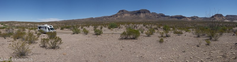 but it becomes impressive with incredibly huge steep mountains and in places on the Mexican side of the Rio Grande a natural sheer wall over 1,000 feet tall! The influence of the river offers sections of lush green but the overwhelming lack of moisture and heat draws a visible line where the desert takes over.
Mexico – Texas, Rio Grande River between us.
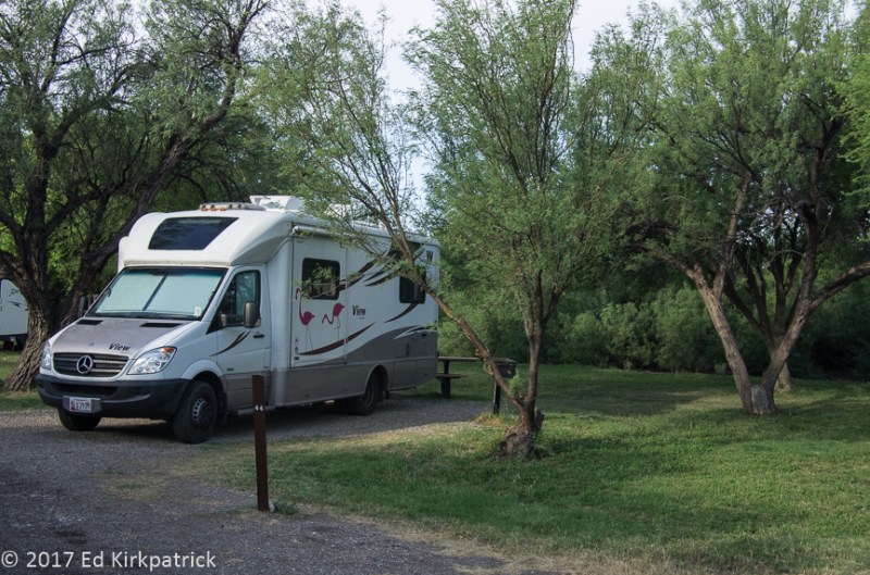
We set up camp for the next two nights at BJ’s RV Park in Terlingua, which lies between the two, state and national, Big Bend parks. No resort but hey, it works 🙂
I will interject an IMPORTANT NOTE here….after Presidio, if you drive a diesel there are only TWO places it can be had south of US 90; Terlingua/Study Butte and Panther Gap in the National Park. While we were there, Terlingua’s pumps were broken and one of the two at Panther Gap! WHEEEE!!
In Big Bend National Park and down the Ross Maxwell Scenic Drive we did the short walk out the Lower Burro Mesa Pour-off Trail.
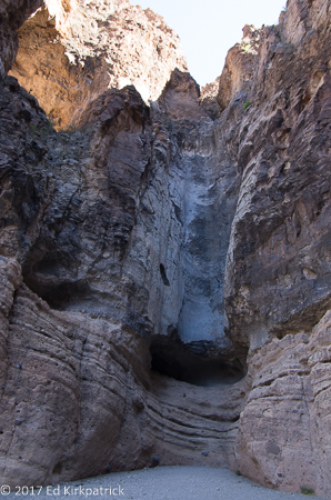
After a rainstorm, the water run-off would pour down and over that black edge. Not today…
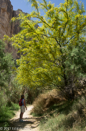
While it was disappointing although not surprising that there was no water to see we encountered a lovely intoxicating scent in the air and we had discovered the Desert Willow in bloom.
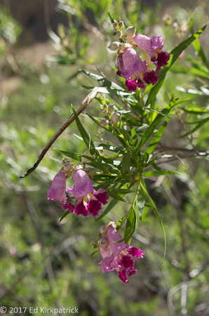
Lovely to see, magnificent to smell.
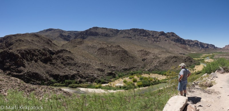
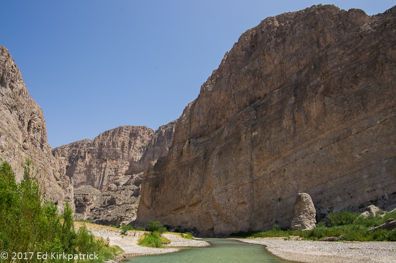
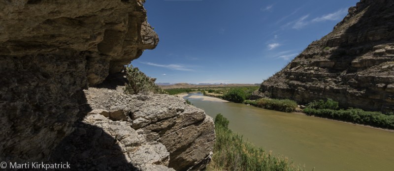
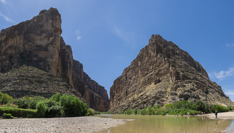
Driving on down to the end of Ross Maxwell Drive to Santa Elena Canyon we hiked the trail back along the Rio Grande River next to the sheer 1,500 ft. Mexican wall.

Mexico to the left of the gorge cut by the Rio Grande River and the USA to the right. The river flows out of the cut and turns to the left… Just astonishing.
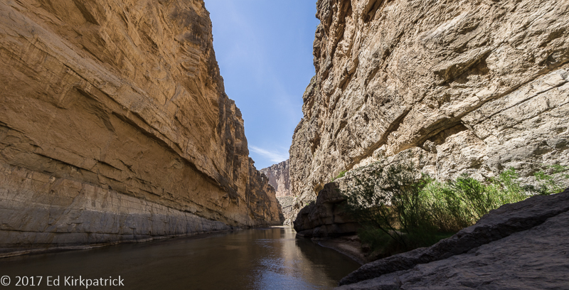
All the way in on the trail this was the end without getting wet. Many kayakers passed us paddling downstream.
Leaving BJ’s to actually camp inside Big Bend National Park we found a wonderful campsite at the Rio Grande Village where we dry camped in a site where we just fit but, it was mostly shady, lots of room around us, a back-in site on the outer row so nobody behind AND level…SCORE!
We were very happy here.
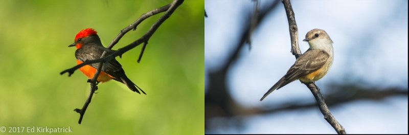
Vermillion Flycatchers… Mr. in his flamboyant color and Mrs. in her lovely subtle color had a nest directly over our picnic table. What beautiful and pleasant neighbors.
The eastern end of Big Bend is where the Rio Grande goes into the Boquillas (bo KEY yes) Canyon. The walk here has more shade and a nice breeze so we enjoyed our lunch next to the river before going back as far as possible.
Headed into the Boquillas Canyon hike. The Rio Grande is never very wide here. Mexico on the right, USA on the left.
Just about 7 miles from the trail at Boquillas Canyon there is the Boquillas Border Crossing, the only legal crossing in the 350 miles between Presidio and Del Rio. With a fenced, lockable road to the fenced, lockable building where a US Park Ranger has the duty of checking everyone’s passport, informing folks that the gates are closed at such and such time and that the only way across is to wade through the Rio Grande or for $5 round trip cash only, one of the Mexicans on the other side will row over, pick you up and take you across. Once on the other side, in Mexico, it’s a long dusty walk or for $5 a horseback ride or for $8 a pickup truck ride up to little Boquillas Del Carmen where tourists flock for breakfast or lunch and a visit to Mexico.

Many modes of transportation on the Mexican side of the river.
When you come back the Park Ranger inserts your passport into a special machine, you pick up the attached phone and answer the Border Patrol Agents questions while they observe you through their camera!
However, just back down at the Boquillas Canyon Trail there are little “stands” of trinkets displayed by the Mexicans who have just waded across the river to place their wares for American tourists to buy. There are signs and notices everywhere telling us not to buy these crafts as it encourages the illegal crossing of the Mexicans trying to make a buck.
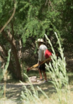
This Mexican gentleman just waded across the Rio Grande to sell his wares. He will go home to Mexico shortly. Seven miles down the road, Americans go through the Border Control Point ( which cost us $3.7 million to build) to have a bite to eat in Mexico and say we did.
As a treat we decided to stay for a night at the Chisos Mountains Lodge for our last night in Big Bend.
We just by happenstance got the very last room and it was in the old original and rustic section of rooms but it was charming.
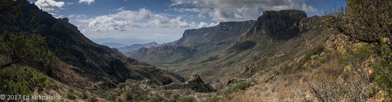
The Chisos Mountains being big mountains get a lot more rain than the surrounding desert and are strikingly beautiful. They are central in the park and the biggest draw for visitors, especially hikers.
Those bigass mountains are the Chisos in the early morning haze of changing weather.
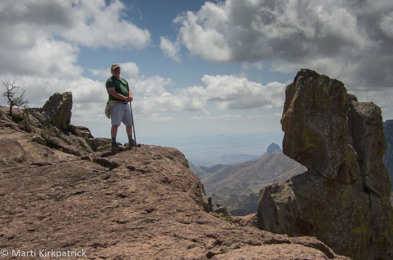
We hiked the wonderful Lost Mine Trail and had a fun conversation with a mom and her delightful son Luke, who goes to Pyle Middle School in Bethesda, Maryland…the same school Ed went to 50 years ago…it’s a small world 🙂
One of our views on the lower end of the Lost Mine Trail at about 6000 feet elevation.
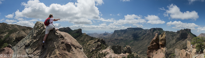
Marti at the very top. The next step is dowwwwwwn.
In all honesty we were not sure if we even wanted to bother with Big Bend. We were SO wrong! While a great deal of it is just incredibly poor, dry, empty desert, it is in many places incredibly beautiful and we enjoyed it very much……oh and the name….Yup….it is BIG!!! Do put in on your MVL.
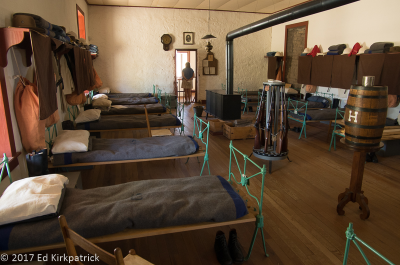
Inside the barracks of H Company at Ft. Davis.
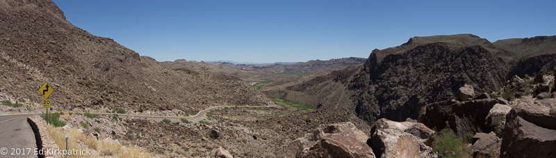
The ride through Big Bend Ranch State Park on 170. Really empty….
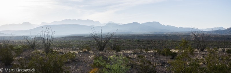
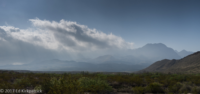
Humid hazy air, strange in the desert, plagued us photographically, but it’s still pretty.
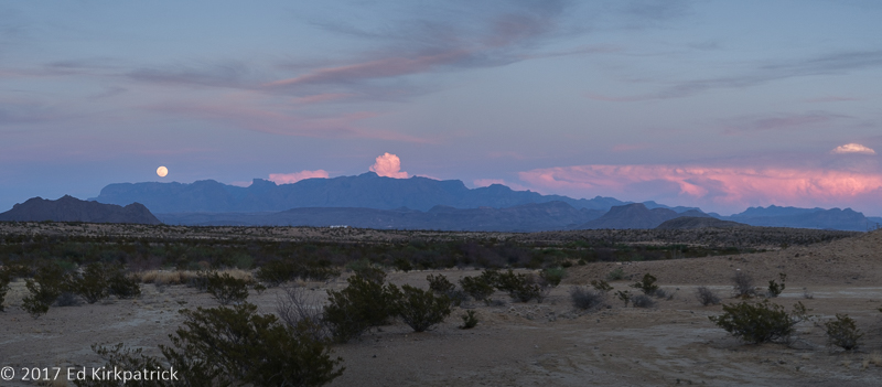
Moonrise of the full moon one evening at BJ’s RV Park in Terlingua.
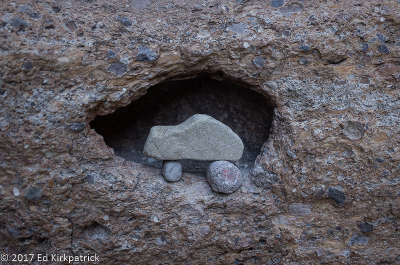
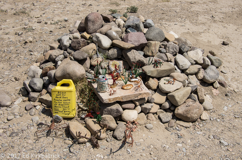
Some clever soul left a nice surprise in a niche at Lower Burro Mesa Pour-over trail.
The Palo Verdes in bloom on the trail in Santa Elena Canyon is also nearly as fragrant as the Desert Willow.
Marti took a side trip off the main trail in the Santa Elena Canyon while Ed rested in the cool shade. This is looking back out and downstream on the Rio Grande. Mexico is on the right.
At the mouth of Santa Elena Canyon, Ed waded to within inches of Mexico and risked a $5,000 fine if caught stepping across the border. Signs were posted warning not to do cross illegally.

The view back North from the Boquillas Canyon atop a short rise.
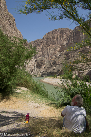
Pic-a-nicking on the Boquillas Canyon hike. Granola bars and an orange. No Chablis this time…
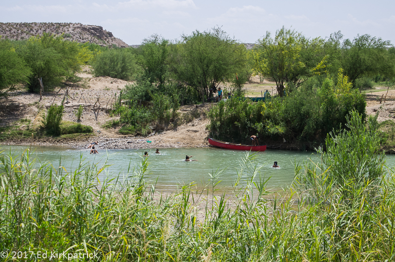
Mexican kids playing in the river. Looks like fun, but that would have ruined their day.

Pretty country.
Ed tempting fate once again. To paraphrase Ed in reverse to our son Kevin, “This is the last time I saw your Dad.”
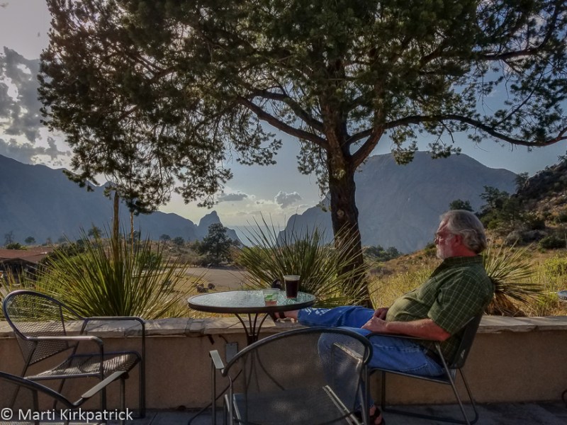
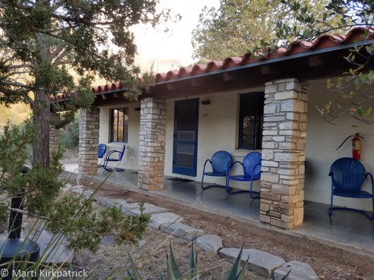
After a fabulous 5.6 mile hike on the Lost Mine Trail, a delicious pork chop dinner and a something chocolate dessert Ed finally relaxes on the porch at the Chisos Mountain Lodge. In the distance is the famous Window. Tourists come from everywhere to watch the sunset in the window’s notch.
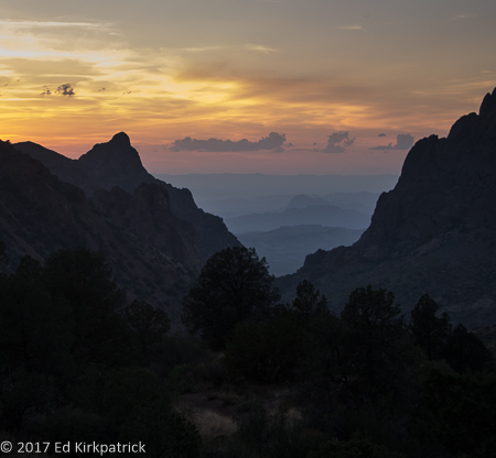
There is a much better view from just outside our rooms.


Beautiful!
LikeLiked by 1 person
Thanks. Amazing landscape, someplace I’ve never been.
LikeLike