
Tags
#Prescott Arizona, boondocking, Glen Canyon Dam, Lake Powell, Navajo Bridge, Navajo Generating Station, North Rim Grand Canyon, Page Arizona, Vermilion Cliffs
We had been to the South Rim of the Grand Canyon back in mid May of 2015 (if you don’t recall a blog post it’s because we didn’t get one done…sorry), and it had rained, hailed, thundered, sleeted and snowed on us all on the same day!
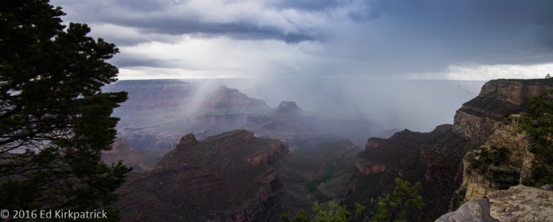
Craaaaazzzzzy weather at the South Rim in October 2015.
This being late October (2016), we knew the higher elevation North Rim would be closed up for the season, but Rt. 67, the road in, was still open and the views still there so we headed off. As expected there were very few people and the views were indeed beautiful.
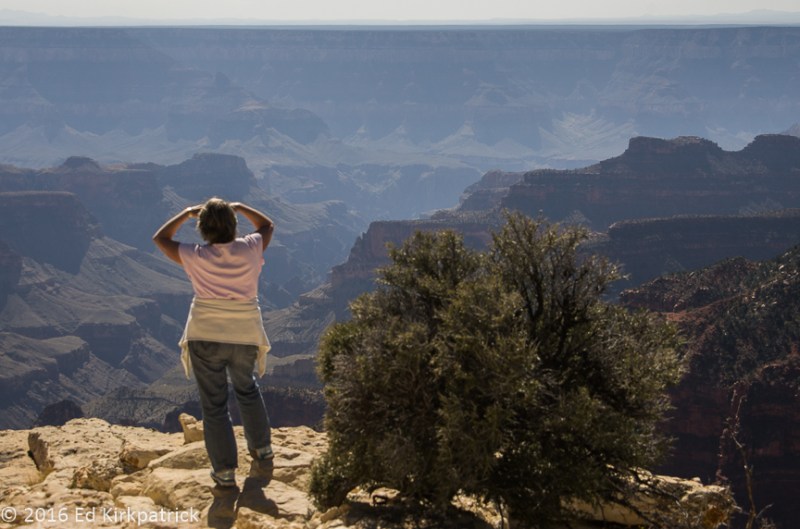
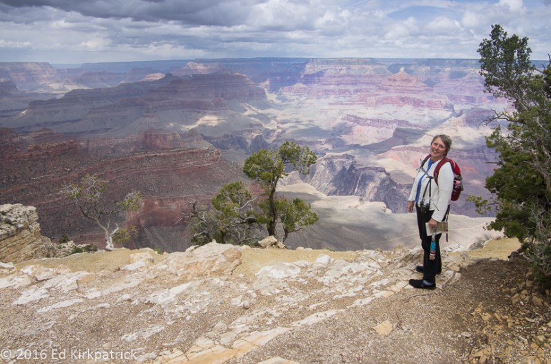
Marti in her classic pose at the North Rim of the Grand Canyon.
We have been delighted and amazed as we travel around the country how many folks say they grew up, went to school, have immediate family etc. in Maryland, particularly within the Frederick-Baltimore-DC metro-Eastern Shore area. While we were sitting trapped at the end of a point and waiting for a bunch of 20 somethings to finish their photos/viewing one asked where we were from. When we said Maryland, he points to a gal and says, “I think she’s from Maryland.” Turns out she graduated from the same high school a year after my niece Janetta!
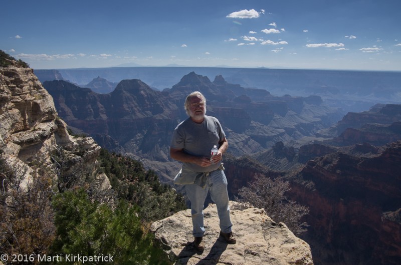
Anybody who knows me realizes this is a huge accomplishment to stand so near the edge. The very faint mountain peaks in the far distance are the San Francisco mountains at Flagstaff, Arizona 65 miles away as the crow flies.
With everything closed for the season we planned on boondocking (camping not in a designated campground, with no hook ups, often off the grid) somewhere outside the park in the Kaibab National Forest, (boondocking not being allowed in the park). I’d read that there were good places up FR22 so we headed up this pretty, decent dirt road. At about 9,000 feet we found a nice almost level spot where we could tuck back into the trees, and settled in.

Settled in for the night at 9,160 feet elevation in the Kaibab National Forest.
It was windy and high so we knew it was going to be cold but let me tell you the night sky…WOW!! We watched 6 satellites, one the Space Station, crossing the heavens, and the Milky Way literally stretched from horizon to horizon! Nice night 🙂
Next morning after a little walk about,

Just below our campsite for the night, this was our morning walk about.
we drove back out 67 to US89A heading to Page, AZ and Lake Powell. This beautiful drive past the deep red (iron oxide) Vermilion Cliffs and over the Colorado River’s Marble Canyon (the western boundary of the Navajo Nation) at Navajo Bridge should be on your MVL (Must Visit List).
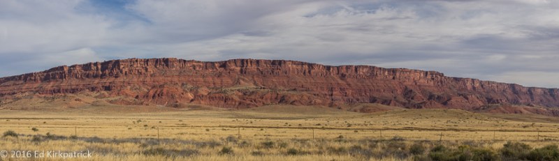
Vermilion Cliffs are full of spectacular rock formations which can only be seen by extensive backpacking.

Dedicated in 1929, the closer bridge is Navajo Bridge spanning the Colorado River . The farther bridge was opened in 1995. Navajo Bridge is now for pedestrians only. Vermilion Cliffs are in the distance.
We stayed at Page Lake Powell Campground the best game in town and very convenient to drive over to Glen Canyon Dam where we did the tour with Paul, which was our good fortune.

Glen Canyon Dam and the Glen Canyon Bridge below.

Marti listening to Paul, our tour guide in the bowels of the dam.
Seems his dad graduated college and came to the dam construction company town of Page to teach. Paul, who is a few years younger than us, was born here and as a kid he and his friends played at the dam running all over and through it! All the workers knew them and sort of kept an eye on them, security not being what it is today. During his senior year of school Lake Powell was finally full (over the years it mostly is not) and he and his buddies challenged a friend to jump in. He did and started swimming to shore. Everyone piled into their car to go pick him up, but a Park Ranger saw and got to him first. When Paul and his friends showed up they all claimed they didn’t know the guy and the Ranger didn’t charge anyone.
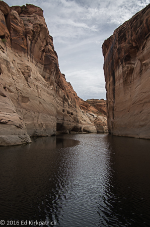
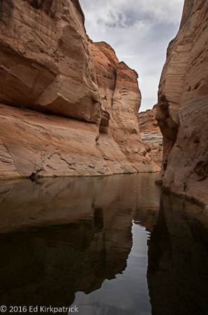
We went to Antelope Point Marina on Lake Powell and did an hour long boat trip up Antelope Canyon with Jared our guide.

Jared knows the lake well enough to take his hand off the helm.
He loves the lake and knows it inside out and backwards having been in many of the over 90 side canyons! He also loves to photograph and showed us some of his work which was quite good. When we got back to the marina, we had a late lunch of good hamburgers and talked about how much we want to spend a few months or more exploring and living in a houseboat on the lake.

Entering Antelope Canyon and the Navajo Generating plant is in the distance.
This will be our last post from 2016. After wintering at home in Maryland house-sitting and “doing the holidays” it’s past time to get you all up to date with where we are and have been since getting back on the road at the end of March. We thank you so much for riding along with us on our adventures over the next hill 🙂
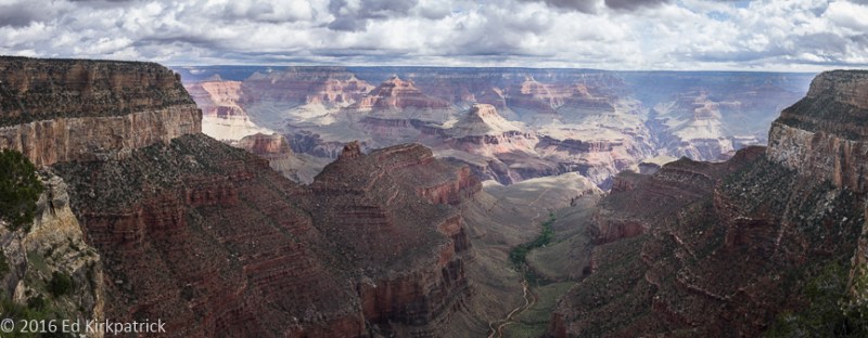
South Rim from the Grand Canyon Village.
Way below Marti is the Bright Angel Trail to the bottom of the Canyon.
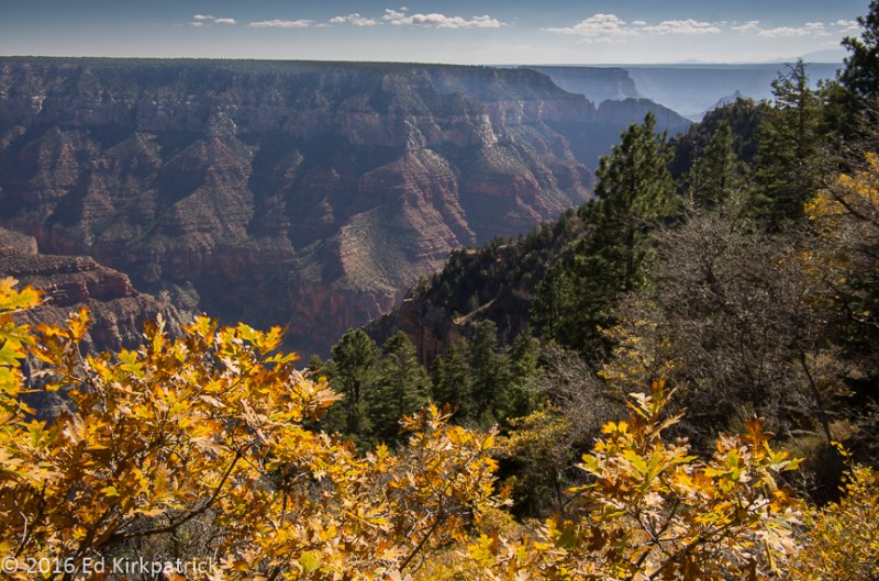
At the North Rim the aspens had already lost their leaves but the oaks still were in full color.
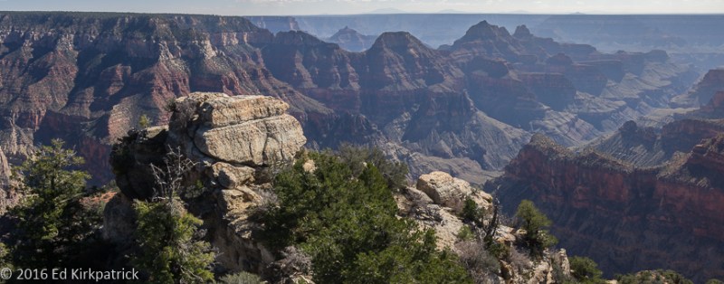
Looking West from the North Rim.
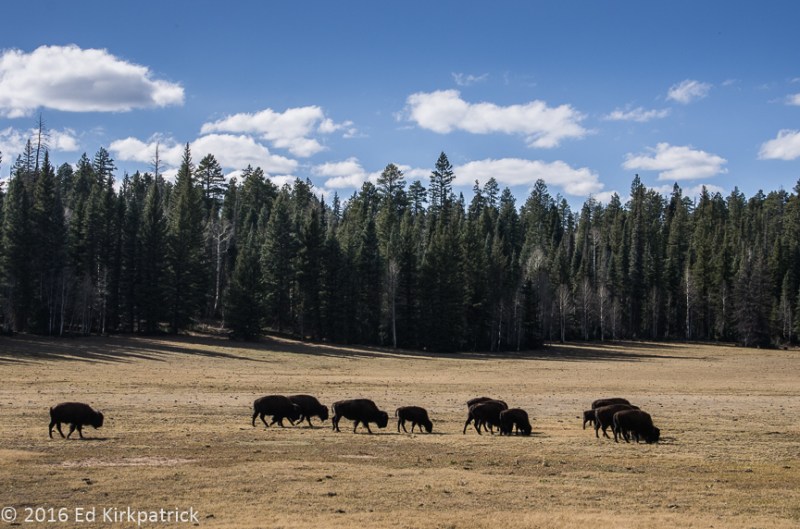
Some locals on the road leading out of the North Rim in the Kaibab National Forest.
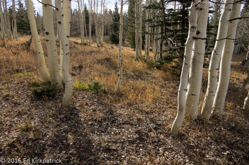
Aspens grow in clumps and are a single organism connected together underground.

Looking across House Rock Valley to the Vermilion Cliffs.
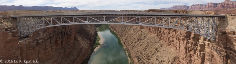
The new bridge from Navajo Bridge over the Colorado River at Marble Canyon.
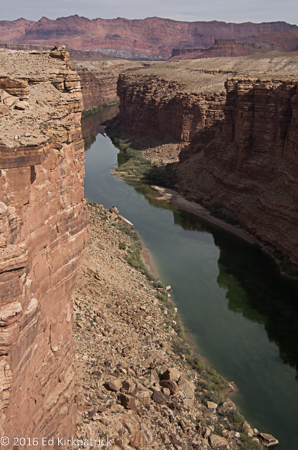
The Colorado River in Marble Canyon.
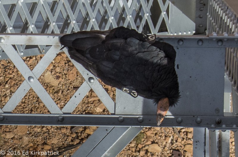
California Condor #53. We saw six that day on the bridge span, all tagged. There are over 400 total in the reintroduction program, up from 22 at the low point.

The turbine room inside Glen Canyon Dam.
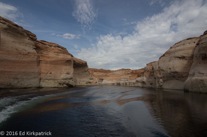
Scenes from our boat tour of Antelope Canyon on Lake Powell.

Marti sees faces in everything.

Stripes and swirls
Nearing the top of the canyon on the water.
With the water levels as low as they were we could only go so far without walking.
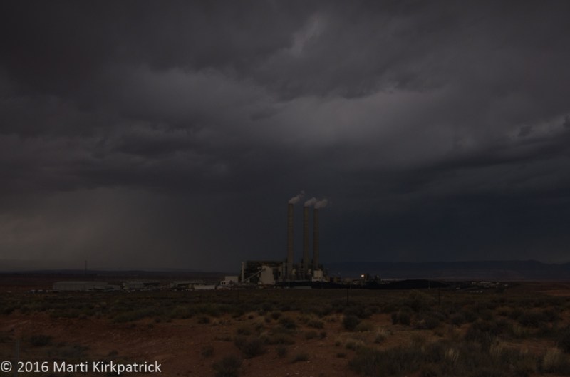
A big storm approaches the coal burning Navajo Generating Station which may be closing soon.

The next morning after a big thunderstorm the water vapor rises off Vermilion Cliffs.
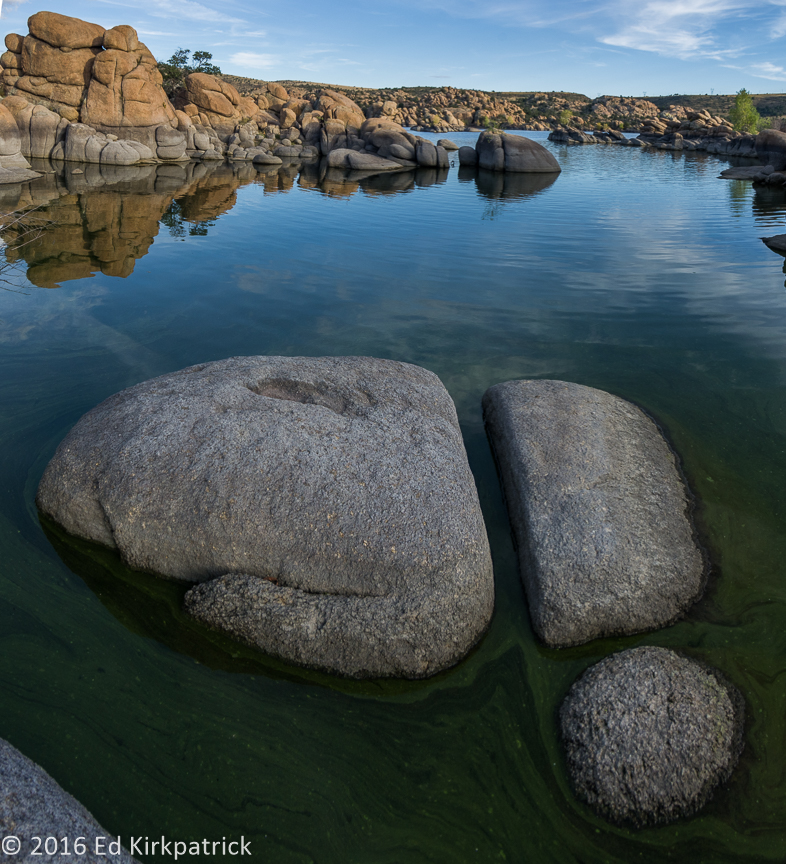
From our trip home we end with two photos at Lake Watson in the Dells in Prescott, Arizona. One of our favorite places.


It’s lovely out west. On your next journey to the Grand Canyon State, try the North Rim for an even more amazing experience. Glen Canyon, once you get back in the crevices, was designed just for photographers! Thanks for the journey. Each post enriches my day.
LikeLike
Thanks Marti & Ed, we love traveling with you. Your pix are classic.
LikeLike
Magnificent! Thanks for sharing.
LikeLiked by 1 person
Thank you Camille!
LikeLike
The most beautiful pictures of the area I have seen. Thank you so much for taking the time to share with us. Part of you must want to just keep going forward and not record yesterday. Happy Trails.
LikeLiked by 1 person
Thank you Anne! We do need to get caught up with ourselves, AND do a better job of getting our posts out 🙂
LikeLike