• About

Whack-A-Mole Wheels

Whack-A-Mole Wheels

Tag Archives: Utah

Beauty & Bones ~ Dinosaur National Monument

29 Sunday Sep 2019

Posted by Ed and Marti Kirkpatrick in Travels

≈ 5 Comments

Tags

Carnegie Dinosaur Quarry, Colorado, Dinosaur National Monument, Green River, Josie Bassett Morris, Petroglyphs, Utah

When Ed and I set out on this adventure in our beloved Whack-A-Mole Wheels home we had only one destination on our itinerary, the southeastern parts of Utah that we had not been able to explore in 2018 due to the emergency eye surgery in Provo. I had mapped out our route through Medicine Bow (the Scotts Bluff visit being a last second whim) and then a stop at Dinosaur National Monument before heading south for Arches, Canyonlands, etc.  As we came along west, I decided not to bother with Dinosaur….then I decided what the heck let’s go….then I decided nah, let’s skip it.  The morning we headed out from dry camping north of Steamboat Springs (another last second whim visit) south on pretty RT 13 and then west on RT 64 for Rangley CO. I said to Ed, “What the heck, it’s still early and we’re practically there, let’s go to Dinosaur.”  Decisive ain’t I😉

20190906-_EKP0228

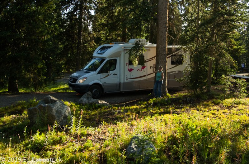
Meadows Campground Routt National Forest above Steamboat Springs, Colorado. Fine dry camping.

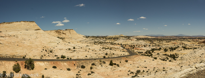
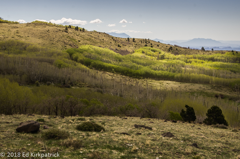
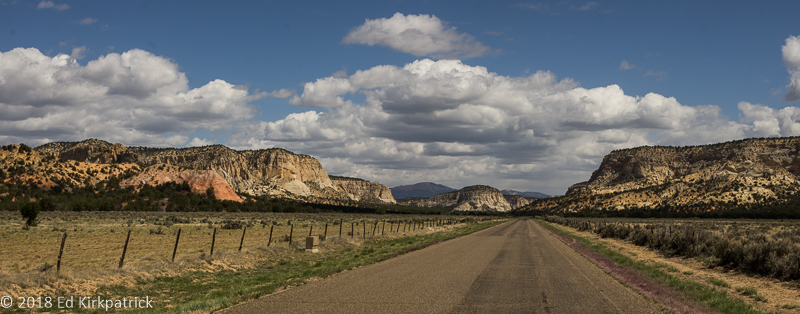
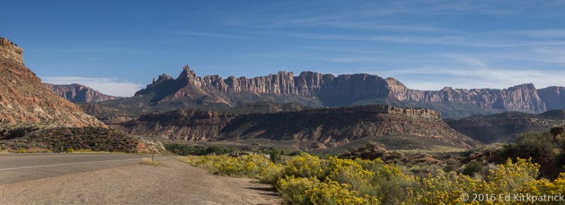
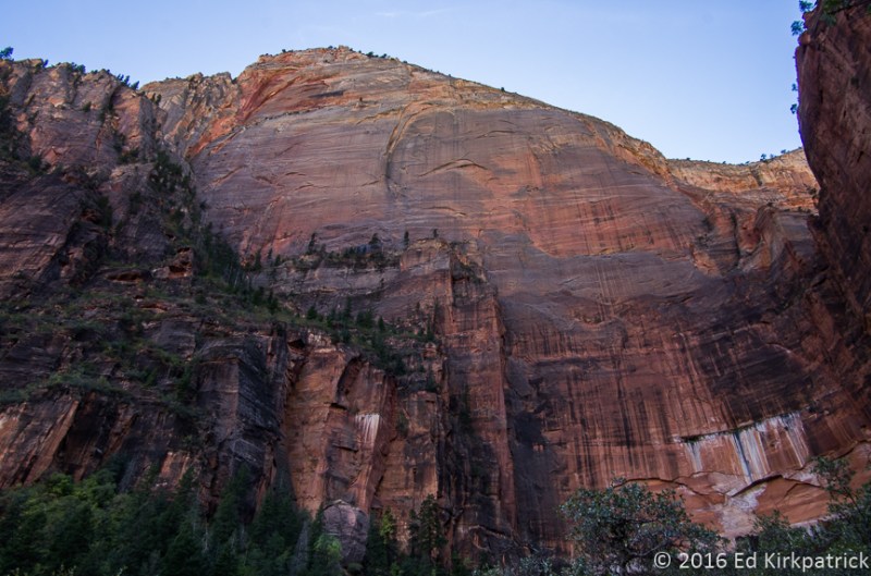
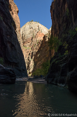
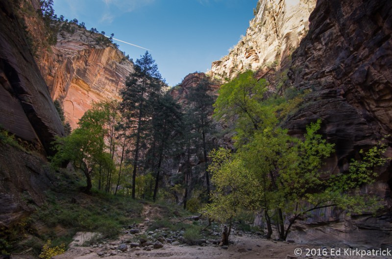
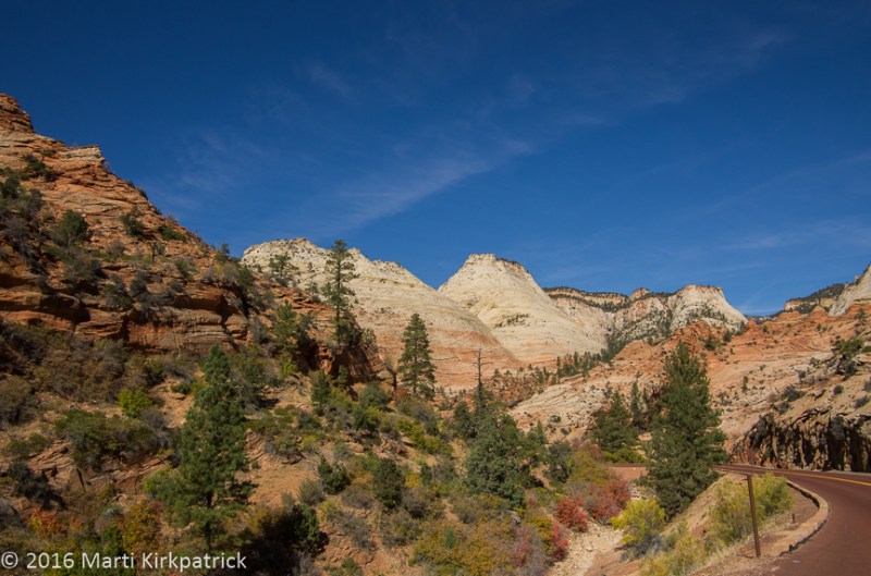
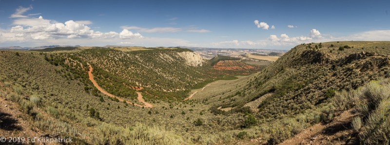
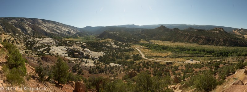
While I had done a little reading about Dinosaur National Monument, it turns out I had not quite got the details correct.  I knew that there were two separate entrances about 26 miles apart. The first, with the most land area in Colorado, and the second smaller area in Utah.  A couple of miles east of the tiny town of Dinosaur, off US Route 40, I knew that the Colorado entrance, Harper’s Corner Rd, went about 30 some miles in and was an in & out road,( you drive in then back out on the same road). I knew that the road actually went from Colorado into Utah and back into Colorado.  I knew that just getting into the monument required driving a number of miles on a dedicated park service road.  I also “knew” the famous quarry wall exhibit was back in on Harper’s Corner Rd.  We pulled in, skipping the visitor center.  The road starts to climb at once and up and up we drove enjoying the expanding view and the lack of other cars.  At the top the good paved road mostly runs near the rim of the plateau where overlooks afford wonderful views across the surrounding mountains, and deep canyons.

20190906-_EKP0253-Pano

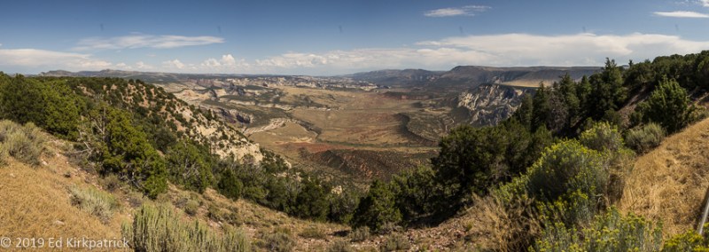
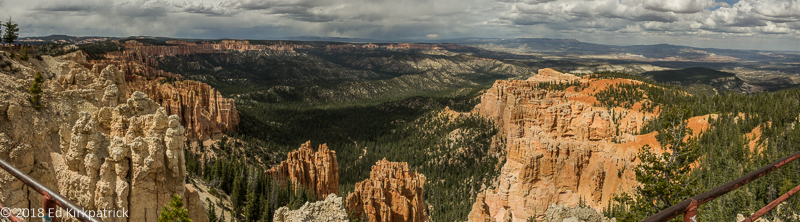
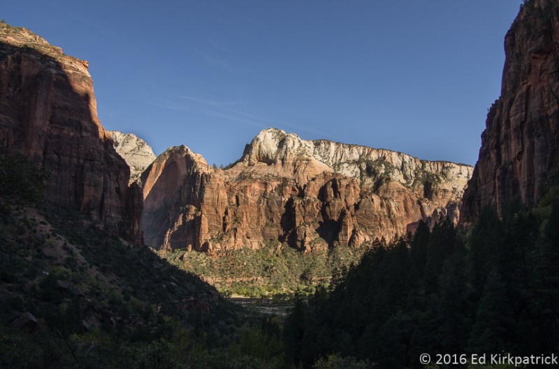
From the plateau Echo Park Overlook on Harper’s Corner Road.

20190906-_EKP0265-Pano

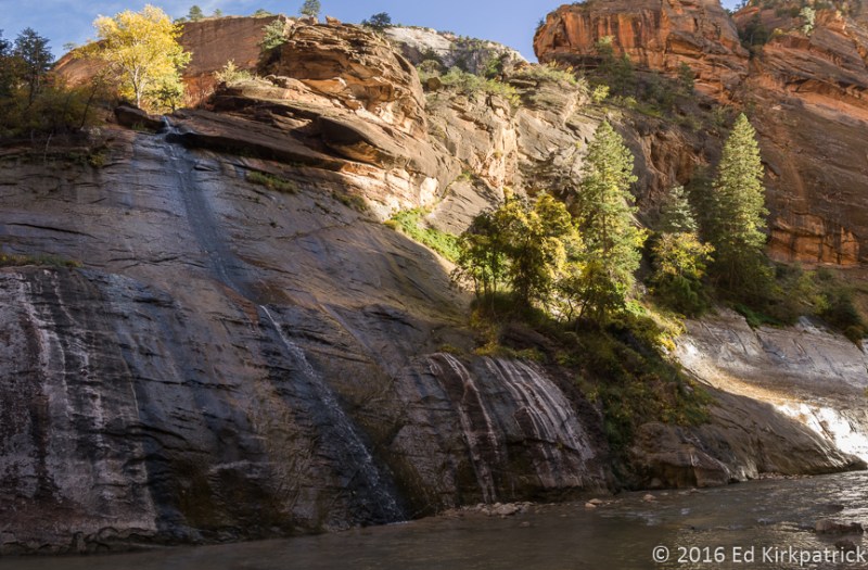
Iron Springs Overlook.  The Green and Yampa Rivers have cut canyons across the landscape which contribute to these magnificent views, this one having been cut by the Yampa River.

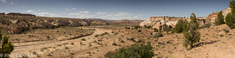
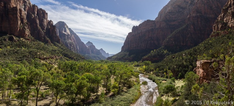
I kept telling Ed, “I don’t know where the fossil wall place is, I know it’s supposed to be back a ways.  I’m not sure where?  At least it’s a beautiful drive!” Then we arrive at the end of the road!  We park and get out nodding hello to the handful of other folks.  One gentleman, asks me if I know where the fossil quarry place is, and I allow as I thought it was here but clearly not.  We walk a short way out a path and decide against taking it as it heads down hill and what goes down, has to come up. 😊 We laugh with the guy I spoke with earlier about our joint mistake, but agree it was worth the drive.   I started to get a sneaky feeling about my goof.  Ed and I notice another family and wander over to ask if they knew what the deal was and yup, I really blew it.  The quarry is on the Utah entrance side!!  We all laugh and chatted about the beauty of the place and our confusion.  This man also told us about Green River Campground over in the Utah part where there were a good number of first come, first serve dry camping spots.  Taking our time to stop at the overlooks we skipped coming in, we headed back out for Jensen UT where RT 149 is the road into Dinosaur National Monument (Utah side) and the campground.

20190906-_EKP0324-Pano

Surprise! The Green River flows right next to the Green River Campground! To all the campers, we really recommend this park.  Dry camping with really good water out of the scattered hydrants.

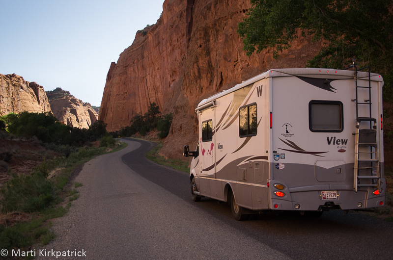
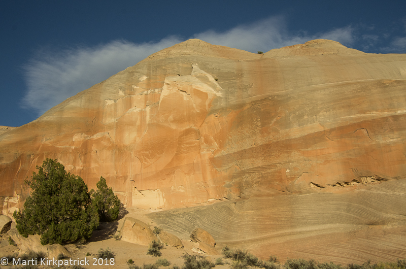
The next morning we drove out RT 149/Club Creek Rd to where the pavement stops.  Here the dirt road forks and we proceeded left on Josie Ranch.  Just a short ways down we pulled over to look at the first set of Fremont Culture petroglyphs.  Further down the road there’s another pull out where we stopped to make the short climb up to the more extensive collection of petroglyphs.

20190907-_EKP0349

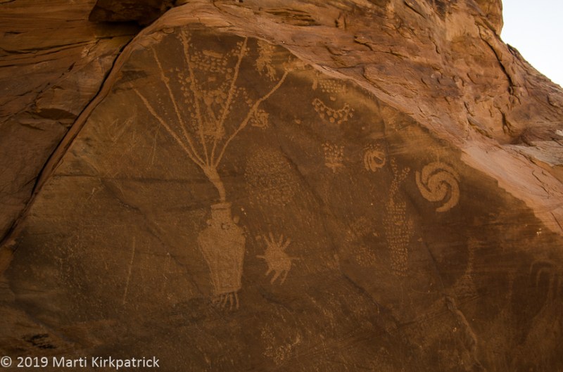
Petroglyphs are scratched into the desert varnish on the rocks, while Pictoglyphs are painted or drawn on the rock with natural dye paints.

20190907-_EKP0351

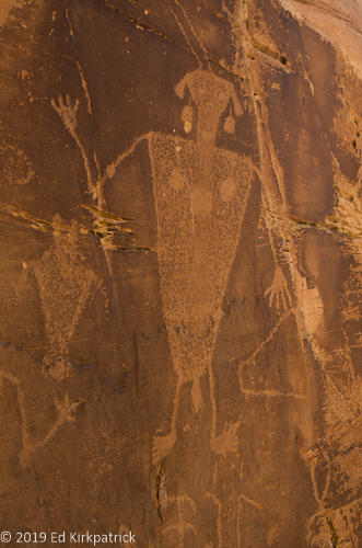
These are considered of the Fremont Culture.

Continuing down the road we arrive at Josie’s ranch. Josephine (Josie) Bassett Morris was born January 17, 1874, in Arkansas. Involved with Butch Cassidy, as well as several other outlaws Josie was married four times, divorcing (and perhaps poisoning one) all her husbands.  Josie moved to homestead here on Cub Creek in 1913.  With the help of her son Crawford McKnight (father husband #2) she built a log cabin and lived here, ranching (cattle rustling) by herself for the next 50 years!  Sustaining a broken hip when a horse knocked her down, Josie finally had to leave her home and died a few months later at age 90!

AR-160329956

This is Josie well into her life at Cub Creek.  Marti had a blast researching her life and intends to keep looking.  We do suggest you have a look for yourselves. Josie, her sister “Queen” Anne Bassett, oh and their mother, were really something, think Butch and Sundance…  Wikipedia…

20190907-_EKP0402

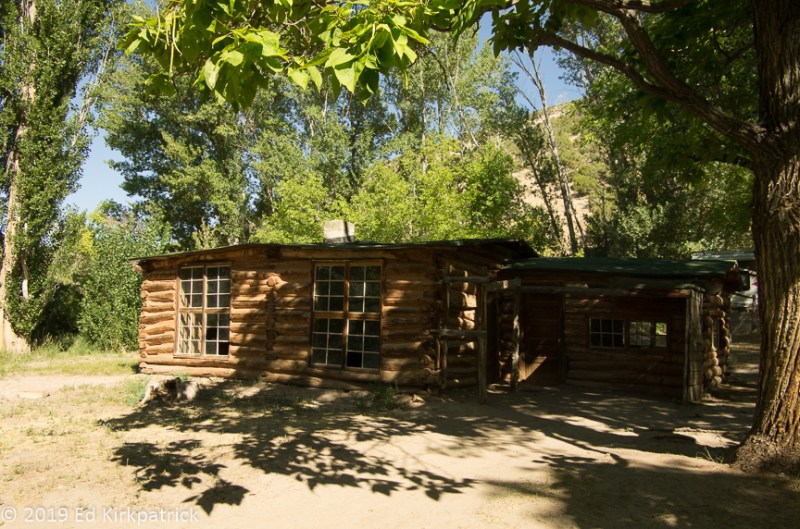
Josie’s cabin has been partially restored although the inside is full of dirt… It is a lovely location for a home though.

Finally, after all the fun we’d already had at Dinosaur National Monument, we drove over to the visitor center (Utah) and took the required shuttle up to see the world famous Carnegie Dinosaur Quarry!

20190907-_EKP0543

This dinosaur fossil bed was discovered in 1909 by Earl Douglass, a paleontologist working for the Carnegie Museum in Pittsburg.  The quarry contains eleven different species of dinosaurs and over the years they have supplied museums around the world.  Odd as it may sound this amazing wall of fossils is now considered repetitious.  While there are digs still very much being done in other locations of the monument this vast pile is no longer being excavated….the world has all of these guys it needs!

I am sooooo glad I woke up and changed my mind!  Fascinating on so many levels and we both agree, put Dinosaur National Monument on your MVL (Must Visit List) and SEE IT ALL!!!


20190906-_EKP0295-Pano

Overlooking Echo Park from a different point of view.

20190906-_EKP0306-Pano

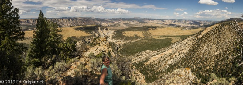
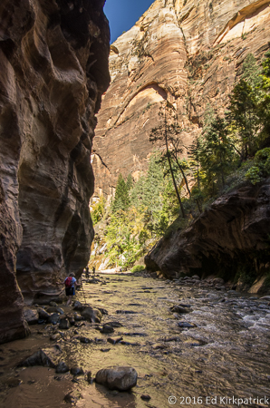
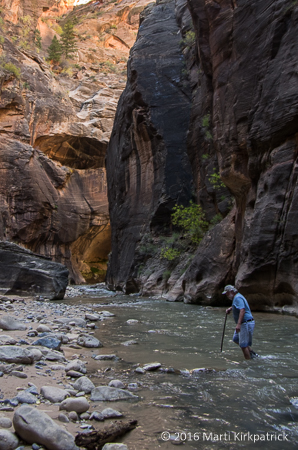
Where’s Marti? Canyon Overlook.

20190907-_EKP0352

Looks just like the Sunday funnies… sort of.  Enormous amounts of scholarship have been done on petroglyphs all over the southwest, but Ed wonders if it wasn’t just some bored prehistoric teenagers out for the afternoon.

20190907-_EKP0369-Pano

Desert lizards, there are a number of them on this wall, but the big one is over six feet long.  He is so impressive that all the brochures have his picture, the lizard not Ed.

20190907-_EKP0383

Marti finds this fascinating because it is so different from so many petroglyphs we have seen. Ed, on the other hand, thinks she looks like Sally from the Peanuts comic strip.

20190907-_EKP0384

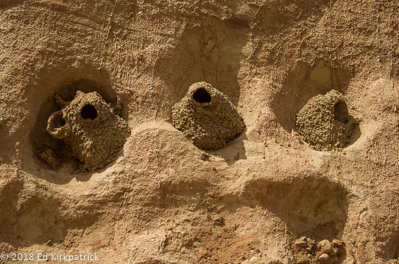
Pretty high up on this cliff wall, we saw packrat nets. Debris piles of everything from stones to mud, to any bit of this or that are built into the nest. The packrat uses urine which crystallizes as it dries holding everything together.  Some of the nests have been carbon-dated at 15,000 years old. Home is where the heart is…

20190907-_EKP0387-Pano

Looking down on Whack-A-Mole Wheels on Cub Creek Road from the petroglyph cliff wall.

20190907-_EKP0409

Hiking back up Josie’s box canyon, Marti had to climb up to the peek-a-boo hole in the rocks.  She needed a boost up as it was harder than it looked.

20190907-_EKP0412

The box canyon right behind Josie’s cabin where she corralled her horses and livestock. Now that we know more about her, tucking things into box canyons might be something she learned from some rather nefarious friends! 🙂

20190907-_EKP0497-Pano

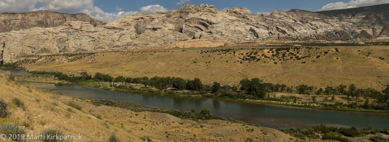
The Green River that John Wesley Powell explored on his way to the Colorado River is just beautiful,  strong and clean.  It also in many places appears very green.  The mountain in the middle of the picture is Marti’s new favorite, Split Rock Mountain.

20190907-_EKP0512-Pano

Ed just really liked this big-ass rock overhanging the Green River just up from the campground.

20190907-_EKP0539

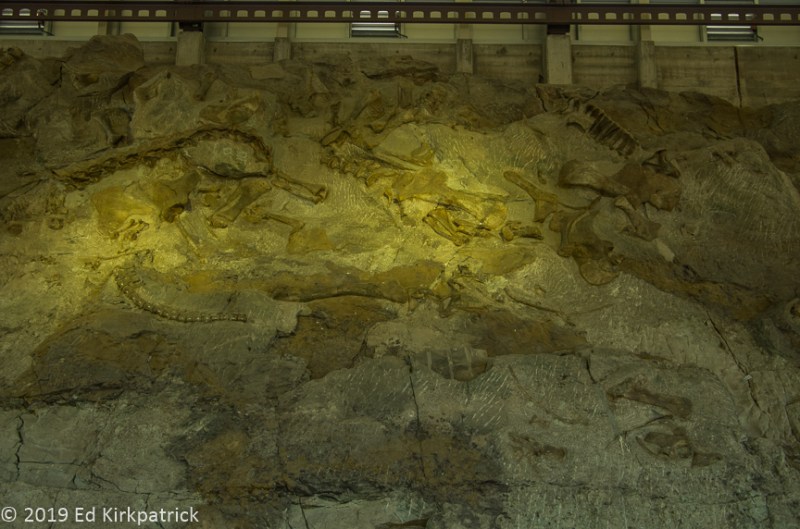
Bones, bones and more bones in the Quarry Hall.

20190908-_EKP0547-Pano

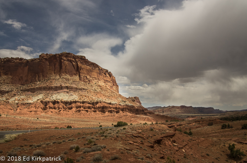
Leaving the Green River Campground the next morning rain was on our horizon.  This was a good thing as it helped clean off the gobs of dead grasshoppers we had collected all the way across Nebraska on the front grille and bumper of the rig.


Utah ~ Scenic Byway 12, Burr Trail & the LDS

24 Tuesday Jul 2018

Posted by Ed and Marti Kirkpatrick in Travels

≈ 13 Comments

Tags

Burr Trail, Capitol Reef National Park, Grand Staircase/Escalante National Monument, LDS, Mormon Tabernacle Choir, Provo, Salt Lake City, Scenic Byway 12, Utah

The US Department of Transportation, Federal Highway Administration lists Utah Route 12 as one of America’s Scenic Byways.   We had begun our traverse of the 124 mile long route with Bryce Canyon located at mile marker 13 (see the last post) and were now ready to continue on.

After Bryce, Route 12 slides in and out of Grand Staircase-Escalante National Monument.  We stopped at the Escalante Heritage Center which has an interesting display about not only the town of Escalante but the 1880 Mormon pioneer expedition from Escalante to Bluff, Utah referred to as the Hole in the Rock Expedition.

20180517-_EKP5843

This is a painting depicting the descent through Hole In The Rock that the Mormon pioneers blasted and built creating the gap that allowed them to continue on their way to Bluff, Utah. No one was lost. It was an incredible feat.

At mile marker 70 we stopped and marveled at the slick rock at Head of the Rocks Overlook.

20180517-_EKP5848-Pano

The term, slick rock is attributed to cowboys because shod horses hooves would slip on the bare rock and sometimes they would go down.  Crossing, particularly when wet, is very precarious whether on horseback or in a wagon.

20180517-_EKP5856-Pano

The CCC spent 5 years building a road through here parts of which are now RT. 12.  It’s known as the Million Dollar Highway because of the backbreaking labor and tons of dynamite used to blast through the slickrock terrain.

Just about five more miles down the road we stopped to enjoy the amazing views over the deep canyon of the Escalante River and a bit further on, down into Calf Creek where I hope to someday hike up to the falls.

20180517-_EKP5871

The trail Marti hopes to hike someday is visible in the bottom of the canyon.

I had done my research as well as I could and assured Ed we could and should leave Scenic 12 and do the Burr Trail Road which crosses Grand Staircase-Escalante to Capitol Reef National Park.  So at Boulder (AKA  Boulder Town), we turned onto Burr Trail Rd where just a few miles in there was the 7 site BLM (Bureau of Land Management) Deer Creek Campground. Technically (according to their listing) we wouldn’t fit, but hey, it’s us so we “pushed and shoved” and JUST fit into spot #5 🙂

20180517-_EKP5897

The Moon and Venus delighted us that evening but the mosquitos soon drove us back inside. The creek was right behind us.

What a wonderful road!  Paved and basically empty of other vehicles Burr Trail Rd heads down through The Gulch into beautiful Long Canyon.

20180518-_EKP5905-Pano

Top of the Gulch headed down into Long Canyon on the Burr Trail road.

20180518-_EKP5940

Down inside the wonderful Long Canyon.

We saw an opening in the cliffs and stopped to walk back a short slot canyon.  Meeting a couple on the way out we were told it was called Singing Canyon which fit the effects we’d discovered already 🙂

20180518-_EKP5956

Headed back into the slot of Singing Canyon.

20180518-_EKP5965

… looking back out to Long Canyon.  Ed had lots of fun chatting with the Goddess Echo.

20180518-_EKP6002-Pano

The landscape opens up outside of Long Canyon.

20180518-_EKP6039-Pano

The Henry Mountains and the Water Pocket Fold before them as we cross into Capitol Reef National Park where the Burr Trail road turns to dirt.


Coming out of the canyon it’s not much farther to the border between GS-ENM and CRNP where the pavement stops. The dirt road looked good and a nice Canadian couple we had chatted with the night before had said the entire road was fine, and well…it is us… so we continued on.

20180518-_EKP6067-Pano

Today the hole in Peek-a-boo Rock is kept company by a sunspot of light.  🙂

20180518-_EKP6073

This should have been our first clue things were going to go downhill from here.

20180518-_EKP6084-Pano

800 feet down in just 1/2 a mile on slippery gravel and Marti had every confidence in Ed.  Of course, we didn’t know he had a detached retina in his right eye…  just knew that things were not as clear as they might have been.

At the bottom of the Burr Trail Switchbacks, one can go left (Notom) or right (Bullfrog) on the Notom – Bullfrog Rd.  The Burr Trail continues right towards Bullfrog and Lake Powell and most folks actually go this way. We went left because the road would eventually take us to where we wanted to be for the night.  If one looks at the various websites both official and personal the road is “well maintained”, “only accessible by passenger cars”, “VERY rough”, “not recommended for RV’s”, and “impassable when wet”.

20180518-_EKP6113-Pano

We had a spectacular day for this drive but as can so often happen…

20180518-_EKP6122

…the clouds suddenly appeared ominous from the West and the road was, to put it politely, crap.  Ed cursed the Canadian fellow many times but Marti thinks he was mistaken and had turned the other way to Bullfrog.  We still had over 30 miles to go.

20180518-_EKP6135

And the storm continued to build.  Marti kept wanting to stop.  Ed, remembering the “impassable when wet” part, was thinking about how much trouble we would be in if it actually started to rain.

Out of the backcountry of Notom Road and on Rt. 24 the RV campgrounds in the towns of Fruita and Torrey were full but a nice lady at one told us about tiny Sunglow Campground in the Fishlake National Forest a few miles further west near Bicknell.

20180518-_EKP6161

Sunglow Campground. We made it!

Happily, we did manage to get the nowhere near level, but very nice, second to the last spot.  The last spot was taken by a couple of delightful Dutch kids, Christine, a gastroenterologist and Jacob-Jan, a physicist. We really enjoyed talking with them over a couple of beers the two nights we were camped here.

Next morning we wanted to finish up the bit of the road we’d skipped doing the Burr Trail and so headed back towards Torrey and south on Scenic 12.

20180519-_EKP6162-Pano

Rt. 12 south heading for Boulder Mountain and the Dixie National Forest.

Here the road climbs Boulder Mountain in Dixie National Forest and because of the extra altitude, 9,606’ at the top of the road (the actual top is 11,313’) and the pine and aspen this area has an entirely different landscape…

20180519-_EKP6214-Pano

At the summit, the forest opens up and the view back to Boulder, Burr Trail Road and Long Canyon is spectacular. 

Bright and early the next morning we packed up and headed back down to Fruita and the visitor center.

20180518-_EKP6157

The Fluted Wall on Rt. 24 west of Fruita, Utah. 

This is the most known/visited part of Capitol Reel and from here we did the paved Scenic Drive.

20180520-_EKP6255-Pano

EPH Hanks Tower at the end of the paved road on Scenic Drive.

20180520-_EKP6259-Pano

This particular morning the clouds and approaching storm were almost more spectacular than the landscape.

20180520-_EKP6304-Pano

Scenic Drive in Capitol Reef National Park.

It was on this drive that Ed admitted his eye/vision was pretty bad and the better part of discretion was to head for Provo and Salt Lake City where there would be eye specialists.

20180520-_EKP6342-Pano

And that is what we did. Through the rain and the clouds across Utah on Rt. 89 to Provo.  Just an incredibly beautiful state. In fact, just put the entire state on your MVL, (Must Visit List).


20180517-_EKP5840

Inside a Mormon wagon.  Can you imagine traveling through this part of the world with this view?

20180517-_EKP5862

Scenic 12 outside of Escalante, Utah.

20180517-_EKP5877-Pano

Marti calls these green river snakes.

20180517-_EKP5887

The Hogback at MM80 on Scenic 12.  You will note the lack of shoulder or railing.

20180518-_EKP5974

Inside Long Canyon.

20180518-_EKP5983-Pano

Geological canvas abstract painting.


20180519-_EKP6208

Notice how the aspens are at all different stages of leafing out. That’s because each grove is a single organism connected by roots underground and consequently each grove has its own timeline for waking up.

20180520-_EKP6324

Heading back up the Scenic Road to leave for Provo… It started raining just as we left the park and rained all the way across the state.

20180526-20180526_113456-Pano-2

After Ed’s eye surgery, we went up to Salt Lake City for two weeks. The streetcar stop was right outside the KOA so going in to Temple Square and city center was very easy.  This is the Mormon Temple reflected in the pool in the gardens.

20180531-20180531_194335

Thursday evenings the Mormon Tabernacle Choir’s rehearsal is free and open to the public.  We had a lovely dinner at Caffe Molise then walked over and thoroughly enjoyed this amazing choir.  Marti says if we lived here she would be here every Thursday.

20180526-20180526_140752

Not a headache.  Not disgusted, but under doctor’s orders to rest his eye by looking down for a while.  All in all, we really liked Salt Lake City not to mention beautiful Utah.  We will be back!


White House, Toadstools & Bryce Canyon ~ OR ~ You’ve Gotta Take a Walk

08 Sunday Jul 2018

Posted by Ed and Marti Kirkpatrick in Travels

≈ 9 Comments

Tags

Bryce Canyon, Paria Canyon, Queen's Garden Trail, Red Canyon Campground, Thor's Hammer, Toadstool Trailhead, Utah, White House Trail Head

As some of you know, not only were we home (Maryland) for almost a month, we’re now on the road again, New York and as of yesterday Vermont, heading for Canada.  Even so, Utah is just so magnificently beautiful and Ed’s photographic eye captures it so well, I still want to share our adventure and lots of pictures with you…   sooooo…

Leaving Wapatki Monument we headed north on US 89 toward Page and Lake Powell which we wrote about back in May of 2017.  We spent the night at the Page Lake Powell Campground where we’ve stayed before and tried to ignore the first really hot day we’d had pretty much this whole trip.

20180511-_EKP4931-Pano

The water level in Lake Powell is way down.

Utah’s Grand Staircase – Escalante National Monument begins just outside of Page and we had heard good things about the White House Trailhead Campground about 30 miles on up US 89.  Stopping in at the Paria Contact Station, the nice BLM (Bureau of Land Management) lady said we might have a little trouble with the last dip in the dirt road but there was a spot about 1 ¾ miles back where we could camp.  She doesn’t know us 🙂 We went the full 2 miles with no problem and being there early in the day had our choice of 4 of the 6 small sites; (there are also 5 walk-in tent sites beyond these sites).

20180511-_EKP4943-Pano

Whack-A-Mole Wheels camped at White House Trailhead, in Paria Canyon, Utah.

20180511-_EKP4982

The urRu/Mystics were watching over us. You will know the reference or you won’t. But here’s a clue – Dark Crystal.

20180512-_EKP5127-Pano

The Paria River “flows” down the canyon passed White House Trailhead.

20180512-_EKP5088

The wind creates beautiful leaf tracks in the sand and dust.

After our lovely 2 days at White House, we popped back south on US 89 a mile and a half to the Toadstools Trailhead where we did the short and easy hike back to see these fun rock formations.

20180513-_EKP5137

Toadstools, also known as Hoodoos, are formed when weathering removes the softer sandstone from around a harder sandstone cap.

20180513-_EKP5135

On the trail back to the toadstools, we discovered evidence in the sand of a pursuit of one type of critter by another more slithery type. 🙂

Bryce Canyon National Park was on our list back in the fall of 2016, but at 8,000 to 9,000 feet it was too cold when we were “in the neighborhood” so it was front and center on this Spring’s Utah adventure list.  As navigator, I directed Ed to continue on north along US 89 to Johnson Canyon Road which was supposed to be very pretty. The filming set for the old TV show “Gunsmoke” was also supposed to be on this road.

20180513-_EKP5189-Pano

The first part of Johnson Canyon Road which was quite beautiful and also paved… Then it becomes rough, washboarded dirt and the country is just flat and ugly.  As far as the Gunsmoke set, it’s on private property and was completely falling down and derelict. Oh, well…

Once out of the awfulness of the end of Johnson Canyon 89 is pretty and unlike the last time we were here the Sevier River had a lot of water in it.  Just shy of four miles down the righthand turn onto Rt 12 we were happy to find a not quite level spot at the first come, first served, Red Canyon Campground in the Dixie National Forest where with our America the Beautiful Senior Pass the price is $9 a night. We ended up staying 4 nights. 🙂

NOTE:  These America the Beautiful LIFETIME passes were only $10 when we bought ours a few years ago.  They have since gone up to $80 but even at that price if you do a lot of national parks, monuments and sites (a handful of states also recognize them) these passes are worth every cent.  Generally, they cut the price of admission either in half or FREE!

20180513-_EKP5213-Pano

Bryce Point at the furthest point on the road in the park is the start of a nice walk on the Bristlecone Pine Loop trail. There are shuttle buses that do a partial loop in the park.  In an RV when the shuttle is running you cannot stop at those spots so you need to take the shuttle.  However, there are many more viewpoints, including this one where you can park and get out to see the view or hike.

20180515-_EKP5549-Pano

Natural Bridge is one of the viewpoints where the shuttle bus does not stop.

20180515-_EKP5571-Pano

Piracy Point, another non-shuttle stop.


Just a couple of words about Bryce and then I will let Ed’s photographs and our comments tell the rest of the story.  First ~ Put this on your MVL (Must Visit List) but DO IT OFF SEASON!  It actually wasn’t too bad but we strongly suggest you start each day early to get a jump on the crowd.  We had a nice chat with one of the shuttle bus drivers when no one else was on board and he said in the last couple of years Utah is making a BIG push to attract tourists. They are pushing extra hard in Asia and Europe and judging from the myriad of languages we heard here (and in 2016 at Zion), they’re getting a huge response. He also said their visitor numbers are doubling every year lately!  Second ~ Stop at every overlook and look 🙂 . Third ~ Hike, a little or a lot, get out and walk at least some of the rim trail and down into the canyon.  Some folks claim it’s all the same but from subtle to radical it’s really all different!  Fourth ~ watch for the Violet-green Swallows.  They are beautiful. Ed tried to get a photo but they are too fast!   Mostly JUST GO!! 🙂


20180512-_EKP5031

Swallow nests made of mud from the Paria River at White House Canyon.

20180512-_EKP5044

Frank H. Clark, Sept. 25, 1911, left his mark on the wall at White House Trailhead.

20180512-_EKP5086

An old stile that was in a fence that is no longer here.  Someone ranched this area back in the day but no longer.

20180512-_EKP5090

The sandstone cliffs are what remains of ancient sand dunes and the lovely shapes and patterns are carved by wind and water.

20180512-_EKP5102

The swirls and ribbons left by different colored sand and dust blowing into dunes and over the ages metamorphosing into lovely sandstone cliffs.

20180512-_EKP5111

And then there’s the color of the cactus blooming amongst the sand dunes.

20180513-_EKP5146-Pano

Toadstools Trail.  Marti likes the white cliffs better than the toadstool formations.

20180513-_EKP5165

This speaks for itself.

20180513-_EKP5202

A roadside attraction while Johnson Canyon Road was still pretty.

20180515-_EKP5520

In Bryce Canyon, a Peregrine Falcon eyes Ed but decides better of it.

20180515-_EKP5545

Another vista at Bryce.

20180515-_EKP5589

A fire started by a lightning strike years ago leaves a scar but the forest always comes back.

20180515-_EKP5663-Pano

John’s Valley Road, a 60-mile side trip originates across from the Bryce Canyon entrance road. We decided we needed a break from all the red and orange rock and so headed north down Black Canyon towards the small town of Antimony. 

20180515-_EKP5661

The Osiris site at the base of Black Canyon is now an abandoned mill site.  

20180515-_EKP5681

Coming out of John’s Valley Rd, at Kingston and then onto Rt 89, look what we found! Butch Cassidy’s boyhood home.

20180516-_EKP5688

The next day we went for a hike down the Queen’s Garden Trail into the canyon.  Marti said it would be fun.  She failed to mention the last mile part…

20180516-_EKP5692

Heading down on the Queen’s Garden trail.

20180516-_EKP5703-Pano

… and down some more.  Why is everybody coming in the other direction?

20180516-_EKP5706

Ed found some shade.

20180516-_EKP5718

But, it does give you a whole new perspective.

20180516-_EKP5731

Still going down…

20180516-_EKP5749

And here’s Queen Victoria for whom the gardens are named.

20180516-_EKP5747

In case you didn’t see her in the photo above.

20180516-_EKP5766

Nearing the end of the down part is the shady part looking down into the valley and Marti’s gourmet lunch, granola bars, and water.

20180516-_EKP5784

The up part starts,

20180516-_EKP5791

and here’s the part Marti left out, 850ft. up over a mile of trail switchbacks.  The strategy was to go from shady spot to shady spot to get our breath.

20180516-_EKP5793

A view of Thor’s Hammer formation near the top.  It was pretty, Ed admits and worth the climb.

20180516-_EKP5809

looking back down the trail, you got to admit it’s spectacular.

20180516-_EKP5812

Goodbye from Bryce Canyon! We hope you can make it too someday.

Zion National Park ~ Dry & Wet Hiking Galore!

27 Thursday Apr 2017

Posted by Ed and Marti Kirkpatrick in Travels

≈ 7 Comments

Tags

#Zion National Park, Emerald Pools, River Walk, Springdale, The Narrows, Utah, Virgin River, Whiptail Grille

Continuing south on the extremely barren Extraterrestrial Highway (375) from little Rachel, NV we picked up US RT. 93 to State Rt.168 and onto I-15 E.  Approaching the northwest corner of Arizona the landscape improves particularly as the road starts to run along the Virgin River which is just beautiful.  Pretty quickly we were into Utah where we headed for RT 9 on our way to Zion National Park. 20161016-_EKP2806-Pano

Named a national park in 1919, Zion expected 4 million visitors last year!  Thank goodness it was mid October which is towards the end of the season. With only 3 roads in the entire park, each covering a different area, the incredibly popular Zion Canyon section is nearly overwhelmed with visitors. During most of the year generally, March/April until October/November a free shuttle service provides the only access to this section, unless you’re an extreme hiker!  We camped under the Guardian at the Zion Canyon Campground & RV Park in Springdale which is just inside the park and at a shuttle stop.

20161016-_EKP2810

Whack-A-Mole Wheels, our first evening in Zion.

Riding the shuttle all the way to the last stop, Temple of Sinawaza, we did the River Walk which runs along the Virgin River.  Just a 2 mile roundtrip this is an easy paved walk and allowed us the time to do a second longer hike afterwards.

20161018-_EKP2863

Hanging Gardens along the River Walk trail.

Catching a return shuttle we hopped off at The Grotto Stop where we climbed the 2 mile Kayenta Trail to connect to the Emerald Pools Trail at the Middle Pool.

20161018-_EKP2907-Pano

Looking back down the canyon at the Virgin River from Kayenta Trail.

20161018-_EKP2931

Emerald Pools Trail

From there we did the steeper climb up to the Upper Pool which was rather sad as a pool goes but the cliff face….WOW!

20161018-_EKP2935

Standing at Upper Pool looking up the wall.

then on down the Emerald Trail to the Lower Pool and across the Virgin River to catch the shuttle at the Zion Lodge Stop.

20161018-_EKP2968

End of the hike.  Marti did NOT tell me she was going to drag me 5 more miles after I did 2 on the River Walk trail…  I was cooked.

All in all, this hike was probably 5 miles and well worth it especially because I saw my very first California Condor flying high over head!  Very massive and very exciting!! but he disappeared back over the cliff top before Ed could get a picture.

The Narrows was our plan for the next day’s hike.  One of the most popular hikes in the park it goes up into the beginning of Zion Canyon.  Accessed at the end of the River Walk this end of the Narrows is called Bottom Up because it starts at the bottom of the beginning of the canyon and you’re mostly walking upstream IN the Virgin River.  Even though we got a late start and the water temperature was 49* we put on our sneakers, grabbed a walking stick and caught the shuttle back to the River Walk, which we did at a pretty good clip, and then headed off for the real hike, into the river and canyon.

20161019-_EKP2985

The Bottom-Up into the Narrows.

Surprisingly we got use to the cold pretty quickly.  Of course after a while we were also numb.  🙂  While we had a lot of fun, I would like to do it sometime when it’s warmer and we have an earlier start.  That evening after changing into warm, dry clothes we had a wonderful meal at The Whiptail Grill.  Listed as Mexican it is not what you might expect and we highly recommend it!

20161020-_EKP3096-Pano

Heading out of Zion on 9 East the next morning.

To leave Zion we planned to continue out Rt. 9 the Zion-Mount Carmel Highway which requires going through a 1.1 mile long tunnel which has size restrictions.  At 11’4” high and 7.5’ wide you have to buy a $15 pass which allows you to drive down the center of the tunnel. The Park Ranger at the entrance calls the Park Ranger at the other entrance who stops and holds that traffic and when the tunnel is empty, you get to proceed.  Very civilized 🙂

20161020-_EKP3101

That hole in the cliff is a window in the tunnel… No kidding, they put windows in the tunnel.

20161020-_EKP3110

… I may have illegally stopped in the tunnel so Marti could snap a picture out the window. The tunnel window…

Zion is truly magnificent; Ed says he likes it better than the Grand Canyon because for him in particular it’s more accessible.  We managed a decent look around but there is much more to do, so join us and put it on your MVL (Must Visit List).


20161018-_EKP2876

Along River Walk.

20161018-_EKP2896-Pano

A bit further on the River Walk,  Ed thinks, but we don’t really remember clearly.  Alcohol was not involved, it came later.

20161018-_EKP2932

Approaching Upper Pool which is located under the white streaks in the lower right corner.

20161018-_EKP2933

Looking straight down the canyon from the same spot as above.  The wall is on the right hand, Upper Pool is behind me.

20161018-_EKP2942

Continuing on down to the lower pool trail, Marti may or may not have crossed the chain to get close enough to the edge to take this photo lying on her tummy.

20161019-_EKP3027

Ed picking his way across the knee deep, fast flowing and cold Virgin River in the Narrows.

20161019-_EKP3032

In the Narrows.

20161019-_EKP3033

Marti in a shallow spot headed for the sunny spot.

20161019-_EKP3053

Our view from where we sat to have our lunch, granola bars and  oranges.

20161019-_EKP3063

A place where the Virgin River turns and the canyon narrows seem to box you in.

20161019-_EKP3077

Some peoples to give a sense of scale.

20161019-_EKP3078

One of the prettiest and more open spots on the wade up the river.

20161019-_EKP3081-Pano

Water cascading down the rock face of the canyon.

20161019-_EKP3087

Marti has never used a walking stick until this day and she is very thankful she did.  This is the entire width of the canyon, wall to wall and the cliffs are hundreds of feet tall. We did not make it to Wall Street which is the famous really narrow and tall cliff section where the cliffs are 1500 feet high.  It was too late in the day, too cold and we still had to walk back out. Next time.

20161020-_EKP3115

In the very, very dark tunnel approaching one of the several windows.

20161020-_EKP3159-Pano

An incomplete Nature made window

20161020-_EKP3143

On the other side of the tunnel on RT 9 East, the park is very different with wonderful hikes but we couldn’t park our rig.  We will have to come back when we can rent a car.

Enter your email address to follow this blog and receive notifications of new posts by email.

Join 221 other subscribers

View Recent Posts

  • Cod Jigging and New Friends! March 2, 2020
  • Grand Tetons ~ Yellowstone October 11, 2019
  • Beauty & Bones ~ Dinosaur National Monument September 29, 2019
  • Wyoming ~ In the Medicine Bow Corner September 25, 2019
  • A Bit of Western Nebraska September 5, 2019

Get Caught Up

Blogs We Follow

  • john pavlovitz
  • Take To The Highway
  • Kelly Time
  • HowToRVgeeks
  • WANDERTOPIA
  • BoomerCafe ... it's your place
  • Island Girl Walkabout
  • The Online Photographer
  • Technomadia
  • Wheeling It: Tales From a Nomadic Life

Categories

Blog Stats

  • 24,723 hits

Blog at WordPress.com.

john pavlovitz

Stuff That Needs To Be Said

Take To The Highway

Kelly Time

HowToRVgeeks

WANDERTOPIA

BoomerCafe ... it's your place

Island Girl Walkabout

Hector and Brenda on a journey of discovery

The Online Photographer

Technomadia

Adventures in Nomadic Serendipity

Wheeling It: Tales From a Nomadic Life

On the Road Since 2010, Traveling Across USA & Europe With Pets

  • Follow Following
    • Whack-A-Mole Wheels
    • Join 184 other followers
    • Already have a WordPress.com account? Log in now.
    • Whack-A-Mole Wheels
    • Customize
    • Follow Following
    • Sign up
    • Log in
    • Report this content
    • View site in Reader
    • Manage subscriptions
    • Collapse this bar
 

Loading Comments...