• About

Whack-A-Mole Wheels

Whack-A-Mole Wheels

Tag Archives: Washington State

Mount St. Helens

09 Sunday Oct 2016

Posted by Ed and Marti Kirkpatrick in Travels

≈ 3 Comments

Tags

David Johnston, Harry R. Truman, Johnston Ridge Observatory, Mt. St. Helens, Volcanos, Washington State, Yakima River

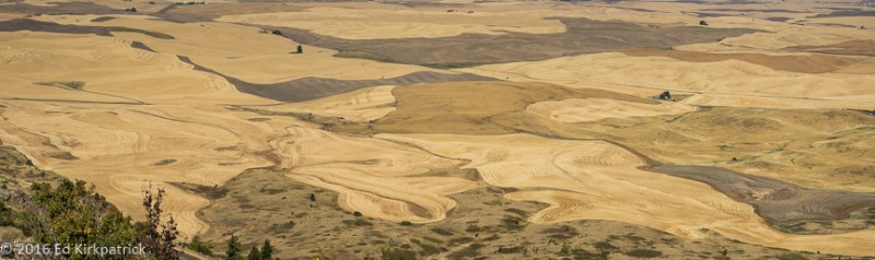
Heading towards Mount Saint Helens from Ellensburg we drove south on State Rt. 821 which follows along beside the Yakima River through huge grass covered basalt mountains.  It was a Saturday and even though it was cloudy and just barely warm the river was full of folks individually, or tied together in groups, tube floating down this lovely wide river.  It’s a delightful drive and we highly recommend it over the parallel route of Interstate 82 and the rafting part looks like great fun.

_ekp9545

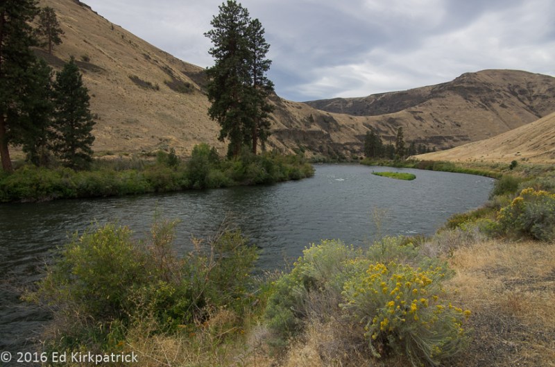
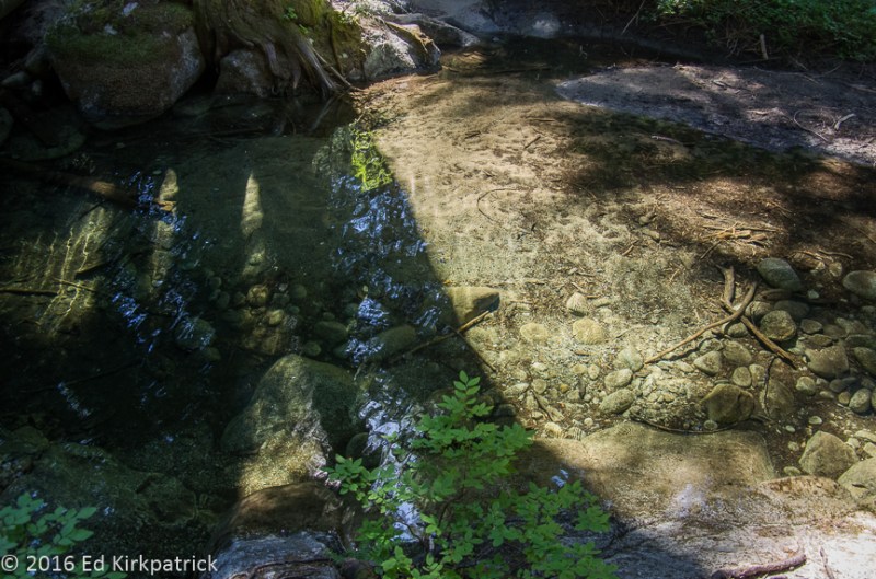
A small stretch of the Yakima River without tubers.

20160827-_ekp9563

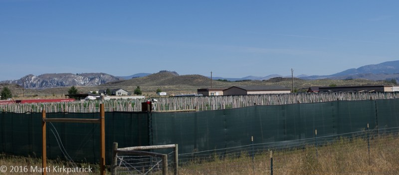
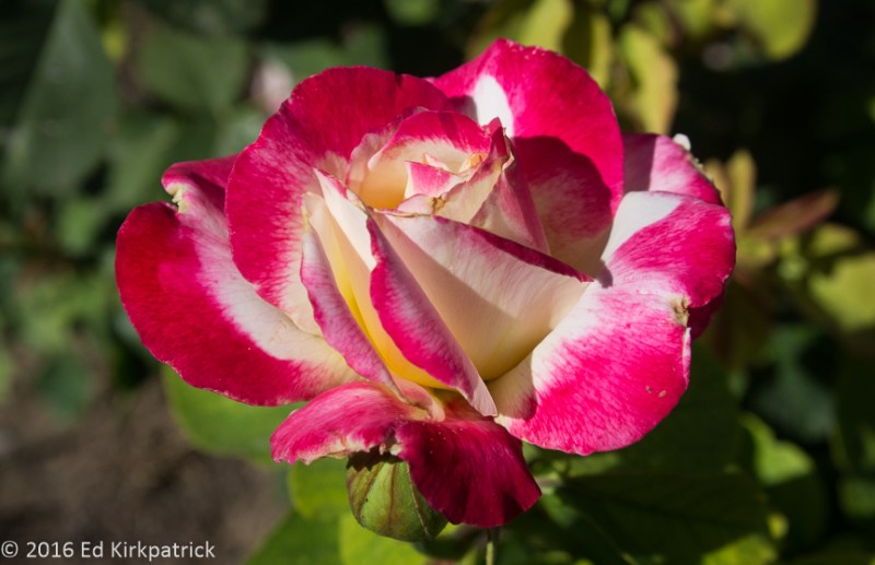
As we left the Yakima River Canyon we found this orchard of espaliered apple trees. This is something you usually see in formal gardens. Why they were espaliered we don’t know but they sure were pretty. 

From there we took the beautiful US Hwy 12 to get to St. Rt. 505 then St. Rt. 504 (Spirit Lake Hwy) up to Johnston Ridge Observatory 5 ½ miles from the blast site of Mount St. Helens.  This drive affords spectacular views of the forest destruction, lahar mudflows, ash fields, surrounding landscape and of course, the still active but quiet volcano herself.

_ekp9658-pano

Mount Saint Helens

_ekp9680-pano

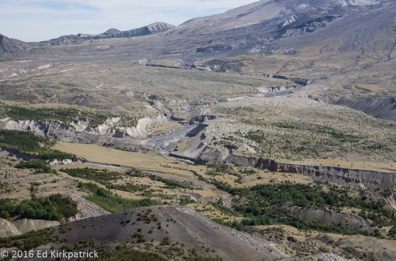
This is one of the lahars from the eruption.  A lahar is a type of mudflow or debris flow composed of a slurry of pyroclastic material and water.  The material flows down from a volcano, typically along a river valley. In this case the North Fork of the Toutle River valley covering 25 square miles.    A video is here.  

The observatory is named for David A. Johnston the USGS volcanologist who was killed while manning an observation point 6 miles from the volcano near this spot. The display of photographs, and timeline of the eruption on May 18, 1980 is very interesting, and the section with the stories of survivors and what they saw and went through is fascinating and incredibly sobering.

_ekp9628

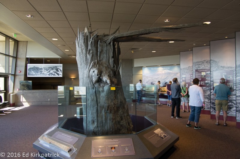
Johnston Ridge Observatory.  Flying rocks, over three feet in diameter, moving at 300 MPH ripped this tree apart. 

There are ranger’s talks held about every 20 minutes and we decided to listen to one. Like many of you dear readers, back in that spring of 1980 we had followed the news articles detailing the destruction, the many lives lost and the effects of the aftermath, but we had no idea really until we listened to Ranger Todd (who’s been here 30 years) tell about the eruption.  With encyclopedic knowledge (and humor) he explained the astonishing speed and power of the explosion and destruction accompanied by first hand photos and accounts.  Quite literally jaw dropping!!  Ed and I both agree he is one of the most fascinating, informative and delightful people experiences we’ve had on this adventure!  Absolutely put a visit to Mount St. Helens and the Johnston Ridge Observatory on your MVL (Must Visit List)!!


_ekp9562

Our first view of Mt. Rainier from the Yakima River Valley.  Shortly after this it was obscured by clouds never to be seen by us again.

_ekp9597

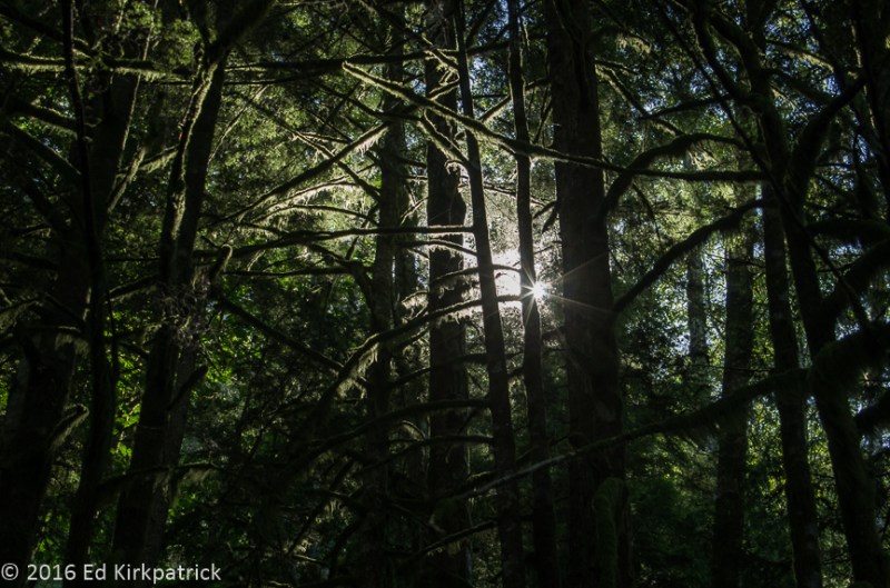
A typical view along HWY 12.

old-mt-st-helens

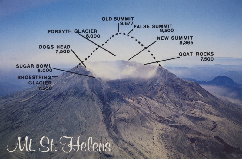
Before May 18th, 1980…

_ekp9651

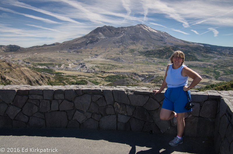
and now.  This is from the Johnston Ridge Observatory.

_ekp9663

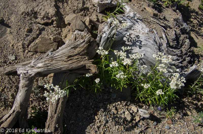
The soft ash is easily eroded by snowmelt and rain.  You can see some vegetation is coming back.

_ekp9653

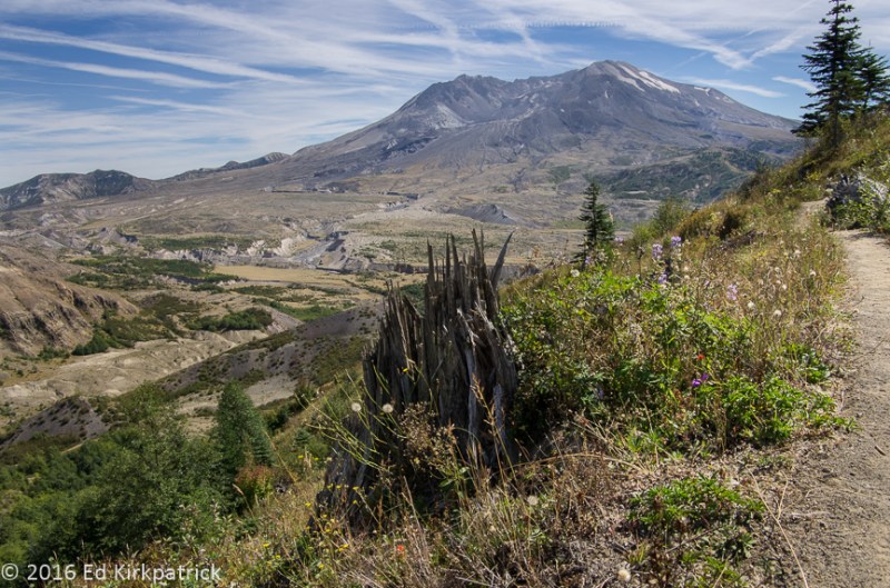
We walked out along a path that ran along a very, very steep and soft hillside.  This tree is one of the remaining examples of how violent the explosion was at this distance from the volcano.

_ekp9674

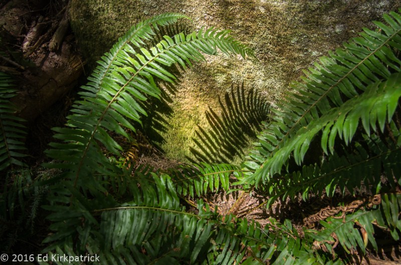
A pretty detail along the above path where we stopped to chat with an older couple who were sitting to enjoy the view.  They come here often to see the rebirth and remember because they lived through the eruption.  The gentleman told us that on the night of THE day he got up to check on things and  also to drive down to check on their neighbors. Down the road the mud flow was high enough to come to his floorboard so he turned around and went back home.  He said  “I got her up (pointing to the lady) and said wake the boys and get the 3 dump trucks and go! ”  At that point the pickup would not start again so they left it and fled in the dump trunks!!!   

20160828-_ekp9615-pano

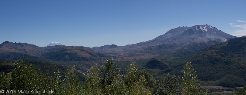
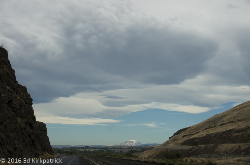
A view of snow covered Mt. Adams on the left, 25 miles away where a hiking party on the summit witnessed the eruption.  They heard no noise whatsoever because they were in the so called “quiet zone” due to the complex response of the eruption’s sound waves to differences in temperature and air motion of the atmospheric layers.  Others heard the boom as far away as British Columbia, Montana, Idaho and northern California.  Prevailing winds blew the ash cloud towards them and static electricity from the dust particles charged every metal thing they had with them causing it to hum including a 14 year old boys braces.  Then debris began falling on them and barely escaping with their lives they ran down the mountain.

20160828-20160828_130421

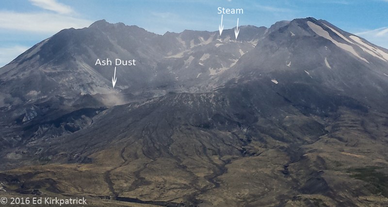
The volcano is still active with live steam vents in the crater and some recent rumblings.  Winds kick up the ash creating a haze around the crater.

_ekp9688

Harry Truman, who owned and operated the Spirit Lake Lodge refused to leave and is buried under more than 150 feet of debris.  He is one of 57 dead or missing.

Washington State ~ Orchards and Mountains

03 Monday Oct 2016

Posted by Ed and Marti Kirkpatrick in Travels

≈ 6 Comments

Tags

Cascade Mountains, Deception Falls, Leavenworth, Ross Lake, Sherman Pass, Stonerose Interpretive Center, Washington Pass, Washington State, Winthrop

After our Spokane goodbyes we headed north for the town of Republic via US Hwy 395 toward Kettle Falls Washington where we’d again pick up US 2.  This is where the Kettle River flows into the mighty Columbia which is the largest river in the Pacific Northwest.  Having lots of time we decided to investigate the Kettle for a while so stayed with 395N which follows the river all the way to Canada.  Not wanting to go that far we crossed the river at Orient onto Orient Cut Off then south on Pierre Lake Rd and back down to Lake Roosevelt created by the Columbia River’s Grand Coulee Dam 144 miles downstream!  It is a pretty drive on mostly good dirt roads.

20160819-_ekp9095

Pierre Lake Road down to Lake Roosevelt

Heading west on US 2 over Sherman Pass we got into Republic in time for a late lunch at the Knotty Pine (very good bacon cheeseburger) and a visit at the Stonerose Interpretive Center and Eocene Fossil Site. Turns out right here in town there’s an extensive plant and insect fossil site dating from about 50 million years ago. For a small fee we’re all invited to come look for them, and even keep up to 3 finds!  We didn’t know about this interesting fact and consequently did not allow time to go digging….but I will if we ever get back this way 🙂

The next morning we continued on State 20W through big hills/mountains covered with dry grass towards Tonasket where we started seeing orchards of apples, pears and cherries.  We cut back into the hills to look at the countryside and orchards.

20160820-_ekp9119-pano

Fruit orchards use reflective mylar to bounce sunlight back up to the bottom of the fruit to even out ripening.

On Pine Creek Road we drove past a place completely surrounded by high, screened fencing with cameras posted everywhere….HOLY COW IT’S DOPE!!… Yup, this is Washington State and it’s LEGAL cannabis!  Welcome to Empire Experience, marijuana growers! And yes, it certainly is a bit of a shock to folks who grow up in the 60’s, but we couldn’t help laughing!!

20160820-_ekp9129-pano

Cannabis, Marijuana, Dope, Pot, Grass, Weed, 420, whatever.  It’s legal!

We spent the next few days at the nice enough Pine Near RV Park (a really easy walk into town) in Winthrop which is a touristy town, but cute enough and GOOD home-made ice cream….have you noticed a theme with me yet 🙂

With Winthrop as home base, we drove out beautiful 20W, put this road on your MVL (Must Visit List), into the Okanogan National Forest.  This route takes you by the Washington Pass Overlook where a short walk goes out to a wonderful view of the mountains, and the road you’ve just ascended.

20160821-_ekp9252

Looking down on HWY 20 from the Washington Pass overlook. 

Further west at the edge of Mount Baker-Snoqualmie National Forest and Ross Lake National Recreation Area, where we turned around for the day, the view over Ross Lake looking into the North Cascade Mountains is just fabulous, and with more glaciers than at Glacier National Park!

20160821-_ekp9289-pano

Ross Lake looking north towards the Cascade Mountains

On the return trip we had to stopped for a short hike in the woods at Happy Creek Trail….I mean with a name like that 🙂

20160821-_ekp9348

A picture of Marti taking a picture of Happy Creek.

Continuing on our trip west we back tracked a bit and picked up St. Rt. 153S through the Methow Valley along the Methow River down to where it joins the Columbia and we picked up 97S.  Lots more orchards and grapes growing, at least until we got on US 2 west and back into the mountains of the Wenatchee National Forest. From Coles Corner we wandered up 207N to pretty Lake Wenatchee where we drove out lovely NF65 (National Forest road) which while paved allowed for no errors.

20160823-_ekp9393

Along NF 65 in a wide spot.

Back tracking again, we camped at Icicle River RV just outside of Leavenworth, which is a tourist town I salute.  Seems back in the early 1960’s this struggling logging town decided to do something to save itself and formed a committee, Project LIFE (Leavenworth Improvement For Everyone).  Looking at their lovely alpine mountain location and taking a cue from a California town which had “gone Danish” they became Bavarian!  New fronts went onto buildings, Bavarian artwork, food, festivals and crafts were produced and promoted and they are now doing just fine thank you!  Pretty clever I think 🙂

The next morning we drove on out US 2W, by the way also put this road on your MVL, to visit Deception Falls and walk the loop trail.  Not only is it really beautiful, but the parts of the trail that had steps were designed by someone who actually placed them at the correct height and stride, very rare!

20160824-_ekp9457

Along the loop trail at Deception Falls.

After this we drove almost to the town of Index where we stopped to hike the Bridal Veil Falls trail.  Turns out it was a good bit further and up than we thought so although we never quite made the falls we had a gorgeous walk in the woods!

20160824-_ekp9538

We are amazed at the ferns.

We took a couple of days to have a nice visit with Marguerite a newly discovered 3rd cousin of Ed’s, in Ellensburg and then headed out for our next blog posting… Mount St. Helens, Coming Soon!   🙂


20160820-_ekp9137-pano

Heading back into the hills where they grow the cannabis.

20160821-_ekp9271

A spectacular view of the Cascades with nice green meadows.

20160821-_ekp9327

Happy Creek Trail

20160821-_ekp9351

Happy Creek

20160821-_ekp9366

Washington Pass on our return trip in the afternoon.

20160824-_ekp9427

An interesting intrusion of quartz?

20160824-_ekp9519

Ferns in the late afternoon light along the Bridal Veil Falls Trail

20160824-_ekp9433

A tree on a stump.  The loop trail along Deception Falls

20160824-_ekp9437

Can you see the cat peering out from the stump?

20160824-_ekp9448

Below Deception Falls on the loop trail

20160824-_ekp9460

A log bridge over the creek below Deception Falls

20160824-_ekp9430

The water of this creek at Deception Falls is nearly sterile of life due to a lack of nutrients.  The stream flows over granite which is high in silica, a mineral which does not easily dissolve in water and thus does not contain many nutrients.  Combined with low light this inhibits algae growth essential as the basis of life in the water. But it sure is clear.

20160824-_ekp9492

The end of the day’s hike on Bridal Veil Falls Trail. 

Washington ~ Spokane and the Polouse

17 Saturday Sep 2016

Posted by Ed and Marti Kirkpatrick in Travels

≈ 9 Comments

Tags

Basalt, Lentils, Manito Park, Missoula Glacial Lake, Palouse, Riverside State Park, Spokane, Steptoe Butte, Washington State, Wild Sage

With our arrival in Washington, Ed adds one more, #45 to his almost completed list of states visited.  We headed straight for Spokane (spoKAN) to visit with Moni (Monica) & Fred Spicker.  Moni and I became “blood sisters” back in junior high school but missed each other’s wedding because we got married on the same day. Although we have rarely seen each other since our early 20’s we still start right up where we last left off.  Fred was in recovery from an involved shoulder surgery and so Moni went into tour guide mode and showed us the surrounding sites.

20160819-_ekp9090

Moni and Fred outside their cute Craftsman house beside Corbin Park, Spokane.

The geology of Eastern Washington is a fascinating result of almost unimaginable huge flows of lava followed much later by equally huge floods of water.  At the end of the last Ice Age in western Montana, a glacial ice dam that had blocked the Clark Fork River for thousands of years broke.  The estimated 500 cubic MILES of water that was Glacial Lake Missoula came roaring out of the mountains of Idaho scouring, reforming, redirecting and gouging the landscape around Spokane, the Columbia Basin and eventually into the Pacific.  Geologists estimate there were as many as 40 of these floods over about 2,000 plus years!

Our first day Moni took us to the Riverside State Park and the Bowl & Pitcher for a short walk around the lovely Spokane River.  Great basalt rock formations and cliffs make an interesting and unique landscape that invites climbing but closer inspections of potentially loose rock keep me on the trail.

20160815-_ekp8914-pano

The Bowl and Pitcher on the Spokane River in Riverside Park, Spokane.

Having worked up a bit of an appetite, we collected Fred and went to Mary Lou’s Milk Bottle for lunch.  Their specialty is milkshakes and we do recommend them…in fact that’s all I had for lunch 🙂

The next day we went to Manito Park in the South Hill neighborhood of Spokane and had a nice walk around the various gardens and greenhouse.  The Rose Hill area of the gardens was especially nice.  Unlike so many rose gardens we’ve been to, here instead of a single plant of each they did large groupings and the effect of a mass of say Queen Elizabeth next to Mt. Hood was wonderful. The scent on the soft breeze was pretty darn nice too!

20160816-_ekp8944

While Marti and I agree this is an exquisite photograph of a beautiful rose, she’s irritated that I did not take a picture of the overall garden, but she loves me anyway.

That evening we had a delicious dinner at Wild Sage where Ed and Fred enjoyed the attentions of possibly the most lovely and exotic Cleopatra-like waitress ever.

On day 3 Moni (being a dedicated Whack-A-Mole Wheels blog reader) loaded us and some good sandwiches up and headed out to show off the kind of landscape she was sure we’d love.  She was right!  The incredibly beautiful Palouse prairie with its layers of varying depths of loess (windblown silt) lying on top of Washington’s ever present volcanic basalt is like nothing we’ve ever seen.  It’s a unique landscape, there is nothing else like it in the world.

20160817-_ekp9024

Amber waves of grain, the Palouse.

While vast amounts of wheat, barley and chick peas are grown here it is the Palouse that is the most important lentil growing region in the US. For miles and miles the undulating hills of crops are only broken up by spots of ground too steep to plow, often faced with exposed basalt.  These “eyebrows” add a delightful feature to this fabulous countryside.

20160817-_ekp9031-pano

Eyebrows.

Moni drove us to the top of the 3,612 foot tall Steptoe Butte sitting in isolation on the Palouse.  This quartzite protrusion of bedrock is 400 million years old, having withstood the much younger lava flows of the basalt layers under the surrounding layers of loess.  The view, well, put it on your MVL (Must Visit List).

20160817-_ekp9011-pano

View from the top of Steptoe Butte. It’s just magnificent.

On the southern end of the Palouse is the Snake River, where the farming stops because basically the soil ends.  Then about 4 miles upstream from the confluence with the Snake and the Palouse River we visited the beautiful Palouse Falls State Park and had our picture taken 🙂

20160918-_igp8338

Don’t step back…

All in all, a perfect start to our Washington State adventures.  Thank you Moni & Fred!


20160816-_ekp8931-pano

Spokane, Washington, a really nice city.

20160815-_ekp8930

Spokane River in Riverside State Park.  

20160816-20160816_102421

Nishinomiya Tsutakawa Japanese Garden in Manito Park.

20160816-_ekp8952-pano

The formal Duncan Gardens in the same park.

20160816-_ekp8957

In the greenhouse, I did not note the name of this really cool flower.

20160817-20160817_105717

Steptoe Butte at 3,612 feet elevation it’s a good spot for radio towers but the view is still nice.

20160817-_ekp8973-pano

On the Palouse…

20160817-_ekp9056-pano

Piles and piles of grain, the harvest was underway.

20160817-_ekp8990-pano

Lentils from Steptoe Butte. It goes on forever.

20160817-_ekp8965-pano

Steptoe Battlefield where a fight with Indians occurred in 1858.

20160817-_ekp9063-pano

Our view from our picnic site on the Snake River.

20160817-_ekp9079

and the Palouse Falls on the Palouse River just above the Snake.

Enter your email address to follow this blog and receive notifications of new posts by email.

Join 183 other subscribers

View Recent Posts

  • Cod Jigging and New Friends! March 2, 2020
  • Grand Tetons ~ Yellowstone October 11, 2019
  • Beauty & Bones ~ Dinosaur National Monument September 29, 2019
  • Wyoming ~ In the Medicine Bow Corner September 25, 2019
  • A Bit of Western Nebraska September 5, 2019

Get Caught Up

Blogs We Follow

  • john pavlovitz
  • Take To The Highway
  • Kelly Time
  • HowToRVgeeks
  • WANDERTOPIA
  • BoomerCafe ... it's your place
  • Island Girl Walkabout
  • Страничка Доброго Дяди
  • Technomadia
  • Wheeling It: Tales From a Nomadic Life

Categories

Blog Stats

  • 27,118 hits

Blog at WordPress.com.

john pavlovitz

Take To The Highway

Kelly Time

HowToRVgeeks

WANDERTOPIA

BoomerCafe ... it's your place

Island Girl Walkabout

Страничка Доброго Дяди

Technomadia

Adventures in Nomadic Serendipity

Wheeling It: Tales From a Nomadic Life

On the Road Since 2010, Traveling Across USA & Europe With Pets

  • Subscribe Subscribed
    • Whack-A-Mole Wheels
    • Join 183 other subscribers
    • Already have a WordPress.com account? Log in now.
    • Whack-A-Mole Wheels
    • Subscribe Subscribed
    • Sign up
    • Log in
    • Report this content
    • View site in Reader
    • Manage subscriptions
    • Collapse this bar
 

Loading Comments...