Tags
BonTours, Gros Morne National Park, Lighthouses, Lobster Head Cove, Newfoundland, Rocky Harbour, Tablelands, Western Brook Pond
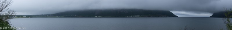
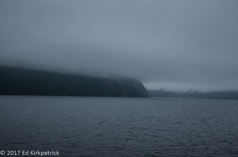
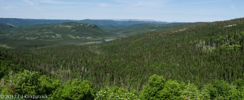
Saying goodbye to the tippy-top of the Northern Peninsula we headed out in light fog for the 432 inland loop back towards 430 South on our way down to Gros Morne National Park. Having just driven on past Gros Morne on the way up to L’Anse aux Meadows because the weather was so bad, we hoped things would be better now. Inland the sky was beautiful and sunny. Of course when we got back to the coast the fog was well on its way to being pea soup thick.
Headed into pea soup fog… oh well, it’s Newfoundland!
We settled into Gros Morne RV Campground in Rocky Harbour which while not a tourist town by US standards, it is more touristy then anyplace we’d been. The advantage with that is a wider selection of restaurants. We did Earl’s which was fine although they know fish better than fried chicken. The second night we went to Ocean View. I admit it, we can be a little snobby sometimes, but with real table linens, nothing served in plastic, complimentary dinner rolls, SEVERAL kinds of vegetables and good food….well it was a very nice 🙂
Note to RV’ers: we had low voltage issues at the campground. We like to be tucked away if possible and so were at the end of the line which the owner acknowledged as the problem. We just didn’t brew coffee AND run the electric water heater at the same time and it worked ok.
The next day we had a reservation for the 11 o’clock boat tour on Western Brook Pond. It is a lovely 3 kilometer walk from the parking lot to the boat launch & café at the mouth of this fjord. Naturally it was a foggy day as we headed out early with all fingers and toes crossed that the sun would do its thing and burn off at least most of it before our boat ride. We got in line, headed up to the open top deck when boarding and they set out.
Lovely weather for a boat ride.
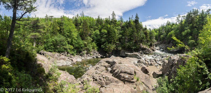
About 10 minutes into the 2 hour tour, the boat slowed almost to a standstill and they announced that the earlier tour boat ahead of us had just radioed back to say the ceiling had dropped completely to water level so we would be turning around and given a refund. Back on shore I checked the weather forecast, whispered to the weather gods and booked the following day’s 12:30 trip. Not ready to call it a day, we decided to walk at least part of the Snug Harbour Trail that’s just up from the boat launch.

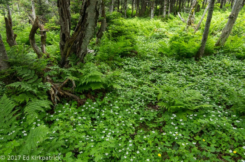
Foggy days may suck for boat rides, but they are great for the colors of these woods.

The nice soft light of cloudy days really favors Ed’s new favorite flower, Bunchberry which is in the dogwood family and explains why when we first saw it we said to each other, “Baby Dogwoods???”
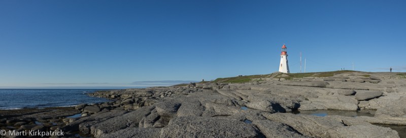
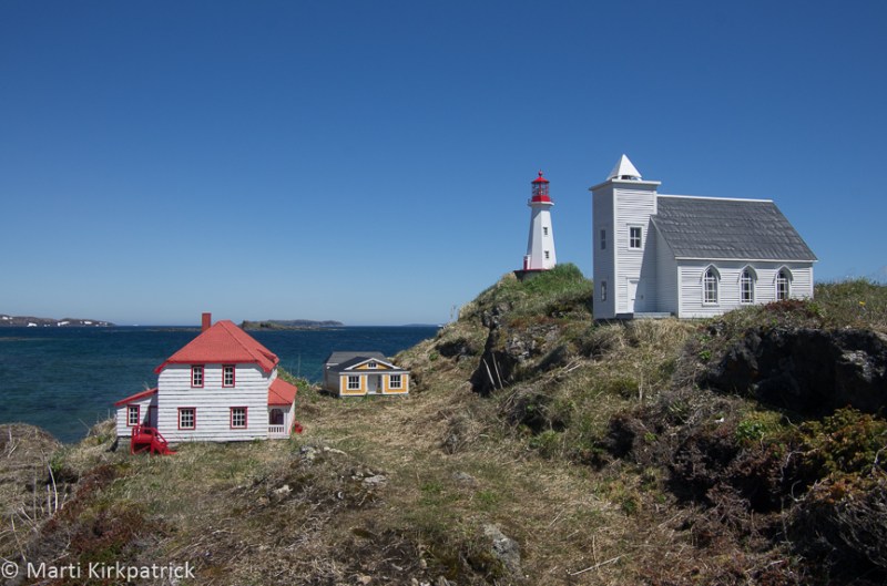
Heading back to Rocky Harbour and with the fog finally lifting we decided to drive out to the Lobster Cove Head Lighthouse. The good citizens had long worried about the dangers their husbands, sons and neighbors had endured with only an oil lamp in a fellow fisherman’s home window offering guidance to those at sea. Finally this lighthouse opened in 1898 with a kerosene vapor lamp and a fifth-order dioptric lens maintained by keeper Robert Lewis, was sending out its life-saving flash ever 2 ½ seconds.
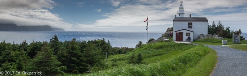
Lobster Cove Head Lighthouse only had three lightkeepers: Robert Lewis was the first keeper at an annual salary of $504 until 1902 when William Young succeeded him until 1941 when William’s son, George, became the third and final keeper of the light until 1969 when it was automated.
We awoke to a beautiful sunny day and were so thankful our tour had been cancelled the day before!

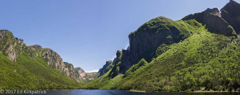
Walking towards Western Brook Pond, it’s a better day for a boat ride. You can see the fjord’s opening.

Entering the Western Brook Pond fjord. Technically it’s not a fjord because it has been cut off from the sea by rising land and is now all fresh water.
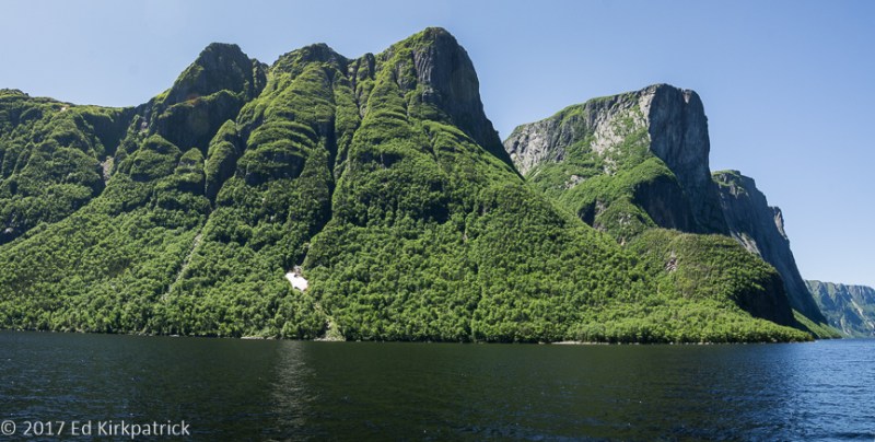
Fjords are cut by glaciers which in this case pushed down the land and as the glacier retreated its weight was gone and the land rose to cut if off from the sea. Over time the salt water has been flushed out and replaced with fresh therefore it is no longer a technical fjord.
Wanting to sort of put a finish on the entire Western Brook experience we did the short walk out to where it flows into the Gulf of St. Lawrence.
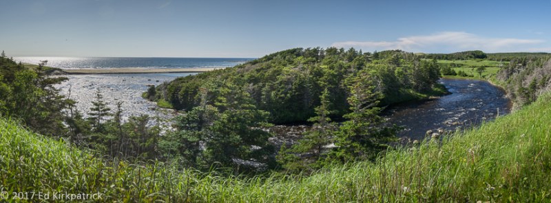
Western Brook flows a short distance across the bog and down into the Gulf of St. Lawrence.
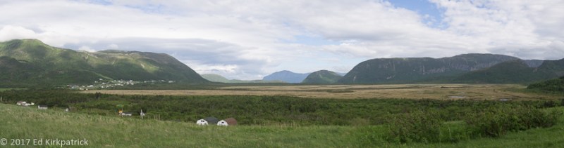
With another sunny day (yippee) we headed for the most southwestern section of Gros Morne to walk on the Earth’s mantle. This part of the park known as the Tablelands reminded Ed of our desert southwest with its barren red rock.

A short walk out along the edge of the Tablelands is rock that is of the Earth’s mantle.
Pushed up from deep inside the earth by tectonic plate collision several hundred million years ago these mountains are peridotite, and very low in nutrients and calcium while high in heavy metals, magnesium and iron, hence unable to support plant life.

Pockets of green can be attributed to water and a lack of the heavy metals etc.
Before signing off I need to make a correction to our last posting and then a confession 🙂
I’m happy to say thank you to reader Deborah Gordon (via FaceBook) who not only corrected my location of the mini village in the Newfoundland ~ Part One post but also identified the artist, ~ “That little mini village you photographed is directly across from my house and is actually in Ship Cove ( Cape Onion is on side of the point that runs parallel ). Built by Brian Decker as a community sponsored project, it’s meant to portray the old town, which still has some of those same buildings in it. Too bad you didn’t stop in for a cup of tea!”
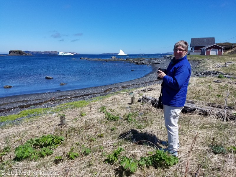
Confession ~ I have taken things a bit out of order as far as our travels go. In between these two blog postings Ed & I took the ferry over to Labrador for a very short visit. We will share that adventure in our next installment, as well as lots more icebergs, beautiful hikes and wonderfully friendly folks. We sure hope you continue to ride along!!

On our first walk out to the boat dock we encountered this yearling calf who was soon disinterested in all the gawkers so he just walked off. There are over 120,000 moose on Newfoundland and all of them originate from four animals imported in 1904.

Foggy day walk to the boat…

Non foggy day walk to the boat. What a difference a day makes.
but what a beautiful walk we had in the misty, drizzly fog.

This is Cow Parsnip. It’s all over Newfoundland and it’s pretty. However, it is poisonous and will give you a nasty rash of blisters. Don’t touch it.
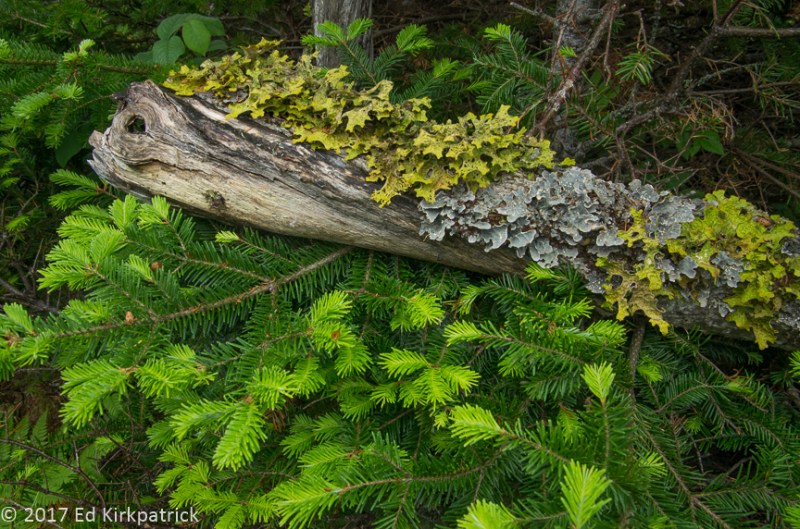
Marti just loves the mosses and lichens and ferns and flowers etc, etc, etc…
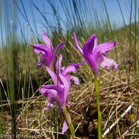
On the sunny day’s walk in the bog Dragon’s Mouth.

In our family this is a big bugger but to geologists this is known as an erratic. A large stone dropped or deposited by retreating glaciers.

Pissing Mare Falls on Western Brook Pond. Don’t blame us for the name…
The head of Western Brook Pond which by the way is neither a fjord or a pond. It’s a big effing lake. The Brits called everything a pond back when they were naming places so it stuck.
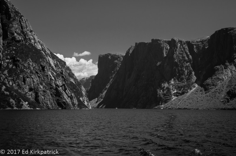
The larger tour boat is in this photo. Can you see it? These cliffs are 2000 ft. tall.
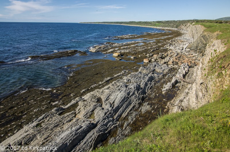
We finished up our day on Green Point near Rocky Harbour. Love the stratified rocks.
Gros Morne on our way to the Tablelands. Notice the snow on the distant mountains.

Tablelands, Marti may or may not have collected a rock, a particularly nice piece of Olivine/peridotite.

Trout River Pond in Gros Morne.

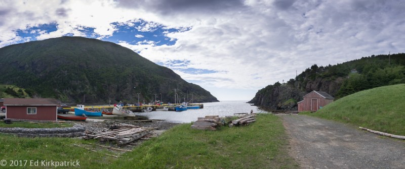
The village of Trout River at the end of the road in southwest Gros Morne.
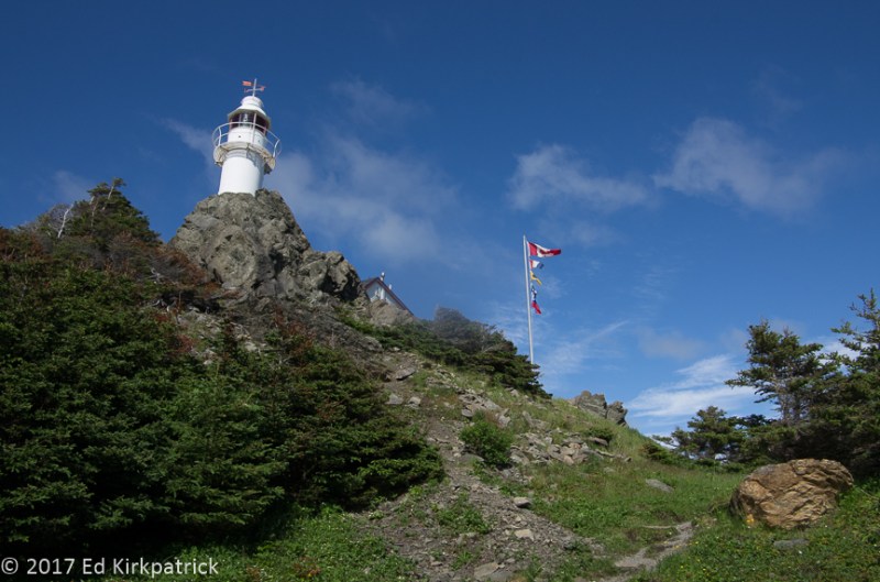
Lobster Cove Head Lighthouse.
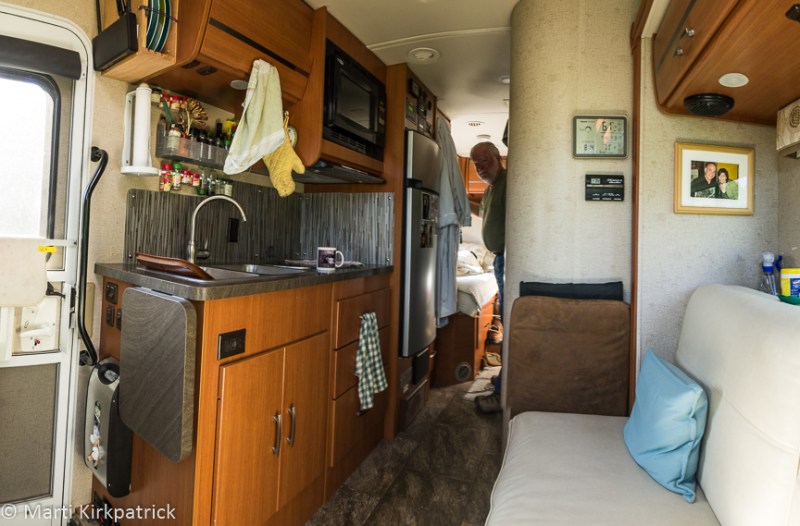
Ed peeks around the corner to say goodbye from our home, Whack-A-Mole Wheels.