• About

Whack-A-Mole Wheels

Whack-A-Mole Wheels

Tag Archives: Newfoundland

Newfoundland, Part Seven~ St. John’s, The Big City

31 Tuesday Oct 2017

Posted by Ed and Marti Kirkpatrick in Travels

≈ 3 Comments

Tags

Blue Rodeo, Cabot Tower, Cape Spear, Jelly Bean Rowhouses, Newfoundland, Pippy Park, Quidi Vidi Brewery, Royal St. John's Regatta, Signal Hill, St. John's, The Rooms

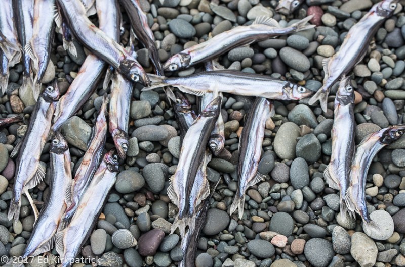
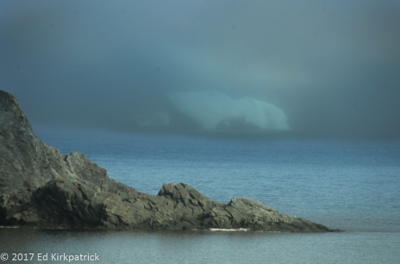
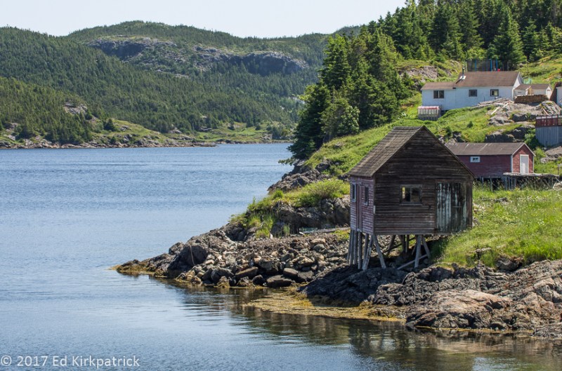
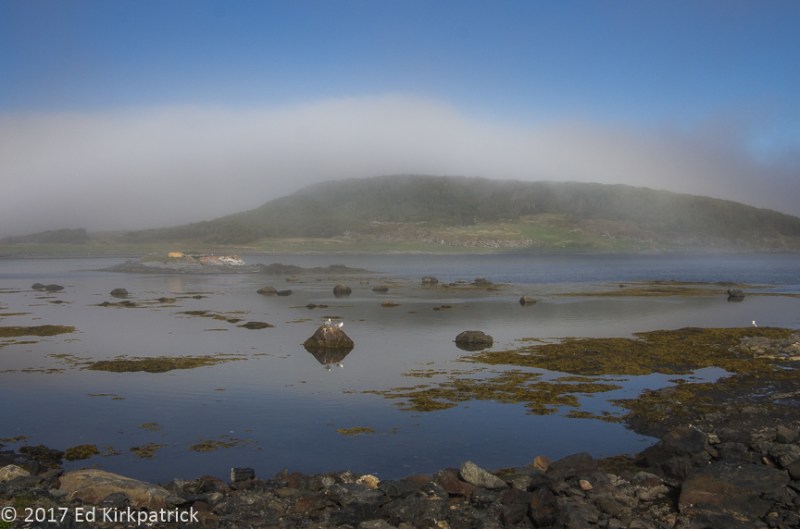
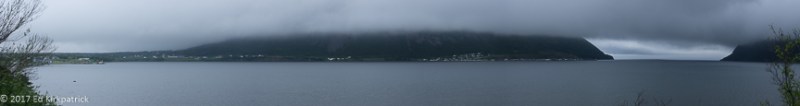
Waking to a sunny day, we continued north on 10 except for side trip one, to Bauline East.  A small, pretty harbour in a tiny town we got our first look at what happens to cod after folks cut out the fillets and tongue.

20170731-_EKP2330-Pano

Bauline East Harbour


20170731-_EKP2336

After the fillets and tongues are taken, there is a lot of waste which goes right into the water to eventually be consumed by various bottom creatures.


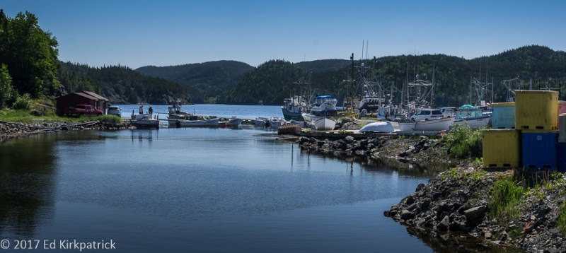
Side trip two was to Bay Bulls where Pennecon Limited clearly must be the biggest employer in town.

20170731-_EKP2347-Pano

Bay Bulls and the Pennecon Limited yard.


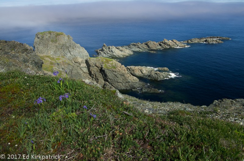
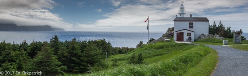
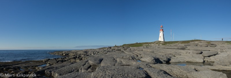
We wanted to go to the easternmost point in North America so we took Petty Harbour Road off 10 to wander the long way around to Cape Spear Lighthouse National Historic Site.  The second lighthouse built in Newfoundland, it began operation in 1836.  Similar to the Cape Bonavista lighthouse, the light tower centered in the surrounding square wooden keepers house was built first with the house constructed around it.  The light apparatus was seven oil burners (Cape Bonavista light had six) set in silvered reflectors with the whole apparatus being turned by weights that needed frequent rewinding.  Fun fact: the copper-domed lantern room and the lighting apparatus, which had already been used for twenty-eight years in the Inchkeith Lighthouse on the Firth of Forth in Scotland, was designed and provided by Stevenson and Sons,  Stevenson being the grandfather of author Robert Louis Stevenson!

20170731-_EKP2383

The original Cape Spear Lighthouse. There is no access to the tower itself unfortunately. 


20170731-_EKP2392

We thought the way they stored the glass globes for the light’s oil lamps was interesting.


After enjoying the views at Cape Spear we headed the last 18 miles up to St. John’s and the Pippy Park Campground & Trailer Park.  With no reservations, there were no hook-up sites available but there was a small, mostly empty overflow spot where we could boondock.  St. John’s is the provincial capital city and Newfoundland’s largest city so we knew this was going to be a switch from the quiet we’d been enjoying for so long.

Opened in 2005, The Rooms houses the Art Gallery of Newfoundland and Labrador, the Provincial Archives of Newfoundland and Labrador and the Provincial Museum of Newfoundland and Labrador.

20170801-_EKP2422-Pano

The Rooms.  Everywhere we have been in Newfoundland and Labrador we always saw references to The Rooms holding artifacts from whatever Interpretation Center we were visiting.  We had to go.

We figured it was a good place to start our exploration of St. John’s, so we rang for a taxi, driving and parking an RV in the city not being high on our list.  🙂  Jumping into the cab, the driver who is just as friendly as everyone in the province, says, “So ya here for the regatta tomorrow?” “Ahhhh, what regatta?” say we.   “Ya donna know ‘bout the regatta?  The Royal St. John’s Regatta?  It’s huge, the whole island comes, 40,000 maybe 50,000 people!”  WELL…..surprise!!!  No wonder the RV park was full!  BUT….we went on to The Rooms.

20170801-_EKP2403

On the very top floor of the exhibit, these canoes and kayaks were laid out on the rafters.


Having done pretty much all of The Rooms and had a lovely light lunch in the museum, we headed down towards the harbor in a zig-zag fashion looking for the famous Jelly Bean Row houses.  Pretty quickly it becomes apparent that these wonderful colorful houses (which by the by we have noted in previous blog posts are all over The Rock) are not just one row, but street after street of multi-hued homes, many accented with potted bouquets of magnificent flowers.

20170801-_EKP2425-Pano

Jelly Bean Row Houses are a common and fun feature of St. John’s.


20170801-_EKP2429

Flowerboxes add even more color.


The next morning, Wednesday, August 2nd dawns a bit raw and grey, but we’ve decided that after we run a couple of errands we’re going to join with all of (or at least a whole lot of) Newfoundlanders and go to the 199th Royal St. John’s Regatta,  It’s the oldest annual sporting event in North America.  Guess what….it’s a local holiday and pretty much nothing is open not even the grocery stores because, well, everyone is down by Quidi Vidi (kiddy viddy) Lake!  So we call for a taxi and he takes us as close as he can.  WHAT FUN!!

20170802-20170802_135649

Bang! at the shot of the starter’s gun, the rowers are off for a half mile leg before turning around and finishing here at the start line.  The most strategic part is executing the turn properly.


20170802-20170802_140539

Winners!  Racers of all ages from young kids to grey hairs, everyone used the same boats.


Having enjoyed ourselves with “all the rowing” and the famous French fries at Ziggy Peelgoods (four lines and nearly half hour wait) we hiked via Kings Bridge Road into downtown. Down at the harbour, we had an “okay” steak dinner at The Keg Steakhouse & Bar overlooking the ships tied up just outside across the way.  Afterwards, we wandered around a bit, heading back up the hill.  Note: St. John’s was built on a steep hillside so from the harbour most everything else is up, so good exercise! 🙂 As we got up to just below George Street all access was blocked, there were “event people” and “event security” everywhere and music could be heard.  As we walked up around the perimeter I asked what was going on and they said “Blue Rodeo is playing tonight”   “OK, who are they?”  “One of the top bands in Canada for the last 20 years!”  When we got to where they were taking/selling tickets I reminded Ed Life’s an Adventure and we handed over our cash, went in and had a BLAST!  Blue Rodeo is GOOD!

20170802-20170802_213530

Blue Rodeo!  It was a late night but what a blast.  The aroma of weed lingered in Marti’s sweater for a week. No, she didn’t, it was just in the air.


Next day was an oil change and check up at the St John’s Mercedes dealer and errands.  In the late afternoon our friend, Suzanne Anthony a fellow full-timing, blogging RV’er also living in a View similar to our rig, joined us in camp.  We had been sharing notes and suggestions all around Canada so it was great fun to finally meet.

The following morning the three of us drove over to Quidi Vidi Village in our RV.  A neighborhood of St. John’s once known as a fishing village, Quidi Vidi Village is now a major tourist attraction because of the Quidi Vidi Brewery. They are famous for their Iceberg beer which I have mentioned before as well as seven other beers.  Unfortunately, there are no tastings without a tour, and all the tours were booked.  Oh well, Ed had tried a number of them already 🙂

20170804-_EKP2439

The green building is the brewery.


20170804-_EKP2446-Pano

The Quidi Vidi harbour is almost a lake with a tiny narrows, visible on the right, as the entrance to the ocean.


Next on the list of St. John’s attractions was Signal Hill, the site of Marconi’s first transatlantic wireless communication and Cabot Tower.  Overlooking the harbour and the Atlantic Ocean this high hill has been an important defensive position since 1640 and even held anti-aircraft and anti U-Boat defense guns of the United States during World War II.

20170804-_EKP2499

Cabot Tower on Signal Hill.


20170804-_EKP2501-Pano

The view of St. John’s and the harbour from the top of Cabot Tower. You can see what a perfect defensive position this hilltop is.


We dropped Suzanne at The Rooms where she would spend the afternoon and with plans to meet later in town for drinks and dinner, we went back to camp to do laundry.  With another taxi ride into town, we walked around a bit and then had a good meal at Oliver’s, which we recommend.

We had actually been a little uncertain about going to THE BIG CITY after all the quiet villages and no crowds we’d been experiencing.  As it worked out, even with the regatta, country/rock concert and all, it did not feel overcrowded and we had a lot of fun!  Plus, there is the bonus of meeting a fellow RV traveler and absolutely now having a new friend!  It’s an adventure!


20170731-_EKP2339

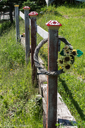
Leaving Bauline Harbour we saw this really cute yard ornament.


20170731-_EKP2344

In Bay Bulls, this drilling rig is at the head of the harbour, coming or going we couldn’t tell.


20170731-_EKP2346

Like it says on the side of the ship, it’s a heavy lift crane…


20170731-_EKP2354

…to lift heavy stuff like all this anchor chain.  Look at the size of the links and the anchors compared to the trucks in the yard.


20170731-_EKP2369

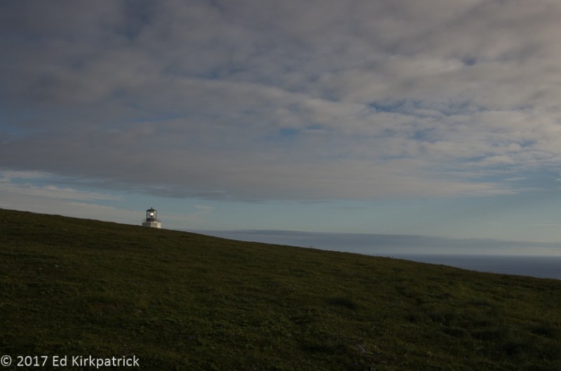
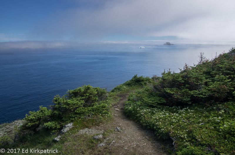
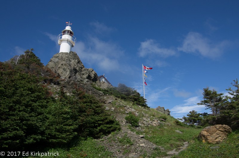
The new light at Cape Spear which came on in 1955.  It’s a pretty place with lots of boardwalk and paths around the cape and cliffs.


20170731-_EKP2377-Pano

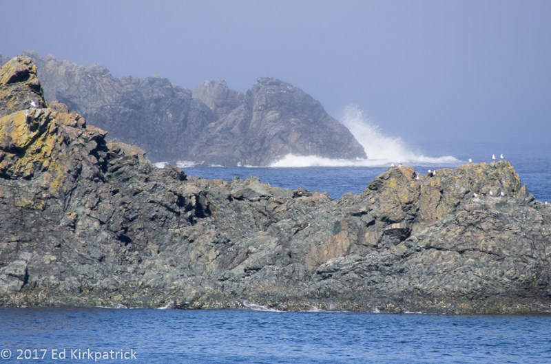
A view from the cliffs at Cape Spear. Marti thinks the white foam looks like a bridal train.


20170731-_EKP2391

The lightkeeper’s office which is restored to the period of 1839.  Note the flags used for sending messages and weather status.   In Canada, the job of lightkeeper is often passed down from father to son and so, the Cantwell family were the keepers of the Cape Spear light for over 150 years with only two short intermissions.


20170731-_EKP2401

There are two heavy gun emplacements on Cape Spear to help defend the nearby convoy routes to Europe during WWII.  The 10″ M1888 guns were Lend-Lease batteries on disappearing carriages.  The emplacements are currently under restoration.


20170731-20170731-_EKP2398

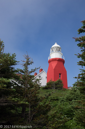
The current light, 45 feet tall with a visible range of 20 nautical miles, went into service in 1955 and is automatic.


20170801-_EKP2417-Pano

The interior space at The Rooms is as beautiful as it is functional. History, culture, art and the archives of Newfoundland and Labrador are all housed here in one building.


20170801-20170801_125413

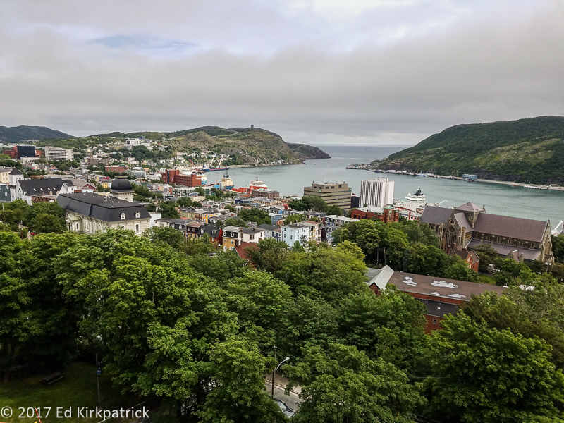
As we waited for a table in the cafe at The Rooms, we had a lovely view from the balcony of downtown St. John’s and the harbour with Cabot Tower and Signal Hill in the distance.


20170801-20170801_131811

What kind of chowder? Fish Chowder of course…  delicious too.


20170801-_EKP2435

Mailbox detail from some of the jelly bean houses.


20170801-_EKP2428

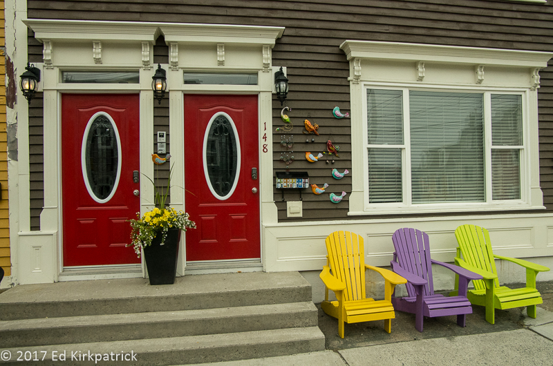
Newfoundlanders use color everywhere to brighten up their homes and lives.


20170802-20170802_202256

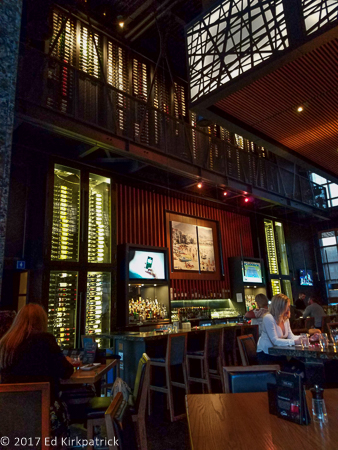
At The Keg Steakhouse & Bar, they store the wine in these immense walls of temperature controlled movable racks.  


20170804-_EKP2456-Pano

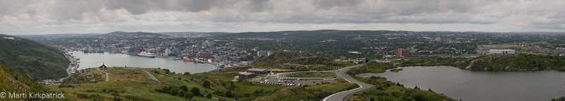
Quidi Vidi Lake on the right and St. John’s Harbour on the left from Signal Hill.


20170802-20170802_212209

Yours Truly at the Blue Rodeo concert on George Street with thousands of our new best friends and their weed… 🙂


t


Cape St. Mary’s & Ferryland, Newfoundland ~ Part Six

09 Monday Oct 2017

Posted by Ed and Marti Kirkpatrick in Travels

≈ 6 Comments

Tags

Avelon Peninsula, Black Legged Kittiwakes, Cape St. Marys, Colony of Avelon, Common Murres, Lord Baltimore, Newfoundland, Northern Gannets

Hello faithful readers!  We apologize for the long delay in posting and readily admit to actually being back in Maryland for some time now.  Life, as we’re sure you know, can just sort of get in the way and all of a sudden time has flown by.  We have been talking about our wonderful summer in Newfoundland so constantly that it’s a wonder our friends and family here at home haven’t abandoned us!  Having both agreed it would be unfair to not share with you the rest of our adventure in the hopes that you too will visit this amazing island, we shall pick up where we left off 🙂

As we continued our exploration of Newfoundland, now in our sixth week, we headed south on the TCH (Trans Canada Highway) for the Avalon Peninsula where we went around counter-clockwise south on 100 on the first “finger” known as the Cape Shore.

Avelon Peninsula

Avalon Peninsula – southeast Newfoundland

As usual, the road was full of potholes and DIPS, and I capitalize that to emphasize the seriousness of these struts, shocks, and axle wrecking road hazards.  Ed’s favorite bumper sticker was, “I’m not driving drunk. I’m avoiding potholes!”  Happily, however, when not closely watching this obstacle course of a road, Ed managed to also see the big hilled, lovely countryside stretching out around us.  At St. Bride’s the road turns east and becomes even more horrific.  Pretty soon, however, we get to the very narrow but smooth road out to Cape St. Mary’s Ecological Reserve and our destination for the day. The site of some of Newfoundland’s largest seabird colonies, we were very lucky to have a pretty day as we headed out the easy 1 km grassy path to the best viewing point.

20170728-_EKP2056

On the way out to the viewing point, the presence of over 60,000 birds becomes apparent.

Approximately 24,000 northern gannets, 20,000 black-legged kittiwakes, and 20,000 common murres, among other birds, come here each year to nest on the cliff edges and the 100 meter tall sea stack known as Bird Rock.  Before we even leave the interpretive center we catch whiffs of bird poo on the air and it’s not too far down the walk before we start to hear them, but it’s not until we get much closer that the smell and noise become really impressive, but WOW what a sight!

20170728-_EKP1981

Nesting Northern Gannetts occupy the sea stack, Black-legged Kittiwakes, and Common Murres nest in the remaining cliffside niches behind Marti and behind where I am standing.


20170729-_EKP2149

Northern Gannetts all perform this greeting dance whenever one partner returns to the nest.


20170729-_EKP2171

Common Murres, one here holds a capelin in his/her beak.


20170729-_EKP2183

A Black-legged Kittiwake contemplates its next move…

Having spent a couple of hours just sitting and watching the birds (and humpback whales) we slowly walked back towards the interpretation center enjoying the views and chatting with a couple of folks along the way.  Back at the parking lot, we settled in to boondock for the night. Over our cocktails, we watched the advancing pea-soup thick fog obscure the Lighthouse when the foghorn began sounding – all night, every 30 seconds.  The fog eventually became so thick the foghorn was hard to hear but it was a peaceful comforting sound all the same.

20170728-_EKP2067

Just at sunset, the distant fogbank approaches for the night and next day.


20170728-_EKP2088

…and here it is.

20170729-_EKP2095

Before we departed Cape St. Mary’s we took one last hike out in the fog to view the birds again.


20170729-_EKP2103

‘ Twas still foggy.

Next morning still in the fog we left Cape St. Mary’s, to continue on our journey. At the village of Branch, the road (now 92) turns north and the Sun came out…well at least for a while. 🙂  As is true in most of Newfoundland the road either hugs or is within a few miles of the coast and the view out the inland window is of wide open barrens punctuated with incredibly dense thickets of mostly fir, spruce, and ash.

20170730-_EKP2291-Pano

This is the barren peat bog part dense with fern, berry plants and low scrubby growth.

At the top of this first loop we cross over to the Irish Loop heading south toward the town of St. Vincent’s where we’ve been told the whale watching is world famous.  A steep dropoff at the shoreline here creates a deep water area where the feeding humpbacks can be seen within 300 feet of the long stone beach.

20170729-_EKP2260

Two humpbacks are blowing here right offshore.


20170729-_EKP2240

The beach was littered with capelin which had washed up.  These small fish are what the whales, seals, and cod feed on.  They stay out to sea all year except when they breed in the warmer waters near shore. The whales follow them in which is when we get to see them feasting on the schools.

We continued on to Trepassey where for some reason I expected a larger town.  Sort of looking for a place to stop for the night we headed out a road with a sign that pointed to an “interpretive site” thinking that might be a spot where we could stay.  The road quickly turned to gravel, but we kept going and on a big curve I spotted a lighthouse ahead and figured ah ha, we can stay there.  Eventually, we rattled and banged our way to the end of the road where we did indeed find the Powles Head Lighthouse and outside the fence a small, mostly level, gravel parking space. The old lightkeepers home was just up the hill and someone clearly lived there, so we walked up to the screened door and knocked and knocked and called “Hello”.  After a bit, an older gentleman came to the door.  We pointed to our RV and asked if it was alright if we stayed the night.  He allowed as he didn’t know what the authorities would say but he certainly didn’t care. The weather had definitely deteriorated back to heavy fog and drizzle so we did not walk around, but we did have a peaceful night with just the sound of a foghorn once again lulling us asleep.

Next morning I had wanted our next stop to be the Mistaken Point Ecological Reserve which is world famous for the 575 million year old fossils preserved in the rock, and the Cape Race Lighthouse where the Marconi Wireless station received the Titanic’s fateful distress call April 14, 1912.  The dirt road to the end, however, is about 15 miles of what even locals call treacherous and the weather was still fog and rain so we put it on our “must come back list” 🙂

Ed & I are lifelong Marylanders and as such, we had to visit Ferryland and the Colony of Avalon site where George Calvert, 1st Baron Baltimore had his agent Captain Edward Wynne establish what became the first successful permanent colony in Newfoundland, with a population of 100 souls by 1625.  Calvert wanted the colony to be a refuge for Roman Catholics being persecuted in England. By 1629 Calvert, however, wanted a place more hospitable, i.e. warmer and so he set sail south, settling in what would become Maryland.

20170730-_EKP2305

In its 25th consecutive season, archeologists have only uncovered a third of the original four-acre site.


We had the visitor center to ourselves and enjoyed reading about the colony and seeing the many items (be sure to open the drawers under the displays) already found in this still very active archeological dig. We also highly recommend stepping into the kitchen in the back of the gift shop and chatting with the delightful and knowledgeable docent in period dress, busily cooking something from a 17th century cookbook over the open fire!  They work at perfecting a different recipe each week, and there’s a social media contest for those who want to try their hand at it in their own homes.

The next morning dawned bright and sunny and we headed north up the coast to Cape Spear and St. John’s but that’s our next post.  Coming soon we promise!


20170728-_EKP1828

Common Murres nesting on the cliffs.


20170728-_EKP1902

Common Murres both in and out of the water.  They spend most of their time at sea and can swim underwater for distances of 98 feet on a regular basis with diving depths of up to 590 feet being recorded.


20170728-_EKP1951

That bit of fluff there is a baby gannet.  Often they just lay around and we thought they were dead but then… they wake up!


20170728-_EKP1937

Black-Legged Kittiwakes and babies…


20170728-_EKP2023

Looking back towards the lighthouse at Cape St. Mary’s.


20170728-_EKP2068

Looking north from beyond the lighthouse the evening was beautiful just as the fog approached from the south.


20170728-_EKP2083

Cape St. Mary’s lighthouse.


20170729-_EKP2206

It is a pretty walk.


20170729-_EKP2222

but it can get foggy at any moment then the world disappears. On average it’s foggy 200 days out of 365.


20170729-_EKP2282

Now you seem him, now you don’t…


20170730-_EKP2298

Not your average RV park…


20170730-_EKP2313-Pano

Looking back over the Avalon Colony site towards Ferryland.


Fogo Island ~ Newfoundland Part Four

13 Sunday Aug 2017

Posted by Ed and Marti Kirkpatrick in Travels

≈ 16 Comments

Tags

150 Canada, Fogo Island, Fogo Island Inn, Icebergs, Joe Batt's Arm, Kissing the Cod, Newfoundland, Nicole's Cafe, Screeched In, Tilting

On Fogo Island, the Town of Fogo Island is comprised of several small villages which used to be separate and unique defined largely by either their religion or ethnicity.  The villages: Fogo, Joe Batt’s Arm, Barr’d Island, Shoal Bay, Tilting, Seldom and Little Seldom were all amalgamated in 2011 forming one community in order to more efficiently provide services and a stronger regional voice politically.

Fogo Map

Fogo Island

The ferry to Fogo Island (round trip $22.25 Canadian!) operates on a first come, first served basis. We headed out really early from Twillingate and the hour long drive to the village of Farewell to hopefully be in line for the 9AM ferry.  It turns out I failed remedial reading and departure was set at 8:30AM. However, we did get there with lots of time to spare and easily made it on board.

20170711-20170711_083643

The MV Legionnaire is a brand new ship and was nice and shiny.

On the Fogo Island side, the ferry docks just outside the village of Stag Harbour where we off-loaded and headed for the only RV campground on the island.  Within 10 minutes we were both grinning ear to ear already in love with this rocky place!  Getting to the campground we found a lovely spot on a rise overlooking Banks Cove in a mostly empty park. Bordered on one side by Brimstone Head and a much smaller rocky hill on the other this place is only lacking WIFI, although it can be had up by the Lions Club rec-hall at the top of the park.

First thing we did after hooking up was to hike the very steep, but largely staired, 338 ft climb up to the platform perched at the top of Brimstone Head.

20170711-_EKP9766-Pano

Brimstone Head on the left with Banks Cove and our campground on the right.  Notice the stairs leading up to the platform.  Stairs and boardwalks are built all over Newfoundland and especially on Fogo to provide access as well as protect the bogs and fragile plant life.  

On the way up we stopped and had a long chat with Lorne Simms who pointed out her home near the trail just over on the other side from Banks Cove.  As we have already experienced, folks from Newfoundland are beyond friendly.  She told us to stop in for tea if we came by on a hike and offered her canoe if we wanted to paddle around the cove! In chatting with Newfoundlanders, Ed likes to say that in two minutes you are friends and in ten, family.

It was a very warm day, near 80*, hot by Newfie standards, and Ed decided he’d go for a swim just to prove he could.  After warming up he broke a chunk off the bit of iceberg just on the edge of the water and we had 15,000 year old ice for our cocktails 🙂

20170711-_EKP9828

Marti insists that I did not swim but just dipped.  Call it what you will, it was cold. There was a Newfie fellow who did actually swim around for a good 15 minutes. This chunk of bergy bit provided us with a freezer full of ice for our cocktails.  The ice is so dense it does not absorb salt from the ocean.  Just rinse it off with fresh water and it’s good to go.

20170711-_EKP9830

My legs are not normally purple.  It was COLD.

When we woke the next morning we could see a big iceberg just off the point of the next cove so we hiked out to take a closer look.  We sat for a long while just watching the icebergs. Giving different ones names so we would know which one was which, we talked about them as if they were dear friends.

20170712-_EKP9881

We called this one the Matterhorn and it was with us for the entire week as it broke up and finally melted/floated away.

After about an hour we walked on around the point looking for the continuation of the trail we’d been told was there.  Not finding any kind of path Ed surprised the heck out of me and said let’s just go up and over!

20170712-_EKP9888

It was remarkably steep and unlike most climbs we have done before, Ed found the footing very easy and secure and I did not.

When we first got to the campground I had a nice chat with the gentleman registering us. He informed me that there was a kitchen party here at the Lions Club Wednesday night and we should be sure to come as it was lots of fun with Newfie music, Newfie food (JamJams) and a 50/50. Oh, and of course we could also then be Screeched-In.  Ed in particular is always ready for a good time and so of course we headed up when the doors opened about 8:30.

20170712-20170712_223714

Part of the Screeching-In ritual is reciting Newfie sayings and phrases.  For the life of me, I had no idea what Denny had said to me and my efforts to repeat it caused gales of laughter from the locals.  

20170712-20170712_225910

The final step in the initiation to become an Honorary Newfoundlander (being Screeched-In) is to “Kiss the Cod”. He was frozen solid but still fishy.  You do what you have to do… We had a blast and have certificates to prove it.

Fogo Island is the largest of the Newfoundland Labrador offshore islands.  Originally a part of the French Coast, by the mid 1700’s the English and Irish were settling here and indeed the small town of Tilting on the northeast corner is to this day uniquely Irish and Roman Catholic.  In Tilting we visited the Dwyer Premises which offers a close look at the salt cod fishery process of old (for individual consumption the basics of the process has not changed).

20170713-_EKP9948

Looking out from the Dwyer Premises to see the fishing stage and decking poles which are called longers, that make up the stage platform. The building is where the cod was split and salted, then a few days later the salt was washed off and the fish flakes laid out to dry in the sun and wind. Every night the pieces of fish were stacked and covered and laid out again the next day. The fishing of cod, salt preservation and extracting of cod liver oil was the whole reason for being in every village on Newfoundland.

Because there was an unnamed walking trail sign by a short dirt road we drove out to the little pullout next to a narrow path along Oliver’s Cove that was to be one of our prettiest hikes on the island.

20170718-20170718_144346

Oliver’s Cove.  Marti just maybe might have found a rock she liked…

Our favorite village was Joe Batt’s Arm, and in all honesty it wins over Tilting because of Nicole’s Café!  As you dear readers have probably noted, we travel by our stomachs 🙂  If you’re on Fogo, DO NOT miss Nicole’s!  Everything is wonderful but the mussels are… WOW!

20170714-_EKP0108-Pano

Fishing stages in Joe Batt’s Arm with the village across the water.

Just before heading to Fogo I had done a little Googling which is when I discovered that one of those really wonderful, off the beaten path, expensive inns I had seen one day while day-dreaming around the internet was actually here… on Fogo and in Joe Batt’s Arm!  Ed would not indulge me 😦

20170714-_EKP0112-Pano

Zita Cobb left her home of Fogo Island at the age of 16, but after making millions in the dot com industry she returned to help the islanders she loved.  Long story short, she had this 29 suite inn built and decorated by local artists and workers.  It offers employment for up to 70 islanders and profits are used in many ways to help Fogo.  We have heard Newfoundlanders praise her efforts and express disdain that they could never afford to stay.  Personally Ed thinks it’s about the ugliest thing he ever saw.  The retired Coast Guard ice breaker is part of the recognition of Canada’s 150 year celebration . It is crossing from one coast to the other visiting communities along the way.  It was in town for the annual Dory Races in Joe Batt’s Arm.

We did the hike out to the Giant Auk sculpture and sat for a long time just watching the ice, waves and birds.

20170713-_EKP0022

The Great Auk was hunted to extinction so now it gets a bronze statue to remember it by.  It is looking  towards Iceland where there is a matching Auk looking back. No, while big, they were not this big, but about 30″ tall.

Back in Fogo the village, we did the hike at Lion’s Den and also the hike up to Fogo Head.

20170717-_EKP0262-Pano

Along the Lion’s Den Hike looking back to Shoal Tickle.  A tickle is a narrow and shallow passage of water that will “tickle” the bottom of your boat as you pass over if you aren’t careful.

20170716-_EKP0174

Looking back at some of Fogo Village and Brimstone Head from Fogo Head. The pond is an old impoundment for the town’s water supply.

We watched icebergs for hours.  We had long conversations with the nicest people with the most wonderful accents (not all of which we completely understood).  We fell in love with an incredibly beautiful, quiet, rugged and magical spot populated with kind, caring, hard working honest folks.  We stayed 8 days…..a record for us.  This is a MVL (Must Visit List) place if ever there was one….but you must slow down and be content to just sit quietly for a long time to watch, see, absorb…..and to be rejuvenated.


20170711-_EKP9787

That’s a big fishing boat, did you even notice it…  there is a reason there’s a huge Facebook Group following the Newfoundland icebergs.

20170711-_EKP9792

Watching them, waiting for the moment a piece breaks off or it splits, the sound, a cannon-shot and then they roll over.  It becomes addictive, and peaceful.

20170712-20170712-_EKP9864

Here, we happened to be looking in the right direction when a chunk fell off, we heard the sound and Ed started shooting.  I wish you could hear it.  Come to Newfoundland next June.

20170714-20170714_144924

A bit of Joe Batt’s Arm.

20170713-_EKP0007

The walk out to the Great Auk.  A 4.6K round trip.  Ed measured it.

20170713-_EKP0043

Designed by the same architect as the Inn, this is the largest of four working artist’s studios around the island.

20170713-_EKP0009

Detail of a small pool and rock on our walk out to the Auk. The water is stained by the peat and reflects clouds and sky nicely.

20170713-_EKP9953

The interior of the fishing stage at Dwyers Premises

20170717-_EKP0215-Pano

From the trailhead of Lion’s Den looking back at Fogo.

20170711-_EKP9841

At the end of the day, after an unusual thunderstorm the clearing sky over our cove.

20170718-20170718_174557

With apologies for the length of this post we offer you a little Maker’s Mark over 15,000 year old ice.


Twillingate ~ Newfoundland Part 3

09 Wednesday Aug 2017

Posted by Ed and Marti Kirkpatrick in Travels

≈ 17 Comments

Tags

Fogo, French Head, Icebergs, Long Point Lighthouse, New World Island, Newfoundland, Twillingate

Please bear with me as I offer a word about this posting.  For those of you who follow us on a map….there are indeed a few miles (405 miles/653 kilometers) between the ferries from Labrador to the town of Twillingate where this posting begins. Having either covered the area before and/or because a lot of it’s on the TCH (Trans Canada Highway) and not a place which we explored or of which we took photos the decision was to skip ahead, soooo, here we go. You are not missing anything! 🙂

Welcome to Twillingate, Iceberg Capital of the World according to their signage and advertising and indeed there were a good number of icebergs to see.

20170710-_EKP9625

Yes, there are a few icebergs.  It was a hazy day and they were a few miles off… but look at all that ice.

On the official Newfoundland map the Twillingate ~ New World Island area actually has its own enlargement which is quite handy as it covers three main islands, lots of coves, points and arms.   The roads for the most part are awful and we did arrive in the fog and mist soon to be rain, which wasn’t helpful, but hey we’ve learned, it is Newfoundland and the Sun will come out, tomorrow, tomorrow!  Hey, that’s a good idea for a song! 🙂

We stayed at Peyton’s Woods RV Park which has a laundry, and those can be a bit hard to find here so, yippee!   It is just a short drive from here out to the Long Point Lighthouse at Crow Head where there is also an elevated viewing platform.

20170709-_EKP9290

A few hundred feet above the sea, the view from Long Point Lighthouse is grand, even with fog…  Even because of the fog.

20170709-_EKP9323

Long Point Lighthouse.  Both times we were here, the lighthouse was closed. It is interesting to note however, that apparently the lighthouse is most unusual because it was designed and built for two families.

We drove down 340 and out the 345 arm to Tizzard’s Harbour and enjoyed the views and icebergs.  The landscape here is more mountains and tight coves with small villages tucked into little harbours.

20170710-_EKP9508-Pano

Not really sure which place this is, but note as we have, the lack of pleasure boats.  All these boats are working boats.  So far on our visit to Newfoundland we have not seen a single non-working boat.

We especially enjoyed the little village of Valley Pond where we had a nice conversation with an older gentleman who wandered over to ask where we were from.  Chatting is something Newfoundlanders love to do as does my dear husband.  In fact, we have had the most delightful chats, both long and short, with many Newfie folks who might possibly be the friendliest people on the planet.

20170710-_EKP9534

Over a ways to the left is where we had our nice chat with the man who lives in this house, cuts and stacks this wood and stays warm during the winter.

Over by Durrell just east of Twillingate town there’s the French Beach Trail which we took out towards French Head.

20170710-_EKP9686

French Head.

20170710-_EKP9685

Did you note that iceberg in the picture before?…  from French Head this is it next to Bacalhao Island nearly 8 miles away.  A big piece of ice and most of it is underwater. Yes, I have a telephoto lens.

The weather was not our friend and we did not cover this area as thoroughly as we generally do, we mostly just drove about the countryside. All prejudice aside, I do think these particular photographs of Eds are especially magnificent and I hope you enjoying seeing them more than reading my ramblings 🙂

Also, truth be told, while in Twillingate we had another place on our radar…. Next post, a ferry ride and Fogo Island!!


20170709-_EKP9270

From Long Point Lighthouse it was very foggy but look at the iceberg ghost.

20170709-_EKP9272

More foggy icebergs.  Aren’t they magical?

20170709-_EKP9313

Long Point as the fog recedes.  You can’t believe the changes it makes moment to moment. Magic.

20170709-_EKP9314

As the fog receded we walked around below the Long Point light.

20170709-_EKP9318

Marti just can’t get over the fact that this is a big fat red milk bottle.  I guess you have to be old enough….

20170709-_EKP9332

Seagulls get a front row seat to waves crashing.

20170709-_EKP9414

This iceberg is still attached below water but has a gap that waves crash through.  Soon it will separate and roll over.

20170709-_EKP9432

This the whole iceberg…  note the pale green underwater part and there’s a lot more we can’t see.

20170710-_EKP9556

Near Valley Pond.

20170710-_EKP9570

A bit of Canadian charm in Valley Pond.

20170710-_EKP9601-Pano

On our hike around French Head it’s not always about the ocean.

20170710-_EKP9636

We watched this iceberg float behind this island in about ten minutes.

20170710-_EKP9707

The incredible mystical dance of light on 10,000 plus year old ice and billions of years old water, is beyond my ability to describe, so all you have to do is enjoy it.

20170710-_EKP9524

The perfect picture.  A boat, a fishing stage, a light and an iceberg. It don’t get no better than this.

20170710-20170710_155802

Well, maybe….  

Newfoundland ~ Part Deux, Gros Morne

22 Saturday Jul 2017

Posted by Ed and Marti Kirkpatrick in Travels

≈ 12 Comments

Tags

BonTours, Gros Morne National Park, Lighthouses, Lobster Head Cove, Newfoundland, Rocky Harbour, Tablelands, Western Brook Pond

Saying goodbye to the tippy-top of the Northern Peninsula we headed out in light fog for the 432 inland loop back towards 430 South on our way down to Gros Morne National Park.  Having just driven on past Gros Morne on the way up to L’Anse aux Meadows because the weather was so bad, we hoped things would be better now. Inland the sky was beautiful and sunny.  Of course when we got back to the coast the fog was well on its way to being pea soup thick.

20170701-_EKP8654

Headed into pea soup fog…  oh well, it’s Newfoundland!

We settled into Gros Morne RV Campground in Rocky Harbour which while not a tourist town by US standards, it is more touristy then anyplace we’d been. The advantage with that is a wider selection of restaurants.  We did Earl’s which was fine although they know fish better than fried chicken.  The second night we went to Ocean View. I admit it, we can be a little snobby sometimes, but with real table linens, nothing served in plastic, complimentary dinner rolls, SEVERAL kinds of vegetables and good food….well it was a very nice 🙂

Note to RV’ers: we had low voltage issues at the campground.  We like to be tucked away if possible and so were at the end of the line which the owner acknowledged as the problem. We just didn’t brew coffee AND run the electric water heater at the same time and it worked ok.

The next day we had a reservation for the 11 o’clock boat tour on Western Brook Pond. It  is a lovely 3 kilometer walk from the parking lot to the boat launch & café at the mouth of this fjord. Naturally it was a foggy day as we headed out early with all fingers and toes crossed that the sun would do its thing and burn off at least most of it before our boat ride.  We got in line, headed up to the open top deck when boarding and they set out.

20170704-_EKP8802

Lovely weather for a boat ride.

About 10 minutes into the 2 hour tour, the boat slowed almost to a standstill and they announced that the earlier tour boat ahead of us had just radioed back to say the ceiling had dropped completely to water level so we would be turning around and given a refund.  Back on shore I checked the weather forecast, whispered to the weather gods and booked the following day’s 12:30 trip.   Not ready to call it a day, we decided to walk at least part of the Snug Harbour Trail that’s just up from the boat launch.

20170704-_EKP8838

Foggy days may suck for boat rides, but they are great for the colors of these woods.

20170704-_EKP8851

The nice soft light of cloudy days really favors Ed’s new favorite flower, Bunchberry which is in the dogwood family and explains why when we first saw it we said to each other, “Baby Dogwoods???”

Heading back to Rocky Harbour and with the fog finally lifting we decided to drive out to the Lobster Cove Head Lighthouse.  The good citizens had long worried about the dangers their husbands, sons and neighbors had endured with only an oil lamp in a fellow fisherman’s home window offering guidance to those at sea. Finally this lighthouse opened in 1898 with a kerosene vapor lamp and a fifth-order dioptric lens maintained by keeper Robert Lewis, was sending out its life-saving flash ever 2 ½ seconds.

20170704-_EKP8918-Pano

Lobster Cove Head Lighthouse only had three lightkeepers: Robert Lewis was the first keeper at an annual salary of $504 until 1902 when William Young succeeded him until 1941 when William’s son, George, became the third and final keeper of the light until 1969 when it was automated. 

We awoke to a beautiful sunny day and were so thankful our tour had been cancelled the day before!

20170705-_EKP9130-Pano

Walking towards Western Brook Pond, it’s a better day for a boat ride. You can see the fjord’s opening.

20170705-_EKP9090-Pano

Entering the Western Brook Pond fjord.  Technically it’s not a fjord because it has been cut off from the sea by rising land and is now all fresh water.  

20170705-_EKP9027-Pano

Fjords are cut by glaciers which in this case pushed down the land and as the glacier retreated its weight was gone and the land rose to cut if off from the sea. Over time the salt water has been flushed out and replaced with fresh therefore it is no longer a technical fjord.

Wanting to sort of put a finish on the entire Western Brook experience we did the short walk out to where it flows into the Gulf of St. Lawrence.

20170705-_EKP9151-Pano

Western Brook flows a short distance across the bog and down into the Gulf of St. Lawrence.

With another sunny day (yippee) we headed for the most southwestern section of Gros Morne to walk on the Earth’s mantle.  This part of the park known as the Tablelands reminded Ed of our desert southwest with its barren red rock.

20170706-_EKP9198-Pano

A short walk out along the edge of the Tablelands is rock that is of the Earth’s mantle.

Pushed up from deep inside the earth by tectonic plate collision several hundred million years ago these mountains are peridotite, and very low in nutrients and calcium while high in heavy metals, magnesium and iron, hence unable to support plant life.

20170706-_EKP9219-Pano

Pockets of green can be attributed to water and a lack of the heavy metals etc.

Before signing off I need to make a correction to our last posting and then a confession 🙂

I’m happy to say thank you to reader Deborah Gordon (via FaceBook) who not only corrected my location of the mini village in the Newfoundland ~ Part One post but also identified the artist,   ~  “That little mini village you photographed is directly across from my house and is actually in Ship Cove ( Cape Onion is on side of the point that runs parallel ). Built by Brian Decker as a community sponsored project, it’s meant to portray the old town, which still has some of those same buildings in it. Too bad you didn’t stop in for a cup of tea!”

Confession ~ I have taken things a bit out of order as far as our travels go.  In between these two blog postings Ed & I took the ferry over to Labrador for a very short visit.  We will share that adventure in our next installment, as well as lots more icebergs, beautiful hikes and wonderfully friendly folks.  We sure hope you continue to ride along!!


20170704-_EKP8795

On our first walk out to the boat dock we encountered this yearling calf who was soon disinterested in all the gawkers so he just walked off.   There are over 120,000 moose on Newfoundland and all of them originate from four animals imported in 1904.

20170704-_EKP8787

Foggy day walk to the boat…

20170705-_EKP8978

Non foggy day walk to the boat. What a difference a day makes.

20170704-_EKP8846

but what a beautiful walk we had in the misty, drizzly fog.

20170704-_EKP8852

This is Cow Parsnip.  It’s all over Newfoundland and it’s pretty.  However, it is poisonous and will give you a nasty rash of blisters.  Don’t touch it.

20170704-_EKP8865

Marti just loves the mosses and lichens and ferns and flowers etc, etc, etc…

20170705-_EKP9108

On the sunny day’s walk in the bog Dragon’s Mouth.

20170704-_EKP8883-Pano

In our family this is a big bugger but to geologists this is  known as an erratic.  A large stone dropped or deposited by retreating glaciers.

20170705-20170705-_EKP9044

Pissing Mare Falls on Western Brook Pond.  Don’t blame us for the name…

20170705-20170705-_EKP9054-Pano

The head of Western Brook Pond which by the way is neither a fjord or a pond.  It’s a big effing lake. The Brits called everything a pond back when they were naming places so it stuck.

20170705-20170705-_EKP9103

The larger tour boat is in this photo.  Can you see it?  These cliffs are 2000 ft. tall.

20170705-_EKP9169

We finished up our day on Green Point near Rocky Harbour.  Love the stratified rocks.

20170706-_EKP9183-Pano

Gros Morne on our way to the Tablelands. Notice the snow on the distant mountains.

20170706-_EKP9208-Pano

Tablelands, Marti may or may not have collected a rock, a particularly nice piece of Olivine/peridotite.

20170706-_EKP9248-Pano

Trout River Pond in Gros Morne.

20170706-_EKP9260

The village of Trout River at the end of the road in southwest Gros Morne.

20170704-_EKP8954

Lobster Cove Head Lighthouse.

20170706-_EKP9171-Pano

Ed peeks around the corner to say goodbye from our home, Whack-A-Mole Wheels.


Newfoundland ~ Part One

16 Sunday Jul 2017

Posted by Ed and Marti Kirkpatrick in Travels

≈ 27 Comments

Tags

Dr. Grenfel, Dr. Grenfell, Fog, Fossils, Gros Morne National Park, Icebergs, L'Anse aux Meadows, Lighthouses, Lightkeepers Seafood Restaurant, Newfoundland, Port au Choix, SS Ethie, St. Anthony, Vikings, Whales

Newfoundland (newfun LAND)  is an island and when driving an RV to an island the only way to get to it is via ferry, so we reserved a spot online.  Following the instructions to be there an hour before boarding, actually we made a point of being early, we arrived at the dock in North Sydney, Nova Scotia and were sent to lane 11 to queue up and wait our turn to drive onto the MV Blue Puttees bound for Channel-Port aux Basques, Newfoundland.

20170621-_EKP7430

Waiting in queue as the 18 wheelers are loaded on to the MV Blue Puttees.  The vessel is named in honor of the Newfoundland Armed Forces in WWI who were nicknamed the Blue Puttees for the blue leggings (puttees) they wore over their boots.

After the 6 ½ hour crossing we off-loaded and headed straight for the nearest campground JT Cheeseman Provincial Park  where the sites are huge, private, with electric only but on both sides of the space and at least when we were there pretty much empty!  For you fellow RVers, the drinking water spigots all said boil before using, so we just didn’t use it.

20170622-_EKP7602-Pano

The Long Range Mountains run up the entire Northern Peninsula and are an extension of the Appalachians.

We had decided to head for the Northern Peninsula and L’Anse aux Meadows first, so taking the TCH (Trans Canada Highway) to Corner Brook we picked up 450 driving out almost to the end of the road and Blow Me Down Provincial Park. The water here also required boiling.  Before getting there however we stopped at the Blow Me Down Nature Trail between Frenchman’s Cove and York Harbour.  A good distance from the parking lot is a lovely tall waterfall which doesn’t seem accessible but there is a trail that wonders off through the bog ending at what we’d call a river but the local kids we chatted with call a brook! We stayed there only long enough to get a photo as the blackflies were swarming near the water.

20170622-_EKP7555-Pano

This is a  very popular local swimming hole and we passed lots of young people coming back, some wet, some not.  The water is cold snow melt.  You can’t see the blackflies, but trust us, they are there.

The next morning the weather was not in our favor, but very typical for Newfoundland, VERY low clouds/fog and misty.

20170623-_EKP7613-Pano

Just a little fog…

The route up the Northern Peninsula is 430 running right along the coast. There’s a lot of construction on the first bit but one has to remember that with the winters here there’s a very small window to do any type of construction/repair work.  It was to our advantage actually because there wasn’t a lot of traffic and our short waits gave us a chance to look around before moving on up the road.

20170622-_EKP7479-Pano

We could see the beautiful landscape even with the coming and going of the fog.

We stopped at the site of the 1919 wreck of the SS Ethie.  All crewmen and passengers were saved, including a baby that was transferred safely in a mailbag to waiting hands on shore but the ship lost.

20170623-_EKP7637-Pano

Rusting bits are all that’s left of the SS Ethie.

We arrived at Port au Choix (Port ah Shuwwaaa) as the sky was clearing and checked into the Oceanside RV Park run by the United Towns Lions Club.  Situated right on the shore and with electric, water and wifi this is a no frills but wonderful location!  After picking our spot and marking it we headed into town.  Basque whalers in the 16thth century fished here and gave it the name Portuchoa meaning “little port”.

20170623-_EKP7654

The Chaloupe, a vessel of Basque origins was used for hunting whales and fishing cod in the 16th century.  In Newfoundland, they have long disappeared.  The knowledge to construct them is still in use in Basque country in Spain, so in 2004 an association of Basque Maritime Heritage came over and three boats were built.  This is one of them.

Later this area was part of the “French Shore” given to France as exclusive fishing rights, but not as land for settlement, in the 1713 Treaty of Utrecht, and hence the French version of the name which translates to Port of Choice.  We stopped for dinner at Anchor Café where we not only had excellent fish chowder and really good pan fried cod, our friendly and fun waitress Norvalee told us about Pointe Riche Lighthouse.

20170623-_EKP7724-Pano

The wooden “pepperpot” style Pointe Riche Lighthouse in Port au Choix built in 1892 to replace an earlier light.

Back at the campsite we walked around the huge, flat rocks that are the shore and discovered they are covered with fossils!  All in all, put Port au Choix on your MVL (Must Visit List).

20170623-20170623_162328

One of hundreds of fossils we saw in the rocks of Port au Choix.  Ed thinks it is a bill of a swordfish-like billfish.  Marti is waiting for an expert’s opinion.


The next day was just plain ugly weather wise, and not much better the following day, but we headed on north anyway towards Eddie’s Cove where we saw our first iceberg!

20170625-_EKP7812

It’s easy to get excited when it’s your very first iceberg.  Marti was very thrilled. Little did we know what was coming up North. This size is called a Growler.

At this point the road turns east inland where the fog and rain slowly faded away, then up to the northern tip of Newfoundland, splitting into four fingers of road.  We drove up 437 to Cape Onion where we saw more and bigger icebergs.

20170625-20170625_135836

She’s a Happy Camper at Cape Onion the northernmost point in Newfoundland.

Then back down and out 436 to Quirpon and Viking RV Park where we settled in for the night.

To our great relief we woke to find the beautiful sunshine had remained and we quickly headed on up 436 to L’Anse aux Meadows a place that I was very excited to see.  Discovered in 1960 when Helge Ingstad and Anne Stine came to this area following their study of the Norse Sagas. They asked the village residents if they knew of any mounds or unusual shapes in the surrounding landscape.  Local George Decker took them to an area they all called the “old Indian camp”.  Excavations began and with the discovery of an unquestionably Norse made cloak pin the first European settlement in North America was confirmed, dating from 1,000 years ago!

20170626-_EKP7919-Pano

L’Anse aux Meadows National Park.  The boardwalk leads you through the settlement excavation site over to the recreated village.  Once excavated and documented the sites were covered back up with dirt to preserve their integrity for future study but the outlines of the building foundations are quite clear.

20170626-_EKP7938-Pano

…as you can see. Yes, that is snow on the hillside.

20170626-_EKP7970

Walls constructed of peat are based on the foundation excavations, the roof design is taken from known styles recorded in Iceland. They are very substantial and on this nice day pretty cozy feeling.


Back down the south arm of 430 we went to St. Anthony where we discovered Lightkeepers Seafood Restaurant.  Put this on your MVL!  We had lunch here twice and even stayed an extra day to try their dinner menu!

20170626-_EKP8023

Located on Fishing Point, the Fox Point lightkeeper’s home is now a restaurant.

20170702-20170702-20170702_164656

Amazing Seafood Chowder, the best yet for lunch one day and Cod Tongues for dinner appetizers the next.  The Cod Tongues tasted OK but had a chewy texture.  BTW, they’re not really tongues but a muscle from the cheek. Did we mention the Iceberg Beer… oh, oh, oh and Moose Sliders.  Yum!

There is a gift shop and museum across the way as well and we had a wonderful time chatting with the owner as well as purchasing some of his mother’s homemade jams.  On one of our visits I also walked the short trail behind the restaurant where a large white X was painted on a rock.

20170701-_EKP8625-Pano

Do you see it?

Turns out the “X Marks the Spot” where on August 10, 2009 Francis Patey threw his 2 page message about his hometown, inserted into a plastic soda bottle, into the ocean.  For 544 days it traveled along an unknown journey until being spotted and picked up on a Brittany, France beach by Joy Nash!  Francis had included his contact information and Joy did just that!  FUN!!


We visited the Grenfell Center where we learned about the amazing Dr. Wilfred Thomason Grenfell who in the late 19th and early 20th centuries fell in love with Newfoundland and Labrador and spent the rest of his life, along with his wife, doctoring, educating and supporting the peoples in these two incredibly remote and difficult environments by building hospitals and schools.

We sat and watched on a foggy wet Sunday as men worked at the end of a newly constructed rock pier doing something in the waters of St. Anthony harbour.  Watching through binoculars, I asked Ed “What do you think that yellow broken tube thing is?” one of the guys had taken out of a box, my clever husband says “Dynamite, that’s what they were doing, they’re going to blast under the water!”

20170702-_EKP8720

Boooooom! Only when under the water it wasn’t much of a shock but lots and lots of bubbles. The drilling rig is shown on the right side of the photo.  A platform on the end of a long arm attached to a tracked vehicle.  They are blasting away a huge rock shoal to make the harbor deeper for container and cruise ships.  Good for the local economy but we are afraid it might destroy the charm of this small town.

Newfoundlanders call their island “The Rock” and true there is precious little soil on it, but we are having a wonderful time and hope you are enjoying our window into this beautiful place.  There’s a lot more to come and we can’t wait!


20170622-_EKP7588-Pano

Bottle Cove at the end of 450 near our campground at Blow Me Down Provincial Park.

20170623-20170623_185408

Pointe Riche Lighthouse.

20170623-_EKP7721

Pointe Riche Lighthouse, again…

20170623-20170623_225858

June 25th, and almost 11PM this far north and it’s still very light in the western sky.  This is from our campground in Port au Choix.

20170625-_EKP7833-Pano

There are small cemeteries all over Newfoundland.  We think it’s because they are by denomination and most villages have at least two churches each with its own burial ground rather than community cemetery like at home.

20170625-_EKP7873

A small tableau on a hummock in Cape Onion.  We have no idea who built it but it sure is cute and real looking.

20170626-_EKP7954

The interior of the big house at L’Anse aux Meadows is fully outfitted with reenactors who answer your questions and perform the daily duties of life in the year 1000AD.

20170626-_EKP7957

Some of the accoutrements of daily Norse life.  We are told they are only Viking if they are off killing and pillaging. 🙂

20170626-_EKP7959

Detail of an entrance and the sod construction. They cut the peat four miles away so as not to disturb the integrity of the site. The walls are three feet thick.

20170626-_EKP8131

We saw what we think are Minke (minky) whales feeding in the bay of St. Anthony Bight.  These are the only whales we have seen because as we have been told, the capelin are still out at sea and the whales are there feeding on them.  There is no cod inshore yet either for the same reason.  The local fishermen are getting very restless.

20170626-_EKP8189-Pano

Evening at the harbor of St. Carols, near St. Anthony.

20170701-20170701_162111

Marti went for a walk after dinner at the Lightkeepers.  Fog, as usual is coming and going which makes for beautiful light, sometimes.

20170626-20170626_113913

Ed looking very Viking-like.  Kevin says, “Keep your shield up or I’ll ring your bell Dad!” For those who don’t know, our son Kevin was a member of the Society for Creative Anachronism and participated in the Pennsic Wars as a teenager.


Enter your email address to follow this blog and receive notifications of new posts by email.

Join 221 other subscribers

View Recent Posts

  • Cod Jigging and New Friends! March 2, 2020
  • Grand Tetons ~ Yellowstone October 11, 2019
  • Beauty & Bones ~ Dinosaur National Monument September 29, 2019
  • Wyoming ~ In the Medicine Bow Corner September 25, 2019
  • A Bit of Western Nebraska September 5, 2019

Get Caught Up

Blogs We Follow

  • john pavlovitz
  • Take To The Highway
  • Kelly Time
  • HowToRVgeeks
  • WANDERTOPIA
  • BoomerCafe ... it's your place
  • Island Girl Walkabout
  • The Online Photographer
  • Technomadia
  • Wheeling It: Tales From a Nomadic Life

Categories

Blog Stats

  • 24,607 hits

Blog at WordPress.com.

john pavlovitz

Stuff That Needs To Be Said

Take To The Highway

Kelly Time

HowToRVgeeks

WANDERTOPIA

BoomerCafe ... it's your place

Island Girl Walkabout

Hector and Brenda on a journey of discovery

The Online Photographer

Technomadia

Adventures in Nomadic Serendipity

Wheeling It: Tales From a Nomadic Life

On the Road Since 2010, Traveling Across USA & Europe With Pets

  • Follow Following
    • Whack-A-Mole Wheels
    • Join 184 other followers
    • Already have a WordPress.com account? Log in now.
    • Whack-A-Mole Wheels
    • Customize
    • Follow Following
    • Sign up
    • Log in
    • Report this content
    • View site in Reader
    • Manage subscriptions
    • Collapse this bar
 

Loading Comments...