• About

Whack-A-Mole Wheels

Whack-A-Mole Wheels

Tag Archives: Oregon

Oregon and a Family Story!

01 Sunday Jan 2017

Posted by Ed and Marti Kirkpatrick in Travels

≈ 9 Comments

Tags

Bandon Oregon, Cape Blanco Lighthouse, Coquille River Lighthouse, Medford Oregon, Oregon, Pacific Coast Highway, Rogue River

As Ed commented in his Thanksgiving post we are settled in back “home” in Maryland for the duration (February/March) but we do want to share with you our travels this past Autumn. So without further ado, back to Oregon we go 🙂

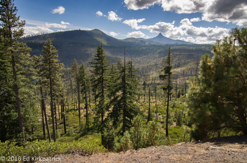
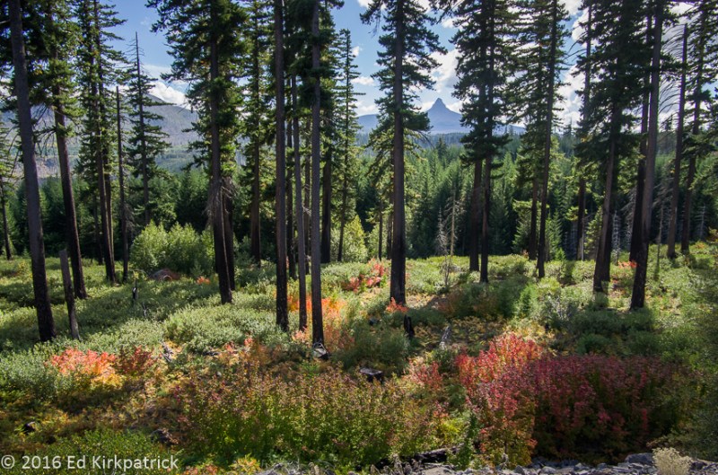
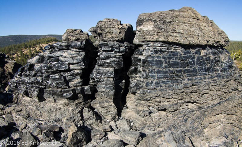
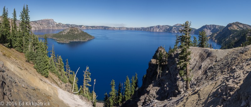
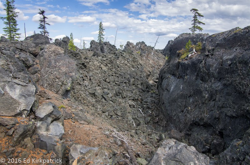
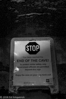
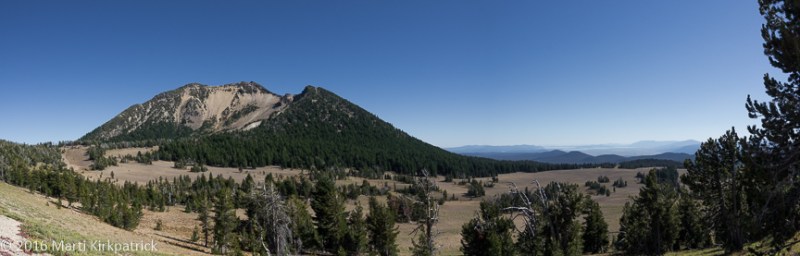
Our destination upon leaving Crater Lake was Medford, Oregon, so we headed down State Rt. 62 where I caught a couple of glimpses of something intriguing enough to say “OK, stop please”.   Walking a short way into the woods we came to a very deep and narrow gorge cut into the pumice.  Generally unnoticed and seldom walked, this chasm called Llaos Hallway is in spots 200’ deep while only as wide as one’s outstretched arms.  Formed by the Whitehorse Creek it is a potentially dangerous hike often in water, with falling sand, pebbles and rock and only a few places where it’s possible to get down in much less out.  That being said, when we have more time and have notified others where we are, I would love to explore this unique geological feature.

20160927-_ekp1706

Llaos is the native american’s god of the underworld and lived beneath Mt. Mazama. 

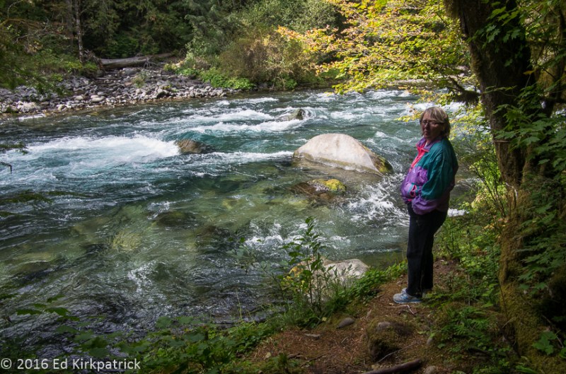
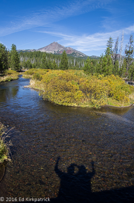
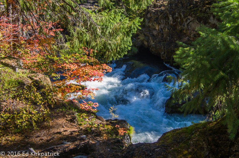
A bit further down 62 the road begins to run beside the beautiful Rogue River in the Rogue River National Forest.  We stopped and walked along the Rogue River Gorge trail and then down the road a bit more stopped at Natural Bridge.  Another magnificent Oregon river the Rogue begs a long and leisurely hike but believing we still had a time consuming day ahead in Medford we didn’t go too far.  Once again, we’ll be back someday.

20160927-_ekp1714

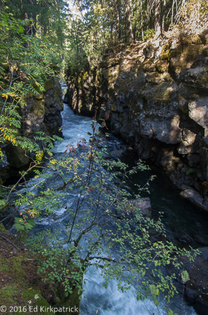
Rogue River Gorge in the Rogue River National Forest.

On Ed’s grandmother’s maternal side the family can trace Newland ancestors way back into American history, all the way to the Mayflower.  In our downsizing over three years ago Ed discovered and researched old family letters from and about his 3rd Great Uncle Ethbert F. Newland (don’t you just love that name?) who left home in Webster, NY at the ripe old age of 18 with his older brother Henry for the wild west.  In 1855 he fought and was wounded in the Rogue Indian Wars. Later he worked as a teamster hauling freight to the California gold miners. On becoming quite ill he headed for San Francisco where he died of consumption (TB) at age 29 with $3,000 worth of gold in his possession! ( $55,000 in today’s money). In the early 1900’s in a rather amazing act of greed for the prime real estate of both current, abandoned or filled cemeteries, he was one of thousands disinterred and reburied in mass graves outside of the city!  Before all of this in 1855, shortly before mustering into the militia, Ethbert, courtesy of the Donation Act of Congress, acquired 160 acres of land near Table Rock, Jackson County, Oregon Territory, eight miles outside present day Medford.

Ed had done his research and located the land plot just by Newland Road and via Google Earth discovered it was now the site of a sewage treatment plant!

20160927-_ekp1776

Not a particularly auspicious outcome for Ethbert’s land claim.

Oh well, we still wanted to check the land records in Medford the Jackson County seat. Figuring it might be a long day of finding the correct office and searching microfilm and/or old books we had hurried down the road.  Surprise!, not only was our first stop the correct office the records were located right there AND under “N” the first name in the deeds record was Ethbert F. Newland!!  In and out in 15 minutes, land sale record copies in hand, we of course went to the 4 Daughters Irish Pub where Ed had the best Reuben sandwich he’s had in years 🙂

20160927-20160927_132647

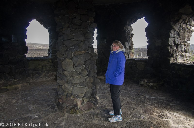
Sorry about the blurry photo but it was dim and my hands were unsteady.

Next day we headed north on Interstate 5 to State Rt. 99 to 42W and the Pacific.  This was a really pretty drive through steep mountains with next to no valleys, reminding us of West Virginia, until further west where it opens up more.  Almost all logging country, we passed through the town of Dillard which is pretty much Roseburg Lumber where they were cutting and making veneer sheets for making plywood.  This is a huge operation with train-car loads going on forever filled with these sheets.  They’re looking for workers if you want a job in some pretty country!

That night we stayed at Bullards Beach State Park two miles north of Bandon OR and we recommend this nice campground even if the beach is about a mile away.  The attraction for us was the Coquille River Lighthouse. First lit in February 1896 it now has a solar powered light although truth is an automated beacon at the end of the south jetty is what ships “watch” for now.

20160928-_ekp1789

The Coquille River Lighthouse.  Coquille is pronounced Ko-kwell, not the French pronunciation of Ko-kwee.

Popping into old Bandon we stopped for coffee and pastries before heading down the Beach Loop Road.  When coming this direction do not take the recommended Pacific Coast Highway 101, take Beach Loop Rd!
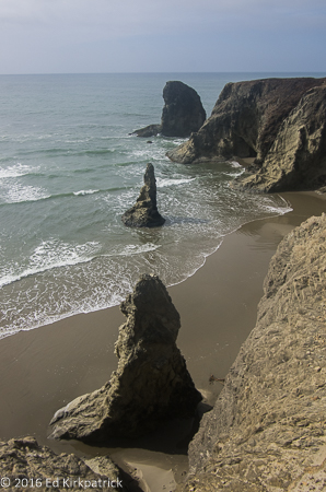
20160929-_ekp1900

The Witches Hat

We stopped over and over again to marvel at the view. Then the road joins back up with 101 and we scooted on down to where we planned to camp at Cape Blanco State Park. Our first stop at the park was the Historic Hughes House & Ranch.   The Sixes River flows into the Pacific here just north of Cape Blanco and in the early 1860’s Irish settler Patrick Hughes and his wife Jane choose this lush valley for their homestead.  Steadily acquiring land until he held more than 1,800 acres their very prosperous dairy produced butter that was shipped by sea to San Francisco.  In 1898 Patrick had a large and lovely home built on a hillside and we enjoyed seeing it.

20160929-_ekp1937

The Hughes House just like the sign says. The semicircular fish-scale and reverse-fish-scale patterns in the siding have a close-up below.

20160929-_ekp1932

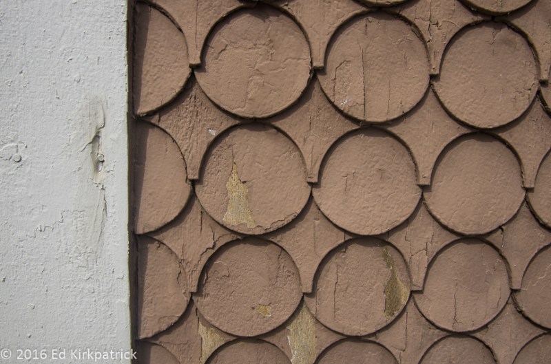
Marti and I are still “discussing” how these shapes are made…

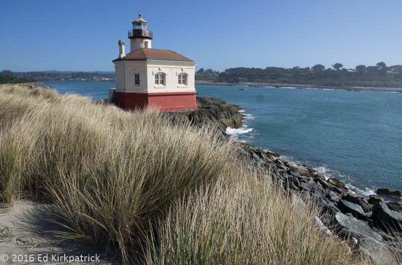
Next stop was out to the Cape Blanco Lighthouse which was built in 1870.  The oldest continuing working lighthouse in Oregon, the Fresnel lens and sunlight gave Ed a great opportunity.

20160929-_ekp1950

The Fresnel lens was made in Paris, France by Henry~Lepaute.

Put this whole day on your MVL (Must Visit List) and if camping be sure to stop here for the night, it’s a lovely campground. Oh, and I will point out this day’s road trip covered a whopping 49 miles, an all day adventure!

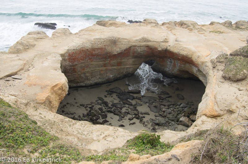
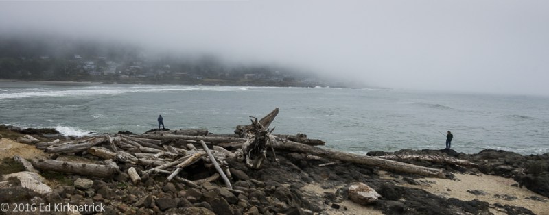
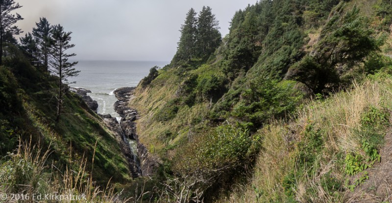
Our last day in Oregon (and the last day of September) driving on down 101 we stopped often to watch the gray whales migrating down the coast.  In fact we got pretty adept at spotting their plume of watery mist as they grabbed a breath of air. Even though it was once again rather gray and damp we stopped at Sisters Rock State Recreation Site.  We hiked down the sandy trail to two of three Sisters, large rock monoliths (the third is surrounded by water) and I climbed down into the mouth of a large sea cave.  The noise of the ocean crashing in and out was wonderful!   We also stopped at Arch Rock and did the short but STEEP hike at Indian Sands, don’t bother with this one, before checking into Harris Beach State Park at Brookings.

20160930-_ekp1992-pano

On the trail down to the three Sisters.  We got wet in a sudden rainshower on the way back.

Oregon is truly beautiful and diverse and for RV folks it has a lot of really great campgrounds. All in all, except for the fact it might explode someday, Ed has put Oregon in his Top 5 States List, Maine is still the winner. Yup, go ahead and put the whole place on your MVL!


20160927-_ekp1761-pano

This the Natural Bridge over the Rogue River.  The river flows in (lower left) a lava tube about 200 ft long and flows out (upper right). It’s the only crossing of the river besides bridges and was used by natives as well as settlers.  Ethbert may have utilized this crossing carrying freight to the miners.

20160927-_ekp1744

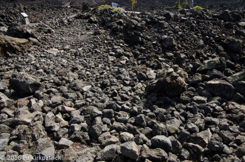
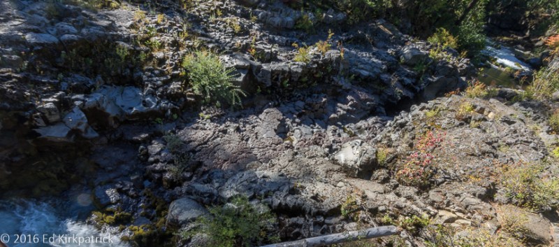
Here’s a blocked lava tube on the Rogue that the water only swirls into and around.

20160927-_ekp1757

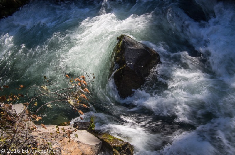
Lots of pretty waterfalls and rapids on the Rogue.

20160927-_ekp1771

This is the downstream exit of the lava tube that forms the natural bridge.

20160927-_ekp1783

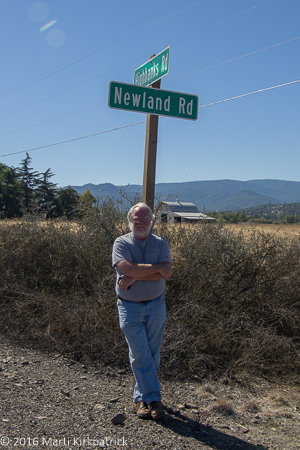
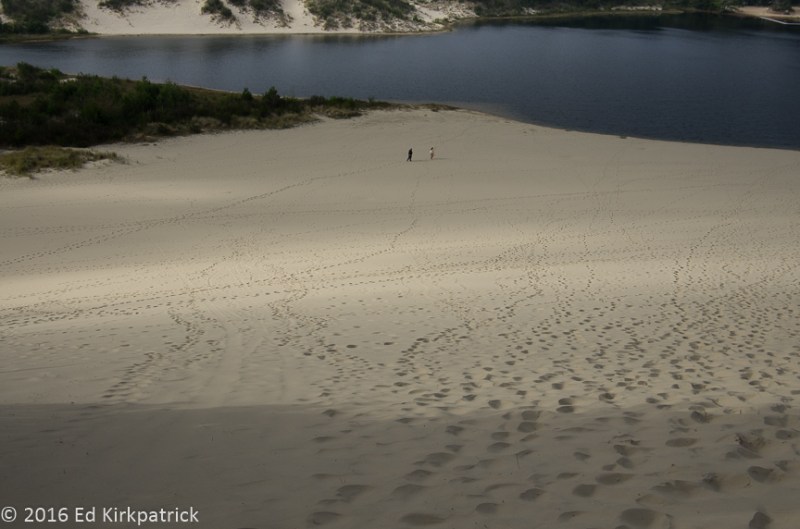
Looking for Ethbert’s land claim.

20160929-_ekp1836-pano

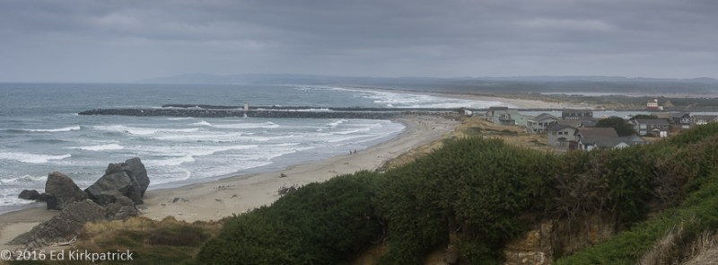
The jetties where the Coquille River empties into the Pacific at Bandon, Oregon.  Can you spot the lighthouse across the river? 

20160929-_ekp1902

The Witches Hat at the Bandon Sea Stacks near Bandon, Oregon from the Beach Loop Road.

20160929-_ekp1878

Face Rock from the Beach Loop Road.


20160929-_ekp1929

Haystack Rock from the Beach Loop Road in Bandon.

20160929-_ekp1936

I loved this French Range #2 wood fired kitchen stove in the Hughes House.  Marti still wants her gas cooktops…

20160929-_ekp1944

Up on Cape Blanco just by the lighthouse we spied this doe.

20160929-_ekp1955

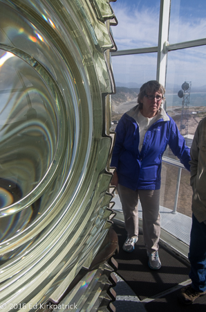
Using Marti for scale to show the size of the Fresnel lens in the Cape Blanco Lighthouse.  In the background you can see the modern day communications gear.

20160929-_ekp1960

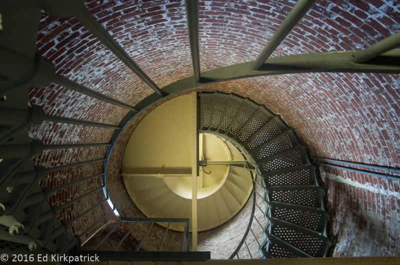
I loved the spiral stairway up into the lens room of the lighthouse.

20160929-_ekp1976

And the Cape Blanco Lighthouse itself.  It was blowing a gale on the point as is the usual weather there.

20160929-_ekp1984-pano

The view looking south from the Cape.

20160929-20160929_185616

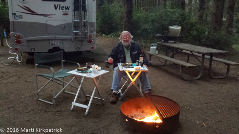
As hard as it was blowing on the Cape, down here in the campground a 1/4 mile away it was fairly calm so we had a fire and enjoyed dinner fireside.

20160930-_ekp2034

Marti climbed down into the mouth of the sea cave at Sisters Rock to get a great shot of the waves surging in through the entrance on the other side.  You can see light reflected on the water from that opening.

20160930-20160930_130937

I do not climb down slippery rocks.

20160930-_ekp2092

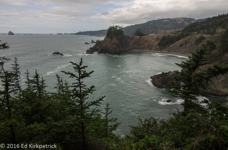
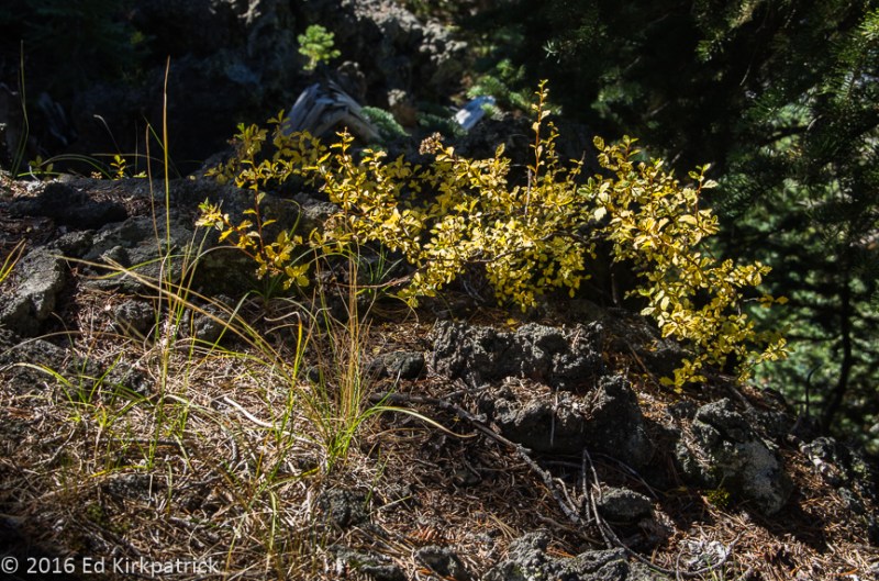
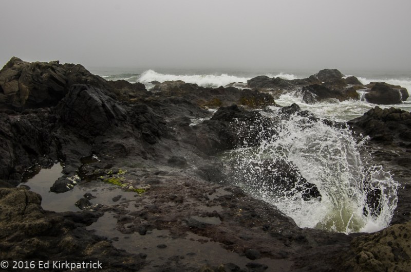
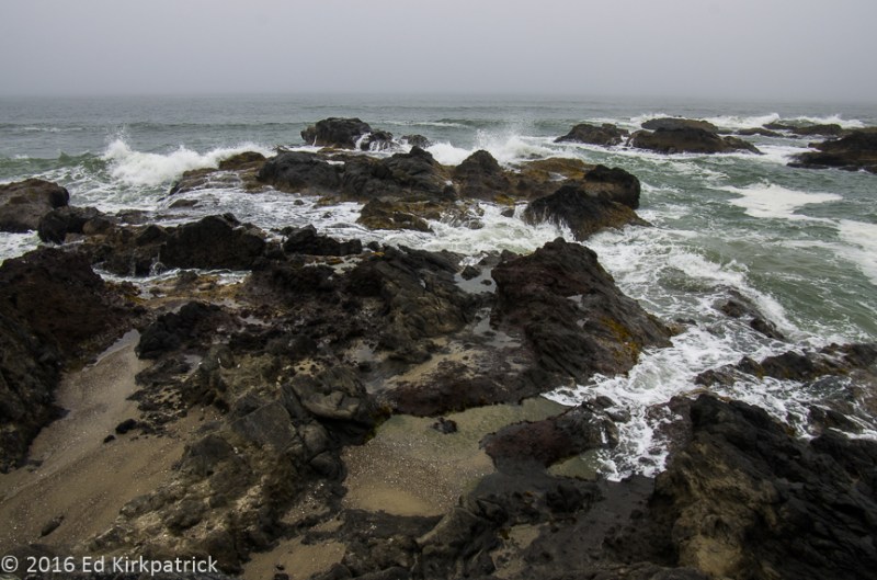
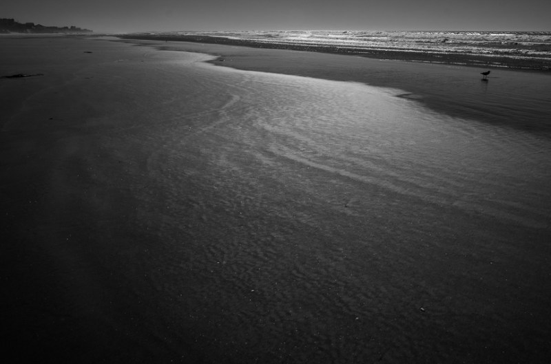
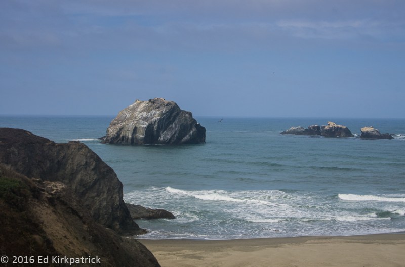
Oregon’s coast is just lovely everywhere which means we can’t remember just where this place is or its name.

20160930-_ekp2097

Arches Rock on the Pacific Coast Highway 101.

Oregon ~ Love A Lotta Lava!

26 Wednesday Oct 2016

Posted by Ed and Marti Kirkpatrick in Travels

≈ 7 Comments

Tags

B&B Complex Fire, Bend Oregon, Crater Lake, Dee Wright Observatory, Lava River Cave, McKenzie River, Newberry National Volcanic Monument, Oregon, Ray Atkeson, Sisters Oregon, Sparks Lake

Needing to stop off in Oregon’s state capital Salem to get our 60,000 mile Sprinter service (the chassis is a Mercedes Sprinter and the coach is Winnebago) afterwards we had a bit of a walk around town and good lunch at the bar in the Table FIVE 08  restaurant.  The next day we left Salem for the cute little town of Sisters via the very pretty State Route 22E to US 20.  This route is almost entirely in both the Willamette and Deschutes National Forests where the huge B&B Complex Fires in August & September of 2003 burned almost 91,000 acres killing over half the trees.

20160920-_ekp1295

As far as your eye can see, most of those trees are dead.  Mt. Washington is the pointy peak in the distance.

20160920-_ekp1287

Slowly over time the forest regrows.

After spending the night at the Sisters Creekside Campground which is in a lovely woods, on the edge of town and walking distance to restaurants, shops and Sisters Bakery, (YUM!!)  we drove west on the beautiful McKenzie Pass-Santiam Pass National Scenic Byway – St. Rt. 242.  This road separates the Mount Washington and Three Sisters Wilderness areas and at the McKenzie Summit is the Dee Wright Observatory where the view across 65 square miles of lava is spectacular!

20160921-_ekp1321-pano

Looking south from the Dee Wright Observatory, at 5187 ft. elevation,  two of the three Sisters still have snowfields.

20160921-_ekp1338

The lighter area center/left is a portion of the treacherous McKenzie Salt Springs and Deschutes Wagon Road constructed during the period between 1866 and 1872 and it followed the original Indian trail across the lava fields.

Route 242 ends at St. Rt. 126 where we headed north following the magnificent McKenzie River.  Remarkably clear and an amazing color the McKenzie is one of the prettiest rivers we’ve seen.  There’s a very popular 26 mile hiking/biking trail running along the river and we did a tiny bit of it and would love to do more someday.

20160921-_ekp1373

Along the McKenzie River.  Note the turquoise blue (not photoshopped) and the clarity of the water. Marti says she was actually enjoying herself very much despite the frown.

20160921-_ekp1395

Waterfalls along the McKenzie River Trail.


At Santiam Junction 126 joins with US20 where we headed back to Sisters.  If you’re ever close to this area I suggest you put this drive on your MVL (Must Visit List).

Moving down the road about 30 miles to Crown Villa RV Resort in Bend we settled in at one of the nicest commercial RV parks ever.  Not cheap, but lots of space in a pretty treed location with the nicest laundry I’ve used to date, make note RV friends!   Unfortunately the weather became wet and generally unpleasant so we decided to poke around Bend which is considered by many folks as being in the USA top 10 places to live.  We had a damp picnic lunch in Drake Park which has some lovely old homes surrounding it and then walked around Downtown Bend which has the Red Chair Gallery where we may have bought some things 🙂  In truth we barely touched town, but what we saw was very nice and probably worth a better look someday. This trip however we were more interested in exploring the immense amount of volcanic landscape here.

I was especially looking forward to seeing the Lava River Cave located in the  Newberry National Volcanic Monument.  To our amazement this is a self guided mile long hike (one way) through an UNLIT lava tube!  No hard hats, no checking to see if you’ve got a flashlight (they do rent very good torches) no Forest Service personnel inside, just enjoy yourself!  We keep asking each other where the liability lawyers were locked up because you’d never see this back home 🙂

20160924-20160924_123619

Inside the entrance to the Lava Tube Cave looking out.

20160924-20160924_105522

It gets beyond real dark in there.  Like any cave it is total blackness.  The ceiling is bend down low in spots.  In other spots it’s very high too.  I made these cave photos black and white due to the poor color rendition in such low light plus they were taken with my phone!

Next on the “lava list” was a walk at Big Obsidian Flow also in the Newberry NVM.  Ed and I have been to lots of lava fields in many states but we have rarely seen any obsidian and to see a really large area covered with this volcanic glass was sooo cool! As much as I wanted to, I followed the rules and did not help myself to a great big chunk of it 🙂

20160924-_ekp1425

The shiny black layer is obsidian, volcanic glass formed by the rapid cooling of lava with minimal crystal growth. Chips of it are extremely sharp.  The Indians used it for arrow and spear points and knives and modern surgeons sometimes use a scalpel fashioned from obsidian that is much sharper than the steel scalpels.

With the sun at last fully back (it was almost hot), we drove part of the Cascade Lakes National Scenic Byway.  Along this route is Sparks Lake which Oregon’s Photographer Laureate Ray Atkeson called the prettiest place in the state. With this recommendation we bounced out the dirt NF400 (National Forest Rd) to hike the Ray Atkeson Loop Trail.  It was a lovely 2.5 mile walk with great views and of course lots of lava. The only negative was maybe the worst allergy attack I have ever had!  There’s some kind of evergreen out here that my nose does NOT like.

20160925-_ekp1446-pano

Sparks Lake with South Sister reflected on the Ray Atkeson Trail. Note the lava in the foreground.

20160925-_ekp1477

The Fall colors were really pretty contrasted with the lava along the trail.

As I have said in other posts I saw a lot of the west back in 1962 and some of those places have always held a special spot in my heart, one of those is Crater Lake.  Back then we had the place pretty much to ourselves. Dad led us on a hike down to the water and I used my hands to drink out of this incredible pristine volcanic caldera.

20160926-_ekp1552-pano

Wizard Island in Crater Lake.  The island is itself a cinder cone, a remnant of a later eruption after the caldera collapsed. The lake is at its deepest 1946 ft. and is the deepest lake in the USA. It was entirely filled by rain and snow melt. 

Now, even though there are many, many more people coming here, and even though the loop road was under repair and causing long delays and even though the one path down to the water was closed, it’s still an amazing place.

Pretty much we think you should put this whole post on your MVL!


20160921-_ekp1302

Some lavas that are very brittle exfoliate into these chunks due to freezing and thawing of ice in cracks.

20160921-_ekp1336

Marti inside the Dee Wright Observatory which was built out of the surrounding lava rocks by the CCC in 1935. Each opening has a plaque beside it saying what mountain is viewed through it.  It was also very cold.

20160921-_ekp1344

The lava fields here at Dee Wright Observatory are AA, (Ah Ah) lava. It’s a Hawaiian word.  The pieces are very rough and jagged.

20160921-_ekp1401

One of many waterfalls on the McKenzie River Trail.

20160924-20160924_114924

The lava tube cave fills with sand and dirt particles washed in by water seeping through the rock.  The floor was covered with drip holes in all kinds of patterns and lines.

20160924-20160924_114236

In case you missed it.  The cave is filled with rock and sandy dirt and is currently impassable. 

20160925-_ekp1454

Ed’s little buddy says, “Put ’em up!”

20160925-_ekp1485

Trees will sprout anywhere there is dirt and moisture. Marti really thought this one was cute.

20160924-_ekp1421-pano

The Big Obsidian Flow in the Newberry National Volcanic Monument. Seated at the top near here, we had a long chat with some very nice young people who were back in the parking lot before us.  As I passed them they handed me a half six pack of various Oregon beers.  They said they really enjoyed talking with us and thought I would like these.  They were right!

20160925-_ekp1528

A nice mountain view across the meadow and stream on the road to Sparks Lake.

20160926-_ekp1592

Marti loves these two stick figures, one walking, one crawling up from Crater Lake. She’s a little nuts, but I will keep her anyway.

20160926-_ekp1600

She likes these trees too…

20160926-_ekp1603-pano

The orange rock feature on the right is called Pumice Castle above Crater Lake.

20160926-_ekp1623-pano

The Rim Road travels away a bit from the crater in some places.   Here it passes Mt. Scott which for obvious reasons we had to have this photo.  Mt. Scott is an extinct volcano that was once larger (before it blew up too) than Mt. Mazama which formed Crater Lake when it collapsed.

20160925-_ekp1526

Goodbye! Until the next post!

Oregon ~ A Pretty Place

21 Friday Oct 2016

Posted by Ed and Marti Kirkpatrick in Travels

≈ 6 Comments

Tags

Columbia River Gorge, Edgefield, Gray Whales, Mt Hood, Newport Oregon, Oregon, Oregon Dunes National Recreation Area, Pacific Coast Hwy 101, Timberline Lodge, Troutdale

Heading toward Portland, Oregon but not wanting to get too near the hustle and bustle (and traffic) we opted to base out of the cute little town of Troutdale and the Sandy Riverfront RV Resort.  For you fellow RV’ers this is a nice place even though it is generally just a lineup of rigs, but lots of flowers, nice people, good laundry and easy short walk into town which is always a big plus in our book!

One of the rewards to our bopping around the country is seeing friends we’ve not seen in years and this time it was our young friend Michelle Hiltner.

20161021-michelle_hiltner

SELFIE!,  You know who, You know who and our sweet friend Michelle.

She suggested meeting at McMenamins’ Edgefield just down the road, where we had a nice lunch and wonderful visit. They make wine and whiskey here on the grounds and being harvest time we stood and watched the initial processing of the grapes, and then of course had a few tastings   🙂

20160911-20160911-20160911_165939

1. The Pinot grapes are dumped into the crusher and separated from the stems.  2. The skins and juice have dry ice added to help prevent bacterial infection, thus the vapor.  3. The juice is dumped into a vat for fermentation.  Fork lifts are handy.

Troutdale calls itself the Gateway to the Gorge and the old State Route 30 part of the Historic Columbia River Highway was designed by Samuel C. Lancaster to take advantage of the many waterfalls and the natural beauty of the landscape.  Completed in 1922 it was an engineering marvel and we drove the narrow, twisting, woodland part between Troutdale and Dodson (where 30 joins up with I-80).  Not only is it a beautiful drive, we were greatly impressed to learn of the generous benefactors who back in the day, had purchased some of the land containing these lovely waterfalls to hold them as public parks and thereby protected for all of us.

20160912-_ekp0370

Bridal Veil Falls, Columbia River Gorge

We finished our tour at the once huge Bonneville Dam (there are larger newer dams upstream on the Columbia) where we greatly enjoyed watching the fat salmon and other fishes going up the fish ladder.

20160912-_ekp0394

The fish ladder zig zags to control the speed of the current because the fish are swimming upstream against the flow.  Salmon prefer 5-7 mph. 

I will admit to wishing at least one of them was on my dinner plate.

20160912-_ekp0389

There are windows looking into the fish ladder where you can see the fish swimming passed.  In a room the public cannot access, there are observers whose job is to count the fish by species as they pass.  8 hours a day, with a break every hour for 15 minutes.  Applications accepted.

The next morning we headed for Mount Hood out State Route 26 to 173-Timberline Hwy and the historic Timberline Lodge where we had a good lunch with an incredible view!

20160913-_ekp0470

To be honest, one floor down from our table at lunch.

Afterwards I pointed to one of many paths and told Ed I just wanted to go up a little ways.  What a beautiful place for a walk and the old lodge is magnificent.

20160913-_ekp0474

The Lodge looking back from our walk.  Next time we are here, we are staying in the Lodge.

Switching gears and directions once again we headed back to the Pacific Coastal Highway 101 where we stopped at a local park (so sorry I am not sure where) and watched the grey whales migrating.  LOTS of whales!!  Granted, pretty much all we saw were them spouting (which by the way is how to spot them, watch for the blast of water from the surface of the ocean), and their tails as they would periodically go deep.  We continued to stop and watch for them, and see them, as we progressed down 101 over the course of several days.  Certainly giving them more anthropomorphic traits then I should, I couldn’t help but chuckle wondering if they have any idea that humans get REALLY EXCITED when just barely seeing a tiny bit of them?

20160914-_ekp0573

Whale Tail. Isn’t it magnificent!?

Taking the Otter Crest Loop Rd off 101 (it’s one way so coming from the north you just have to watch for it after passing Rocky Creek State Scenic Viewpoint).  This is a lovely less traveled route and at the end is Devils Punch Bowl.

20160914-_ekp0828

Devil’s Punchbowl.  Oh well, we were there at low tide.

Landing in Newport for the night we found the bay side much more inviting than the ocean side.

20160915-_ekp0839

Yaquina Bay Bridge in Newport, Oregon.  Designed by Conde McCollough as were many of the bridges on 101 in Oregon. They feature Art Deco details and are delightfully charming.

The next day we went on to Florence, which is a neat town.  The fog had either rolled in, or was advancing as a wall depending on where we were.

20160916-_ekp1188

Headed towards Florence, Oregon where the sand dunes become a prominent feature of the coast.  The fog bank creeps in from the sea as a wall over the town.

My photographer companion says it’s often more interesting than bright sunshine.  We did have a good dinner at  Bridgewater Fresh Fish House-Zebra Bar where I kid you not, the young waiter said to me “would you like me to refill your free water?”

Next posting is headed back inland and it is going to be HOT….well….it was hot a long time ago!  You’ll understand soon 🙂


20160912-_ekp0373

One of several waterfalls along the Rt 30 in the Columbia River Gorge.

20160912-_ekp0441

Latourelle Falls in the gorge.  The bright yellow on the right is a lichen.

20160912-_ekp0446

Vista House in the Columbia River Gorge. This is still navigable waters from the sea.

20160913-_ekp0465

Over there, those are the windows we looked through at lunch in the Timberline Lodge.

20160913-_ekp0471

This is the beginning of our walk, at 6500 ft. elevation, after lunch.

20160913-_ekp0483

Coming and going.  Can some of our birder friends confirm these are Magpies? They were very busy and squawky…

20160914-_ekp0771-pano

Along the Oregon Coast on 101

20160916-_ekp1018

These potholes are worn by the sea and tides.  The water flows in and out underneath.

20160916-_ekp0936

Here the sea erupts out of one of the same potholes as the tide rises. 

20160916-_ekp1086

It was a windy, stormy day.

20160916-_ekp1138-pano

Two fishermen looking for salmon running.

20160916-_ekp1168-pano

Devil’s Churn along Hwy 101

20160916-_ekp1212-pano

Oregon Dunes National Recreational Area on the coast starting at Florence.

20160916-_ekp1230

They are big!

20160915-_ekp0837

Low tide at the beach…

20160914-_ekp0776

Water reflects the sunlight in so many random ways on the coast.

Enter your email address to follow this blog and receive notifications of new posts by email.

Join 221 other subscribers

View Recent Posts

  • Cod Jigging and New Friends! March 2, 2020
  • Grand Tetons ~ Yellowstone October 11, 2019
  • Beauty & Bones ~ Dinosaur National Monument September 29, 2019
  • Wyoming ~ In the Medicine Bow Corner September 25, 2019
  • A Bit of Western Nebraska September 5, 2019

Get Caught Up

Blogs We Follow

  • john pavlovitz
  • Take To The Highway
  • Kelly Time
  • HowToRVgeeks
  • WANDERTOPIA
  • BoomerCafe ... it's your place
  • Island Girl Walkabout
  • The Online Photographer
  • Technomadia
  • Wheeling It: Tales From a Nomadic Life

Categories

Blog Stats

  • 24,723 hits

Blog at WordPress.com.

john pavlovitz

Stuff That Needs To Be Said

Take To The Highway

Kelly Time

HowToRVgeeks

WANDERTOPIA

BoomerCafe ... it's your place

Island Girl Walkabout

Hector and Brenda on a journey of discovery

The Online Photographer

Technomadia

Adventures in Nomadic Serendipity

Wheeling It: Tales From a Nomadic Life

On the Road Since 2010, Traveling Across USA & Europe With Pets

  • Follow Following
    • Whack-A-Mole Wheels
    • Join 184 other followers
    • Already have a WordPress.com account? Log in now.
    • Whack-A-Mole Wheels
    • Customize
    • Follow Following
    • Sign up
    • Log in
    • Report this content
    • View site in Reader
    • Manage subscriptions
    • Collapse this bar
 

Loading Comments...