• About

Whack-A-Mole Wheels

Whack-A-Mole Wheels

Monthly Archives: July 2017

Newfoundland Labrador ~ the Labrador Part

30 Sunday Jul 2017

Posted by Ed and Marti Kirkpatrick in Travels

≈ 10 Comments

Tags

Basque Whalers, Icebergs, Labrador, Pinware River, Port Amour Lighthouse, Red Bay, Trans-Labrador Highway

When we started out on this summer’s adventure we always included Labrador because, well seriously how could we not drop in when this close?  What we did not actually register until being up here in Newfoundland, is that they come as a team.  This province is Newfoundland Labrador, and we now even have the flag sticker on the back of Whack-A-Mole Wheels to prove it 🙂

Driving to St. Barbe we bought our ferry ticket ($48.75 Canadian) for the 1 hour 45 minute ride to Blanc-Sablon which is actually in the province of Quebec.

20170627-_EKP8204

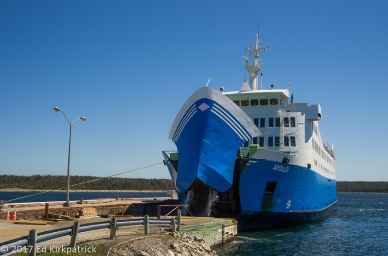
Ed watched in astonishment as water poured out of the mouth of the ferry, MV Apollo into which we were about to drive.

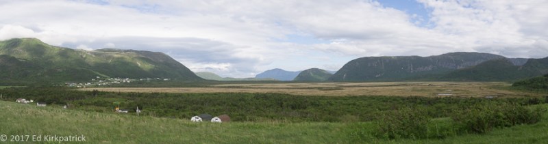
However, literally a few miles up the road you’re in Labrador and shortly L’Anse au Clair.  Not putting to fine a point on it, the roads are CRAP!  We thought we’d seen the worst roads ever in Newfoundland but it turns out they’re running in second place!

20170628-_EKP8518

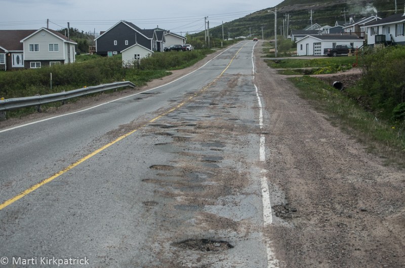
Typical and it does get worse.

Hey, it’s an adventure 🙂


In L’Anse au Clair we checked into the Northern Light Inn & RV. The “RV” part is actually just a gravel parking lot, with water, electric & sewer across the street from the Inn and restaurant behind another building, but it works and once again we pretty much had the place to ourselves.

20170628-20170628_082217

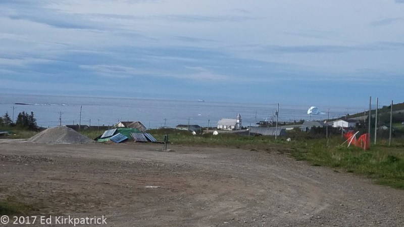
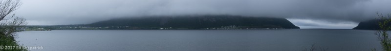
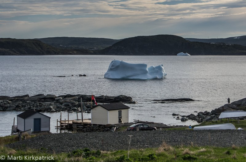
Campground view includes an iceberg, so all is good.

Still being mid-afternoon we headed up 510 to see what we could find.  The first thing that caught our eye was, L’Anse Amour.  Well yeah, “Love Cove” is a place to stop!  Turns out sometime back in the day the name was corrupted from the earlier name L’Anse aux Morts “Cove of the Dead” which probably is in reference to the many lives lost due to ship wrecks.  Interestingly however, the oldest known ceremonial burial in North America is found here.  Dating back 7,500 years is the stone burial chamber of a Maritime Archaic Indian adolescent. Carefully wrapped and placed face down, with a large flat stone on his lower back fires were lit around his body and offerings; a walrus tusk, harpoon head, painted stones and a bone whistle place alongside him.  Clearly he, or his death, was significant but no one knows why.

20170627-_EKP8284

Completely innocuous, you could drive right past and never notice the oldest ceremonial burial site in North America.

Further out this potholed, narrow dirt road we came to the remains of one of the many shipwrecks in the Strait of Belle Isle.  The sort of fun part about this one is that just pieces are what are left after the British blew it up!

20170628-_EKP8315-Pano

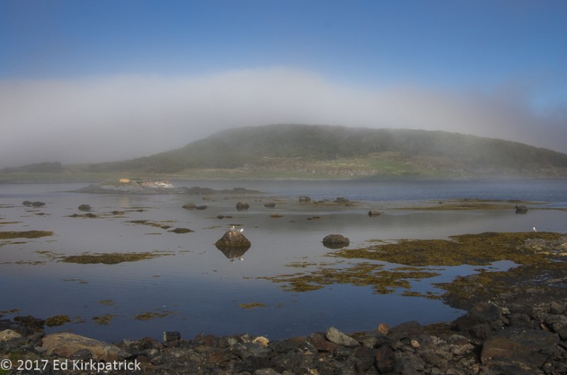
Bits and pieces from the shipwreck… sort of. Oh and if there is a picture of ocean water look for the white bits because it’s an iceberg. See it?

On August 8, 1922 the HMS Raleigh was either: running too fast and hit the rocks avoiding an iceberg OR the ship’s officers were drinking in celebration of their impending salmon fishing trip with the captain asleep elsewhere, when they ran aground not 200 yards from shore ripping a great gash in the belly of the ship.  Eleven lives were lost, but the remaining 680 officers and crew spent the night in every nook and cranny of the nearby Point Amour Lighthouse and surrounding buildings.  For several years after, the ship sat there looking fine (except for the 360 foot long tear in the bottom) and newspapers would run critical and humorous stories complete with pictures, about the negligence of the British officers.  Finally the Admiralty had had enough and sent the Navy to destroy it!


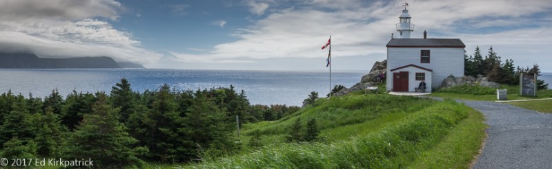
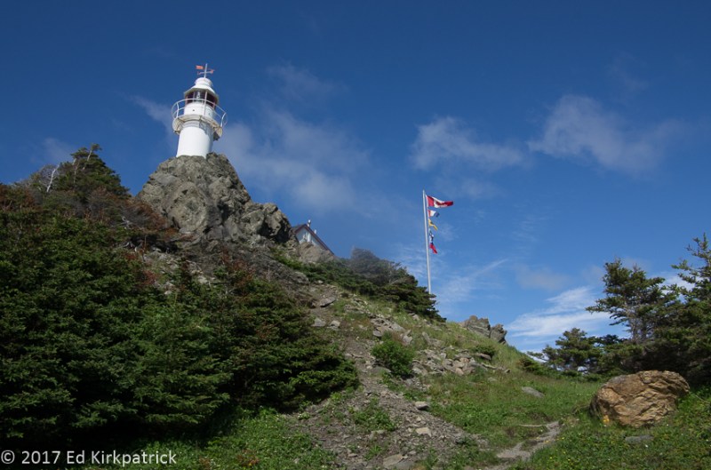
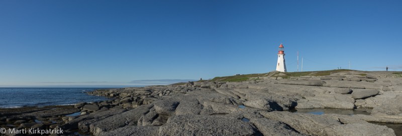
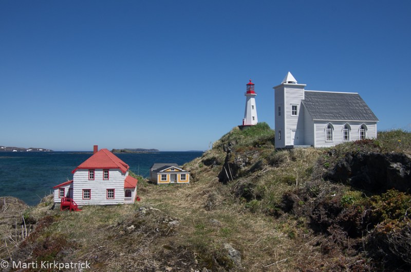
At the end of the road is Port Amour Lighthouse. The second tallest in all of Canada it was completed in 1857 and is 109 feet tall.  We arrived to discover not one, but two tour buses! Being late in the day we chatted with the nice lighthouse tour guides about when they opened and said we’d be back in the AM.

20170627-_EKP8294-Pano

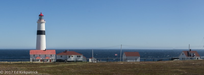
The Point Amour Lighthouse complex.  If you look carefully at the horizon, you can just make out Newfoundland across the strait.

20170627-_EKP8306

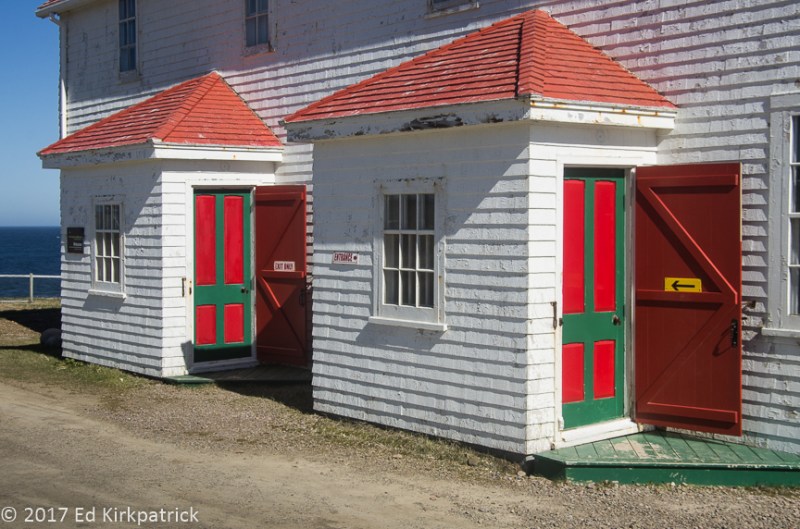
We absolutely loved the red and green doors into and out of the lighthouse.

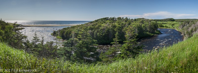
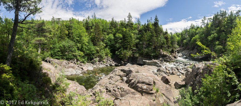
The next morning after our visit with the light we headed on northeast along the horrible potholed 510.  The Pinware River on its way to the Atlantic is a popular fishing challenge and we spent some time just enjoying its incredible beauty from the bridge high above.

20170628-_EKP8379

Looking upstream into the hinterlands of Labrador from the 510 bridge notice that the Pinware River foam is brownish.  That’s from the peat bogs. Even our drinking water was stained tea-color.

20170628-_EKP8383

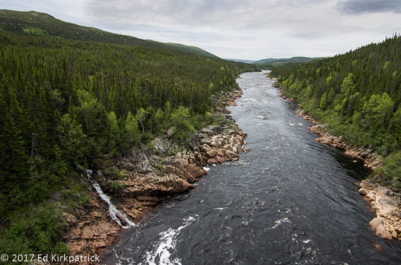
Looking downstream from the 510 bridge, the Pinware River flows out to the ocean.


Red Bay was our destination and we arrived just in time for an early lunch at Whalers Restaurant where the fish ‘n chips are pretty darn good.

20170628-_EKP8502-Pano

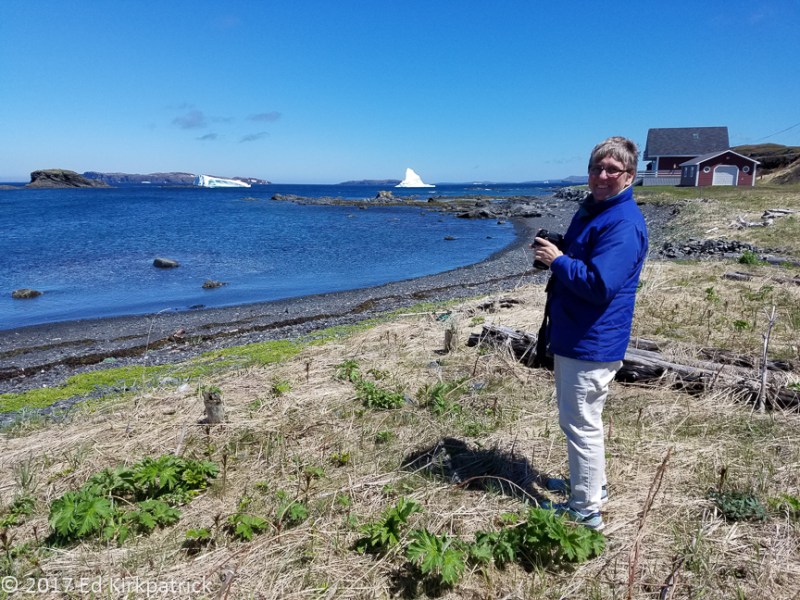
Red Bay, Labrador.  Our friend Suzanne who is also traveling in an RV like ours, came here a week behind us.  She wisely took the tour over to Saddle Island across the water there to view the old Basque whaling site and village. 

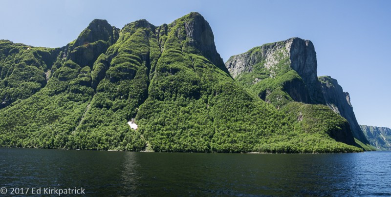
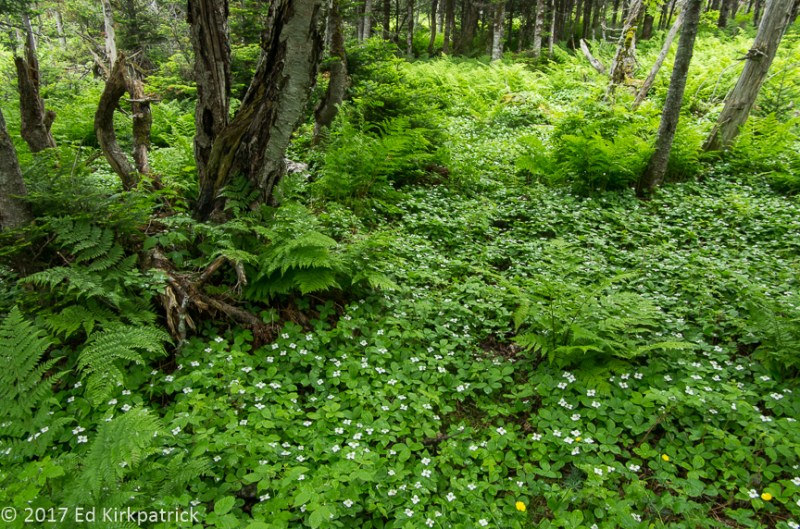
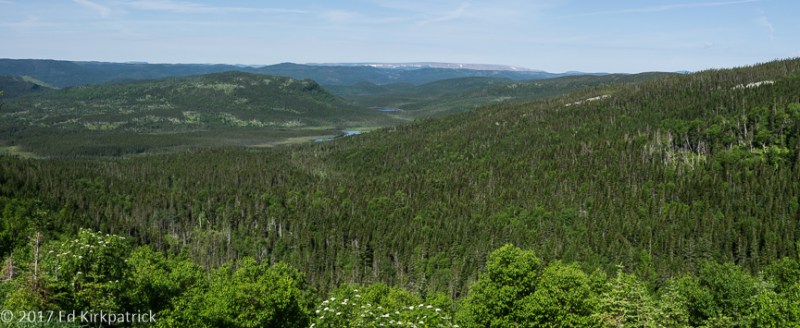
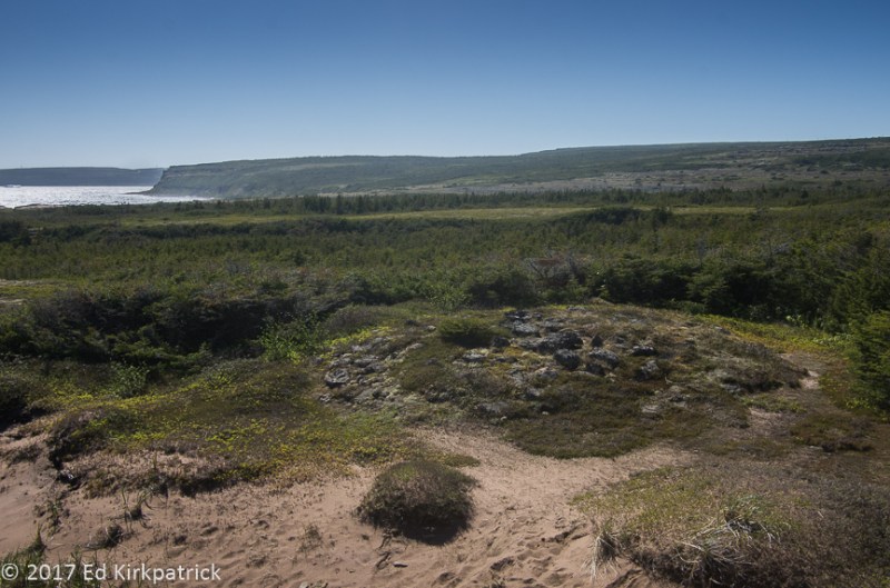
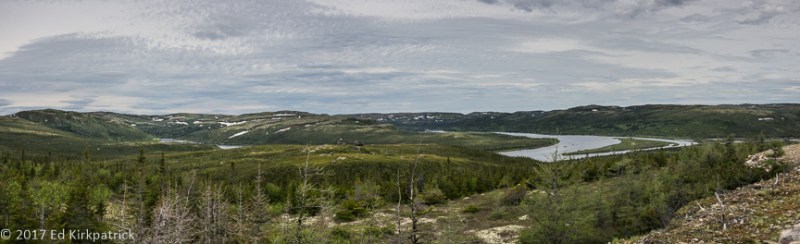
Fortified with food, I told Ed what I really wanted to do was head out the TLH (Trans-Labrador Highway).  Just under 775 miles long this is THE road in Labrador and vast amounts of it, particularly the eastern half where we were, are not paved and wild…. seriously wild, they’ll lend you a satellite phone if you’re traversing from one end to the other 🙂  We set out and WOW it’s pretty country!

20170628-_EKP8435-Pano

Along the TLH looking out into beautiful country.  The white is snow not iceberg 🙂 

Back in Red Bay we went to the Right Whale Exhibit Museum which is excellent and like so many places we’ve been, we had it to ourselves. Red Bay was a major and important 16th Century whaling station for Basque fisherman starting in 1530.  For seventy years they came here in the spring hunted whales, processed the oil and returned back home for the winter! Can you even imagine?…

20170628-_EKP8498

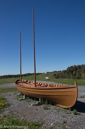
This is a nearly complete chalupa, a boat used by the Basque whalers to hunt and kill whales.  It was found in the harbor.

20170628-_EKP8500

This is a flipper of the Right Whale.  They were called the Right Whales because they swam slowly, were easy to kill and floated when dead hence the “right whale”.  The mannequin is wearing attire copied from bits of clothing found in excavations here in Red Bay.  The barrels for the oil were all made onsite across the way on Saddle Island.

Labrador is basically uninhabited; really, we’re talking about 113,641 square miles of land with a population of 27,197 people! It’s wild and beautiful and empty, and someday we’d like to see it all, but unless we add a boat, plane, ATV, snowmobile and snowshoes to our collection and Inuit or Innu knowledge of the land it’s not likely to happen 🙂 For now however we suggest you put it on your MVL (Must Visit List).


20170627-_EKP8278

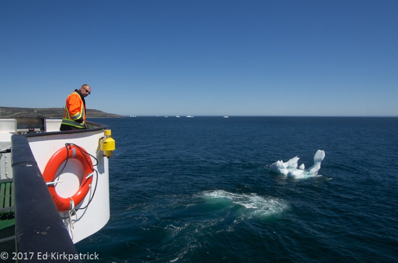
The Captain slowly maneuvers the ferry into the dock in Blanc Sabon, Quebec avoiding the growler lurking beside us.  I asked him if he went to school to learn how do this and he said, he had done this 15,000 times…  

20170628-_EKP8327

Almost all buildings in Labrador and Newfoundland, young and old have these holes or an open slot at the bottom of the storm windows to control condensation. One of the wonderful things about almost all the buildings in this part of the world is they have lace curtains.

20170628-_EKP8334

The obligatory picture of Marti at the top of the lighthouse.  Some day she insists, it will be Ed.

20170628-_EKP8326

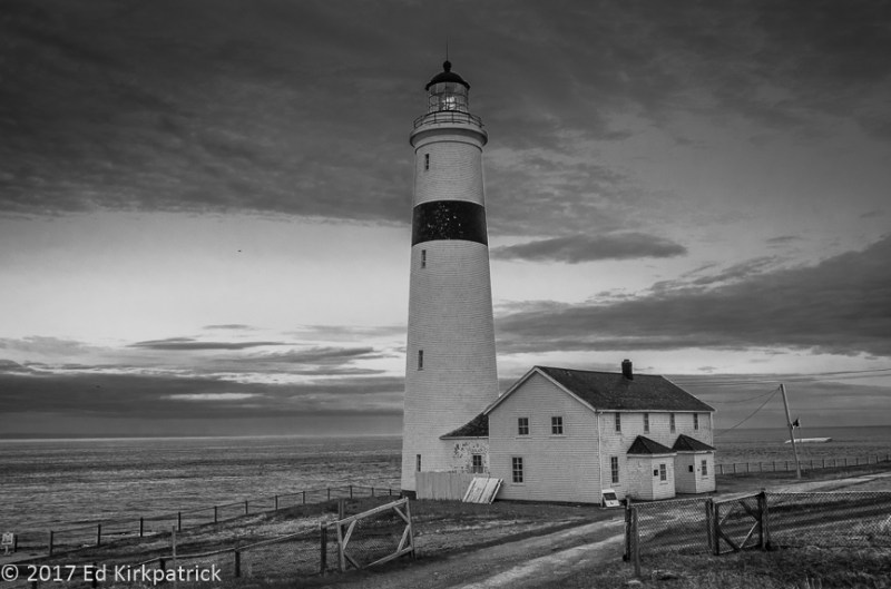
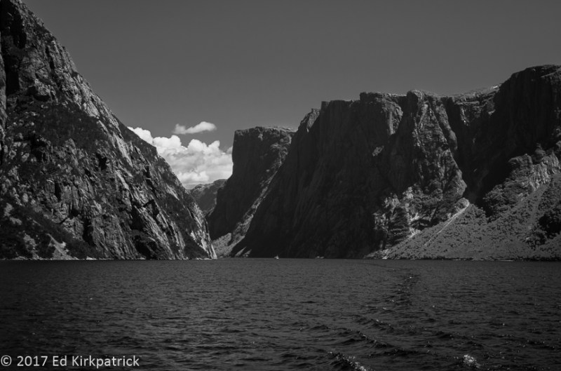
Sometimes a photograph is better as black and white and besides it my photographic roots.

20170628-_EKP8333

The walls at the base of the tower were six feet thick laid cut stone and narrowed as the tower went up.  The tower is a cone shape but the interior space remains the same width rising up. It’s a pretty amazing piece of construction.

20170628-_EKP8346

And the stones were all cut by hand and keyed together. That’s a lot of tink tink tinking…

20170628-_EKP8359-Pano

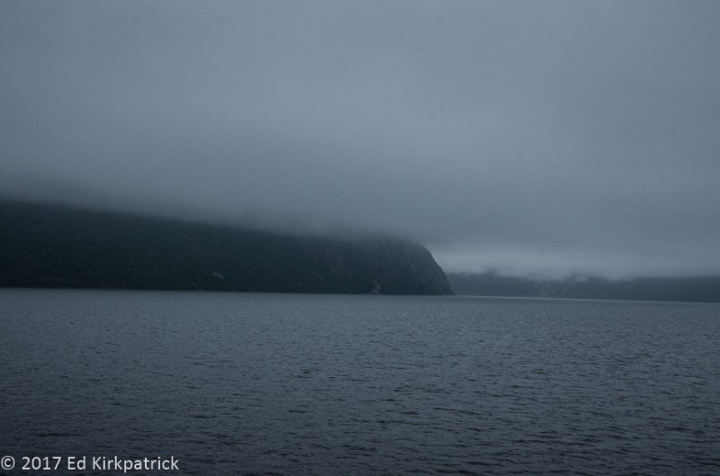
Here is where the Pinware River flows into the ocean.  Notice the icebergs?

20170628-_EKP8427-Pano

The Pinware River from the TLH on the way to Red Bay.

20170628-_EKP8484

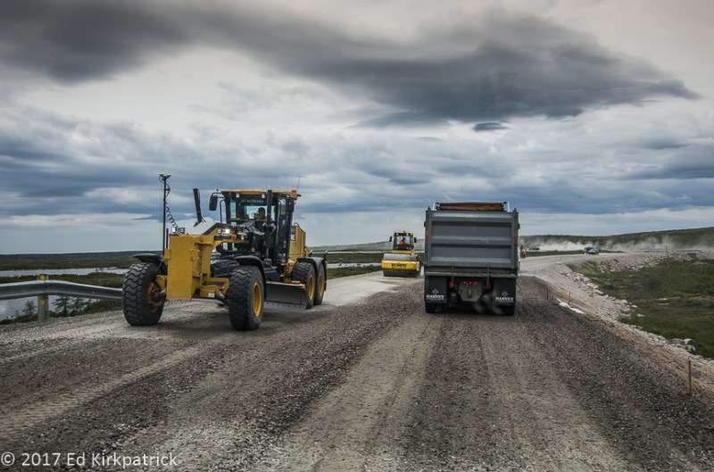
The Trans-Labrador Highway is actually being paved slowly section by section.  The section we drove on was being prepared for paving this late Summer.  We gave up 51 kilometers into it but our friend Suzanne kept going all the way up to Lodge Bay, 77 kilometers away.

20170628-_EKP8499

The recovery and restoration of this chalupa is amazing and the simplicity of its line is beautiful.  It’s very hard to imagine chasing down whales in a boat so small.

20170628-_EKP8507

This is a diorama of the whale oil rendering ovens found on Saddle Island.

20170628-_EKP8517

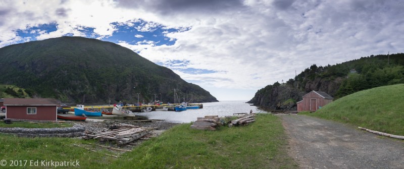
Fishing stage in the harbor of West St. Modeste. 

20170628-_EKP8521

A pull off alongside 510…

20170628-20170628_124123

In the Whaler Restaurant in Red Bay we are invited to pin where we are from.

20170627-_EKP8230

Back at the ferry landing we wave goodbye to Labrador and you until our next post.


Newfoundland ~ Part Deux, Gros Morne

22 Saturday Jul 2017

Posted by Ed and Marti Kirkpatrick in Travels

≈ 12 Comments

Tags

BonTours, Gros Morne National Park, Lighthouses, Lobster Head Cove, Newfoundland, Rocky Harbour, Tablelands, Western Brook Pond

Saying goodbye to the tippy-top of the Northern Peninsula we headed out in light fog for the 432 inland loop back towards 430 South on our way down to Gros Morne National Park.  Having just driven on past Gros Morne on the way up to L’Anse aux Meadows because the weather was so bad, we hoped things would be better now. Inland the sky was beautiful and sunny.  Of course when we got back to the coast the fog was well on its way to being pea soup thick.

20170701-_EKP8654

Headed into pea soup fog…  oh well, it’s Newfoundland!

We settled into Gros Morne RV Campground in Rocky Harbour which while not a tourist town by US standards, it is more touristy then anyplace we’d been. The advantage with that is a wider selection of restaurants.  We did Earl’s which was fine although they know fish better than fried chicken.  The second night we went to Ocean View. I admit it, we can be a little snobby sometimes, but with real table linens, nothing served in plastic, complimentary dinner rolls, SEVERAL kinds of vegetables and good food….well it was a very nice 🙂

Note to RV’ers: we had low voltage issues at the campground.  We like to be tucked away if possible and so were at the end of the line which the owner acknowledged as the problem. We just didn’t brew coffee AND run the electric water heater at the same time and it worked ok.

The next day we had a reservation for the 11 o’clock boat tour on Western Brook Pond. It  is a lovely 3 kilometer walk from the parking lot to the boat launch & café at the mouth of this fjord. Naturally it was a foggy day as we headed out early with all fingers and toes crossed that the sun would do its thing and burn off at least most of it before our boat ride.  We got in line, headed up to the open top deck when boarding and they set out.

20170704-_EKP8802

Lovely weather for a boat ride.

About 10 minutes into the 2 hour tour, the boat slowed almost to a standstill and they announced that the earlier tour boat ahead of us had just radioed back to say the ceiling had dropped completely to water level so we would be turning around and given a refund.  Back on shore I checked the weather forecast, whispered to the weather gods and booked the following day’s 12:30 trip.   Not ready to call it a day, we decided to walk at least part of the Snug Harbour Trail that’s just up from the boat launch.

20170704-_EKP8838

Foggy days may suck for boat rides, but they are great for the colors of these woods.

20170704-_EKP8851

The nice soft light of cloudy days really favors Ed’s new favorite flower, Bunchberry which is in the dogwood family and explains why when we first saw it we said to each other, “Baby Dogwoods???”

Heading back to Rocky Harbour and with the fog finally lifting we decided to drive out to the Lobster Cove Head Lighthouse.  The good citizens had long worried about the dangers their husbands, sons and neighbors had endured with only an oil lamp in a fellow fisherman’s home window offering guidance to those at sea. Finally this lighthouse opened in 1898 with a kerosene vapor lamp and a fifth-order dioptric lens maintained by keeper Robert Lewis, was sending out its life-saving flash ever 2 ½ seconds.

20170704-_EKP8918-Pano

Lobster Cove Head Lighthouse only had three lightkeepers: Robert Lewis was the first keeper at an annual salary of $504 until 1902 when William Young succeeded him until 1941 when William’s son, George, became the third and final keeper of the light until 1969 when it was automated. 

We awoke to a beautiful sunny day and were so thankful our tour had been cancelled the day before!

20170705-_EKP9130-Pano

Walking towards Western Brook Pond, it’s a better day for a boat ride. You can see the fjord’s opening.

20170705-_EKP9090-Pano

Entering the Western Brook Pond fjord.  Technically it’s not a fjord because it has been cut off from the sea by rising land and is now all fresh water.  

20170705-_EKP9027-Pano

Fjords are cut by glaciers which in this case pushed down the land and as the glacier retreated its weight was gone and the land rose to cut if off from the sea. Over time the salt water has been flushed out and replaced with fresh therefore it is no longer a technical fjord.

Wanting to sort of put a finish on the entire Western Brook experience we did the short walk out to where it flows into the Gulf of St. Lawrence.

20170705-_EKP9151-Pano

Western Brook flows a short distance across the bog and down into the Gulf of St. Lawrence.

With another sunny day (yippee) we headed for the most southwestern section of Gros Morne to walk on the Earth’s mantle.  This part of the park known as the Tablelands reminded Ed of our desert southwest with its barren red rock.

20170706-_EKP9198-Pano

A short walk out along the edge of the Tablelands is rock that is of the Earth’s mantle.

Pushed up from deep inside the earth by tectonic plate collision several hundred million years ago these mountains are peridotite, and very low in nutrients and calcium while high in heavy metals, magnesium and iron, hence unable to support plant life.

20170706-_EKP9219-Pano

Pockets of green can be attributed to water and a lack of the heavy metals etc.

Before signing off I need to make a correction to our last posting and then a confession 🙂

I’m happy to say thank you to reader Deborah Gordon (via FaceBook) who not only corrected my location of the mini village in the Newfoundland ~ Part One post but also identified the artist,   ~  “That little mini village you photographed is directly across from my house and is actually in Ship Cove ( Cape Onion is on side of the point that runs parallel ). Built by Brian Decker as a community sponsored project, it’s meant to portray the old town, which still has some of those same buildings in it. Too bad you didn’t stop in for a cup of tea!”

Confession ~ I have taken things a bit out of order as far as our travels go.  In between these two blog postings Ed & I took the ferry over to Labrador for a very short visit.  We will share that adventure in our next installment, as well as lots more icebergs, beautiful hikes and wonderfully friendly folks.  We sure hope you continue to ride along!!


20170704-_EKP8795

On our first walk out to the boat dock we encountered this yearling calf who was soon disinterested in all the gawkers so he just walked off.   There are over 120,000 moose on Newfoundland and all of them originate from four animals imported in 1904.

20170704-_EKP8787

Foggy day walk to the boat…

20170705-_EKP8978

Non foggy day walk to the boat. What a difference a day makes.

20170704-_EKP8846

but what a beautiful walk we had in the misty, drizzly fog.

20170704-_EKP8852

This is Cow Parsnip.  It’s all over Newfoundland and it’s pretty.  However, it is poisonous and will give you a nasty rash of blisters.  Don’t touch it.

20170704-_EKP8865

Marti just loves the mosses and lichens and ferns and flowers etc, etc, etc…

20170705-_EKP9108

On the sunny day’s walk in the bog Dragon’s Mouth.

20170704-_EKP8883-Pano

In our family this is a big bugger but to geologists this is  known as an erratic.  A large stone dropped or deposited by retreating glaciers.

20170705-20170705-_EKP9044

Pissing Mare Falls on Western Brook Pond.  Don’t blame us for the name…

20170705-20170705-_EKP9054-Pano

The head of Western Brook Pond which by the way is neither a fjord or a pond.  It’s a big effing lake. The Brits called everything a pond back when they were naming places so it stuck.

20170705-20170705-_EKP9103

The larger tour boat is in this photo.  Can you see it?  These cliffs are 2000 ft. tall.

20170705-_EKP9169

We finished up our day on Green Point near Rocky Harbour.  Love the stratified rocks.

20170706-_EKP9183-Pano

Gros Morne on our way to the Tablelands. Notice the snow on the distant mountains.

20170706-_EKP9208-Pano

Tablelands, Marti may or may not have collected a rock, a particularly nice piece of Olivine/peridotite.

20170706-_EKP9248-Pano

Trout River Pond in Gros Morne.

20170706-_EKP9260

The village of Trout River at the end of the road in southwest Gros Morne.

20170704-_EKP8954

Lobster Cove Head Lighthouse.

20170706-_EKP9171-Pano

Ed peeks around the corner to say goodbye from our home, Whack-A-Mole Wheels.


Newfoundland ~ Part One

16 Sunday Jul 2017

Posted by Ed and Marti Kirkpatrick in Travels

≈ 27 Comments

Tags

Dr. Grenfel, Dr. Grenfell, Fog, Fossils, Gros Morne National Park, Icebergs, L'Anse aux Meadows, Lighthouses, Lightkeepers Seafood Restaurant, Newfoundland, Port au Choix, SS Ethie, St. Anthony, Vikings, Whales

Newfoundland (newfun LAND)  is an island and when driving an RV to an island the only way to get to it is via ferry, so we reserved a spot online.  Following the instructions to be there an hour before boarding, actually we made a point of being early, we arrived at the dock in North Sydney, Nova Scotia and were sent to lane 11 to queue up and wait our turn to drive onto the MV Blue Puttees bound for Channel-Port aux Basques, Newfoundland.

20170621-_EKP7430

Waiting in queue as the 18 wheelers are loaded on to the MV Blue Puttees.  The vessel is named in honor of the Newfoundland Armed Forces in WWI who were nicknamed the Blue Puttees for the blue leggings (puttees) they wore over their boots.

After the 6 ½ hour crossing we off-loaded and headed straight for the nearest campground JT Cheeseman Provincial Park  where the sites are huge, private, with electric only but on both sides of the space and at least when we were there pretty much empty!  For you fellow RVers, the drinking water spigots all said boil before using, so we just didn’t use it.

20170622-_EKP7602-Pano

The Long Range Mountains run up the entire Northern Peninsula and are an extension of the Appalachians.

We had decided to head for the Northern Peninsula and L’Anse aux Meadows first, so taking the TCH (Trans Canada Highway) to Corner Brook we picked up 450 driving out almost to the end of the road and Blow Me Down Provincial Park. The water here also required boiling.  Before getting there however we stopped at the Blow Me Down Nature Trail between Frenchman’s Cove and York Harbour.  A good distance from the parking lot is a lovely tall waterfall which doesn’t seem accessible but there is a trail that wonders off through the bog ending at what we’d call a river but the local kids we chatted with call a brook! We stayed there only long enough to get a photo as the blackflies were swarming near the water.

20170622-_EKP7555-Pano

This is a  very popular local swimming hole and we passed lots of young people coming back, some wet, some not.  The water is cold snow melt.  You can’t see the blackflies, but trust us, they are there.

The next morning the weather was not in our favor, but very typical for Newfoundland, VERY low clouds/fog and misty.

20170623-_EKP7613-Pano

Just a little fog…

The route up the Northern Peninsula is 430 running right along the coast. There’s a lot of construction on the first bit but one has to remember that with the winters here there’s a very small window to do any type of construction/repair work.  It was to our advantage actually because there wasn’t a lot of traffic and our short waits gave us a chance to look around before moving on up the road.

20170622-_EKP7479-Pano

We could see the beautiful landscape even with the coming and going of the fog.

We stopped at the site of the 1919 wreck of the SS Ethie.  All crewmen and passengers were saved, including a baby that was transferred safely in a mailbag to waiting hands on shore but the ship lost.

20170623-_EKP7637-Pano

Rusting bits are all that’s left of the SS Ethie.

We arrived at Port au Choix (Port ah Shuwwaaa) as the sky was clearing and checked into the Oceanside RV Park run by the United Towns Lions Club.  Situated right on the shore and with electric, water and wifi this is a no frills but wonderful location!  After picking our spot and marking it we headed into town.  Basque whalers in the 16thth century fished here and gave it the name Portuchoa meaning “little port”.

20170623-_EKP7654

The Chaloupe, a vessel of Basque origins was used for hunting whales and fishing cod in the 16th century.  In Newfoundland, they have long disappeared.  The knowledge to construct them is still in use in Basque country in Spain, so in 2004 an association of Basque Maritime Heritage came over and three boats were built.  This is one of them.

Later this area was part of the “French Shore” given to France as exclusive fishing rights, but not as land for settlement, in the 1713 Treaty of Utrecht, and hence the French version of the name which translates to Port of Choice.  We stopped for dinner at Anchor Café where we not only had excellent fish chowder and really good pan fried cod, our friendly and fun waitress Norvalee told us about Pointe Riche Lighthouse.

20170623-_EKP7724-Pano

The wooden “pepperpot” style Pointe Riche Lighthouse in Port au Choix built in 1892 to replace an earlier light.

Back at the campsite we walked around the huge, flat rocks that are the shore and discovered they are covered with fossils!  All in all, put Port au Choix on your MVL (Must Visit List).

20170623-20170623_162328

One of hundreds of fossils we saw in the rocks of Port au Choix.  Ed thinks it is a bill of a swordfish-like billfish.  Marti is waiting for an expert’s opinion.


The next day was just plain ugly weather wise, and not much better the following day, but we headed on north anyway towards Eddie’s Cove where we saw our first iceberg!

20170625-_EKP7812

It’s easy to get excited when it’s your very first iceberg.  Marti was very thrilled. Little did we know what was coming up North. This size is called a Growler.

At this point the road turns east inland where the fog and rain slowly faded away, then up to the northern tip of Newfoundland, splitting into four fingers of road.  We drove up 437 to Cape Onion where we saw more and bigger icebergs.

20170625-20170625_135836

She’s a Happy Camper at Cape Onion the northernmost point in Newfoundland.

Then back down and out 436 to Quirpon and Viking RV Park where we settled in for the night.

To our great relief we woke to find the beautiful sunshine had remained and we quickly headed on up 436 to L’Anse aux Meadows a place that I was very excited to see.  Discovered in 1960 when Helge Ingstad and Anne Stine came to this area following their study of the Norse Sagas. They asked the village residents if they knew of any mounds or unusual shapes in the surrounding landscape.  Local George Decker took them to an area they all called the “old Indian camp”.  Excavations began and with the discovery of an unquestionably Norse made cloak pin the first European settlement in North America was confirmed, dating from 1,000 years ago!

20170626-_EKP7919-Pano

L’Anse aux Meadows National Park.  The boardwalk leads you through the settlement excavation site over to the recreated village.  Once excavated and documented the sites were covered back up with dirt to preserve their integrity for future study but the outlines of the building foundations are quite clear.

20170626-_EKP7938-Pano

…as you can see. Yes, that is snow on the hillside.

20170626-_EKP7970

Walls constructed of peat are based on the foundation excavations, the roof design is taken from known styles recorded in Iceland. They are very substantial and on this nice day pretty cozy feeling.


Back down the south arm of 430 we went to St. Anthony where we discovered Lightkeepers Seafood Restaurant.  Put this on your MVL!  We had lunch here twice and even stayed an extra day to try their dinner menu!

20170626-_EKP8023

Located on Fishing Point, the Fox Point lightkeeper’s home is now a restaurant.

20170702-20170702-20170702_164656

Amazing Seafood Chowder, the best yet for lunch one day and Cod Tongues for dinner appetizers the next.  The Cod Tongues tasted OK but had a chewy texture.  BTW, they’re not really tongues but a muscle from the cheek. Did we mention the Iceberg Beer… oh, oh, oh and Moose Sliders.  Yum!

There is a gift shop and museum across the way as well and we had a wonderful time chatting with the owner as well as purchasing some of his mother’s homemade jams.  On one of our visits I also walked the short trail behind the restaurant where a large white X was painted on a rock.

20170701-_EKP8625-Pano

Do you see it?

Turns out the “X Marks the Spot” where on August 10, 2009 Francis Patey threw his 2 page message about his hometown, inserted into a plastic soda bottle, into the ocean.  For 544 days it traveled along an unknown journey until being spotted and picked up on a Brittany, France beach by Joy Nash!  Francis had included his contact information and Joy did just that!  FUN!!


We visited the Grenfell Center where we learned about the amazing Dr. Wilfred Thomason Grenfell who in the late 19th and early 20th centuries fell in love with Newfoundland and Labrador and spent the rest of his life, along with his wife, doctoring, educating and supporting the peoples in these two incredibly remote and difficult environments by building hospitals and schools.

We sat and watched on a foggy wet Sunday as men worked at the end of a newly constructed rock pier doing something in the waters of St. Anthony harbour.  Watching through binoculars, I asked Ed “What do you think that yellow broken tube thing is?” one of the guys had taken out of a box, my clever husband says “Dynamite, that’s what they were doing, they’re going to blast under the water!”

20170702-_EKP8720

Boooooom! Only when under the water it wasn’t much of a shock but lots and lots of bubbles. The drilling rig is shown on the right side of the photo.  A platform on the end of a long arm attached to a tracked vehicle.  They are blasting away a huge rock shoal to make the harbor deeper for container and cruise ships.  Good for the local economy but we are afraid it might destroy the charm of this small town.

Newfoundlanders call their island “The Rock” and true there is precious little soil on it, but we are having a wonderful time and hope you are enjoying our window into this beautiful place.  There’s a lot more to come and we can’t wait!


20170622-_EKP7588-Pano

Bottle Cove at the end of 450 near our campground at Blow Me Down Provincial Park.

20170623-20170623_185408

Pointe Riche Lighthouse.

20170623-_EKP7721

Pointe Riche Lighthouse, again…

20170623-20170623_225858

June 25th, and almost 11PM this far north and it’s still very light in the western sky.  This is from our campground in Port au Choix.

20170625-_EKP7833-Pano

There are small cemeteries all over Newfoundland.  We think it’s because they are by denomination and most villages have at least two churches each with its own burial ground rather than community cemetery like at home.

20170625-_EKP7873

A small tableau on a hummock in Cape Onion.  We have no idea who built it but it sure is cute and real looking.

20170626-_EKP7954

The interior of the big house at L’Anse aux Meadows is fully outfitted with reenactors who answer your questions and perform the daily duties of life in the year 1000AD.

20170626-_EKP7957

Some of the accoutrements of daily Norse life.  We are told they are only Viking if they are off killing and pillaging. 🙂

20170626-_EKP7959

Detail of an entrance and the sod construction. They cut the peat four miles away so as not to disturb the integrity of the site. The walls are three feet thick.

20170626-_EKP8131

We saw what we think are Minke (minky) whales feeding in the bay of St. Anthony Bight.  These are the only whales we have seen because as we have been told, the capelin are still out at sea and the whales are there feeding on them.  There is no cod inshore yet either for the same reason.  The local fishermen are getting very restless.

20170626-_EKP8189-Pano

Evening at the harbor of St. Carols, near St. Anthony.

20170701-20170701_162111

Marti went for a walk after dinner at the Lightkeepers.  Fog, as usual is coming and going which makes for beautiful light, sometimes.

20170626-20170626_113913

Ed looking very Viking-like.  Kevin says, “Keep your shield up or I’ll ring your bell Dad!” For those who don’t know, our son Kevin was a member of the Society for Creative Anachronism and participated in the Pennsic Wars as a teenager.


Nova Scotia ~ Our Return

01 Saturday Jul 2017

Posted by Ed and Marti Kirkpatrick in Travels

≈ 3 Comments

Tags

Aspy Fault, Cabot Trail, Canada, Cape Breton, Highlands of Cape Breton, John Cabot, Little Narrows, Meat Cove, Nova Scotia, Provincial Parks

Forty-four Junes ago Ed and I went to Nova Scotia for our honeymoon staying in Halifax for five nights.  Even though we didn’t get off the southern hard coast much, we loved it and always wanted to come again. Now, after all these years we have made it back. However, having never seen the icebergs in Newfoundland, we decided they were a priority and not having a good idea about how long into summer they last and knowing we have to pass back this way, we cut our visit here short. So, we jumped onto the Trans Canada to circle Cape Breton on the way to North Sydney and the ferry, but I am getting ahead of myself…

20170616-_EKP7092-Pano

The first thing we noticed is the red dirt of PEI is gone but still pretty.

Coming into the province from New Brunswick on the Trans Canada Hwy 104 we took 302 just outside of Amherst over to 242, the scenic route heading for Joggins Fossil Cliffs.  Large seams of coal were the big draw here starting back in 1686, but the fossil record of the 310 million year old rainforest ecosystem is what earned the cliffs a UNESCO World Heritage Site designation.

20170614-_EKP7016

A nice example of Stigmaria, fossilized tree roots of a lycopsid tree.

Running back on Collector Highway 242 to 320 and then Trunk Highway 2 we drove through huge hills or perhaps little mountains covered with forests with a lovely mix of conifers and deciduous trees.  As near as I can figure it, “collector” is like our general route, “trunk” is like a county route, provincial is equal to state and then there’s the Trans Canada which even though the number changes is equal to our interstates.

20170614-_EKP7030-Pano

The lighthouse at Five Islands Park.

We were headed to Truro to see the tidal bore created as the Bay of Fundy tide flows up the Salmon River.  A tidal bore is created when the incoming tide flows into a narrow river or bay of out flowing water with enough force to create a wave.  Depending on the size of the tide, as you probably know they vary with the moon, season, and wind force, a tidal bore maybe several inches or many feet tall.  While not an overwhelming sight, it was still very cool to watch and see it roll up the river past us.

20170614-_EKP7051

Here it comes!

We drove to Whycocomagh Provincial Park where we were practically the only folks there. Having arrived with lots of daylight to spare we headed out for the ferry at Little Narrows.

20170615-_EKP7066-Pano

This is a cabled ferry but not like our White’s Ferry boat at home, the Gen. Jubal A. Early.

For $7 we crossed and headed off on what the map has marked as a scenic route and a place called Washabuck Center.  Who could resist?  We didn’t know for sure where we went but it turns out there are also Upper Washabuck and Lower Washabuck and somewhere in the middle is perhaps the worst road we’ve ever been on!  A car passed us at one point and you should have seen the shocked look on the driver’s face when he saw us in our RV!  We survived and so did Whack-A-Mole Wheels 🙂

20170615-20170615_155556

This is before the road really got bad and we have since encountered much worse.

NOTE: Fellow campers, we have stayed in a growing number of provincial parks which range from dry camping to 3-way (water, electric, sewer) sites and most are very nice. Be sure to check them out.

The Cabot Trail around Cape Breton Highlands National Park of Canada is a world famous drive and with good reason.

20170616-_EKP7175-Pano

The Highlands, as they are called, are an extension of the Appalachian Mountains and a plateau.  The interior holding no roads or development and very few trails is a wilderness.  This is the Aspy Fault which was created in the Ordovician period when two continental plates collided forming the Appalachians.

We headed north to do the route counter-clockwise planning to catch the ferry to Newfoundland at North Sydney on the eastern side of Nova Scotia.  From the road we spied the Calvin United Whale Cove Cemetery on the hillside at Margaree Harbour and headed out the dirt road for a look.

20170616-_EKP7106-Pano

Just bury me here because this is the view…

20170616-_EKP7118-Pano

behind to the left…

20170616-_EKP7125-Pano

and behind to the right.  Look how pristine the water is.

We spent two nights at Hideaway Campground & Oyster Market at Dingwall were we not only had a lovely view, but a good dinner of their farm raised oysters and very sweet lobster off their son’s boat.

20170618-_EKP7214-Pano

Our view from the bench where we enjoyed our wine in the evening at Hideaway Campground.

We diverted off the Cabot Trail and headed further up the northern peninsula for the village of Capstick where the paved road ends and then on up the dirt road to Meat Cove the most northern community in Nova Scotia and the tip of the province.

20170618-_EKP7250-Pano

Bay St. Lawrence on the way to Capstick.

20170618-_EKP7306-Pano

The village of Meat Cove is the end of the road in Nova Scotia.

On the way back we stopped at Cabot’s Landing Provincial Park on Aspy Bay where some believe John Cabot landed in 1497.  There is little known for sure and some disagreement, but suffice to say everyone agrees he was the first European to land in North America except for the Norsemen but that’s an upcoming blog post 🙂

20170618-_EKP7233-Pano

This is the suspected landing site of John Cabot’s expedition in 1497.

20170618-_EKP7221

Dingwall Harbour on a quiet Sunday morning.

We spent this night at Broad Cove Campground back in the national park, and suggest fellow campers, that it also be a stop for the night on your trip.

On the eastern side of the Cabot Trail the roads are rougher, much steeper and not as pretty.  Maybe in the future they’ll be improved like those bits under construction over on the western side. We did take a short walk at Cape Smokey and saw Lady Slippers!

20170619-_EKP7394

This is a wide section of path on Cape Smokey, but…

20170619-_EKP7399

there are Lady Slippers.

Next blog posting…..Newfoundland!


20170614-_EKP7011

Embedded in the cliff at Joggins Fossils Cliffs is a section of tree trunk.

20170614-_EKP7013

A piece of Stigmaria fossil that shows the pith of the root.

20170616-_EKP7101-Pano

Inverness Beach Boardwalk at Inverness, Nova Scotia.

20170616-_EKP7142-Pano-2

Into the Highlands of Cape Breton.  We ate lunch along the small cove in this photo.

20170619-_EKP7403

There are four languages spoken on Cape Breton: English, Gaelic, French and Mi’kmaq. This is in English and Gaelic though.

20170618-_EKP7220

Dingwall Harbour.

20170618-_EKP7231

Marker for John Cabot’s landing.

20170618-_EKP7324

Fog cascading over the highlands along the road to Cape North and Meat Cove.

20170618-_EKP7336

Green Cove where we stopped to have lunch.

20170618-_EKP7347

At Green Cove there is a terrific example of granite intrusions (pink) into cracks in the gneiss bedrock.

20170619-_EKP7389

Cape Smokey.

20170618-_EKP7303-Pano

Meat Cove proper.  Not much once you get here but the drive and views are really nice.


Enter your email address to follow this blog and receive notifications of new posts by email.

Join 183 other subscribers

View Recent Posts

  • Cod Jigging and New Friends! March 2, 2020
  • Grand Tetons ~ Yellowstone October 11, 2019
  • Beauty & Bones ~ Dinosaur National Monument September 29, 2019
  • Wyoming ~ In the Medicine Bow Corner September 25, 2019
  • A Bit of Western Nebraska September 5, 2019

Get Caught Up

Blogs We Follow

  • john pavlovitz
  • Take To The Highway
  • Kelly Time
  • HowToRVgeeks
  • WANDERTOPIA
  • BoomerCafe ... it's your place
  • Island Girl Walkabout
  • Страничка Доброго Дяди
  • Technomadia
  • Wheeling It: Tales From a Nomadic Life

Categories

Blog Stats

  • 31,355 hits

Blog at WordPress.com.

john pavlovitz

Take To The Highway

Kelly Time

HowToRVgeeks

WANDERTOPIA

BoomerCafe ... it's your place

Island Girl Walkabout

Страничка Доброго Дяди

Technomadia

Adventures in Nomadic Serendipity

Wheeling It: Tales From a Nomadic Life

On the Road Since 2010, Traveling Across USA & Europe With Pets

  • Subscribe Subscribed
    • Whack-A-Mole Wheels
    • Join 183 other subscribers
    • Already have a WordPress.com account? Log in now.
    • Whack-A-Mole Wheels
    • Subscribe Subscribed
    • Sign up
    • Log in
    • Report this content
    • View site in Reader
    • Manage subscriptions
    • Collapse this bar
 

Loading Comments...