Ancient Ruins – Casa Grande, Montezuma Castle and Tuzigoot

Tags

, , , ,

While camped at the RoVer’s Roost RV Co-op two weeks ago we went to see The Casa Grande ( “Big House”) Ruins in nearby Coolidge AZ. Abandoned around 1450 by the ancient Sonoran Desert people who built them, the name refers to the largest structure on the site completed about 1350.

Casa Grande Ruin

Casa Grande Ruin

Built up of layer upon layer of caliche it is four feet wide at the base, narrowing as it goes up. The house consists of outer rooms surrounding an inner structure which is an amazing four stories high. Its walls face the four Cardinal points of the compass with holes and openings that align with the sun & moon at specific times of the year. What this particular structure was used for is unknown. There are other smaller ruins of the village scattered in what was the walled compound.

20150218-Casa Grande

Casa Grande Ruin Roof Structure

Concern about souvenir hunting, graffiti and vandalism prompted repair and protection and in 1892 President Benjamin Harrison set aside a square mile surrounding the ruins as the first prehistoric and cultural reserve established in the United States. The ruins are interesting but Ed was most impressed with the steel shelter roof built over the entire structure in 1932! As you can see, it is indeed remarkable.

After our Natural Bridge adventures were over we headed off to Camp Verde. This area is the location for two important ruins and one natural wonder. Misnamed by early settlers who assumed that it was Aztec in origin, Montezuma Castle is a five-story, twenty room cliff dwelling about ninety feet up a sheer cliff.   Built between 1100 and 1300 it is an excellent example of early stone and mortar masonry constructed almost entirely from chunks of limestone. A short distance away against the cliff there is also a badly deteriorated five-story building with about forty-five rooms. Again these people abandoned these homes by the early 1400’s.

Montezuma Castle

Montezuma Castle

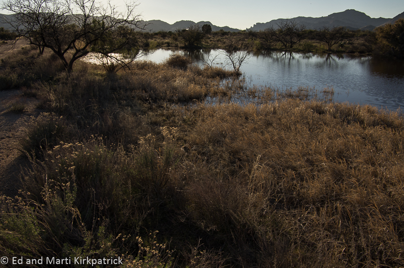
About eleven miles northeast of Montezuma Castle National Monument is Montezuma Well. A natural limestone sinkhole with an incredible upwelling of deep 74 degree groundwater, this peaceful pool is replenished by 1.5 million gallons of water per day!

Montezuma Well

Montezuma Well

Remembering that all the earth’s water is ancient (refreshed is perhaps more accurate) it is estimated that the water entering the pool is about 10,000 years old. The water wells up through two vents with a force so strong divers cannot drop instruments down them.

Irrigation canal at outflow

Irrigation canal at outflow

Overflowing through a long narrow crack this water was directed by the ancient people into dug canals, some as long as seven miles, to irrigate their crops. Interestingly, recent test have shown the water to have high concentrations of arsenic. The area is also full of ruins covering many cultures from pit houses to small cliff dwellings in the walls around the well and pueblo villages dotting the banks of the waterways through the valley.

Cliff house ruins at Montezuma Well

Cliff house ruins at Montezuma Well

Tuzigoot National Monument located on the summit of a long ridge above the Verde Valley just east of Clarkdale, was built between 1000 and 1400. This village began as a cluster of rooms for about fifty people and then about 100 years later the population doubled and then doubled again.

Tuzigoot Ruin

Tuzigoot Ruin

The pueblo eventually was two stories high in places with eighty-seven ground floor rooms and 110 overall.

Tuzigoot Rooms

Tuzigoot Rooms

The visitor center museum here is excellent. I was especially impressed with their collection of pottery. It is very difficult to make large vessels and the number of very large and well proportioned pieces found at this (and other) ancient sites is amazing.

Large Vessels

Large Vessels


Now for some shameless bragging….. A few weeks ago Ed & I were very pleased to have been invited to submit an article and photos to the on-line magazine BoomerCafe.  The magazine is for and about baby boomers but we’re sure younger folks will enjoy it too.  We are really tickled to announce that several days ago we were published!

The Magic of Water – Salt River and Travertine Formations

Tags

, , , , ,

We have mentioned the Tonto National Forest in earlier posts. Encompassing almost 3 million acres including 8 wilderness areas it is just magnificent and covers everything from low desert to pine covered peaks where just the other day snow was falling. We drove down State Route 188 through Tonto Basin and along the Theodore Roosevelt Lake to State Route 88. Known as Apache Trail, 88 starts at the Roosevelt Dam

Roosevelt Dam on the Salt River

on the Salt River and runs 40 miles west through the Superstitious Mountains to Apache Junction over some famously harrowing and beautiful road.

Apache Lake Valley

View from 88 looking back at our campground by the lake.

Ed at Apache Lake

Our spot on the lake.

About 6 miles back on 88, about as far as we dared to drive, is the Burnt Corral Campground on Apache Lake where we dry camped for 2 nights. We have a “Senior Pass” for the National Parks and Forests that gets us in for free. We thought this was sufficient for camping but the nice park ranger who dropped by informed us otherwise. Since we would have had to decamp and drive back out the road to the Ranger Station to get our permit and then likely lose our beautiful spot on the lake, he allowed us to stay the night without it. Just goes to show that nice people are everywhere.

Part of the fun in what we’re doing is meeting people and our neighbors were a young couple, Valerie and Scott, from Boulder CO. Like us, they also designed and built their home, sold it last summer and are living in their truck camper traveling around the west for a year. They kayak, hike, and mountain bike as they go too. Only in their early 40’s we were very impressed.

New Friends

New Friends

After Burnt Corral, we drove north up 87 staying in the Tonto NF through the wonderful tall pine forests (REAL TREES!) around Pine, Strawberry and Payson where we saw a sign for the Tonto Natural Bridge State Park.

Natural Bridge Arch 2

Natural Bridge Arch

Hidden in a tiny valley at the bottom of a steep 14% grade, this natural bridge is 183 feet high, with the tunnel being over 400 feet long and at its widest point 150 feet. It is believed to be the largest natural travertine bridge in the world.

From the brochure…

“The discovery of the small and beautiful valley between Pine and Payson was documented in 1877 by David Gowan, a prospector who stumbled across the bridge as he was chased by Apaches. Gowan hid for two nights and three days in one of several caves that dot the inside of the bridge. On the third day, he left the cave to explore the tunnel and green valley surrounding it. Gowan then claimed squatter’s rights.”

Tonto Natural Bridge Tunnel

Tonto Natural Bridge Tunnel. See the people?

Marti on Trail Natural Bridge

Marti walking down to the tunnel.

Marti in Arch Natural Bridge

That’s a big rock.

Travertine Formations

Details of Travertine formations. As the water runs over the plant material it deposits minerals which become the travertine formation over thousands of years.

Lichens Natural Bridge

This yellow lichen is everywhere around Arizona and we think it is really lovely.

As you can see in Ed’s photos the size of this place is amazing and beautiful. It should go on your Must Visit List.

View on Hwy88

State Route 88 looking back towards the dam.

Apache Lake Cliff Sunrise

Apache Lake Cliff Morning Light

Burnt Corral Clouds

Early Morning Clouds at Burnt Corral

Next up is Camp Verde and ancient ruins.

Why Not and Beyond

Tags

, , , , , , , , , ,

The beauty and wildness and ever changing landscape in the bit of Arizona we’ve been traveling is wonderful. With elevation changes and just curves in the road, the geology and flora changes, often radically. The minerals in the rock means that color variations can be both subtle and stark, but also beautiful. Those minerals also mean there are mines all over the state and most are huge and very destructive. We know we need the materials, but we also believe our stewardship of this land means we must not take and not repair regardless of inconvenience or cost.

Mining operations and tailings just outside of Globe, Arizona

Mining operations and tailings just outside of Globe, Arizona

So hang onto your hat as we cover a lot of ground and add places to your MVL (MUST VISIT LIST 🙂 )!!

Local Mercantile, gas station, restaurant and Mexican Insurance dealer.

Local Mercantile, gas station, restaurant and Mexican Insurance dealer.

We did our first boondocking outside of Why, AZ, a tiny blink of a town at the “Y” intersections of State Hwy 85 and 86. The USPS being what they are would not let the local folks have the name Y for their town because a town has to have at least 3 letters…go figure …hence…Why. Boondocking mostly on BLM land (Bureau of Land Management), National Forests, State Land Trust lands means 98% of the time, no fees, no hook-ups (water, electric, sewer) and no “real” camping sites. Just pick an obviously used spot (worn, probably with a stone fire ring) and claim it as your own, but not too close to your neighbors if there happens to be some, and at Why there were. We found a nice spot with a tree and heard our first coyotes….all good.

Full Moon, Gunsight Wash, boondocking on BLM land outside of Why, AZ

Full Moon, Gunsight Wash, boondocking on BLM land outside of Why, AZ

By the way, we have been told that the only Kyy-Oh-Tee is the one named Wiley. A hard habit to break, the proper pronunciation is Kyy-Oat.

We visited Organ Pipe Cactus National Monument which shares a long border with Mexico. The Border Patrol are ALL OVER southern Arizona and we often go through their road check points. Here in Organ Pipe we chatted with two officers heading out on horseback to do their thing. These horses are wild mustangs who are naturally strong and “smart” about the desert.   After being caught they are broken & trained by prison inmates and then given to the USBP.

Border Patrol on horseback

Border Patrol on horseback

Smuggling Sign

At the Visitors Center, we had to talk our way into being allowed to take our RV (technically 3 feet too long) onto one of the two loop roads through the park. It’s beautiful and we had a great time. Put on your MUST VISIT LIST. (but only in a car).

Organ Pipe Cristate

Organ Pipe Cactus with cristate growth

Organ Pipe Road

Organ Pipe Cactus loop road

Arch Close up

Two arches

On our way to Painted Rocks we passed through Gila Bend… don’t bother with the town but west of there is the Solana Generating Station and miles and miles of irrigated alfalfa fields that are next to a huge factory dairy cow operation.

Solana Generating Station

Painted Rock

Solana Generating Station and a Painted Rock

Then we reversed directions and went east over RT 238 to Maricopa and eventually to AZ 60 and the Tonto National Forest for the night. Put this National Forest on your MVL!! Just beautiful!! We boondocked at Oak Flat Campground.

Oak Flats Campsite

Oak Flats Campsite

This land is sacred to the Apache and is under direct attack by the mining interests and sneaky political tactics. In fact the evening we were there while out for our walk we passed a young Indian doing some quiet ceremony next to a huge “bowl” in the local landscape. The place just felt special.

We went to Globe for lunch and happened into the Drift Inn, a local saloon that’s been in business since 1902 and is quite colorful.

Also in Globe we went to the Besh Ba Gowah Ruins. This small ancient pueblo and the little museum are excellent and should be on your MVL.

Besh Ba Gowash

Besh Ba Gowash

Being children in the 1950’s/’60’s we know all about “duck and cover” and the next day to our surprise we saw a sign for the Titan Missile Museum. Of course we had to visit. It holds the very last of 54 Titan II Ballistic Missiles in its silo! Yes, not only disarmed but with a hole cut in the cone so the world’s satellites can see that it is! Titan Missle NoseThe installation is exactly as it was when it was operational (minus the bomb and rocket fuel) and part of the tour includes a simulated (to an extent) launching of the missile. The tour guide randomly picks someone to be Commander, one of the two people who had to turn the launch keys. As it turns out the woman who “helped” launch the missile emigrated from the Soviet Union 30 years ago! She admitted to us later she was a little freaked out by the whole launch experience. Put this tour on your MVL, very interesting.

Box Canyon Road (2)

Box Canyon Road

We drove across the Box Canyon Rd Hwy 62 to Sonoita. While in hindsight we know we were foolhardy to have taken this 23 mile narrow, windy, twisty dirt road, the drive was magnificent and we survived! At the top of the canyon at 4000 ft. elevation, the surprise is that there are extensive grass lands and cattle ranches across large rolling hills. It is very pretty and a welcomed change from cactus and barren dust and rock.

High Plains Grassland

High Plains Grassland

The last tour we’ve done was at the Kartchner Caverns State Park, which by the way is a lovely campground. These unknown caverns were discovered in 1974 by two young spelunkers, who not only kept this living cave’s location secret but managed over the course of 14 years to keep their find hidden from the general public. Along with the Kartchner family they persuaded the State to buy the land from the family and with huge expense and creativity to safely open it to the public while preserving its pristine and unique formations. Ed and I both separately and together did some caving in our teens and 20’s we cannot believe the beauty of the place and the vast amount of effort it took to open it to tours while not inhibiting or altering its continued growth! It’s an absolutely fabulous story and an extremely beautiful cave. Put this on your MUST VISIT LIST!!! (sorry, no photos allowed but the web link will show you some)

We are back at Catalina State Park where after the rains of two weeks ago the hills are actually showing some green.  We are here for a few days of R&R and housekeeping chores. We even went to an RV show! We’re loving Arizona and hope you’re enjoying Ed’s photographs.


To replace our much missed plastic yard flamingo, our kids made and gave us these stick-on variety to decorate the RV.  We love them. Kids and flamingos both.

To replace our much missed plastic yard flamingo, our kids made and gave us these stick-on variety to decorate the RV. We love them. Kids and flamingos both.

Interior Besh Ba Gowah

"Sphinx" Rock

Interior Besh Ba Gowah and “Sphinx” Rock in Organ Pipe

Picnic spot at the end of Box Canyon Road

Picnic spot at the end of Box Canyon Road

Chain Fruit Cholla (Choyyah)

Chain Fruit Cholla (Choyyah)

Launch Control

Launch Control

Oak Flats Pond 1

Oak Flats Pond

Rock Strata on Gila River-Panorama web

Gila River Cliffs Rock Strata

Box Canyon Road Panorama

Box Canyon Grasslands

Catalina State Park and The Hike.

Tags

, , , , , , , ,

Today in the desert wet wet wet.

Today in the desert wet, wet, wet.

Today, Friday we are just north of Tucson at the Catalina State Park in the Coronado National Forest, which also includes the Pusch Ridge Wilderness Area. We have been here since Monday and keep extending our stay. Weather has been really great for a few days (not to rub it in) but today we are having heavy showers. It rained really hard all night last night too, but we did hear coyotes for the first time. That was really cool!

We were excited to realize that Biosphere 2 which we had heard about when the whole experiment started and “failed” back in the early 1990’s, was just down the road 18 miles. The concept and execution was incredible and its evolution over the years has been remarkable. Our tour guide was very enthusiastic and we thoroughly enjoyed ourselves. So much so that when we left we were the last car in the lot and the gates were closed! Thank goodness they open out automatically! Put this on your must visit list.

Wednesday, Marti marched us up the Romero Canyon Trail here at the park nearly 3.6 miles (that’s 7.1 miles round trip by our Garmin) with an elevation climb of over 1000 ft. to a place called Romero Pools, elevation 3700ft. 20150128-_EKP0003

20150128-_EKP0019

Ed poolside.

These are nice deep pools of cold, cold mountain water draining down from the peaks and we just had to soak our hot, tired feet. There was flotsam in the trees about eight feet up so clearly an incredible amount of water can come crashing down this canyon.   It’s amazing there can be so much water in this dry environment. A local gentleman told us they’ve had so much rain this year they are expecting a wonderful cactus bloom starting next month, we’ll have to come back.

We left the trail head about 10AM and got back around 5PM nearly totally exhausted. This was a hard, hard hike but the landscape and views … just stunning. We also saw a deer, two Golden Eagles soaring, a lizard, two boatmen and assorted little songbirds, (no partridges in a pear tree). We did not see any mountain lions, coyotes or big horn sheep.

20150128-Sierra Daiblo Texas-

Romero Canyon Pools

20150128-_EKP9997

… and this is only half-way to the pools…

20150128-_EKP9996

Cute little fern in a crevice. Marti likes them same as kittens…

20150128-_EKP9992

Cool side (as in temperature) of the mountains.

20150128-_EKP0033

See the moon? It works better in black and white…

20150128-_EKP0029

We’ve seen a very pretty plant called Manzanita (Little Apple) which is everywhere, but so far only in bloom at the higher altitudes and covered with honeybees! The fragrant blossoms smell just like honey. In fact, we have seen loads of honeybees here in the desert where there is no one to poison them.

20150128-_EKP0026

Manzanita to the right of the trail.

20150128-_EKP0016

Marti and Ed wave Hi!

Marti Hiking Romero Pools

Along the trail.

Another day’s outing was the Arizona/Sonora Desert Museum. While slightly interesting the explanation signage gave little actual information. Plus it was very crowded; at least it seemed so after our day in the hills. In general for our $36 we were not impressed, maybe being spoiled by free access to all the Smithsonian museums back home. We do however highly recommend Chiricahua Desert Museum on NM Highway 80. We stopped here a week or so back and it’s well worth the $5 each. Put it on your must visit list.

We are planning to leave here Monday heading out to a BLM (Bureau of Land Management) area near Why, Arizona, to boondock. Boondocking merits its own post but the short of it is camping on public land with no electric, water or sewer hookups, or anything else for that matter.

Bisbee Arizona – Copper, Art and Stairs

Tags

, , , , , , ,

Bisbee from our campsite just before sunrise. Photo by Marti.

Bisbee from our campsite just before sunrise.

Bisbee AZ nestled in the Mule Mountains was founded in 1880 and became one of the richest mineral sites in the world. Producing nearly 3 million ounces of gold and more than 8 billion pounds of copper, not to mention silver, lead and zinc by the early 1900’s Bisbee mining made it the largest city between St. Louise and San Francisco. The last mine closed down in 1975 and the town started to empty and decline, until free spirits and artists flowed in and revitalized this quaint historic town.

Queen Copper Mine entrance and tour train cars. We did the tour...

Queen Copper Mine entrance and tour train cars. We did the tour…

Ed and I have had a blast wondering around the warren of streets and stairs of this delightful and quirky town. Having been built on the sides of mountains many of the homes were originally accessed via mule paths. During the Great Depression the WPA (Work Projects Administration) built steps where these pathways were. Now there are stairs EVERYWHERE and so folks here being clever, this year will be the 25th anniversary of the Bisbee 1000 – the Annual Great Bisbee Stair Climb, oh and participants actually do climb 1,034 steps!! Ed and I did maybe 400 plus over 3 days!20150124-_EKP9925 20150122-_EKP9848

There is art everywhere in this town, good, bad, beautiful and ugly. All of the stairways in the climb have paintings at the beginning with the number of steps and which number the location is for the run. Blank walls all over town are canvases with community murals, master artist paintings and general graffiti. There’s public sculpture and private. Most yards and/or homes have decorative features, clever “junk” and or paintings. Even house numbers and sewer covers are artistic.

There’s OK food, good food and great food offered in small spots and large. There’s a local brewery making wonderful beer. There’s music both in establishments and just common areas. There are a ton of art galleries. And, there is a copper mine tour which is lead by former miners who worked the Queen mine. All of it by Washington DC metro area standards – inexpensive.   WE LOVE BISBEE!! Put it on your MUST VISIT list!

20150124-_EKP9928 20150124-_EKP9914 20150124-_EKP9913 20150124-_EKP9911 20150124-_EKP9910 20150122-_EKP985220150124-_EKP9909 20150124-_EKP9907 20150122-_EKP988320150122-_EKP9847 20150122-_EKP9882 20150122-_EKP987820150124-_EKP9917 20150122-_EKP9877 20150122-_EKP9876 20150122-_EKP9873 20150122-_EKP9870 20150122-_EKP9866 20150122-_EKP9865 20150122-_EKP9864 20150122-_EKP9861 20150122-_EKP9859 20150122-_EKP9856 20150122-_EKP9844 20150121-20150121_174153

Mystery Lights, Big Brother and Salt

Tags

, , , , , ,

Heading to Marfa TX and the Tumble In RV Park we continued to following US 90W. Marfa is famous for the Marfa Lights (this link is to a good description and several good hypotheses but the video image is in my opinion highly suspect. There are other good images online however.) The lights are why we wanted to visit. As it turns out we were there for Ed’s 63rd birthday so we figured it would be a great present and so “they” would certainly come out to play! After dinner when it was dark we headed out to the viewing area and with a few other couples waited patiently for the magic to happen. An hour plus later, cold and no lights, we packed it in. On the positive side the stars, Orion and the Milky Way were magnificent!

Stars east of Marfa Texas.

Stars east of Marfa Texas.

Next morning we head off again on 90W. The landscape continued to be barren and rather ugly. We’d see some sheep or cattle periodically but not much. Then way out in the distance we saw what looked like a hot air balloon. A bit later we both agreed that wasn’t right it had to be a blimp…..a bit farther down the road we agreed yes absolutely a blimp but something was peculiar.

Da Blimp...

Da Blimp…

Then Ed spied what had to be the docking station and some buildings. We stopped and got out the binoculars because something was definitely strange, it wasn’t moving. Ahah!….it was tethered, and maybe 1,000 ft up! We drove a bit closer to the docking area and the sign by the gate answered our questions……Tethered Aerostat Radar System, US Customs and Border Protection! Guess what they’re looking for? 🙂

At Van Horn, still in Texas we continued north on US 54 and the landscape became wonderful as we traveled beside the beautiful Sierra Diablo Mountains. These were the first mountains to show a bit of red color and the drive was delightful and greatly needed after the flat dry cactus wasteland we’d been in.

Sierra Diablo Mountains

Sierra Diablo Mountains

20150120-_EKP9795

At the Guadalupe Mountains National Park we hung a left onto the Texas Mountain Trail US 180/62. Fairly quickly we were out in the open plain again and then salt flats. Scattered across the plain north for a long way are what are sometimes called the Guadalupe Lakes. Control of this valuable resource led to the salt wars of 1877.20150120-_EKP9801

We headed on to El Paso and Interstate 10 on our way to Las Cruces NM for Ed’s birthday dinner in the old town section at a nice restaurant, La Posta de la Mesilla and 3 loads of laundry in the AM! BTW….except for a section on the 375 connecting loop that goes through the Franklin Mountains this piece of road has nothing to recommend it.

20150120-_EKP9794

Boulder field just before the salt flats.

The Pecos Trail – Roy Bean and 4000 year old pictographs

Tags

, , , , , , , ,

After leaving Maryland we stopped at Knoxville Tennessee, a cute little city with good food (Café 4) and exciting music. On our visit we lucked into hearing an amazing Aussie guitarist Anne McCue and the Anne McCue Trio. 20150110-20150110_222630This link is her singing an original tune from her latest CD and take our word for it the night we heard her, her cover of Jimi’s “Voodoo Child” gave Stevie Ray a run for his money.

Tonight we are camping just outside of Del Rio, Texas, just 8 miles from the Mexico border.

Traveling west on US Highway 90 through the bottom of Texas from San Antonio we’re now on what’s called the Pecos Trail. Nasty, rough and empty where Ed says 98% of the plants will bite you, we drove out to Langtry, home of Judge Roy Bean who looks nothing like Paul Newman. While there is nothing much of Langtry still here the museum is not only on the actual spot that Beans saloon, the Jersey Lilly was, the old saloon is still there!

That's Marti, not the Judge, but she is still the law west of the Pecos in our home... :)

That’s Marti, not the Judge, but she is still the law west of the Pecos in our home… 🙂

Ed gives some scale to an ols water windmill.  These mills were bought as kits and assembled on site.

Ed gives some scale to an old water windmill. These mills were bought as kits and assembled on site.

They have also added a lovely cactus garden on the grounds around the original water wind mill. It is a must visit stop if you are at all enamored of old west legends and folks who are truly bigger than life.

20150118-_EKP9716

20150118-_EKP9715

Highway 90 Bridge over the Pecos River

20150118-_EKP9727

Confluence of the Pecos and Rio Grande Rivers looking south with goats.

Working our way back east on 90 to our RV park we stopped at the bridge over the Pecos River. Don’t know about you but for me the Pecos River is THE western location for anything involving water. Due to an 8 year drought, the last little bit before it joins the Rio Grande it just a trickle but the magic of the spot is still there. You can’t really see them in this photo but there’s a bunch of fat and happy goats down there chowin’ down on the wet grasses.

Just a bit on down the road we stopped at Seminole Canyon State Park where there’s a wonderful campground where we wish we were camped. The canyon is home to extensive and sadly quickly disappearing 4,000 year old cliff shelter pictographs. One can only see these on a guided tour which we did and it was well worth the measly $5 per person.20150118-_EKP9761

20150118-_EKP9757

Seminole Canyon

All in all a wonderful start to our stayin’ outta of the COLD travels.

Pictoglyphs

Pictoglyphs

20150118-_EKP9730

Canyon floor.

Short and Sweet – Louisiana Bayou and the Cane Fields

Tags

, , , , , , ,

Hello and Happy New Year!! We had a longer than anticipated visit back home in Maryland but our dear friend Carolyn Mackintosh put us up in one of her Loch Moy Farm apartments and so we had the comforts of home as we visited family and friends. BTW if you’re a horse trials rider or just love to watch dressage, cross-country runs and/or stadium jumping the Maryland Horse Trails at Loch Moy are wonderful.   We have volunteered there for years and this venue and these events are outstanding. You’ll have a great time.

Backing up the calendar a bit to the teaser on our last posting, we headed down to Galveston, TX and spent a couple of days at the Galveston State Park. Outside of town a few miles this lovely campground (Gulf side) was right by the water and mostly empty.

We enjoyed walking on the beach and the beautiful sunrises but have to admit the mosquitoes were thick away from the shore so no campfires.

Sunrise over the Gulf at Galveston - Marti got up to take this shot just outside our door.

Sunrise over the Gulf at Galveston – Marti got up to take this shot just outside our door.

Galveston has some wonderful old homes and an amazing story about the early days of the National Weather Service and Man’s arrogance which you can read about in Erik Larson’s book Isaac’s Storm: A Man, a Time, and the Deadliest Hurricane in History. There is also an interesting museum about ocean oil rigs we recommend.


From Texas we headed off across coastal Louisiana on Rt. 27 and Rt. 82. This whole area is bayou country and water, water everywhere EXCEPT where it’s sugarcane. The road is excellent and it’s a very pretty drive with no traffic, something we love. Along 27 is the Cameron Prairie National Wildlife Refuge. There’s a small section not far from the visitors center where a one way road cuts through a bit of the refuge. There were tons of birds & ducks and even this late in the year lots of alligators.

The sugarcane fields are vast and while many were cut (harvested) many were not. There were also many fields clearly burning or burned and many fields showing new growth. So basically by corn standards, every stage of the plants life all at the same time of year!

Cane cutting T-Rex.

Cane cutting T-Rex.

Sugar cane processing plant

Sugar cane processing plant

Smoke from burning cane on the horizon and burned chaff in the foreground. Note the new cane growing.

Smoke from burning cane on the horizon and burned chaff in the foreground.

Then we started seeing billboards asking drivers to “Please drive carefully and be patient, we’re harvesting”, and were they ever! Rather suddenly, from all directions and in ever growing numbers there were tractors of all sizes pulling trailers of sugar cane down the road. They were all headed here to the processing plant!

We spied the offices and ever hopeful I said “Stop! I’m going to see if we can get a tour”. Of course the very nice lady said the lawyers would not allow it but she did happily answer all my questions. A sugarcane plant can take between 12 and 16 months growth to reach its harvestable stage and will produce 3 to 4 cuttings in a life span. The fields can be burned either before or after harvesting. While my “in house expert” told me the fields were burned because the large amount of chaff left in the fields produced a fungus/bacteria that killed the root my research has indicated something more. Economics is the main reason for burning. Sugarcane has a lot of useless leafy material called “trash” which if not burned off before cutting, adds to the cost of transporting and processing the cane.

New cane growing in burned areas

New cane growing in burned areas

Burning removes this material while not hurting the cane. If the trash is left behind in the field it is piled in fairly deep rows which makes too heavy a mulch for good re-growth of the plants. Also, cane grows in very wet climates and if the trash is left in the field fungus could grow and harm the root.

It was all very interesting and the air had a delightful sweet slightly molasses aroma. Oh, and the very nice lady gave me a small baggy of raw sugar, yummmm!

Austin and Bastrop Texas…

Tags

, , , , , , ,

We headed out of Natchez for Texas taking back roads that were pretty much empty.   Nice enough countryside, lots of water, rivers, streams, lakes and BIG puddles. We stopped for the night at the Twin Dikes COE (Corps of Engineers) park on Lake Sam Rayburn. A lovely large lake and a quiet, mostly empty campground. Took a nice walk before happy hour and enjoyed a peaceful sleep.Lake Sam Rayburn

Next morning the winds had returned with a vengeance and we were glad to not be on major roads as holding the RV steady was a real challenge. Crossing into Texas the speed limit on the 2 lane country road was 75 mile an hour!! We toodled along at about 60 something and thankful there was almost no traffic because what few folks were out there passed us at about 80 mph, blind hills and curves be damned!! East central Texas is not quite flat but pretty enough farm/ranch country. Lots of cattle and lots of big game ranches recognizable because the fencing is at least 8 feet high. Look carefully and you’ll note the livestock is actually antelope and/or other African wildlife. These places either are or supply places where folks can go on “safari” for exotic game without the expense of travel to Kenya or somewhere similar. Not sure how I feel about it but I think it’s cheating.

We arrived in Austin and checked into the Pecan Grove RV Park in the heart of the city. Most of the sites were permanent and mostly well maintained. Enterprise Car Rental was just down the street and Ed walked over and got a car so we could come & go easily both here and then later when we headed over to Bastrop (40 minutes way). Our evenings were spent with our daughter-in-law Christy eating good food, seeing her cute new home, checking out the Christmas tree conversion of a Moon Light ,20141202-20141202_221453 and really enjoying our time together. During the day we wandered around town enjoying the eclectic “weirdness” of Austin and its residents. We also went to the Zilker Botanical Garden which while a little less colorful (winter time, VERY few flowers) was nice.   Their Isamu Taniguchi Japanese Garden however is magnificent! Located on a hill side there are large & small pools and waterfalls hidden throughout and a small stream runs alongside most pathways connecting all the water features together. With rocks and plantings and the movement of the water a constant companion the place is just magical!! Put it on your must visit list!!20141201-20141201_124645

Later in the week we headed on over to Bastrop to visit John Wayne and Michelle Reynolds our “adopted” kids and their 2 year old, Lily. What a smart, sweet, well behaved little doll baby she is! Being a Texan she gives sugar, not hugs & kisses and Marti got as much as she could. Ed unfortunately sporting more hair than she’d ever seen didn’t get his until the day we left. Bastrop is a small charming little town and we enjoyed walking up and down the main street poking our heads in the many galleries and shops including having a chocolate soda at the old time soda fountain & pharmacy that looked like it was right out of “Murphy’s Romance”. A nice visit was had all around.20141203-20141203_134304

Today, we are back home for Christmas and will resume getting you caught up soon about our return to NOLA and sugar cane harvest time!!

Merry Christmas! Happy New Year! Ed and Marti

Next Up, Thanksgiving.

With both a Thanksgiving dinner recommendation from our dear friends Beverley & Rainer Bosselmann and Michael’s very enthusiastic architectural viewing recommendation we headed out of New Orleans for Natchez, Mississippi.

On the way we stopped at Laura Plantation. 20141126-20141126_142323This place had pretty much gone to rack and ruin when somebody with money (we don’t know who) bought the property because he loved the Compair Lapin and Compair Bouki (Disney’s Uncle Remus and Br’er Rabbit) stories which probably originated with the Senegalese slaves living here. It was his wife who convinced him to also pursue the plantations family story, which lead to the restoration. We had a fabulous and feisty tour guide named Rose, who enthusiastically told us all about this Creole Plantation run almost exclusively by women for 4 generations! Weak little southern belles they were not! A most amazing and interesting story. Put it on your list if in the area.. Footnote….Laura is one of 4 tour places along the River Rd…we’re gonna do the other more “typical” antebellum plantations another time.

Heading on down the road we had reserved a camp spot directly across the Mississippi River from Natchez and got checked in and settled down. Next day we headed in for our one o’clock turkey dinner at The Castle on the grounds of Dunleith an 1856 historical home, now operating as an inn. 20141127-20141127_143302The dinner was good, the service not so much (waiter was new we think) and the walk around the grounds afterwards very nice and certainly needed after having eaten every bite!

Overlooking the Mississippi from high up a cliff, Natchez is full of wonderful old, old homes. We did the tour of Rosalie 20141127-20141127_160358which was interesting (and we had the place/tour guide all to ourselves) but not wonderful. We mentally shook our heads as we were told, a servant did this, the servants did that, etc. The only reference to reality was when our guide said “..(can’t remember his name) left the family here and went west to Texas with two slaves probably to avoid the effects of the Emancipation Proclamation.” We wandered up and down streets pointing here and there….”look at that one”…”oh cool”…..lots of fun. We also went out to the beautiful and old Natchez City Cemetery and walked around over hill and dale. Put it on your must visit list too20141128-20141128_151305.

Next stop will be Austin & Bastrop TX……