• About

Whack-A-Mole Wheels

Whack-A-Mole Wheels

Tag Archives: Arizona

Arizona ~ Old and New Favorite Places

17 Sunday Jun 2018

Posted by Ed and Marti Kirkpatrick in Bushes and Blooms, Travels

≈ 11 Comments

Tags

#Prescott Arizona, Arizona, Bonito Campground, boondocking, Catalina State Park, Flagstaff, Lowell Observatory, Sunset Crater, Tucson, Wupatki

Hi there~ It has been many weeks since our last post but we have excuses 🙂 Our main plan for this summer’s adventure is what I have been calling the “middle bits”.  The areas of southern Utah: Bryce, Grand Staircase – Escalante, Capital Reef, Canyonlands, Arches, Moab and on north somewhere.  WELLLL… even though this post isn’t about any of those places, we have in fact done a bit of the above and there will be a post about that coming soon along with Ed’s wonderful photos.  The excuse for the delay is twofold. First, southern Utah is for all practical purposes off the grid (cell phones included) and we couldn’t do a post. And second, there’s the issue of Ed’s totally unexpected emergency detached retina eye surgery complete with a 2-week restriction on not only travel but reading and using his laptop!  So apologies for the delay and we hope you enjoy the below 🙂  Oh, and yes he’s doing well thank you!                                       *************************************************************

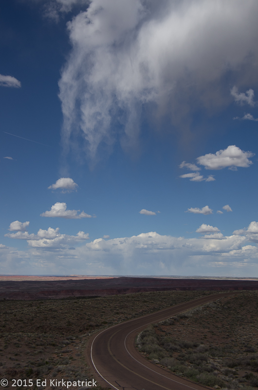
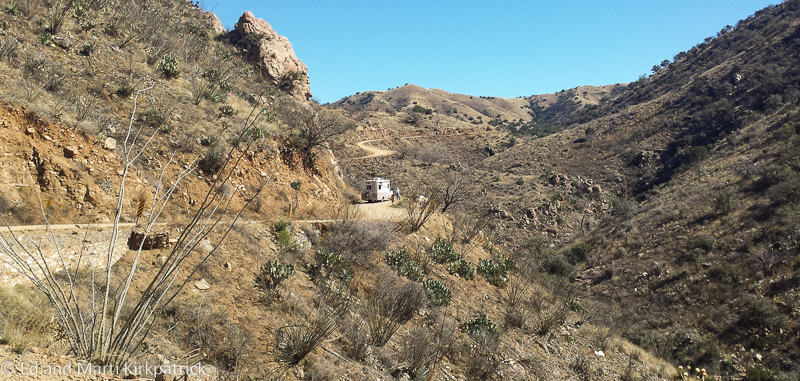
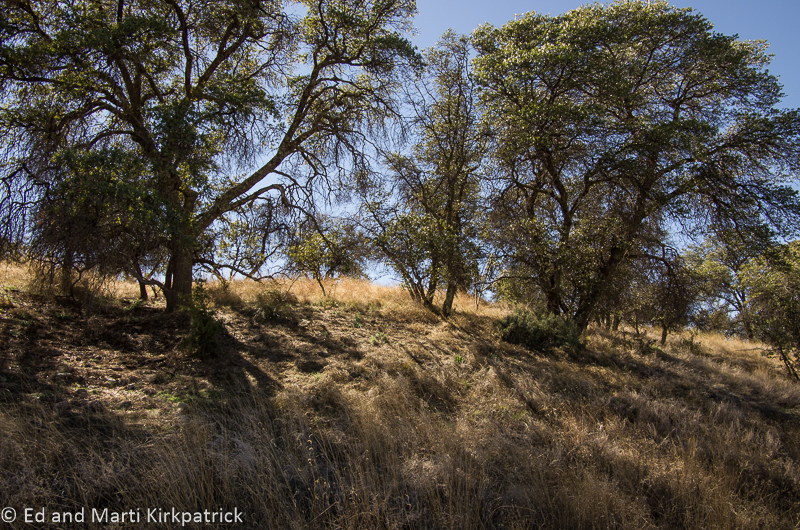
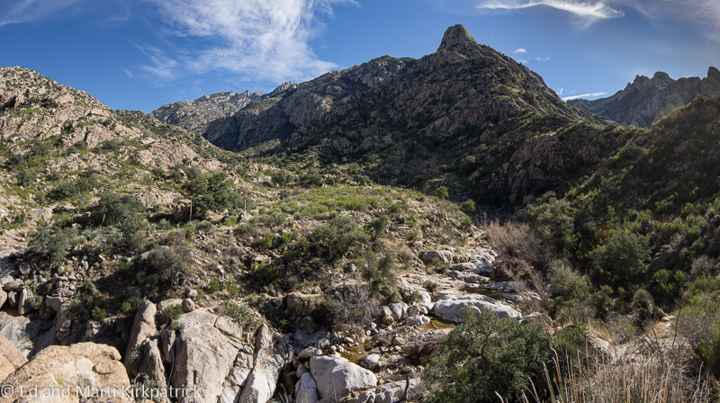
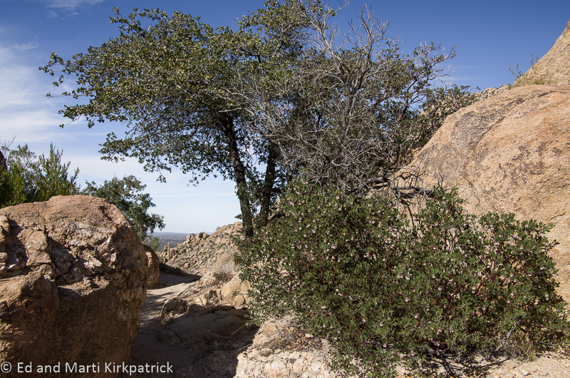
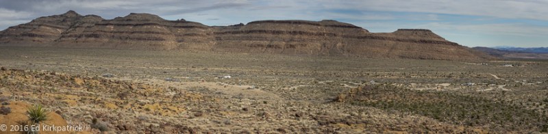
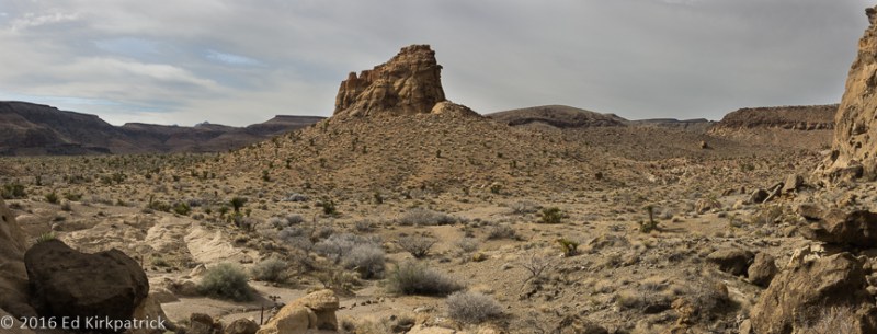
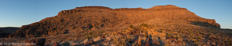
After a quiet night’s sleep at Black Jack Campground we headed on down Rt 78 which for a ways goes through some pretty mountain country

20180427-_EKP4474

78 outside of Blackjack and the forest.

but soon opens up and isn’t as nice. We picked up US 191 heading for Safford, (which is sorry to say downright ugly) and then onto Interstate 10.  We had planned to drop south to one of our favorite places, Bisbee, AZ  but when I phoned the campground in town they said they were completely booked.  Soooo we decided to head on to Oro Valley just north of Tucson and one of our other favorite spots, Catalina State Park, but when I phoned they also were full!  Our nonstop good luck seemed to be on hold, (it was Friday night and weekends are often busier) so we headed for Gilbert Ray Campground just west of Tucson where it’s first come first served and we hoped not full.

20180427-_EKP4496-Pano

Just behind our campsite at Gilbert Ray where it was not full, but in fact almost empty.  Over in front of those mountains is Old Tucson which was built to make movies and has only expanded and grown with many more movies and TV shows. You can take a tour but we didn’t.

20180427-_EKP4502

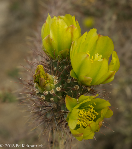
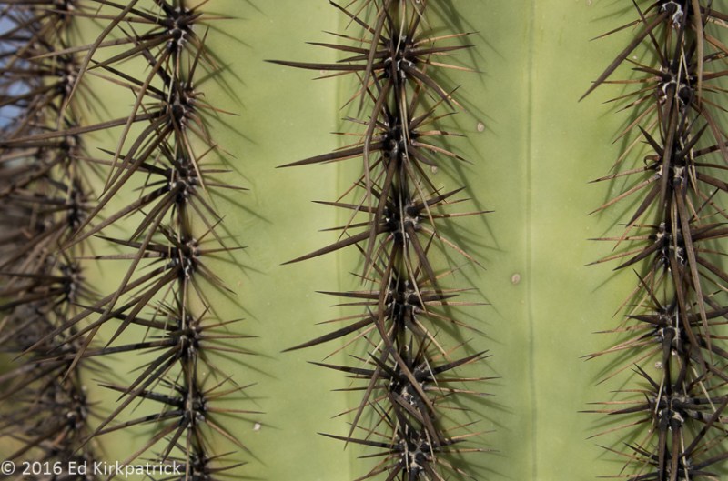
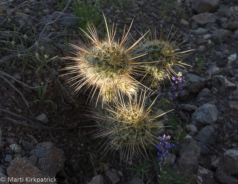
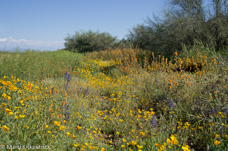
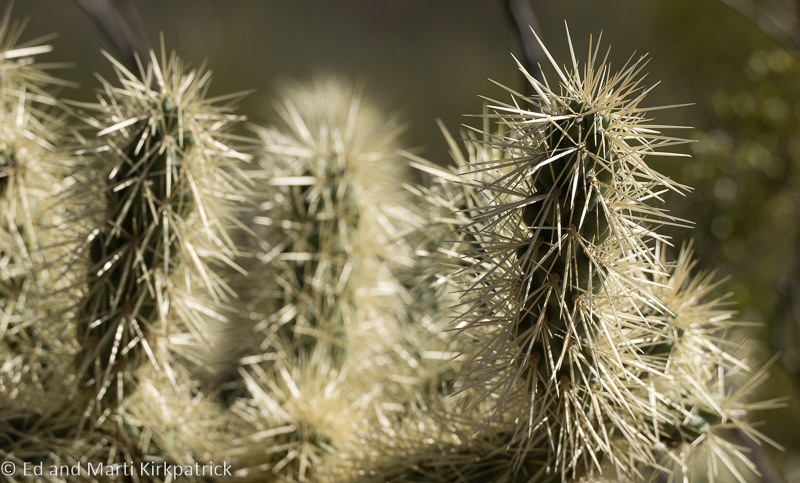
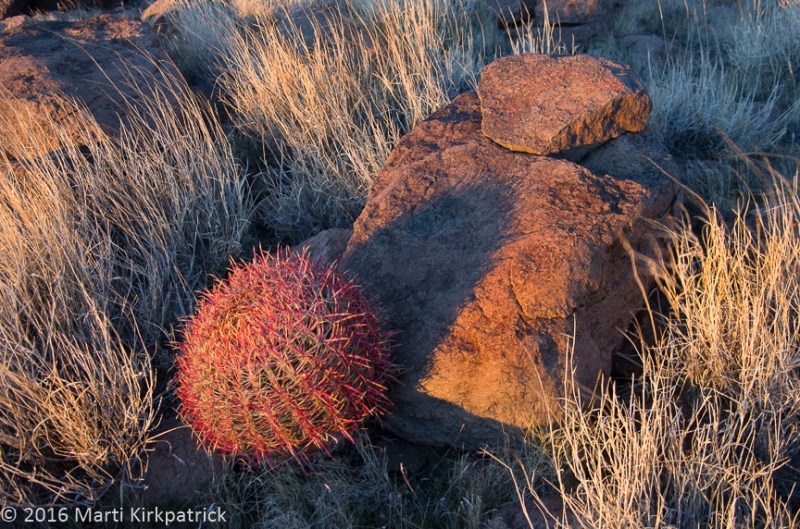
We took a short walk at Gilbert Ray to enjoy the cacti just coming into bloom.  This is a Cholla (choyya) a group of cactus that is perhaps Marti’s favorite.

Every time we’ve been in the Tucson area we’ve planned to go to the Pima Air & Space Museum not for the museum as much as the airplane boneyard.  This time, other than new tennis shoes for me that was the only thing specifically on our MVL (Must Visit List).   We have really been enjoying not planning things out much (or at all) this year but sometimes a little advance research is highly recommended.  Turns out one CAN NOT visit without a 10 BUSINESS DAY ADVANCE REGISTRATION!!!  We have NO IDEA what this is about but find it absolutely ridiculous.  Consequently, it will remain on our MVL for another time.  😦

We ran errands, did some shopping, (did not find my tennis shoes at Fleet Feet but they’re on hold for me in Scottsdale), and had a good steak dinner at The Keg where we always go when in Catalina, where a camping spot had opened up on Saturday 🙂  Interesting side note:  The Keg was the name of a steak restaurant we went to in St. John’s, Newfoundland last summer, so we did some checking.  Not only are they the same, it’s a Canadian company.  The one in Oro Valley is better 🙂

20180430-20180430-_EKP4543

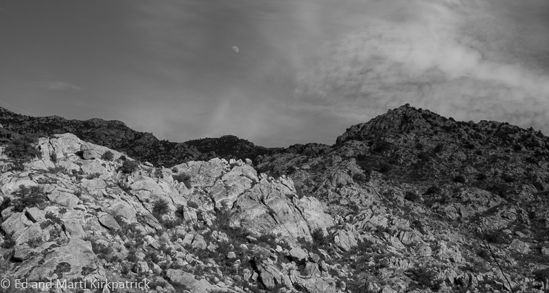
Other than hiking, our favorite thing to do at Catalina is to watch the stars come out and if we are there at the right time of the month, the moonrise over the Santa Catalina Mountains. For my photographer friends, this is hand-held at 1/10 second ISO 1600, just sayin’. 🙂

Wanting to get on north but also working out a plan to catch up with fellow RV full-timer friend Suzanne (who we last saw in St. John’s) we headed for Prescott another of our favorite places.

20180503-_EKP4561-Pano

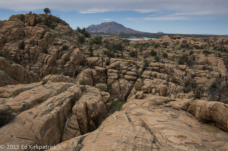
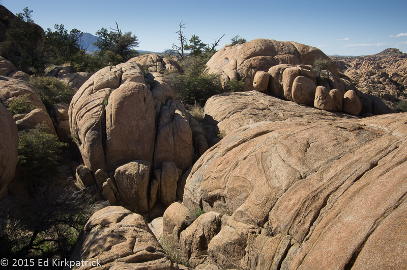
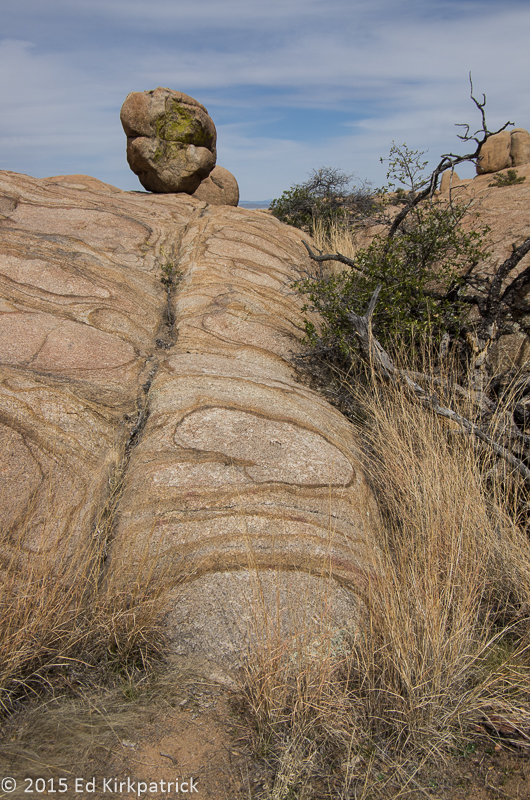
Looking back towards Thumb Butte (on the right) and the Prescott Valley on the left we took a little walk one day.

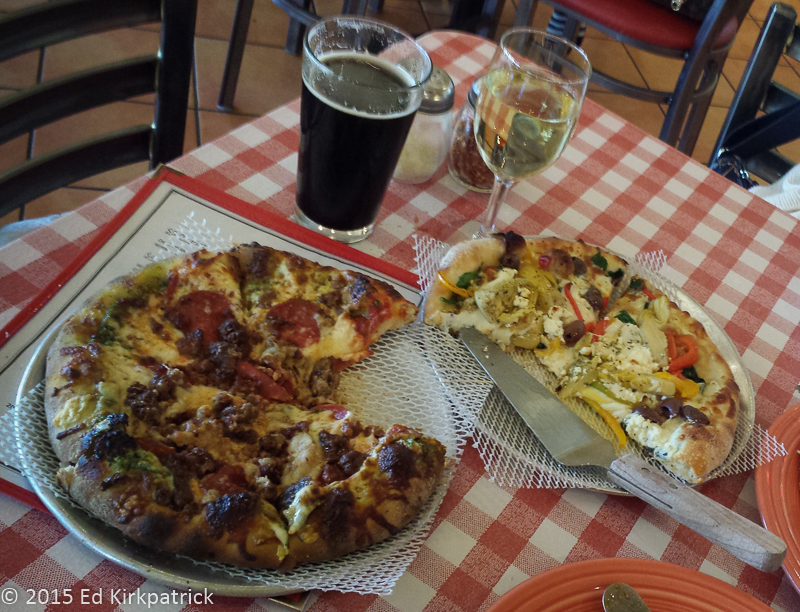
We did a couple of our usuals, Bill’s Pizza, the Phippen Museum plus a nice visit with Suzanne and then headed for Flagstaff, one of my favorite places.

In Flagstaff, we did a few errands, had lunch at the Bun Huggers which was recommended on roadfood.com… don’t bother, it’s just a very mediocre burger and then went to see the Lowell Observatory.  This place has been on our list each time we’ve visited Flagstaff and since we’ve managed to do a couple of “looking at space” things this trip we made sure to go.  The very wealthy Percival Lowell was awarded a Harvard degree with distinction in mathematics in 1876 and then went on to running a cotton mill for 6 years.  For most of the 1880’s he traveled and lived in the Far East returning to the US in 1893. Fascinated with Mars and wanting to study it extensively, he selected a site (the first time anyone had purposely done so) with elevation, remote and most always clear skies and established his personal observatory at Flagstaff, Arizona Territory in 1894.

20180505-_EKP4579-Pano

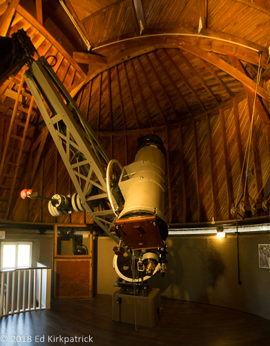
The 13″ Astrograph, a type of telescope used to take pictures only was used to discover Pluto in 1930. Note the wooden film plate at the bottom.

20180505-_EKP4587

An 11×14 BW film was used by Clyde Tombaugh in 1930 to make comparative images to note that what turned out to be the object we call Pluto was moving across the star field which does not move.

A note about camping in the Flagstaff area:  The first night we checked a couple boondocking areas.  Probably in response to the fire ban and extreme dry conditions we found that a number of the forest service roads, including FS 6051 were blocked.  We did go out an unmarked FS road (off Snow Bowl Rd) where we saw a couple of folks but it was VERY rough and VERY unlevel.

20180505-_EKP4608-Pano

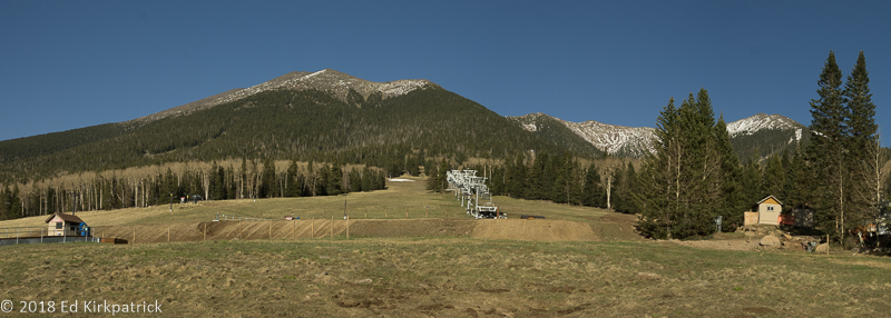
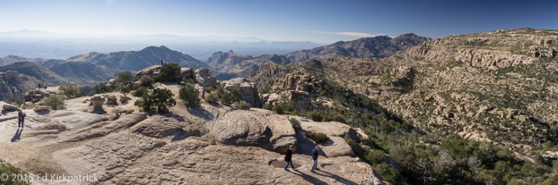
We did enjoy the drive up the Snow Bowl road to over 9000 ft. elevation and the ski area where there was not quite enough snow to ski down the mountain.


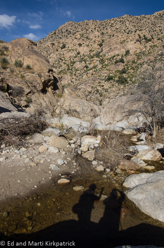
We also checked the boondocking site over by Walnut Canyon and it’s not very level and not pretty, so not for us. We did stay in a spot way out the fairly rough Naval Observatory Road that worked, but I would not take anything much bigger than us past the first section.

20180506-_EKP4619

Tucked in the trees off of Naval Observatory road we boondocked overnight and Ed discovered a set of handcuffs burned up in the firepit.  I kid you not!

Next morning we had a check engine light on and very little power but it was Sunday and Mercedes-Benz of Flagstaff was closed. We checked into Greer’s Pine Shadows where we stayed once before.  NEVER stay here!!  They have no dump station, no showers or bathrooms, sites are tight, mostly permanent folks…. we knew all that from before, but we needed a place.  We set up and after a bit Ed went out, raised the hood and checked the oil dip stick and put it back.  He had no tools out anywhere just a rag in his hand as he stood looking at the engine.  A man from the office (across from us) comes blasting out the door screaming at Ed that they don’t allow any mechanical work being done.  Ed say’s “I’m just looking at my engine!”  This jerk yells “Don’t give me no lip, I’m the manager and I’ll throw your ass out of here!”  Ed, pretty sure the guy might slug him next, shuts the hood and comes in the RV.

Next morning first thing, we drove to Mercedes-Benz of Flagstaff, getting there just after they opened. They said they make a point of trying to get travelers in and out fast.  They not only get to us faster than they said they could, they diagnosed the problem, fixed it for cheaper than we expected and sent us on our way.  Good folks!

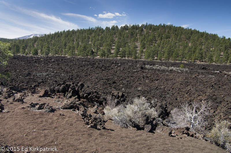
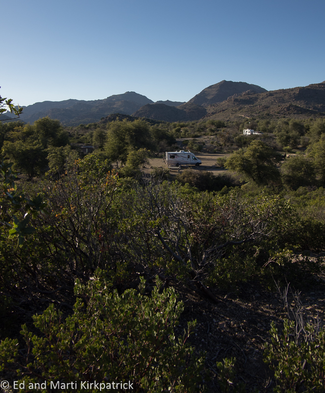
We stayed the next couple of nights at the NFS Bonito Campground just outside of Sunset Crater.  It is a wonderful, dry, first come first served campground, where there are water spigots, nice bathrooms and very few folks, at least when we were there. 🙂

20180507-_EKP4622-Pano

Our camping spot next to the lava field at Bonito Campground.  

20180507-_EKP4652

That knob on the right between the trees is Sunset Crater in the setting Sun. This short walk is just beyond our campsite.  

We had explored the Sunset Crater Volcano National Monument following the 35-mile loop road around to the far end at Wupatki National Monument back in 2015.  This time we explored the ruins of Wupatki and suggest them, and this whole area, for your MVL.

20180508-_EKP4737

The Citadel is the first large ruin one comes to on the loop road from the north entrance. On top of a small hill with a view of the surrounding countryside, 800 years ago the Sinagua culture lived here.

20180508-_EKP4715-Pano

Looking out from atop the Citadel there are in this photograph ruins of eight other smaller pueblos.  Yes, Marti found them but they are very hard to spot.

20180508-_EKP4759

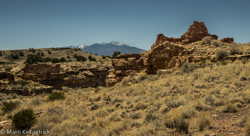
Further down the loop road, Marti walked out to the two dwellings on either side of Box Canyon.  The San Francisco Mountains and Humphrey’s Peak are in the background.

Note: Since we were here and in the last couple of weeks a great deal of Arizona including areas covered in this post are under complete fire bans including camping and hiking due to the extreme drought.


20180427-_EKP4476-Pano

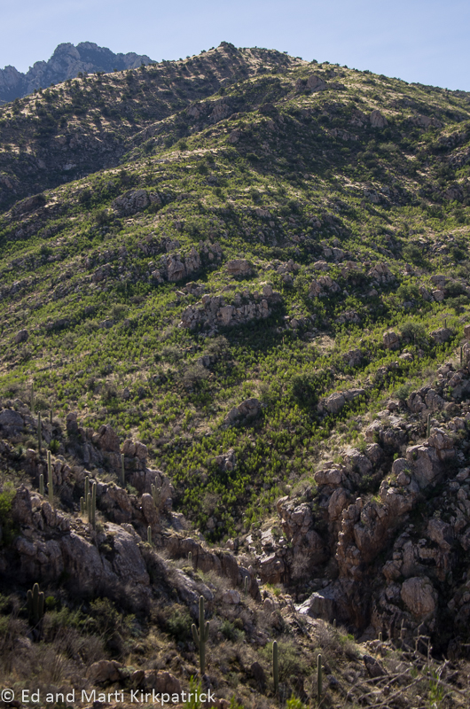
78 continues beautifully down to the valley and the unfortunately ugly Safford, Arizona.  

20180427-_EKP4488

Yet another kind of cholla budding into flower at Gilbert Ray.

20180427-_EKP4495

Guess what…?  more Cholla. There are so many different varieties.

20180427-_EKP4490

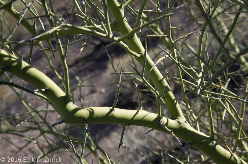
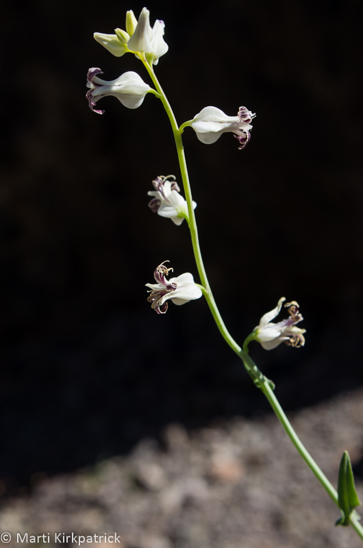
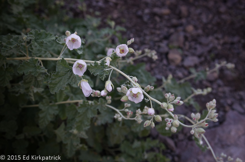
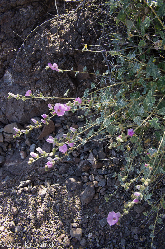
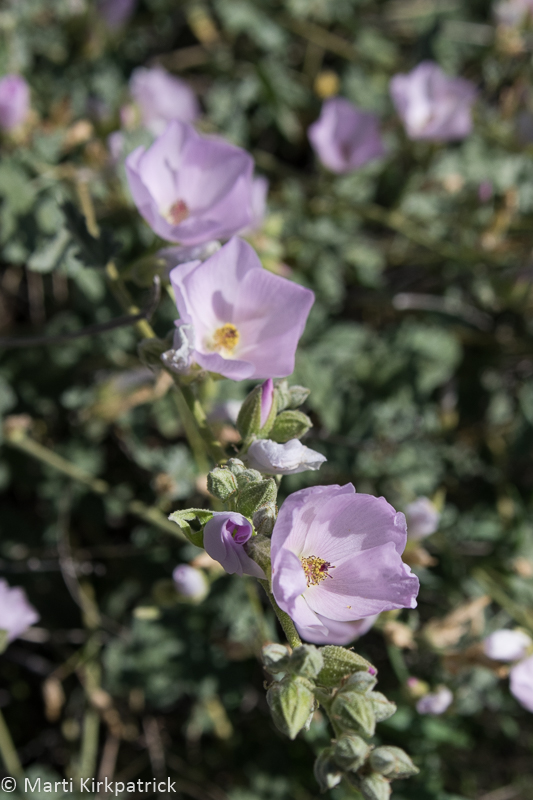
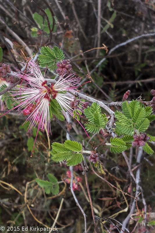
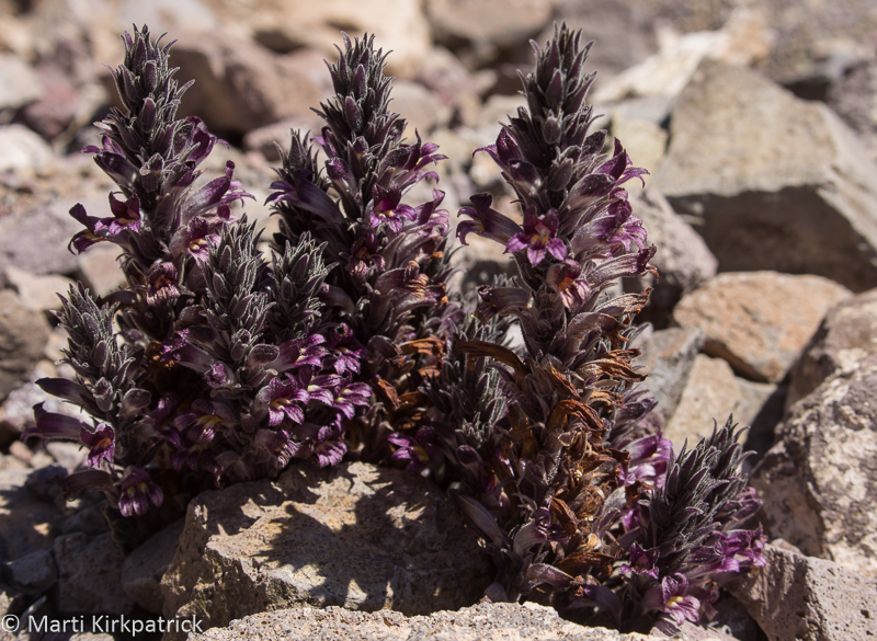
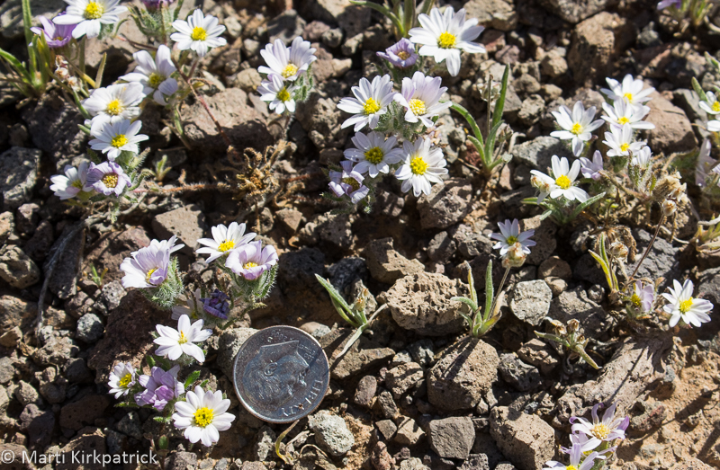
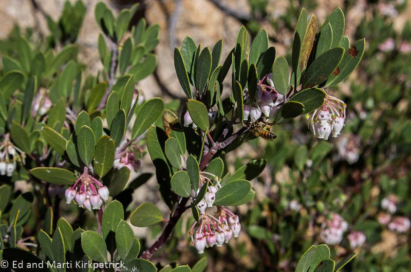
Most plants in the desert can hurt you a little or a lot, but the flowers are magnificent.

20180428-_EKP4534

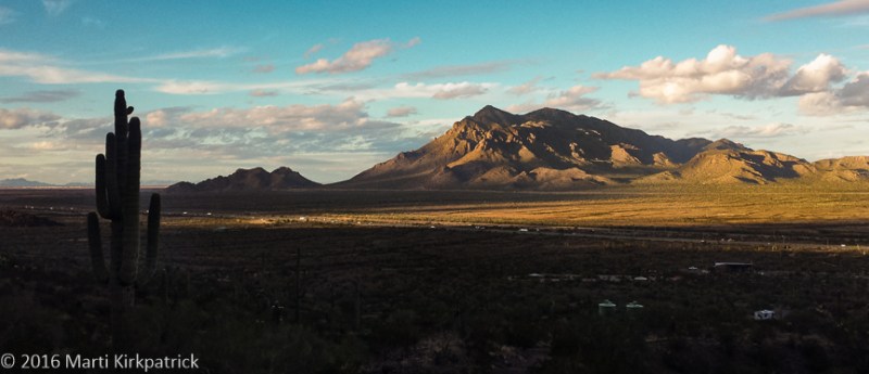
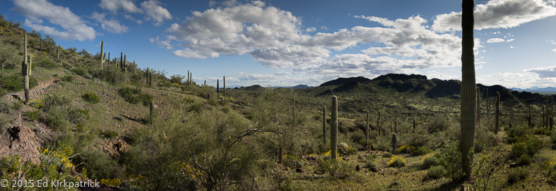
The tall cacti, Suguaro are one our favorites because their expressive arm contortions are so much fun and now they even have flowers.  This is the first time we have seen them in bloom.

20180503-_EKP4559

Thumb Butte in the distance west of Prescott, Arizona.

20180507-_EKP4672

If you just go for a small walk out of the campground into the forest and the wonderful lava fields at Bonito, particularly as the Sun is setting, you too can revel in the beauty left by the incredible forces of Mother Earth.

20180507-_EKP4670

Such peace many centuries after such violence.

20180508-_EKP4703

A short hike into the cinders. Life returns via a bazillion pine cones.

20180508-_EKP4704

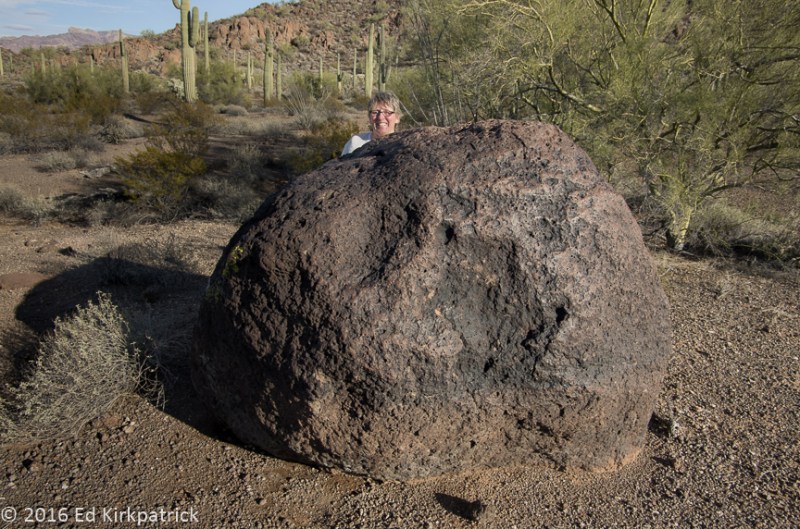
Marti sees creatures everywhere.  Ed, however, being more practical wonders who or what is under that big volcanic rock that fell out of the sky one day about 900 years ago.

20180508-_EKP4797-Pano

Further beyond the Box Canyon dwellings is the beautiful Lomaki Pueblo.

20180509-_EKP4807-Pano

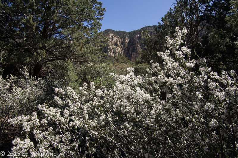
Taken from the Wupaki National Monument loop road, the San Francisco Mountains with Flagstaff, Arizona and the Snow Bowl ski area on the other side.

20180509-_EKP4815

Wukoki Pueblo. Occupied from between 1120 and 1210 AD this unusual three-story tall pueblo sits atop Moenkopi Sandstone.

20180509-_EKP4854

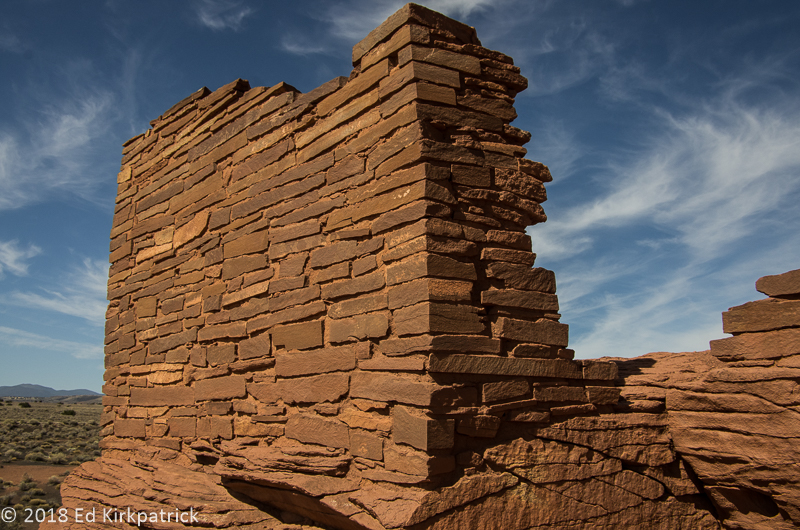
It is hard at first to visually discern where the natural stone outcropping ends and the cut stone masonry begins.  The precision stonework is astonishing.  Perfectly square, plumb corners, built by “primitive” people. They must have had some understanding of basic geometry.
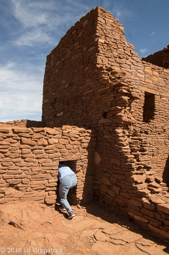
20180509-_EKP4821

Pardon Mart’s butt.

20180509-_EKP4825-Pano-2

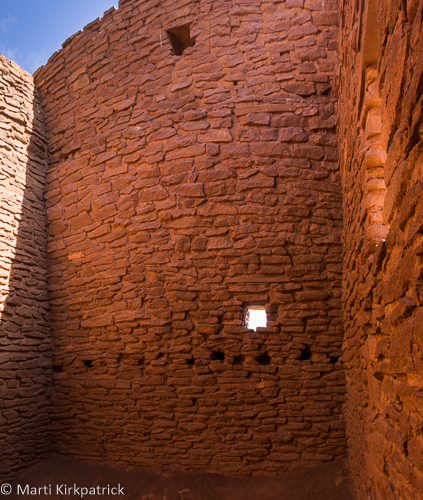
Room interior that shows holes for floor/ceiling joists in the tower room.

20180509-_EKP4849

Remaining wood from the poles used as joists.

20180509-_EKP4890

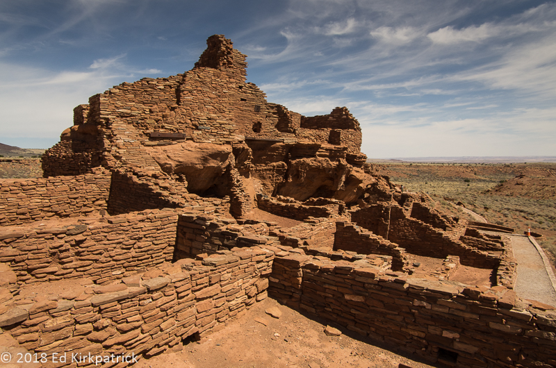
Wupatki Pueblo. The largest complex in the area.

20180509-_EKP4908-Pano

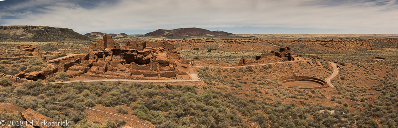
Comprising over 100 rooms, a community room and a ball court, Wupatki is an extremely well preserved and extensive complex.

20180427-_EKP4533

We say goodbye for now as Ed enjoys his wine while cooking dinner and watching the Sun set.

3:10 To Yuma ~Desert Figures ~ Mojave

23 Saturday Jan 2016

Posted by Ed and Marti Kirkpatrick in Travels

≈ 14 Comments

Tags

Arizona, Blythe Intaglios, boondocking, California, KOFA Wildlife Refuge, Mojave Preserve, Spiral Labyrinth, Yuma Territorial Prison

Leaving Ajo, Arizona we headed north to Gila Bend and I-8W towards Yuma which is located on the Colorado River in the southwest corner of Arizona.  There’s precious little on this stretch of highway but there is a place named Dateland where surprise! there’s a date grove!  We like dates, and so we stopped, sampled seven kinds (Honey Dates were the best) and bought some of these sweet healthy treats.  We also tried their “world famous” date milkshake…okay dokey, we can scratch that off the list now 🙂

As you’ll note in the title above, we had a mission on this leg of our adventure.  Having been to Bisbee we know the 3:10 to Yuma movie had that location all wrong.  However, since the movie ends with the train just leaving Contention City we wanted to actually see the notorious prison Ben Wade implies he will once again escape from.  The first seven inmates entered the Territorial Prison at Yuma on July 1, 1876 ( five days after Custer had his last stand at Little Big Horn in Montana and the year my grandfather Deppa was born) where they were locked into the cells they had built themselves.

20160111-_EKP4877

Cell block walk used to be covered with a second story that was the infirmary and offices.

Over the course of 33 years 3,069 prisoners including 29 women (many incarcerated for adultery) were held here.  Although there were many attempted escapes only 2 from within the prison confines were successful.  While we’re not sure it’s worth a trip to Yuma, do put it on your MVL (Must Visit List) if you’re in the area.


While plotting our travels on Google Maps I had noted something marked Spiral Labyrinth outside the Kofa National Wildlife Refuge 6 miles down a dirt road off US Hwy. 95 in Arizona.  I was curious, so I did a little searching and found next to nothing about this, but what I did find was interesting so of course we went looking.  Of unknown origin, but not old, this very carefully built stone labyrinth is amazing and fun.  Someone worked really hard and near as I can find it’s almost a secret.  Put it on your MVL…but….you have to find it yourself 🙂

20160112-_EKP4909-Pano

Marti went in the entrance and it took her about 20 minutes to hit the center.  Then she turned around and walked back out…  another 20 minutes.

From the labyrinth, we headed for California’s US Hwy 95 and Blythe where we were looking for the very ancient Blythe Intaglios.  I have known of these geoglyphs for most of my life and was very excited to see them.  The road they are off of went quickly from bad to nope, so we only managed to see 3 of them.  They are behind ugly protective fencing (why can’t people behave?) so some of the magic feeling is gone.  Even so, one can’t help but wonder… why?  Put them on your MVL.

20160112-Intaglio-

The image is created by scratching away the darker surface stones which reveals the lighter colored soil underneath.  Unlike the labyrinth, there is no ridge of stones because they removed them. 

After spending the night back at Arizona’s Cattail Cove State Park we headed out for our next California destination, dry camping at Hole In The Wall.  Sandwiched between two interstates, 15 & 40, the Mojave National Preserve and indeed the area leading to it, is incredibly vast and empty…and beautiful.  We found a lovely spot in the almost empty campground and settled in for several days.

20160113-_EKP4966-Pano

Looking down on our home for a few days.  Note the stratification in the mountains across the valley.  It became very, very windy at night with gusts near 50 mph but this stopped after dawn every day. We asked the volunteer camp host if it was always this windy and he said, “No, only when it’s windier.”

There are a couple of stories about how this spot got named Hole in the Wall.  One is because of all the holes in the rock, but my favorite is because a former gun-slinger finally settled down in the area and named it for his former hide out 🙂

20160114-_EKP5084-Pano

Looking up Banshee Canyon. See the holes?  The holes are in volcanic ash which is softer than other rock and the wind and water erodes the holes.

The first day we hiked all around behind our site enjoying the views and rock formations.   On day two we did the Ring Loop Trail into Banshee Canyon.  It is so named because early settlers said the wind blowing through sounded like a banshee!  It is an incredibly neat place and I highly recommend it go on your MVL.

20160113-_EKP4963

From our first night’s walk this scene is just uphill from our campsite.  The yellow lichens are really pretty.

We are currently doing chores in Pahrump NV, not a garden spot but they have real stores, gas stations and a very nice Escapee’s RV park not to mention the Chicken Ranch Brothel just down the road.  It’s Nevada, what can we say?  On Monday we head for Death Valley.  We’ve seen it a bit and WOW…..can’t wait to show & tell you all about it!


20160111-_EKP4878

This shows a cell with the iron work that surrounded each cell; doors, floors, walls and ceilings.  All the iron work, welding and shaping was done by inmates.  In fact, everything in the prison was made by the inmates.

20160111-_EKP4875

This shows two cell doors. 1/4″ thick welded and riveted steel that are connected together to prevent one door breaking without the other.  Note that the locks are a good three feet away from the opening on each side.

20160111-_EKP4874

Ahhh… the dark cell.  Solitary confinement in a steel cage.  These cells were hand dug into the caliche hillside.  Caliche is a type of clay/rock that is very, very hard.

20160111-_EKP4871

Inside the Dark Cell, only the floor of the cage remains.  There is a ghost story for this cell and while we were in there Marti saw something flit by! She looked again and to her relief it was just bats.

20160112-_EKP4889-Pano

It’s really magical, especially with the wind blowing.

20160112-_EKP4917

About 2/3’s of the way in an optical illusion occurs that makes the ridges turn into waves rolling towards the center. Amazingly cool…!

20160112-_EKP4918-Pano

Ed at the center of the universe.  I walked in but took the short way out…

20160112-_EKP4922-Pano

The fence is ugly.  BUT if it was not here ATV tracks would obliterate the figure.  In their defense, these figures are hard to see just walking across the desert.

20160112-_EKP4932-Pano

People say this is a horse.  They are very hard to photograph from the ground and we took a ladder in.

20160114-_EKP5045

Anybody who knows Ed, knows this is a big adventure for him.  These are the first set of rings down to the bottom of Banshee Canyon.

20160114-_EKP5048

Marti on the other hand….

20160114-_EKP5079-Pano

Marti looking up at bat caves, we think, in the bottom of Banshee Canyon.

20160114-_EKP5082

We found thousands and thousands of these little bones scattered around this one section of the canyon below what appeared to be bat homes/caves in some of the holes high up.  Note the two femur bones above the quarter.

20160114-_EKP5083

and these skulls were there in the bone yard… Birds? Bats? Lizards? Tourists?  We have to do some research.

20160114-_EKP5091-Pano

From the mouth of Banshee Canyon the valley below.

20160114-_EKP5126

This crew joined us for our picnic lunch.  11 horses branded with a W inside a square.  Their meal was not what our horses back home get.

20160114-_EKP5100

The astonishing variety of colors in the lichens on the rocks here is beautiful.  Marti counted seven different colors. An artist’s palette.

20160114-_EKP4995

Mojave Dawn.  Marti does the before sunrise stuff…

20160114-_EKP5029

Barrel and Hedgehog Cactus in morning sun.

20160114-_EKP5012

Lovely grasses surround rock and a barrel cactus.

20160114-_EKP5031

Hole In The Wall Morning.  

20160114-_EKP5003-Pano

Directly behind our campsite at Hole In The Wall.

Arizona and Unfriendly Weather

20 Wednesday Jan 2016

Posted by Ed and Marti Kirkpatrick in Bushes and Blooms, Travels

≈ 6 Comments

Tags

Ajo, Arizona, Bisbee Arizona, Catalina State Park, Mt. Lemmon, Organ Pipe Cactus, Picacho Peak

Ed and I have joked for years that we’re a bad/weird weather magnet.  Back in the 70’s when we tent camped a lot it always seemed to rain or snow on us and last year we often seemed to drag rain and snow along with us, but of course southern California loved us.  This year it seems abnormally cold temperatures are the camping surprise we’re dealing with.  In fact the temps were so cold and windy heading out of Texas into New Mexico and Arizona that we fled to the border with California in a 3 day hard driving marathon. Landing on Christmas Eve at Cattail Cove State Park just outside Lake Havasu City, AZ we settled in for a few days of wind and cold nights.  While like all the Arizona State Parks we’ve stayed at, Cattail Cove is very nice and we did see a Big Horn Sheep, neither of us sees much point in making this area a destination. 20151227-_EKP4670 
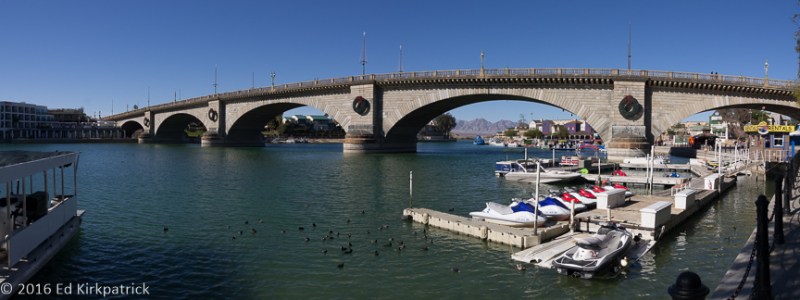
Lake Havasu City was developer Robert McCulloch’s dream based on the recreational draw of the dammed Colorado River and The London Bridge which he purchased, disassembled, shipped and reassembled here as a tourist attraction in 1971. I remember we laughed about this when it happened, and now that we’ve seen it we’re still shaking our heads.20151227-_EKP4665-Pano

We had a looming problem in that our little home’s engine was way overdue for its 40,000 mile check-up and being a Mercedes Benz with each additional 20 miles it beeped and sent us a “HEY” message.  We contacted the nearest California MB Sprinter dealers and they said nope, no RV’s can’t help you or sure, in a month. So even though night time temperatures were still in the low 30’s and high 20’s we headed back to Chandler, AZ to get the work done.  Got there for our appointment and the guy says, sorry our lift broke when we off-loaded the RV before you, all we can do is the oil change!  So, after they did that, we headed for our favorite AZ state park Catalina outside of Tucson where we are familiar with the MB dealer in town.  Loving this area that we consider a MVL (must visit list) place (last year’s Catalina blog) we settled in to do some hiking, do the drive up Mt.Lemmon and welcome in the New Year. Our water line only froze twice 🙂

20160101-_EKP4727

See us having fun on our hike?

20160102-_EKP4755-Pano

Windy Point Overlook on the Mt. Lemmon summit drive.

BTW, to our Sprinter Skinny Winnie friends, we were impressed with Chandler MB and we’ve dealt with Tucson MB twice now and trust them although so far they are the most expensive MB dealer we’ve ever encountered.  😦

Braving the cold we decided to visit some or our favorite MVL places from last winter.  We popped down to Bisbee (where it poured cold rain) planning on dinner and drinks at the wonderful Santiago’s only to find them closed due to a water main break outside their door. We did however have a delightful afternoon (beer was involved) at the Old Bisbee Brewing Company and of course breakfast at the Bisbee Breakfast Club.

20160107-Picacho_Clearing_Storm_Rainbow_2-

From our Picacho Peak State Park campsite looking across the valley, a clearing storm over the Picacho Mountains gave us a wonderful gift.

We revisited another one of Arizona’s wonderful state parks Picacho Peak State Park where I went on a steep, rocky, wonderful hike up the mountain without Ed who was suffering from a weak knee problem.

20160106-Marti_self_3

Marti on her solo hike…

From there down to quiet little Ajo and the Shadow Ridge RV Resort (resort, no, but nice and a good laundry) where part of the fun is hearing and seeing the “boys out to play” in their A10 Warthogs and other really cool jets over the Barry Goldwater Air Force Range.

With the temps once more heading down into the high 20’s we’ve packed up again heading west where it’s a bit better.  Next post will be coming soon…..really….you’ll be surprised 🙂


20151231-_EKP4674

Pusch Ridge Wilderness Area from Catalina State Park.


20160101-_EKP4702

Saguaro Cactus family portrait.

20160101-_EKP4711

Bird’s nest in a saguaro cactus arm.

20151231-_EKP4686-Pano

Sutherland Wash in Catalina State Park.

20151231-_EKP4675

That’s a big Barrel Cactus…

20160102-_EKP4766

Hoodoos on the Mt. Lemmon summit drive.

20160106-Picacho_Peak_Marti_2

Picacho Mountains on Marti’s hike up the Peak trail.

20160107-_EKP4833

We always have gorgeous sunsets at Picacho Peak State Park.

20160110-_EKP4858-Pano

Tillotson Peak in Organ Pipe Cactus National Monument south of Ajo, Arizona.

20160110-_EKP4842

Lots of very sticky sharp things on a Saguaro Cactus.

20160110-_EKP4855

Palo Verde trees have green bark which does the photosynthesis usually done by leaves. They also have leaves which drop in winter.

20160110-_EKP4853

Does this rock make me look fat?

20160103-_EKP4799

Gniess rock.

20160101-_EKP4714

Nice flower.

20160107-_EKP4834-Pano

One last photo of the Picacho Mountains with I-10.

.


Space Rocks, Tree Rocks and Good-bye Arizona

11 Saturday Apr 2015

Posted by Ed and Marti Kirkpatrick in Travels

≈ 4 Comments

Tags

Arizona, Meteor Crater, Painted Desert, Petrified Forest, Starman, Winslow Arizona

With apologies….“Well, I’m a standing on a corner in Winslow, Arizona and such a fine sight to see It’s an ED, my Lord, BY a flatbed Ford slowin’ down to take a look at me….”

On our way east from Flagstaff to our next RV Park and sightseeing destinations Ed said we had to take a swing off of I40 to drop into Winslow so he could stand on a corner. Imagine our surprise to find the only thing going on in this now mostly boarded up town is “THE CORNER”.   He thought he was being really clever.  Turns out everybody’s doing it!   Still lots of fun!

Standing On The Corner

Standing On The Corner

From the day we saw the movie Starman (starring Jeff Bridges & Karen Allen, 1984) we’ve wanted to see Meteor Crater for ourselves. WOW!! is a polite way to describe this amazing hole in the ground! (Truth…..that’s not what I said). Hurtling along at about 26,000 miles per hour 50,000 years ago, a meteorite, or perhaps a dense cluster of meteorites, estimated to have been about 150 feet across, weighing several hundred thousand tons passed through our atmosphere in a matter of seconds crashing into the earth here. 20150330-Meteor Crater PanoThe resulting crater is 700 feet deep and over 4,000 feet across! During its formation, over 175 million tons of limestone and sandstone were abruptly thrown out to form a blanket of debris around the crater for over a mile. Fragments of rock and iron-nickel, some as large as a few feet across, were thrown as far as several miles. The end result today is a fascinating and astonishingly cool scientific reminder of how devastingly fast our little planet can be altered. Definitely put this on your MVL, (must visit list).

About 18 miles east of Holbrook AZ off Rt. 180 is the entrance to the 28 mile drive through Petrified Forest National Park and the southern edge of the Painted Desert.

Petrified Forest

Petrified Forest

Over 200 million years ago trees lived in what was then a floodplain crossed by many streams. Also home to crocodile-like reptiles, giant amphibians and small dinosaurs these trees lived, fell and were washed across these floodplains. Over time a mix of silt, mud and volcanic ash buried the logs cutting off oxygen and slowing their decay. Silica-laden groundwater seeped into the cells of the wood replacing the original tissues with the silica and other minerals turning them to rock – petrification.

Is it wood? Nope, it's really rock.

Is it wood? Nope, it’s really rock.

Time passed, the continents moved, this region was uplifted and the climate changed. More time, wind and water wore away the rock layers and exposed the fossilized animals and these ancient petrified logs.

20150331-_EKP1291Scattered across the desert for miles and still being exposed as the covering rock and sands are eroded away this beautiful landscape can’t help but make one be amazed at the remarkably slow march of time. Even with it so clearly laid out before you it’s almost more than can be grasped. Absolutely a MVL candidate!

Coloration is entirely minerals

Coloration is entirely minerals

20150331-_EKP1300

Petrified wood chips, Marti really liked these.

We had a wonderful two and a half months in Arizona and we still have not seen the northern part.  America’s forty-eighth state is amazing in its landscape and geology, has wonderful state parks and in winter is full of nice friendly Canadians. For those of us who like plants and rocks every turn in the road can produce a drastic change in flora, rock and minerals. Elevation and its effects on them is clearly evident and wonderful to see. We are now in San Diego visiting friends and eating fish tacos while figuring out where to go next.


20150331-Petrified Forest Pano 1

Petrified logs emerging on the plain of the Painted Desert

20150331-Painted Desert  Pano

Painted Desert

20150331-_EKP1332

Virga over the Painted Desert

20150331-_EKP1326

Badlands of the Petrified Forest

20150331-_EKP1320

Blue Mesa between the Petrified Forest and Painted Desert

20150331-_EKP1290

Logs emerging from the rock in the Petrified Forest

20150331-_EKP1329

The Painted Desert

Flagstaff, Arizona – Canyons and Craters and Caboom!

05 Sunday Apr 2015

Posted by Ed and Marti Kirkpatrick in Travels

≈ 5 Comments

Tags

Arizona, Bonito Flow, Flagstaff, Route 66, San Francisco Peaks, Sunset Crater, Volcano, Walnut Canyon

On our way to Flagstaff via another beautiful curvy mountain climbing road we stopped at Walnut Canyon National Monument. The limestone cliffs here are lined with naturally eroded overhangs creating shallow caves and alcoves where starting about 1124 people (now known as the Sinagua) began building their homes. 20150328-Walnut Canyon PanoMostly building in the recesses facing south and east, although there are some north and west facing, there are over 300 rooms around the canyon walls. Using limestone rocks, they shaped them roughly and cemented them together with clay found in the canyon, which they then also used to plaster both the inside and outside of the walls. The site was only occupied for about 100 years and lay basically undisturbed until the 1880’s when the railroad brought souvenir hunters to these ancient dwellings. In 1915 Walnut Canyon was declared a national monument. Everywhere you look there are the remains of these rooms. There is also an excellent, although often narrow, circular trail down around a peninsula in the canyon where one can get a nice view and actually step inside some of these ruins. 20150328-_EKP1182Walking around this narrow and now paved path looking across the canyon to all the many rooms we couldn’t help but chuckle at what OSHA (and modern day parents) would have to say about working and playing here. 🙂

20150328-_EKP1192

Looking closely, midway down, you can see the line of chambers that were homes.

Looking closely, midway down, you can see the line of chambers that were homes.

20150330-20150330_130910

And you can get a Black Cow at the Galaxy Diner on Route 66.

Flagstaff is a neat town and I really liked it….a lot. Ed of course couldn’t help but point out they can get over 100 inches of snow a year! Oh well, guess we’ll not put this on our “I could live here” list! Visiting is however highly recommended. The town backs up to the San Francisco Peaks which are beautiful and is also at a high enough elevation, 7000 feet, to have wonderful Ponderosa Pine forests, which are lovely although my sinuses disagree.

Sunset Crater

Sunset Crater

Just up the road from Flagstaff is Sunset Crater Volcano National Monument. Sunset Crater is the youngest volcano in a string of volcanoes related to the San Francisco Peaks. Most recently erupting about 900 years ago, Sunset Crater is a cinder cone and the cinder and ash field it produced covers 810 square miles! Lava does not explode up and out from this type of volcano, but it can and did squeeze out from the base.

Bonito Flow

Bonito Flow

This lava flow called the Bonito Flow is perhaps 100 feet thick and where it burst out on one side of the crater it filled a narrow valley for 6 miles! The end result for us, is a rugged and sharp landscape that is not only incredibly impressive, it’s beautiful too.

Lava squeezes up and hardens

Lava squeezes up and hardens

Cinders, Aspen and Pine

Cinders, Aspen and Pine

Tough flowers grow in the ash fields

Tough flowers grow in the ash fields

San Francisco Peaks the remains of a large stratovolcano similar to Mt. St. Helens.

San Francisco Peaks, at 12,637 ft are the remains of a large stratovolcano similar to Mt. St. Helens, estimated to have been over 16,000 feet.

Virga falling over the San Francisco Peaks...

Virga falling over the San Francisco Peaks…

Round Rocks & Red Rocks… Prescott and Sedona Arizona

01 Wednesday Apr 2015

Posted by Ed and Marti Kirkpatrick in Travels

≈ 11 Comments

Tags

Arizona, Bill's Pizza, Granite Dells, Prescott, Red Rock, Sedona, The Palace Saloon

Hey there everyone, sorry we’ve been so remiss in getting our blog postings up. We promise to try to do better; in fact we have to because Ed has quite a collection of wonderful photos piling up in Lightroom.

We always look at the places we visit and ask each other if it’s somewhere we could live. Of the two places covered in this posting Prescott makes the list! What a cool little town! We camped at Point of Rocks RV Park because it backs right up to the Granite Dells just outside of town.

Granite Dells, Prescott

Granite Dells, Prescott

One of the coolest things we’ve discovered over the last 2 months in Arizona is the amazing diversity in landscape and geological formations. In fact, Ed calls the whole state a theme park for geologists. The Precambrian Granite Dells, some of the oldest rocks on the planet, are one of these geologic surprises. We spent an afternoon looking at and climbing up and down over this fabulous giant fairy land of stone. We saw faces, Muppets, gnomes, body parts and whole figures reclining in the scattered and balanced granite, and that doesn’t begin to cover our delight in seeing the Liesegang rings (patterns in the rock) caused by the precipitation of limonite.

20150324-_EKP098320150324-_EKP096320150324-_EKP0955

20150324-_EKP1023

Having had a good bit of exercise on day one, we spent day two in town. Whiskey Row before 1953, a notorious red light district right next to the county courthouse, is full of art galleries, restaurants, bars, shops and fun. Ed says he could eat pizza everyday (please no comments 🙂 ) and having gone for weeks without he was getting cranky. Bill’s Pizza came to the rescue and we highly recommend you give them a try if you’re in town. YUMMM!!!

Pizza Pizza!

Pizza Pizza!

We also enjoyed an adult beverage (or more) at The Palace Restaurant and Saloon. On July 14th 1900 when the length of Whiskey Row caught fire the Palace’s patrons carried the huge bar, liquor cabinet and piano player with his piano across the street to the courthouse square where serving continued as they watched the place burn down!! 20150325-_EKP1069

What a town!! Put Prescott Arizona on you MVL (Must Visit List)

Leaving town via the very steep and extremely switch backed State Route 89A through Cottonwood and Jerome we headed for Sedona and Red Rock Country. This is an incredibly beautiful drive but if your vehicle is any larger than our little 25 footer DON’T travel this route! If nothing else gets you the tiny cliff-side town of Jerome will!

Road on the left and road on the right...

Road on the left and road on the right…

Sedona is known for glorious red rock mountains and it truly is lovely in all directions. We did not do more than drive through town as it’s a big tourist destination and being Spring Break it was busier than we generally care for. We did however go on a 5 mile hike back up the Mund’s Wagon Trail just up the road from the Rancho Sedona RV Park where we camped. Compared to some of our hikes this was relatively easy and we had a delightful day.

On Mund's Wagon Trail

On Mund’s Wagon Trail

20150327-_EKP1113We’ll be posting soon with our continuing “WOW, look at that!” trip to Flagstaff and surrounds, ‘til then hope you are enjoying Ed’s photos!


Sleeping figure.  Can you see it?

Sleeping figure. Can you see it?

Marti scrambling...

Marti scrambling…

20150324-_EKP0959

Liesegang rings

Balancing Rock

Balancing Rock

20150324-_EKP1029

In Prescott, memorial to Roosevelt's Rough Riders, the Arizona 1st Cavalry

In Prescott, memorial to Roosevelt’s Rough Riders, the Arizona 1st Cavalry

Elks Theater in Prescott

Elks Theater in Prescott

20150327-_EKP1108

Cairns on the Mund’s Wagon Trail

20150327-_EKP1127

Agave Century Plants. Babies from the dead one in the middle

20150327-_EKP1140

Trail-side blooms

20150327-_EKP1103

Sedona Red Rocks on the trail

20150327-_EKP1104

All done...

All done…

Desert Bloomers

13 Friday Mar 2015

Posted by Ed and Marti Kirkpatrick in Bushes and Blooms

≈ 6 Comments

Tags

Arizona, desert wildflowers, Picacho Peak

If you’ve been following our postings you know there has been some considerable rain in Arizona and from what the locals have told us it’s been wet all winter (by their standards) and they predicted an excellent desert spring bloom. They were right! The flowers started popping a couple of weeks ago and it’s only getting better as the days get longer and warmer. The effects of water, sunlight, wind and elevation on the earth’s surface is accentuated in the desert and it’s been great fun seeing how these elements affect the growth and blooming of the astonishing array of plant life. Suddenly we’re seeing green creeping up the mountainsides and flowers bursting forth in little nooks and crannies as well as in vast blankets of blooms.   Every turn produces another little gem we’ve not seen before. While we know it’s only just begun we want to share with you some of the beauty of the spring time desert. Enjoy!

Brittlebush and Lupine

Brittlebush and Lupine

Lyreleaf Jewelflower

Lyreleaf Jewelflower

Desert Mallow

Desert Mallow

Desert Mallow

Desert Mallow

Picacho Peak Flowers-0821

Desert Mallow

Hedgehog Cactus and Lupine

Hedgehog Cactus and Lupine

Fairy Duster

Fairy Duster

20150308-_EKP0920

Cute but we don’t know yet…

Desert Broomrape

Desert Broomrape

White Tackstem

White Tackstem

Desert Marigold

Desert Marigold

Picacho Peak Flowers-0806

Common Fiddleneck

Cholla

Cholla

Arizona Poppies

Arizona Poppies

Don't know #2

Don’t know #2

Picacho Peak Poppy Field

Picacho Peak Poppy Field

Mojave Desert Star

Mojave Desert Star

Mojave Desert Star and White Tackstem

Mojave Desert Star and White Tackstem

Really pretty

Really pretty

Don't Know #3

Don’t Know #3

Arizona Poppy and Cholla

Arizona Poppy and Cholla

Mojave Desert Start, Lupine and closed Arizona Poppy

Mojave Desert Start, Lupine and closed Arizona Poppy

Roadside Arizona Poppies, Lupine and Desert Globe Mallow

Roadside Arizona Poppies, Lupine and Desert Globe Mallow

Marti hunting flowers

Marti hunting flowers

Little Dude, not a flower

Little Dude, not a flower

Picacho Peak Flower Hike

Picacho Peak Flower Hike

The Magic of Water – Salt River and Travertine Formations

01 Sunday Mar 2015

Posted by Ed and Marti Kirkpatrick in Travels

≈ 7 Comments

Tags

Arizona, burnt corral campground, Roosevelt Dam, tonto national forest, tonto natural bridge, travertine

We have mentioned the Tonto National Forest in earlier posts. Encompassing almost 3 million acres including 8 wilderness areas it is just magnificent and covers everything from low desert to pine covered peaks where just the other day snow was falling. We drove down State Route 188 through Tonto Basin and along the Theodore Roosevelt Lake to State Route 88. Known as Apache Trail, 88 starts at the Roosevelt Dam

Roosevelt Dam on the Salt River

on the Salt River and runs 40 miles west through the Superstitious Mountains to Apache Junction over some famously harrowing and beautiful road.

Apache Lake Valley

View from 88 looking back at our campground by the lake.

Ed at Apache Lake

Our spot on the lake.

About 6 miles back on 88, about as far as we dared to drive, is the Burnt Corral Campground on Apache Lake where we dry camped for 2 nights. We have a “Senior Pass” for the National Parks and Forests that gets us in for free. We thought this was sufficient for camping but the nice park ranger who dropped by informed us otherwise. Since we would have had to decamp and drive back out the road to the Ranger Station to get our permit and then likely lose our beautiful spot on the lake, he allowed us to stay the night without it. Just goes to show that nice people are everywhere.

Part of the fun in what we’re doing is meeting people and our neighbors were a young couple, Valerie and Scott, from Boulder CO. Like us, they also designed and built their home, sold it last summer and are living in their truck camper traveling around the west for a year. They kayak, hike, and mountain bike as they go too. Only in their early 40’s we were very impressed.

New Friends

New Friends

After Burnt Corral, we drove north up 87 staying in the Tonto NF through the wonderful tall pine forests (REAL TREES!) around Pine, Strawberry and Payson where we saw a sign for the Tonto Natural Bridge State Park.

Natural Bridge Arch 2

Natural Bridge Arch

Hidden in a tiny valley at the bottom of a steep 14% grade, this natural bridge is 183 feet high, with the tunnel being over 400 feet long and at its widest point 150 feet. It is believed to be the largest natural travertine bridge in the world.

From the brochure…

“The discovery of the small and beautiful valley between Pine and Payson was documented in 1877 by David Gowan, a prospector who stumbled across the bridge as he was chased by Apaches. Gowan hid for two nights and three days in one of several caves that dot the inside of the bridge. On the third day, he left the cave to explore the tunnel and green valley surrounding it. Gowan then claimed squatter’s rights.”

Tonto Natural Bridge Tunnel

Tonto Natural Bridge Tunnel. See the people?

Marti on Trail Natural Bridge

Marti walking down to the tunnel.

Marti in Arch Natural Bridge

That’s a big rock.

Travertine Formations

Details of Travertine formations. As the water runs over the plant material it deposits minerals which become the travertine formation over thousands of years.

Lichens Natural Bridge

This yellow lichen is everywhere around Arizona and we think it is really lovely.

As you can see in Ed’s photos the size of this place is amazing and beautiful. It should go on your Must Visit List.

View on Hwy88

State Route 88 looking back towards the dam.

Apache Lake Cliff Sunrise

Apache Lake Cliff Morning Light

Burnt Corral Clouds

Early Morning Clouds at Burnt Corral

Next up is Camp Verde and ancient ruins.

Why Not and Beyond

14 Saturday Feb 2015

Posted by Ed and Marti Kirkpatrick in Travels

≈ 15 Comments

Tags

Arizona, Besh Ba Gowah, boondocking, Border Patrol, Box Canyon, Catalina State Park, Globe AZ, Kartchner Caverns, Organ Pipe Cactus, Titan Missles, Why AZ

The beauty and wildness and ever changing landscape in the bit of Arizona we’ve been traveling is wonderful. With elevation changes and just curves in the road, the geology and flora changes, often radically. The minerals in the rock means that color variations can be both subtle and stark, but also beautiful. Those minerals also mean there are mines all over the state and most are huge and very destructive. We know we need the materials, but we also believe our stewardship of this land means we must not take and not repair regardless of inconvenience or cost.

Mining operations and tailings just outside of Globe, Arizona

Mining operations and tailings just outside of Globe, Arizona

So hang onto your hat as we cover a lot of ground and add places to your MVL (MUST VISIT LIST 🙂 )!!

Local Mercantile, gas station, restaurant and Mexican Insurance dealer.

Local Mercantile, gas station, restaurant and Mexican Insurance dealer.

We did our first boondocking outside of Why, AZ, a tiny blink of a town at the “Y” intersections of State Hwy 85 and 86. The USPS being what they are would not let the local folks have the name Y for their town because a town has to have at least 3 letters…go figure …hence…Why. Boondocking mostly on BLM land (Bureau of Land Management), National Forests, State Land Trust lands means 98% of the time, no fees, no hook-ups (water, electric, sewer) and no “real” camping sites. Just pick an obviously used spot (worn, probably with a stone fire ring) and claim it as your own, but not too close to your neighbors if there happens to be some, and at Why there were. We found a nice spot with a tree and heard our first coyotes….all good.

Full Moon, Gunsight Wash, boondocking on BLM land outside of Why, AZ

Full Moon, Gunsight Wash, boondocking on BLM land outside of Why, AZ

By the way, we have been told that the only Kyy-Oh-Tee is the one named Wiley. A hard habit to break, the proper pronunciation is Kyy-Oat.

We visited Organ Pipe Cactus National Monument which shares a long border with Mexico. The Border Patrol are ALL OVER southern Arizona and we often go through their road check points. Here in Organ Pipe we chatted with two officers heading out on horseback to do their thing. These horses are wild mustangs who are naturally strong and “smart” about the desert.   After being caught they are broken & trained by prison inmates and then given to the USBP.

Border Patrol on horseback

Border Patrol on horseback

Smuggling Sign

At the Visitors Center, we had to talk our way into being allowed to take our RV (technically 3 feet too long) onto one of the two loop roads through the park. It’s beautiful and we had a great time. Put on your MUST VISIT LIST. (but only in a car).

Organ Pipe Cristate

Organ Pipe Cactus with cristate growth

Organ Pipe Road

Organ Pipe Cactus loop road

Arch Close up

Two arches

On our way to Painted Rocks we passed through Gila Bend… don’t bother with the town but west of there is the Solana Generating Station and miles and miles of irrigated alfalfa fields that are next to a huge factory dairy cow operation.

Solana Generating Station

Painted Rock

Solana Generating Station and a Painted Rock

Then we reversed directions and went east over RT 238 to Maricopa and eventually to AZ 60 and the Tonto National Forest for the night. Put this National Forest on your MVL!! Just beautiful!! We boondocked at Oak Flat Campground.

Oak Flats Campsite

Oak Flats Campsite

This land is sacred to the Apache and is under direct attack by the mining interests and sneaky political tactics. In fact the evening we were there while out for our walk we passed a young Indian doing some quiet ceremony next to a huge “bowl” in the local landscape. The place just felt special.

We went to Globe for lunch and happened into the Drift Inn, a local saloon that’s been in business since 1902 and is quite colorful.

Also in Globe we went to the Besh Ba Gowah Ruins. This small ancient pueblo and the little museum are excellent and should be on your MVL.

Besh Ba Gowash

Besh Ba Gowash

Being children in the 1950’s/’60’s we know all about “duck and cover” and the next day to our surprise we saw a sign for the Titan Missile Museum. Of course we had to visit. It holds the very last of 54 Titan II Ballistic Missiles in its silo! Yes, not only disarmed but with a hole cut in the cone so the world’s satellites can see that it is! Titan Missle NoseThe installation is exactly as it was when it was operational (minus the bomb and rocket fuel) and part of the tour includes a simulated (to an extent) launching of the missile. The tour guide randomly picks someone to be Commander, one of the two people who had to turn the launch keys. As it turns out the woman who “helped” launch the missile emigrated from the Soviet Union 30 years ago! She admitted to us later she was a little freaked out by the whole launch experience. Put this tour on your MVL, very interesting.

Box Canyon Road (2)

Box Canyon Road

We drove across the Box Canyon Rd Hwy 62 to Sonoita. While in hindsight we know we were foolhardy to have taken this 23 mile narrow, windy, twisty dirt road, the drive was magnificent and we survived! At the top of the canyon at 4000 ft. elevation, the surprise is that there are extensive grass lands and cattle ranches across large rolling hills. It is very pretty and a welcomed change from cactus and barren dust and rock.

High Plains Grassland

High Plains Grassland

The last tour we’ve done was at the Kartchner Caverns State Park, which by the way is a lovely campground. These unknown caverns were discovered in 1974 by two young spelunkers, who not only kept this living cave’s location secret but managed over the course of 14 years to keep their find hidden from the general public. Along with the Kartchner family they persuaded the State to buy the land from the family and with huge expense and creativity to safely open it to the public while preserving its pristine and unique formations. Ed and I both separately and together did some caving in our teens and 20’s we cannot believe the beauty of the place and the vast amount of effort it took to open it to tours while not inhibiting or altering its continued growth! It’s an absolutely fabulous story and an extremely beautiful cave. Put this on your MUST VISIT LIST!!! (sorry, no photos allowed but the web link will show you some)

We are back at Catalina State Park where after the rains of two weeks ago the hills are actually showing some green.  We are here for a few days of R&R and housekeeping chores. We even went to an RV show! We’re loving Arizona and hope you’re enjoying Ed’s photographs.


To replace our much missed plastic yard flamingo, our kids made and gave us these stick-on variety to decorate the RV.  We love them. Kids and flamingos both.

To replace our much missed plastic yard flamingo, our kids made and gave us these stick-on variety to decorate the RV. We love them. Kids and flamingos both.

Interior Besh Ba Gowah

"Sphinx" Rock

Interior Besh Ba Gowah and “Sphinx” Rock in Organ Pipe

Picnic spot at the end of Box Canyon Road

Picnic spot at the end of Box Canyon Road

Chain Fruit Cholla (Choyyah)

Chain Fruit Cholla (Choyyah)

Launch Control

Launch Control

Oak Flats Pond 1

Oak Flats Pond

Rock Strata on Gila River-Panorama web

Gila River Cliffs Rock Strata

Box Canyon Road Panorama

Box Canyon Grasslands

Catalina State Park and The Hike.

31 Saturday Jan 2015

Posted by Ed and Marti Kirkpatrick in Travels

≈ 10 Comments

Tags

Arizona, Biosphere 2, boondocking, Catalina State Park, Chiricahua Desert Museum, rattlesnakes, Romero Canyon, Romero Pools, Tucson

Today in the desert wet wet wet.

Today in the desert wet, wet, wet.

Today, Friday we are just north of Tucson at the Catalina State Park in the Coronado National Forest, which also includes the Pusch Ridge Wilderness Area. We have been here since Monday and keep extending our stay. Weather has been really great for a few days (not to rub it in) but today we are having heavy showers. It rained really hard all night last night too, but we did hear coyotes for the first time. That was really cool!

We were excited to realize that Biosphere 2 which we had heard about when the whole experiment started and “failed” back in the early 1990’s, was just down the road 18 miles. The concept and execution was incredible and its evolution over the years has been remarkable. Our tour guide was very enthusiastic and we thoroughly enjoyed ourselves. So much so that when we left we were the last car in the lot and the gates were closed! Thank goodness they open out automatically! Put this on your must visit list.

Wednesday, Marti marched us up the Romero Canyon Trail here at the park nearly 3.6 miles (that’s 7.1 miles round trip by our Garmin) with an elevation climb of over 1000 ft. to a place called Romero Pools, elevation 3700ft. 20150128-_EKP0003

20150128-_EKP0019

Ed poolside.

These are nice deep pools of cold, cold mountain water draining down from the peaks and we just had to soak our hot, tired feet. There was flotsam in the trees about eight feet up so clearly an incredible amount of water can come crashing down this canyon.   It’s amazing there can be so much water in this dry environment. A local gentleman told us they’ve had so much rain this year they are expecting a wonderful cactus bloom starting next month, we’ll have to come back.

We left the trail head about 10AM and got back around 5PM nearly totally exhausted. This was a hard, hard hike but the landscape and views … just stunning. We also saw a deer, two Golden Eagles soaring, a lizard, two boatmen and assorted little songbirds, (no partridges in a pear tree). We did not see any mountain lions, coyotes or big horn sheep.

20150128-Sierra Daiblo Texas-

Romero Canyon Pools

20150128-_EKP9997

… and this is only half-way to the pools…

20150128-_EKP9996

Cute little fern in a crevice. Marti likes them same as kittens…

20150128-_EKP9992

Cool side (as in temperature) of the mountains.

20150128-_EKP0033

See the moon? It works better in black and white…

20150128-_EKP0029

We’ve seen a very pretty plant called Manzanita (Little Apple) which is everywhere, but so far only in bloom at the higher altitudes and covered with honeybees! The fragrant blossoms smell just like honey. In fact, we have seen loads of honeybees here in the desert where there is no one to poison them.

20150128-_EKP0026

Manzanita to the right of the trail.

20150128-_EKP0016

Marti and Ed wave Hi!

Marti Hiking Romero Pools

Along the trail.

Another day’s outing was the Arizona/Sonora Desert Museum. While slightly interesting the explanation signage gave little actual information. Plus it was very crowded; at least it seemed so after our day in the hills. In general for our $36 we were not impressed, maybe being spoiled by free access to all the Smithsonian museums back home. We do however highly recommend Chiricahua Desert Museum on NM Highway 80. We stopped here a week or so back and it’s well worth the $5 each. Put it on your must visit list.

We are planning to leave here Monday heading out to a BLM (Bureau of Land Management) area near Why, Arizona, to boondock. Boondocking merits its own post but the short of it is camping on public land with no electric, water or sewer hookups, or anything else for that matter.

Enter your email address to follow this blog and receive notifications of new posts by email.

Join 221 other subscribers

View Recent Posts

  • Cod Jigging and New Friends! March 2, 2020
  • Grand Tetons ~ Yellowstone October 11, 2019
  • Beauty & Bones ~ Dinosaur National Monument September 29, 2019
  • Wyoming ~ In the Medicine Bow Corner September 25, 2019
  • A Bit of Western Nebraska September 5, 2019

Get Caught Up

Blogs We Follow

  • john pavlovitz
  • Take To The Highway
  • Kelly Time
  • HowToRVgeeks
  • WANDERTOPIA
  • BoomerCafe ... it's your place
  • Island Girl Walkabout
  • The Online Photographer
  • Technomadia
  • Wheeling It: Tales From a Nomadic Life

Categories

Blog Stats

  • 24,723 hits

Blog at WordPress.com.

john pavlovitz

Stuff That Needs To Be Said

Take To The Highway

Kelly Time

HowToRVgeeks

WANDERTOPIA

BoomerCafe ... it's your place

Island Girl Walkabout

Hector and Brenda on a journey of discovery

The Online Photographer

Technomadia

Adventures in Nomadic Serendipity

Wheeling It: Tales From a Nomadic Life

On the Road Since 2010, Traveling Across USA & Europe With Pets

  • Follow Following
    • Whack-A-Mole Wheels
    • Join 184 other followers
    • Already have a WordPress.com account? Log in now.
    • Whack-A-Mole Wheels
    • Customize
    • Follow Following
    • Sign up
    • Log in
    • Report this content
    • View site in Reader
    • Manage subscriptions
    • Collapse this bar
 

Loading Comments...