• About

Whack-A-Mole Wheels

Whack-A-Mole Wheels

Tag Archives: California

California, Here We Come

07 Saturday Jan 2017

Posted by Ed and Marti Kirkpatrick in Looking Back On Our Travels, Travels

≈ 6 Comments

Tags

#California Coast Redwoods, #Jedediah Smith Redwoods, #Shasta Trinity National Forest, California

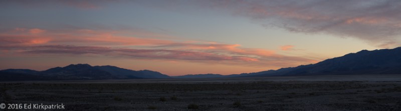
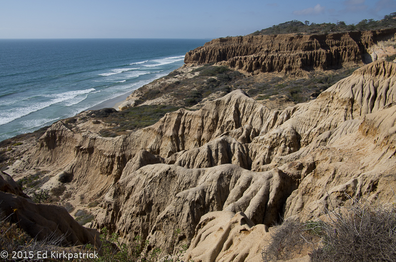
Leaving the very nice Harris Beach State Park (we’d stay here again in a heartbeat) just north of Brookings, Oregon we only had plans to cover about 28 miles to our next camping spot Village Camper Inn RV Park (fine enough, but not as nice as their webpage looks) in Crescent City, California.  In this last bit of Oregon I once again suggested leaving US 101 for a coastal side road Rt. 872/Oceanview Drive in part so we could stop at McVay Rock State Recreation Site. None of it proved as nice as I’d hoped for.  The road does not offer views of the ocean and while McVay was pebbles rather than sand, it was nothing special. Oh well, it was not our reason for today’s travels.

20161001-_ekp2115

Goodbye to Oregon’s coast.

Getting back onto 101S, just before Fort Dick, CA, we took State Route 197/North Bank Road which follows along the Smith River to today’s travel goal, Jedediah Smith Redwoods State Park.

20161001-_ekp2150

Wood Sorrel, ferns and big trees.

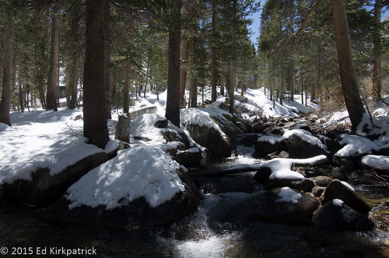
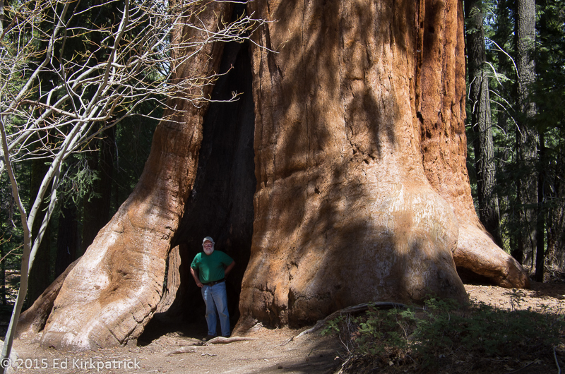
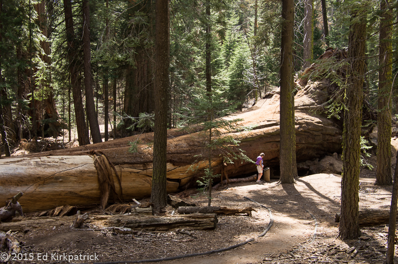
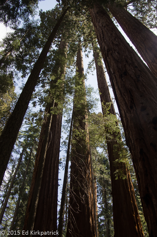
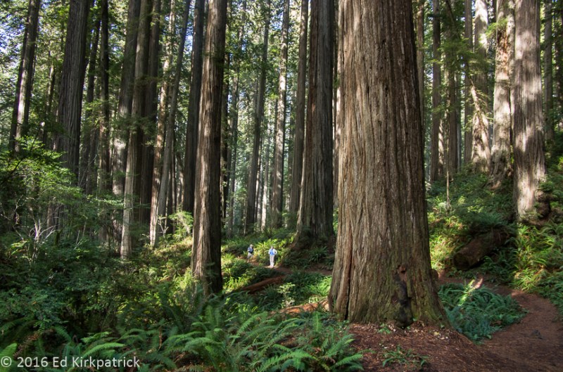
Protecting seven percent of all the old growth redwoods in the world these 10,000 acres of temperate rainforest are truly magnificent!  California coast redwoods thrive at elevations below 2,000 feet.  Year-round moderate temperatures and as much as 100 inches of winter rains provide the perfect environment for a magical green wonderland of moss, ferns, rhododendrons, azaleas and trees that can grow to 350 feet or more with a base nearly 20 feet in diameter!  After a nice chat with the park ranger lady, who checked out the size of our rig, we took the beyond narrow, unpaved and potholed Howland Hill Rd.  Officially not recommended for RVs (but Ed is a VERY skilled driver) and absolutely not after a rain storm, this was a wonderful route.

20161001_140818

It seems more narrow than it looks…

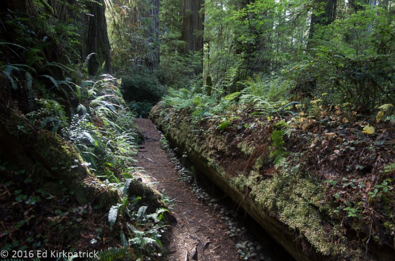
Off this road we walked the popular Stout Grove Trail and much further in the less traveled Boy Scout Tree Trail. Jedediah Smith Redwoods State Park should be on your MVL (Must Visit List)!

The next two days were so rainy we didn’t venture out (thank goodness we’d already done Howland Hill) but come day three we headed on down 101S to pick up an alternate route, the ten mile Newton B. Drury Parkway.  While it looked lovely going through another redwood forest the fog and heavy misty rain kept us mostly inside the RV.

Back out on 101 the weather improved and we stopped several times to look at the Pacific seascape.  Stopping on one narrow shoulder I thought I heard seals, so hopped out to look.  Not too far out in the ocean was an impossibly steep big rock absolutely covered with seals all the way to the top!  We have no idea how they got up there and unfortunately none came or left while we stood watching.  A bicycling couple from Germany stopped and we shared our binoculars with them.  They agreed, it just didn’t seem possible but clearly it was!

20161004-_ekp2255

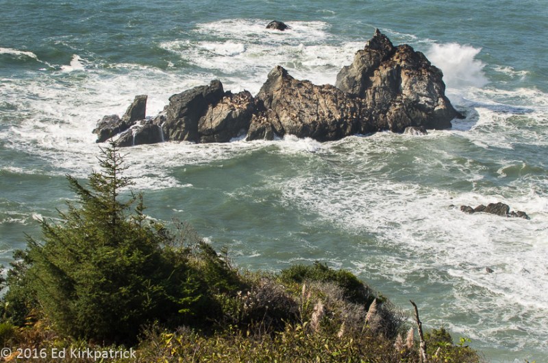
The rock with all the seals.  With all the noise they were making maybe they too were wondering, “How do I get off this damn rock?”

20161004-_ekp2255-2

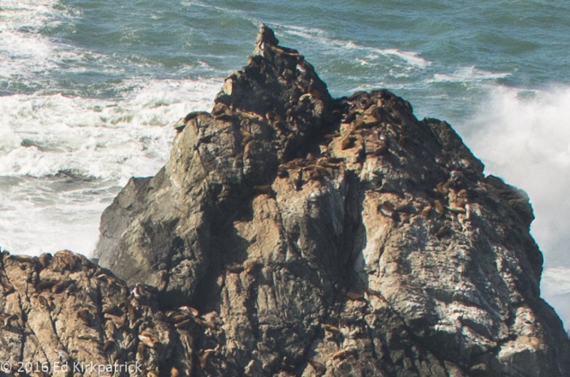
Here’s a crop to show the seals all the way up at the top.  Try doing that on your stomach with flippers!

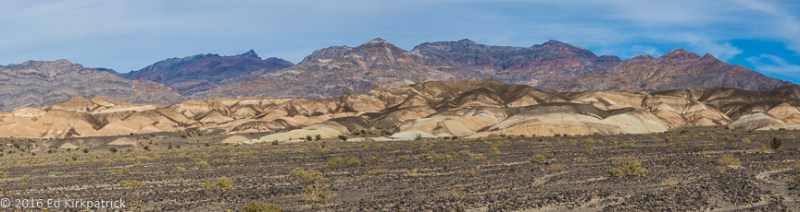
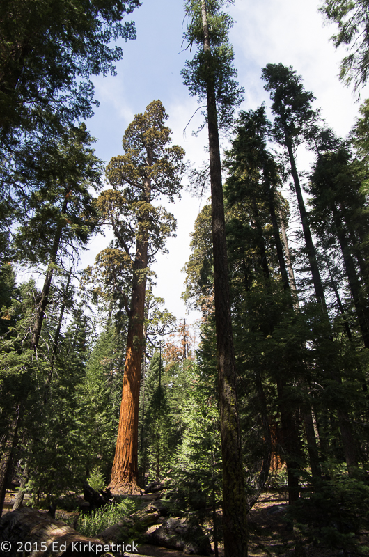
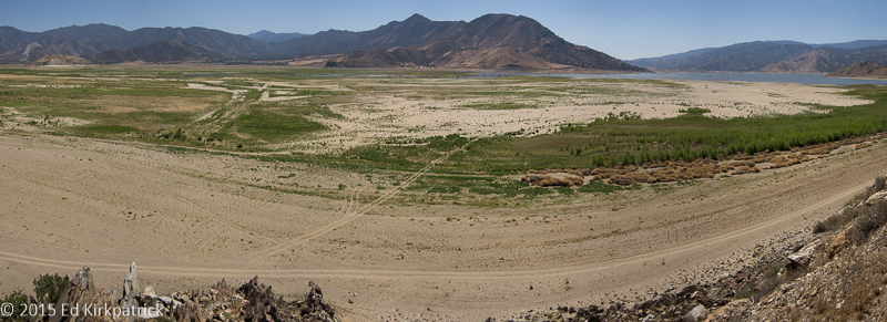
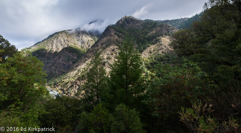
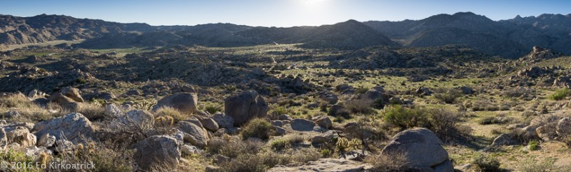
We spent the night at Emerald Forest Cabins & RV in Trinidad (OK park in the woods, they were still renovating and improving….) and next morning we drove down 101 to State Rt. 299 East.  This 153 miles of road goes through pretty mountainous country although once again rainy clouds and heavy fog obscured a lot of the first bit until the weather started to lift and the sun came out.  The first 38 miles follows several streams and then at the little town of Willow Creek just a ways into the Shasta Trinity National Forest it runs beside the beautiful Trinity River.  There was a great deal of road construction going on this entire way so a lot of stopping and sitting.

20161005-_ekp2266

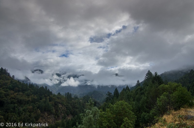
Heavy clouds obscuring the mountains along 299 East.

Someday however, I’d like to go back (in the SUNSHINE) and spend some time in this area.  We spent the night at the very nice Premier RV Resort in Redding, CA and recommend them as a good campground for all you RV’ers.

I’ll stop here as that pretty much covers our coastal travels, and our next adventure (which deserves lots of space) came as a complete and wonderful surprise when I said….”Hey, let’s go here!”


_ekp2172

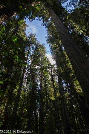
There’s a lot of looking up in the Jedediah Smith Redwood State Park.

_ekp2190

Ed! He’s in there! This is the trail in the Stout Grove.

20161001_143845

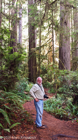
He’s easier to see in this photo.

20161001-_ekp2164

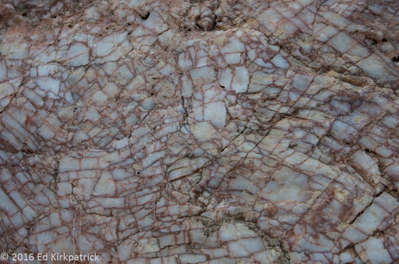
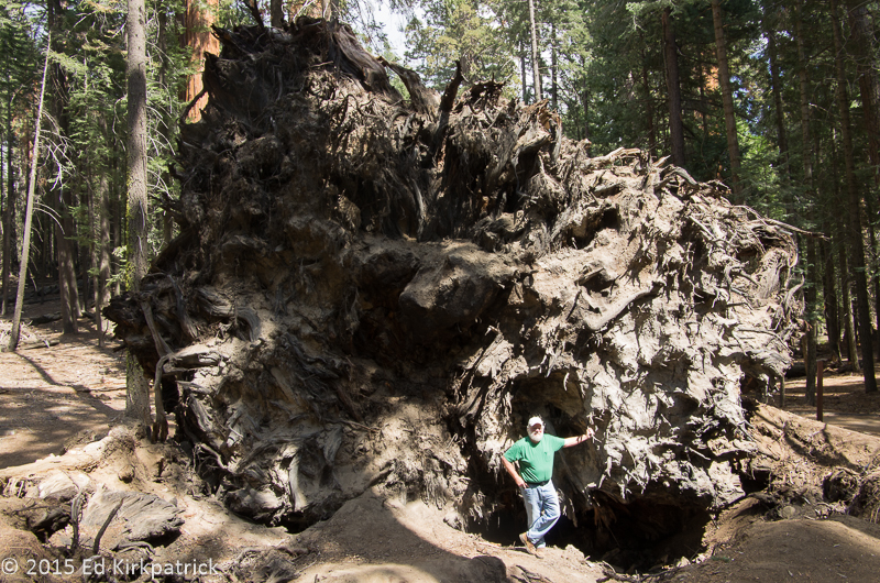
Marti says this is a jigsaw puzzle nightmare.

20161001-_ekp2165

If a tree falls in the forest….

20161001-_ekp2169

The light in the Stout Grove was really fun that day.  It wasn’t raining either!

20161001-_ekp2188

We did not drive into the Stout Grove Trail, but rather parked out on Howland Hill Road.

20161001-_ekp2192

Starting out on the Boy Scout Tree Trail.

20161001-_ekp2206

Deep into the trail the trees, they are big.

20161001-_ekp2209

Fairy Land or Hobbits either one…

20161001_160945

Trolls! Marti discovered this guy lurking in a stump.

20161001-_ekp2187

…and the horse he rode in on.

20161004-_ekp2245

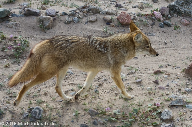
Back out on 101 we spied a herd of Roosevelt Elk. They are all over out there.

20161005-_ekp2270-pano

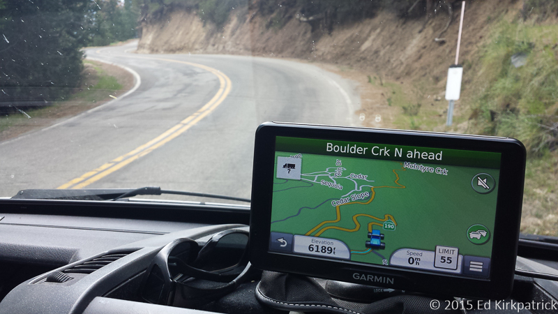
Driving east now through the Shasta Trinity National Forest near Lewiston, CA.  My GGG Uncle Ethbert Newland (see last post) hauled freight from here to Placerville, CA during the gold rush days in the early 1860s.

20161005-_ekp2279-pano

The Trinity River runs down this valley.

20161005-_ekp2285

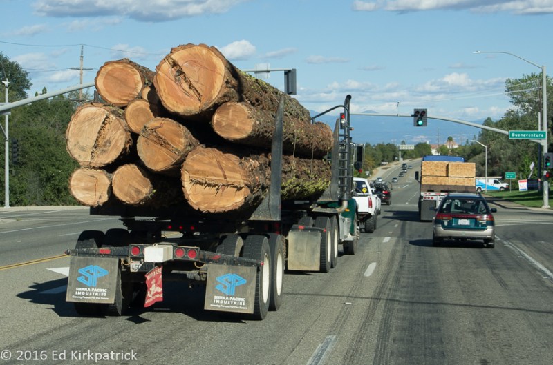
They cut some big trees out here.  These logging trucks are everywhere. The truck in front has the finished product loaded.


Hello from Maryland!! 

05 Tuesday Apr 2016

Posted by Ed and Marti Kirkpatrick in Bushes and Blooms, Travels

≈ 6 Comments

Tags

boondocking, California, Culp Valley, Joshua Tree National Park, Jumbo Rocks, Phainopepla, Ryan Ranch

We have obviously covered a great deal of country since our visit to Death Valley.  However, before we knew we had to make this run home, we did get to boondock (camping with no water, electric, sewer hookups) in two places we couldn’t manage last year.  First in the beautiful Culp Valley high above Borrego Springs CA and then Joshua Tree National Park CA. We spent four terrific days at each location and had lots of delightful hikes and gorgeous starry nights.  We recommend both for your MVL (Must Visit List), but stay away on weekends and go preferably in February when both places can be pretty cold at night, but much less crowded.

20160215-_EKP6141-Pano

Looking back into the Culp Valley campground.

20160222-_EKP6334-Pano

The ruins of Ryan Ranch (on the left) near the Ryan campground in Joshua Tree National Park.

After Joshua Tree we slipped down to Desert Hot Springs for some laundry chores, our posting of the 2nd Death Valley installment, and a long soak in said hot springs 🙂   It was during this time we received the news that my brother Bruce had passed away from complications of Parkinson’s Disease.   He and his wife Luanne lived in The Villages in Florida, but he was to be buried back home in Darnestown, Maryland and we had four weeks to make the trip home.

So over the course of 3 weeks we worked our way home stopping at a lot of places we have blogged about before; Prescott, Arizona,  Catalina State Park in the Oro Valley outside of Tucson as well as quirky little Bisbee in southeast Arizona. We did a short visit with our dear kids in Austin and Bastrop TX. Then stopped off in New Orleans where we got to watch the anything goes goings-on for St. Patrick’s Day (oh my, those tiny green stars were paint, not pasties!) and on home via Ed’s sister Susan’s in Tucker, GA.

During this drive back east we also received the sad news of the death of our best man (so many, many years ago) Bruce Will, a back home walking friend Leslie Schwartz, and Ed’s Aunt Lois!  An incredible reminder to do all those things you’ve always wanted to but don’t think you have time for, and most importantly, tell those you love “I LOVE YOU” at every opportunity!

We will be hanging around the mid Atlantic for about a month (we’ll do a post I’m sure) and then plan to head towards the Pacific Northwest, via what route we haven’t figured out yet, but you’ll be the first to know! 🙂


20160229-A05_Bruce_DeppaWhen I was little of course I knew I had two brothers who were older than me, but what I could not seem to grasp was how to differentiate between the older and the even older, so, to me, Roy was my “little” brother and Bruce was my “big” brother….and OH what a big brother he was!

He could walk on his hands around the yard.

He could crack a bull whip and flip me in the air.

During his college years he’d bring his dates home for Sunday dinner.  It was a heck of a lot cheaper than restaurants and if they’d already met the folks on the first date, well, they sure couldn’t read anything into future visits!  He would always ask me, 10, 11 year old ME, what I thought of the girls he’d brought home!  AND, he REALLY listened to what I had to say!

When I was in high school and shall we say a little much for Mom & Dad to understand (and vice versa), I’d go to Bruce for someone I knew would listen to my frustrations, dreams, raging and mediocre poetry!

He would babysit our very precocious toddler Scott so Ed and I could have a little “us time”… and he must have set a land speed record getting to us when Scott was killed in Iraq.

Bruce always woke with a smile on his face, excited about the new day.

Bruce never met a stranger.

Bruce was kind, understanding, intelligent, interested in everything and everyone.

Bruce was my big brother.


20160218-20160218-20160218-_EKP6279-Pano

Clearing storm early one morning at Culp Valley.

20160215-_EKP6128

Looking down to Borrego Springs, California from above the Culp Valley.

20160217-_EKP6202

Hiking in Culp Valley on a windy day.

Cat_Claw-6254

The Cat Claw bush and Ed never did make friends… He has another name for it but this is a family blog.

20160222-_EKP6355

A Joshua Tree at Joshua Tree.

20160223-_EKP6388

Climbers scaling Headstone Rock at Ryan Ranch.  Joshua Tree is a very popular destination for climbing and bouldering.

20160223-_EKP6703

The Joshua trees were just coming into bloom.

20160223-_EKP6724-Pano

Joshua Tree Panorama.

20160223-_EKP6741

Marti left me on a rock pile and went off to look at these rocks.

20160223-_EKP6750-Pano

While she was away I photographed some of the local flora. It’s called Mickey Mouse Prickly Pear.

20160225-_EKP6898

Jumbo Rocks hike.

20160223-_EKP6812

Our neighbors, Kimberley and Emily were hiking the California Hiking and Riding Trail.

20160225-_EKP6869-Pano

Jumbo rocks Campground in Joshua Tree.

20160223-_EKP6772

Our new friend a Phainopepla, (FAY no PEP la).

20160225-_EKP6882

Mistletoe, the mass of reddish brown on the left is the Phainopepla’s favorite food.  The literature says he will eat 1300 of those berries a day.  We’re not sure… and who counted all those berries anyway.

20160225-_EKP6900

Evening light at the end of our hike at Jumbo Rocks.

20160225-_EKP6885

More of those Shadow People.

20160226-_EKP6912

On the way out of Joshua Tree National Park. What a great name.

#boondocking, #California, #Culp Valley, #Joshua Tree National Park, #Jumbo Rocks, #Phainopepla, #Ryan Ranch


Death Valley ~ Part Three

08 Tuesday Mar 2016

Posted by Ed and Marti Kirkpatrick in Bushes and Blooms, Travels

≈ 5 Comments

Tags

California, Death Valley, Desert Gold, Emigrant Canyon, Furnace Creek, Kit Fox Hills, Titus Canyon

This final posting on our wonderful visit to the remarkable Death Valley is a collection of Ed’s photographs mostly from our last day there.   We had a terrific time and will get back someday hopefully with a jeep, stronger legs and reopened roads!  If at all possible, please put Death Valley National Park on your Must Visit List.  Oh and if you do, I suggest An Introduction to the Geology of Death Valley by Michael Collier as a very informative read.  You can pick it up at the visitor center in Furnace Creek.


20160127-_EKP5813-Pano

Just off the road to Scotty’s Castle are the Kit Fox Hills in the Grapevine Mountains.

20160128-_EKP5947

Desert Gold, you cannot help but smile when you see these flowers and since we were there,  there has been a massive bloom of them.

20160125-_EKP5546-Pano

Evening along Badwater Road.

20160117-_EKP5298

This guy and his buddy were entirely too friendly and healthy for wild animals.  The tourists must be feeding them.

20160128-_EKP5982

Titus Canyon meanders through some very ancient rock formations.  Here, the sunlight reflects off the mountains beautifully lighting this face.

20160128-_EKP5978

Titus Canyon in the Grapevine Mountains.  Although the mountain range was geologically speaking uplifted quite recently most of the rocks that make up the range are over half a billion years old. This road runs 24 miles one-way from Rhyolite, Nevada to the exit in Death Valley, California.  From there we hiked back up the road about two miles.

20160128-_EKP5965

A formation of Megabreccia or the Jigsaw as it is known locally.

20160128-_EKP5992

Travertine (Ed is pretty sure but invites comment from someone who knows better).  There was lots of it in Titus Canyon.

20160128-_EKP5967

In Titus Canyon, fractured quartz  with a reddish/pink mineral (feldspar?) intrusion that gives it this pattern.  This piece is about the size of a soccer ball.

20160130-_EKP6093

Mysterious pot-holes in the floor of Panamint Valley.

20160117-_EKP5307
20160117-_EKP5254

Desert Sand Verbena, L                        Brown-eyed Evening Primrose, R

20160117-_EKP5314-Pano

A spreading bloom of Desert Gold paints the alluvial fan of the Black Mountains near Ashford Mill.

20160128-_EKP6021

Marti climbed up to an abandoned mine to see what she could see and took this photo looking back at our rig on Emigrant Canyon Road in the Panamint Mountain Range.

20160128-_EKP6019

Here’s the mine.  She really wanted to go in but promised she wouldn’t.

20160128-_EKP6007-Pano

Looking south across the Panamint mountains to Telescope Peak, 11,049 feet.

20160128-_EKP6010

At the top of Emigrant Canyon in the pass elevation 5318 feet.

20160128-_EKP6042-Pano

HWY 190 looking east back down eight miles to Stovepipe Wells from Emigrant Canyon Road.

20160128-_EKP6052-Pano

On our way back to our campsite at Furnace Creek and it’s almost cocktail time…


Death Valley ~ Part Two

27 Saturday Feb 2016

Posted by Ed and Marti Kirkpatrick in Travels

≈ 8 Comments

Tags

California, Death Valley, Furnace Creek, Harmony Borax Works, Mesquite Flat Sand Dunes, Twenty Mule Teams, Ubehebe Crater

As promised, part two of our visit to beautiful Death Valley documented with Ed’s wonderful photos of this unique landscape.

Harmony Borax Works

Borax was discovered near Furnace Creek in 1881 and by 1884 the Harmony Borax Works was processing the ore.  The greatest obstacle to this venture was the 165 mile distance to Mojave, the nearest railhead.  Wagons weighing 7,800 pounds empty were constructed to haul the ore.  A “train” of two of these wagons plus a metal water tank where hitched to a team of 18 mules and 2 horses.  When loaded it weighed in at 73,200 lbs, (36.5 tons) and it took ten days to haul the ore from the mine to the rail yard.  Although only operating for 6 years, the 20 Mule Team is still Death Valley’s most famous symbol.

20160126-_EKP5640

The two wagons and the water tank pulled by the twenty mule teams.

20160126-20160126_131700

At Furnace Creek there is a wonderful little museum all about Death Valley and the people who lived and died here.  This borax wagon wheel is seven feet high and the iron tire is six inches wide.

Salt Creek

A .8 mile boardwalk loop which affords an up close look at pickleweed and salt grass growing in  the salt marsh and along Salt Creek, which is also the only home to the Salt Creek Pupfish.

20160127-_EKP5791-Pano

There IS water in Death Valley and Salt Creek is proof of that.  However it is so salty precious little, animal or plant can survive in it or near it. 

20160127-_EKP5805

Salt Creek Pupfish can and do survive even though some summers there is only a small bit of water left after evaporating in the heat.

20160127-_EKP5802

Pickleweed thrives in this salty soil.

20160127-_EKP5796

A harsh place but the sound of streams is nice and the same anywhere.

Devil’s Corn Field

Near the Mesquite Flat Dunes, Devil’s Corn Field is a flat plain covered with large clumps of salt tolerant Arrowweed.  Catching and holding windblown sand at their base, these tall straight stalked grasses look very much like sheaves of harvested corn.

20160127-_EKP5811-Pano

Mesquite Flat Dunes

20160128-_EKP5994-Pano

The best known and most easily accessible sand dunes in Death Valley, Mesquite Flat Sand Dunes while not particularly high, the tallest is 100 feet, they do cover a vast area.

Ubehebe Crater

The Ubehebe (YOO-bee-HEE-bee) Crater and the smaller Little Hebe Crater and several other small craters in the area, are known as Maar volcanos.  They are created when hot magna rising through a fault flashes ground water into steam which expands with incredible pressure releasing in a tremendous explosion called a hydrovolcanic eruption.

20160127-_EKP5840-Pano

Ubehebe Crater is over a half mile wide and 400 feet deep.

20160127-_EKP5855

You should have heard Marti saying, “Edward!” as I kept inching closer to this 400 foot tumble.

20160127-_EKP5857-Pano

We circumnavigated the larger Ubehebe and a small unnamed crater next to it and in front of Little Hebe crater.

20160127-_EKP5899

Little Hebe has the distinction of its entire rim being intact thus indicating it may be the youngest crater.

20160127-_EKP5892-Pano

From Little Hebe looking back to Ubehebe note our RV there on the far left edge for scale.

20160127-_EKP5922

I be, you be, we be at Ubehebe Crater!  Note again the RV a half mile away across the crater.

20160127-_EKP5931

This raven and his missus followed us nearly all the way around the crater until they realized there was no treats coming and another carload of tourists pulled into the parking lot.  Off they went. At one point we watched him dig up an anthill and eat ants. Yummers.

NOTE: Several postings ago I mentioned more research needed to be done about the bones we found in Banshee Canyon at Hole In The Wall.  I did more investigating and we are now 99% sure the bones and certainly the two skulls are Harris Antelope Squirrels which we also saw playing on the rocks there. That being the case, the feasting almost had to be by owls.  Hawks might also partake, but we believe owls would be more likely to live in the holes in the rock walls.

The third and last photo collection of Death Valley is coming real soon!


Death Valley ~ Amazing!

20 Saturday Feb 2016

Posted by Ed and Marti Kirkpatrick in Travels

≈ 9 Comments

Tags

Artists Drive, Badwater Basin, California, Dantes View, Death Valley, Desert, Devils Golf Course

During the summer of 1962 my Dad loaded us up in the station wagon for a sightseeing trip across country.  Among the many places he took us was the desert southwest where he had worked in the 1930s and he and Mom started their married life.  The idea of a place called Death Valley fascinated me and I wanted to go see, but my father said no, there was nothing there worth seeing.   Sorry Dad but WOW you were SOOOO wrong!  In fact, now that Ed and I have been to Death Valley, it is solidly on my top 5 favorite places list!

Covering over 3.3 million acres Death Valley is a place of extremes.  Bordered on the west by the Panamint Range, the highest peak being Telescope at 11,049 ft. and on the east by the Amargosa Range made up of the Grapevine, Funeral and Black Mountains, nearly 550 square miles of the Death Valley basin is below sea level.  In fact at 282 ft below sea level, Badwater Basin is the lowest elevation in North America and the 8th lowest in the world.  It is this valley depth, steep mountain height and relatively narrow shape of the basin that influences the temperatures where HOT does not begin to describe it.

As we all know warm air rises and cool falls.  Here at these extreme low elevations as the soil and rock get very hot and as this hot air rises back from the heated surface it is trapped by the mountain walls and only cooled slightly more than the air temperature. Then this descending air is compressed and heated even more due to the low elevation air pressure. This super heated air cycles though the valley as the ground temperature climbs ever higher adding “fuel to the fire” so to speak. 🙂  The highest temperature in the world was recorded here on July 10, 1913 at a whopping 134°, (disputed by some weather historians, they do still claim Death Valley has the highest temperature ever reliably recorded) and that’s just air temperature.  The highest ground temperature is an incredible 201°!

NOTE:  Perhaps Dad was right to not bring his family here during the month of August 🙂

There are four major mountain ranges between the Pacific and Death Valley, each depleting the amount of rain-fall advancing eastward.  These rainshadows cumulatively rob pretty much all the moisture before it can fall here, consequently the average rain for an entire year is only 1.94 inches!  Last October however there were back to back storms followed then on the 18th by an incredible storm where 2.7 inches of rain fall in just five hours!  From the Los Angeles Times news article, Death Valley District Ranger Paul Forward, trapped near Grapevine Canyon and Scotty’s Castle, “It started with heavy hail,” he recalled. “Three hours later, the dry wash was transformed into floodwaters 100 feet wide with 20 foot waves. The air was filled with the sounds of massive boulders grinding against each other as they rolled down the canyon.”

This 1,000 year flood destroyed roads and caused extensive damage that will take perhaps two years to repair.   Consequently, there are a number of places now closed to visitors.  There are also a number of places where we would have liked to have gone, but they are only accessible by high clearance and/or 4 wheel drive vehicles.  Even so, over five days we had a fabulous time exploring.

Badwater Basin

All the rain that falls on the surrounding mountains and the valley carries with it dissolved minerals and salts which can not flow out because Death Valley is an enclosed basin.  Badwater, being the lowest place in the valley, is where all this mineral rich water flows to and evaporates leaving behind this layer of salt.

Badwater-1

282 feet BELOW sea level.

Badwater-2

The pool comes and goes.  Look carefully at the red arrow to see the big sign on the mountain side that marks sea level.

Badwater-4

The salt layer is quite thin and the crystals are constantly growing and changing.   Most of the salt is sodium chloride (table salt). Calcite, gypsum and borax make up the remainder.  The crystals are constantly changing with rainfall and evaporation and the tiny hairlike crystals are shaped by the winds as they grow.

Badwater-3

We were there.

Devil’s Golf Course

Devil’s Golf Course is several feet higher than Badwater Basin and consequently it stays dry which allows the weathering processes of wind and rain to sculpt the salts, minerals and mud into a crazy landscape of rough, complicated and beautiful formations.

Devils_Golf_Course-2

Devils Golf Course.  These formations vary from about six inches to knee high.

Devils_Golf_Course-1

Badwater Basin and Mormon Point are to the south of Devils Golf Course.

Devils_Golf_Course-4

The salt spire’s edges are very sharp. Do not fall down in this place.

Dante’s View

Considered one of the most breathtaking views in the park, Dante’s View overlooks Badwater Basin 5757 feet below.

20160126-_EKP5619

Looking down on Badwater Basin and eight miles across the valley floor to the alluvial fans of the Panamint Range.

20160126-_EKP5607-Pano

Looking North towards Furnace Creek.

20160126-_EKP5628

and looking South. Note the salt pools which are green and can be quite deep.

20160126-_EKP5633

Looking back to Dante’s View (see the RV?) and beyond, the high point is Dante’s Peak. 

20160126-_EKP5626

Contemplating the fall…  Hiking up to Dante’s Peak.

20160126-_EKP5605

Marti summits the peak!

Artist’s Drive

Artist’s Drive  is a nine mile loop drive back against the face of the Black Mountains noted for its astonishing variety of rock colors.  White, pink, green, yellow, mauve, purple, orange and browns, these colors are caused by the oxidation of the different metals in the rock.

Artist_Drive_-1

Heading up the alluvial fan of Artist’s Drive.

Artist_Drive_2

During very occasional rains over thousands of years, the water floods so forcefully down the mountains shooting over the cliff face carrying the stones and sediment away from the wall creating the piles of sand and rock.

Artist_Drive-4

The “Artist’s Palette” on Artist’s Drive.

Artist_Drive_-3

Looking back at the end of the drive.

Part Two of Death Valley is coming soon!


3:10 To Yuma ~Desert Figures ~ Mojave

23 Saturday Jan 2016

Posted by Ed and Marti Kirkpatrick in Travels

≈ 14 Comments

Tags

Arizona, Blythe Intaglios, boondocking, California, KOFA Wildlife Refuge, Mojave Preserve, Spiral Labyrinth, Yuma Territorial Prison

Leaving Ajo, Arizona we headed north to Gila Bend and I-8W towards Yuma which is located on the Colorado River in the southwest corner of Arizona.  There’s precious little on this stretch of highway but there is a place named Dateland where surprise! there’s a date grove!  We like dates, and so we stopped, sampled seven kinds (Honey Dates were the best) and bought some of these sweet healthy treats.  We also tried their “world famous” date milkshake…okay dokey, we can scratch that off the list now 🙂

As you’ll note in the title above, we had a mission on this leg of our adventure.  Having been to Bisbee we know the 3:10 to Yuma movie had that location all wrong.  However, since the movie ends with the train just leaving Contention City we wanted to actually see the notorious prison Ben Wade implies he will once again escape from.  The first seven inmates entered the Territorial Prison at Yuma on July 1, 1876 ( five days after Custer had his last stand at Little Big Horn in Montana and the year my grandfather Deppa was born) where they were locked into the cells they had built themselves.

20160111-_EKP4877

Cell block walk used to be covered with a second story that was the infirmary and offices.

Over the course of 33 years 3,069 prisoners including 29 women (many incarcerated for adultery) were held here.  Although there were many attempted escapes only 2 from within the prison confines were successful.  While we’re not sure it’s worth a trip to Yuma, do put it on your MVL (Must Visit List) if you’re in the area.


While plotting our travels on Google Maps I had noted something marked Spiral Labyrinth outside the Kofa National Wildlife Refuge 6 miles down a dirt road off US Hwy. 95 in Arizona.  I was curious, so I did a little searching and found next to nothing about this, but what I did find was interesting so of course we went looking.  Of unknown origin, but not old, this very carefully built stone labyrinth is amazing and fun.  Someone worked really hard and near as I can find it’s almost a secret.  Put it on your MVL…but….you have to find it yourself 🙂

20160112-_EKP4909-Pano

Marti went in the entrance and it took her about 20 minutes to hit the center.  Then she turned around and walked back out…  another 20 minutes.

From the labyrinth, we headed for California’s US Hwy 95 and Blythe where we were looking for the very ancient Blythe Intaglios.  I have known of these geoglyphs for most of my life and was very excited to see them.  The road they are off of went quickly from bad to nope, so we only managed to see 3 of them.  They are behind ugly protective fencing (why can’t people behave?) so some of the magic feeling is gone.  Even so, one can’t help but wonder… why?  Put them on your MVL.

20160112-Intaglio-

The image is created by scratching away the darker surface stones which reveals the lighter colored soil underneath.  Unlike the labyrinth, there is no ridge of stones because they removed them. 

After spending the night back at Arizona’s Cattail Cove State Park we headed out for our next California destination, dry camping at Hole In The Wall.  Sandwiched between two interstates, 15 & 40, the Mojave National Preserve and indeed the area leading to it, is incredibly vast and empty…and beautiful.  We found a lovely spot in the almost empty campground and settled in for several days.

20160113-_EKP4966-Pano

Looking down on our home for a few days.  Note the stratification in the mountains across the valley.  It became very, very windy at night with gusts near 50 mph but this stopped after dawn every day. We asked the volunteer camp host if it was always this windy and he said, “No, only when it’s windier.”

There are a couple of stories about how this spot got named Hole in the Wall.  One is because of all the holes in the rock, but my favorite is because a former gun-slinger finally settled down in the area and named it for his former hide out 🙂

20160114-_EKP5084-Pano

Looking up Banshee Canyon. See the holes?  The holes are in volcanic ash which is softer than other rock and the wind and water erodes the holes.

The first day we hiked all around behind our site enjoying the views and rock formations.   On day two we did the Ring Loop Trail into Banshee Canyon.  It is so named because early settlers said the wind blowing through sounded like a banshee!  It is an incredibly neat place and I highly recommend it go on your MVL.

20160113-_EKP4963

From our first night’s walk this scene is just uphill from our campsite.  The yellow lichens are really pretty.

We are currently doing chores in Pahrump NV, not a garden spot but they have real stores, gas stations and a very nice Escapee’s RV park not to mention the Chicken Ranch Brothel just down the road.  It’s Nevada, what can we say?  On Monday we head for Death Valley.  We’ve seen it a bit and WOW…..can’t wait to show & tell you all about it!


20160111-_EKP4878

This shows a cell with the iron work that surrounded each cell; doors, floors, walls and ceilings.  All the iron work, welding and shaping was done by inmates.  In fact, everything in the prison was made by the inmates.

20160111-_EKP4875

This shows two cell doors. 1/4″ thick welded and riveted steel that are connected together to prevent one door breaking without the other.  Note that the locks are a good three feet away from the opening on each side.

20160111-_EKP4874

Ahhh… the dark cell.  Solitary confinement in a steel cage.  These cells were hand dug into the caliche hillside.  Caliche is a type of clay/rock that is very, very hard.

20160111-_EKP4871

Inside the Dark Cell, only the floor of the cage remains.  There is a ghost story for this cell and while we were in there Marti saw something flit by! She looked again and to her relief it was just bats.

20160112-_EKP4889-Pano

It’s really magical, especially with the wind blowing.

20160112-_EKP4917

About 2/3’s of the way in an optical illusion occurs that makes the ridges turn into waves rolling towards the center. Amazingly cool…!

20160112-_EKP4918-Pano

Ed at the center of the universe.  I walked in but took the short way out…

20160112-_EKP4922-Pano

The fence is ugly.  BUT if it was not here ATV tracks would obliterate the figure.  In their defense, these figures are hard to see just walking across the desert.

20160112-_EKP4932-Pano

People say this is a horse.  They are very hard to photograph from the ground and we took a ladder in.

20160114-_EKP5045

Anybody who knows Ed, knows this is a big adventure for him.  These are the first set of rings down to the bottom of Banshee Canyon.

20160114-_EKP5048

Marti on the other hand….

20160114-_EKP5079-Pano

Marti looking up at bat caves, we think, in the bottom of Banshee Canyon.

20160114-_EKP5082

We found thousands and thousands of these little bones scattered around this one section of the canyon below what appeared to be bat homes/caves in some of the holes high up.  Note the two femur bones above the quarter.

20160114-_EKP5083

and these skulls were there in the bone yard… Birds? Bats? Lizards? Tourists?  We have to do some research.

20160114-_EKP5091-Pano

From the mouth of Banshee Canyon the valley below.

20160114-_EKP5126

This crew joined us for our picnic lunch.  11 horses branded with a W inside a square.  Their meal was not what our horses back home get.

20160114-_EKP5100

The astonishing variety of colors in the lichens on the rocks here is beautiful.  Marti counted seven different colors. An artist’s palette.

20160114-_EKP4995

Mojave Dawn.  Marti does the before sunrise stuff…

20160114-_EKP5029

Barrel and Hedgehog Cactus in morning sun.

20160114-_EKP5012

Lovely grasses surround rock and a barrel cactus.

20160114-_EKP5031

Hole In The Wall Morning.  

20160114-_EKP5003-Pano

Directly behind our campsite at Hole In The Wall.

The Owens Valley and Bishop California ~ Just Gorgeous

24 Friday Jul 2015

Posted by Ed and Marti Kirkpatrick in Travels

≈ 10 Comments

Tags

Alabama Hills, Bishop California, Bouldering, Bristlecone Pine Forest, Buttermilks, California, Hot Springs, John Muir Wilderness, Manzanar

Hey there folks, just a quick note ~~ as you no doubt have noticed there’s been a lot of time between our posts. We were out of internet range a bit, and then we stopped off in New Mexico to visit my sister and Ed’s cousins, then on to Austin Texas and NOLA visiting more friends and family. Long time short 🙂 we have been back in Maryland since mid June after a surprise 5 day visit to Providence Hospital in Mobile, AL and a fast run back home to our own doc’s and hospital. Ed’s the problem child this time with diverticulitis and an abscess but he’s doing fine and everything is going to be great after a lot more antibiotics and a surgery. We do however have to postpone our travels until about the end of September. After this post and probably one more about our adventures we hope you’ll wait patiently until we get back to regular blogging about what’s over the next hill!!


I’ll tell you right up front, every place in this rather long blog post (which dates back to early May) should be on your MVL (must visit list)

Located in the northern end of the Owens Valley in the eastern midsection of California, is the town of Bishop. Small and delightful, it would be a major contender in our short list of places to live. Nestled down between some of the highest peaks of the Sierra Nevada Mountains to the west and the White Mountains to the east (both running in the fourteen and thirteen thousand foot elevation range) everywhere we looked the view was magnificent, and with the fairly heavy snow that fell while we were there it only got prettier.

Bishop has quite a few restaurants including a famous bakery, Schat’s, another bakery Great Basin with amazing sandwiches, and Mahogany Smoked Meats more amazing sandwiches, and a fairgrounds RV park that while not pretty, is in the heart of town and not expensive. Ed was too busy enjoying his sandwich at Great Basin to take a picture…

Schat's Bakkery Breakfast of Champions!

Schat’s Bakkery Breakfast of Champions!

Mahogany Meats ~ Now, that's a sandwich!

Mahogany Meats ~ Now, that’s a sandwich!

Most of all Bishop is a hop, skip and jump from some of the prettiest country anywhere and is a climbing Mecca to boot. We kept extending our stay and will absolutely be back for another visit.

Ever since we started out back in November 2014 we seem to take weather with us, snow, rain, and/or wind. To California’s great delight we brought snow this time and the mountains really got dumped on. Just before the weather really started to come in we went down HWY 395 to Big Pine and up RT 168E to the road up to Schulman Grove in the Bristlecone Pine Forest in the White Mountains at just over 10,000 feet elevation. Ancient Bristlecone Pines can live practically forever…. the oldest is over 5,000 years old! The tree only grows in isolated groups at high elevation in a couple of places out west. They thrive in extremely dry, lousy soil, high wind and cold which also gives them a very short growing season. They can survive even when part of the tree is dead, which helps give them a most unique appearance.

Schulman Grove Bristlecone Pine Forest

Schulman Grove Bristlecone Pine Forest

Unfortunately the really, really old ones are about 12 miles out a road our RV could not possibly do and my planned hike into the forest was curtailed by very menacing clouds moving in fast, however someday we’ll be back.

We had to skedaddle down the mountain in front of this storm.

We had to skedaddle down the mountain in front of this storm.

Next day we headed out RT 168W (Line Rd.) to the Buttermilks. The landscape of these ginormous glacial erratic boulders is just incredibly cool and I had fun pretending I actually knew what I was doing 🙂 .20150506-_EKP2369 Our rock climbing kids Kevin and Za were very jealous we got to this world class bouldering Mecca before them. Even if you don’t want to try your hand at climbing the rocks are wonderful to see both for their size and the patterns in them.

Ginormous Rocks at the Buttermilks

Ginormous Rocks at the Buttermilks

The following day we headed south down 395 to the Manzanar National Historic Site near ironically enough, the town of Independence. The incarceration of Japanese Americans during WWII was one of Americas lowest points and this site is the best preserved of the 10 internment camps that were located around the country. The day we were there the wind was just howling as it so often does in this area and it certainly added to the embarrassment Ed and I felt as we spent a couple of hours reading the many exhibits in the center and then touring the grounds. Not a pleasant visit but important to remind ourselves that we must never forget acts of shame done in blind fear and ignorance.

After this somber start of the day we headed on down 395 towards Lone Pine and the Alabama Hills. Another landscape of wonderfully formed granite, Alabama Hills has been one of Hollywood’s favorite locations clear back to the 1920’s. We had a lovely little hike and promised ourselves next time we’d stop at the movie history museum in town.

Bad guys are in dem thar rocks!

Bad guys are in dem thar rocks!

The following day the on again off again winter weather really showed up. It was 36* in the morning and we hunkered down as it rained, snowed and blew all day. The mountains the next morning were covered in deep snow and it was just beautiful. We headed out HWY 6E to RT 120 and then Benton Crossing Rd.   A lovely drive with patchy snow on big rolling hills, and the mountains as backdrop we headed for the main attraction at the far end, hot springs.

Benton Road

Benton Crossing Road

There are quite a few in the valley and most of these in this area are public and free. The one we stopped at, Hill Top, comes out of the ground at 136*, but it’s picked up by a pipe that has a diversion valve in it so one can open it and allow the water to run freely over the ground cooling it before it gets to the “tub” where the temp is about 104*. Never being one to really like hot tubs, I went exploring while Ed had a lovely dip and chat with a couple of other folks there.

Does he or doesn't he?

Does he or doesn’t he?

The next day, our last in Bishop, was crisp and clear and we headed north up 395 to Tom’s Place and the Rock Creek Forest Service Road up into the Sierra’s, We drove until the snow was covering the narrow road and pulled off to continue on foot. About a mile and a quarter further up the road is the Mosquito Flats Trail-head parking lot and several trails into the John Muir Wilderness. We headed out the Morgan Pass trail into the Little Lakes Valley. The air at over 10,000 feet is a bit thin, and the hike to get there was a bit long in that thin air, BUT, the only thing missing on this glorious Mother’s Day was the physical presence of our two boys….and the girls they love…but because we know how much they’d love this place we felt them with us and it was magical…and I might have cried a little bit.

Little Lakes Valley, John Muir Wilderness on Mother's Day 2015

Little Lakes Valley, John Muir Wilderness on Mother’s Day 2015


Cactus Flowers

Cactus Flowers near Bristlecone Pine Forest

At the Buttermilks. Note the eroded pattens in the rock.

At the Buttermilks. Note the eroded pattens in the rock.

20150506-_EKP2361

Fracturing of the rock that results in the large grains of “sand” below.

Showing the large grains of eroded granite.

Showing the large grains of eroded granite.

Alabama Hills.

Alabama Hills.

Desert Flowers at Alabama Hills

Desert Flowers at Alabama Hills

Marti holding up the Mobious Arch in the Alabama Hills.

Marti holding up the Mobious Arch in the Alabama Hills.

A big place.

A big place.

Last shot of the Alabama Hills.

Last shot of the Alabama Hills.

Rock Creek down from Mosquito Flats Trail head

Rock Creek down from Mosquito Flats Trail head

Marti spied this coyote having a dump and he really looked embarrassed to be seen.

Marti spied this coyote having a dump and he really looked embarrassed to be seen.

Proof!  She was there.

Proof! She was there.

Snow shadows.

Snow shadows.

Proof! Ed was there...

Proof! Ed was there…

The High Sierra to Bishop, California ~ Just WOW!

29 Monday Jun 2015

Posted by Ed and Marti Kirkpatrick in Travels

≈ 4 Comments

Tags

Bishop, California, Carson Pass, Lee Vining, Monitor Pass, Mono Lake, Sierra Nevada

Heading off to cross the southern part of the Sierra Nevada Mountains (the northern bits still being too cold) there were only a couple of passes open. Luckily for us one of the most convenient to our location and destination of Lee Vining, CA was State Hwy 108 crossing the Stanislus National Forest over the Sonora Pass. Even though this is the 2nd highest pass it was open and we happily started off at a leisurely rate stopping along the way to do two short hikes to see the views and the rare formation, “Columns of the Giants”.

"The Columns of the Giants were created by perfect conditions, when lava flowed into an ancient riverbed and pooled behind a natural dam. As this deep pool of lava slowly cooled, the molten rock hardened and shrank, splitting into multi-sided vertical columns. As the hot lava cooled, like most liquids, it shrank, causing tension in the new rock. Cracking relieved the vertical stress. Vertical columns occurred only where lava of uniform composition and thickness cooled evenly from top to bottom. During the first lava flow the straight columns were formed. The second flow left twisted upper layers over the already cooled first layer. The vanished glacier during the ice age polished the tops of these columns, leaving behind their scrape marks and exposing the columns. The rocks at the base of the columns are called talus. As water seeped into cracks in the rock and froze, the expanding ice crystals slowly wedged the massive blocks apart. Heaps of smaller rocks collected at the bottom where they’ve separated and fallen. You can feel the cool air rising through the talus. Remnants of this ancient ice still remain, covered and preserved by the fallen rock." Tuolumne County Historical Society

From the Tuolumne County Historical Society website, “The Columns of the Giants were created by perfect conditions, when lava flowed into an ancient riverbed and pooled behind a natural dam. As this deep pool of lava slowly cooled, the molten rock hardened and shrank, splitting into multi-sided vertical columns. As the hot lava cooled, like most liquids, it shrank, causing tension in the new rock. Cracking relieved the vertical stress. Vertical columns occurred only where lava of uniform composition and thickness cooled evenly from top to bottom. During the first lava flow the straight columns were formed. The second flow left twisted upper layers over the already cooled first layer. The vanished glacier during the ice age polished the tops of these columns, leaving behind their scrape marks and exposing the columns. The rocks at the base of the columns are called talus. As water seeped into cracks in the rock and froze, the expanding ice crystals slowly wedged the massive blocks apart. Heaps of smaller rocks collected at the bottom where they’ve separated and fallen. You can feel the cool air rising through the talus. Remnants of this ancient ice still remain, covered and preserved by the fallen rock.”

20150502-_EKP2165

This is where we turned back from the Sonora Pass 26% grade.

After driving sixty miles over four hours and approximately eight miles from the end we came to a sign warning of an upcoming 26% grade!! As our son Kevin said…”that’s damn near straight up!” It’s not but it is incredibly steep and the most we’d ever done was 14%, but we decided to give it a go. The RV went slower and slower and was not downshifting. Ed thinks it wouldn’t let go of the gear long enough to downshift and so at a narrow pull-off we stopped. Not knowing if that was or was not the 26% or how much more there might be (after quietly sitting a while and being really irritated) we did a careful about-face and headed back out. If any of you gentle readers have any sway with the Cal Trans Highway folks, please tell them to post the warning signs at the BEGINNING of these mountain pass roads!!

After spending the night dry camping at the Jackson Rancheria Casino in Jackson and having a good steak dinner and only losing 84 cents total at the slots we headed for State Hwy 88, over the Carson Pass and then onto Hwy 89 and the Monitor Pass. 20150503-20150503_134128Turns out the frustration the day before was a blessing, Hwy’s 88 and 89 are gorgeous!! Kit Carson guided wagon trains through much of this country and many things are named for him. The roads run primarily along a ridge and the views of snow covered mountains and valley lakes are wonderful.

Looking southeast to Antelope Valley from Carson Pass.

Looking southeast to Antelope Valley from Carson Pass

Arriving late afternoon in Lee Vining with heavy dark clouds, lightning and rain/almost snow on our heels we settled in for the night at Mono Vista RV Park. Having driven up and across these steep and treacherous mountains, our respect and admiration has grown tremendously for those pioneers who traversed this area in wagons and on foot. 20150503-_EKP2180I’m not sure any of us can truly understand the drive and determination it took for people to leave all they knew back East to cross this vast country risking everything and everyone they loved, to hopefully achieve a dream in a place they had only heard about. It’s mind-blowing and they came in droves.

The next morning with the sun struggling to make an appearance, we visited Mono Lake ( pronounced Mow-Know Lake) one of the places I have wanted to see for years. Ed’s not quite sure why I’m so enthralled with this terminal saline soda lake, (and the tiny biting flies didn’t help) but I find it interesting and mysteriously beautiful. 20150504-_EKP2257I suggest it for you MVL, (Must Visit List). The Mono Lake Committee has an excellent visitor center/store where a young man enthusiastically answered all our questions and explained in great detail the agreement reached with the City of Los Angeles who started diverting the lake water back in 1941. We would later learn that LA started buying water rights all over the Owens Valley back in the early nineteen teens which eventually lead to water wars and years of legal battles and a parched, destroyed landscape.

Mono Lake Panorama

Mono Lake Panorama

Next stop was Bishop CA. at the top end of the Owens Valley. A wonderful little town with a famous bakery, lots of restaurants and world class rock climbing/bouldering all around. We liked it so much, and found so much to see in the general area that we stayed for a week. We will absolutely be back and highly recommend this town and area for your MVL.


20150503-Monitor Pass Valley Pano

Monitor Pass Valley – Marti wants her house right there by that first big pine tree…

20150503-Mono Lake Pano

Looking down to Lee Vining, CA and Mono Lake from HWY 395

20150504-_EKP2256

Tufa formations on Mono Lake

20150504-Sierra Storm Pano

Storm clouds approaching over the Sierra at Mono Lake moments after the photo above this one.

20150504-_EKP2291

Marti gets her workout…


The Giant Sequoias and Big Sur

09 Saturday May 2015

Posted by Ed and Marti Kirkpatrick in Travels

≈ 6 Comments

Tags

Big Sur, California, Fishermans Wharf, Hearst Castle, Highway 1, Monterey, Paso Robles, Seals, Sequoias, Wine Country

From Kernville (last post) we drove up Hwy 99 to Sequoia National Forest and over to the Great Divide Highway and the Trail of 100 Giants . Here we followed the walking path amongst these amazing trees. This place is a cathedral and just like the 4th movement of Beethoven’s 9th it brought tears to my eyes. We were especially lucky in having the place almost completely to ourselves. Put this on your MVL (Must Visit List) and renew your soul.20150420-_EKP1732

Trail of 100 Giants - Sequoia National Forest

Trail of 100 Giants – Sequoia National Forest

From the there we continued on to RT 190 which is fairly wide but wins the nonstop twistie-windie (Ed’s new word) prize. It took us almost three hours to cover twenty-seven miles. His arms and shoulders hurt at the end, but it was beautiful!

Twistie-windie road ahead... and note, the speed limit... only in California or maybe Texas but there's no twistie-windie roads there.

Twistie-windie road ahead… and note, the speed limit… only in California or maybe Texas but there’s no twistie-windie roads there

Driving the San Joaquin Valley which is the middle and southern part of California’s Central Valley where a great deal of our food comes from, we landed in Paso Robles, CA where a good bit of our good wine comes from. We even stayed at the Wine Country RV Resort! One of the resort’s offerings is an almost private tour of local wineries with a knowledgeable driver. So after going on our own to visit Wild Horse for tastings, the next day we joined Buzz (I kid you not) for a tour of three small wineries, Halter Creek, Opolo, Whalebone and then back to Wild Horse. Yup, we were buzzed (and broke) when the day was done, but our evening selection of wines has gone way up in variety and quality. 🙂

Paso Robles Vineyards

Paso Robles Vineyards

From Paso, it’s an hour or so drive over beautiful 46W to US1 and the Hearst Castle at San Simeon. We did the general tour and the upstairs tour and while the famous view was mostly fogged-in we could still tell the location was worth the effort.

San Simeon coastal view from the Hearst castle.

San Simeon coastal view from the Hearst castle.

20150423-Hearst Library Pano

Part of the upstairs tour was Hearst’s Library… our favorite room.

The house and grounds however did not impress us near as much as the Biltmore in Ashville, NC nor Winterthur in Delaware. However, that being said the State Parks system which operates the place did impress us with the closing of all restrooms in favor of port-a-potties. Nice to see some folks in this state acknowledging the drought!   FYI, we asked and Patty is doing fine and was just up a couple of weeks ago for a family wedding.

Staying in the Central Valley we moved up to Yanks RV Resort in Greenfield. From here we did a day trip and drove over to Monterey to walk around Old Fisherman’s Wharf and Cannery Row. Most of the wharf is restaurants and almost all have someone out front hawking their place with clam chowder samples. We tried each and the Italian restaurant Domenic’s won us over for lunch. They had gorgeous prawns right off the boat that morning that were huge! The day’s special was seven of them steamed, in a garlic, basil, red pepper and light butter and wine sauce over pasta that was to die for!!! Our waiter, Pablo put bibs (origin: Late Middle English: probably from Latin bibere ‘to drink’.) on us… YUMMMM!!

Them's some prawns!

Them’s some prawns!

20150427-SealOh and the view out the window into the harbor was delightful with a couple of seals and one sea otter swimming through periodically. Put this place on your dining MVL.

One among many amazing views on this drive.

One among many amazing views on this drive down Highway 1 in Big Sur.

The next two days we headed on down the famous Pacific Coast Highway US 1 from Monterey to Big Sur and on down to just below San Simeon and back across 46 to Paso.

Looking back north up the coast.

Looking back north up the coast at a different crossing.

The coast line, where we also saw a pod of whales, is just incredible with huge cliffs, towers of rock in deep and astonishingly blue water where the large waves just keep coming and coming and coming.  It is mesmerizing and makes one feel so small and yet so alive all at the same time.  Absolutely put on your MVL!

NOTE– We are fascinated by the agriculture (and the reality of this drought) in the Central Valley and spent several days just driving around and looking at it. I know we said last post we’d write about “where our food comes from” but you’ll have to wait please.


Marti examines a tree that fell last year.  Nobody was hurt, but there were witnesses...

Marti examines a tree that fell last year. Nobody was hurt, but there were witnesses…

The Six Sisters

The Six Sisters

Ed gets to the root of things here...

Ed gets to the root of things here…

Such a spiritual place.

Such a spiritual place.

The peacefulness of the silence is only interrupted by birdsong.

The peacefulness of the silence is only interrupted by birdsong.

Ice Plants and other wildflowers flourish in the cool moist air.

Ice Plants and other wildflowers flourish in the cool moist air.

A nice home site next to this cove.

A nice home site next to this cove.

Waterfall at Julia Pfeiffer Burns State Park, Big Sur

Waterfall at Julia Pfeiffer Burns State Park, Big Sur

Shamrocks at Big Sur

Shamrocks at Big Sur

Sticky monkeyflower (Mimulus aurantiacus)

Sticky monkeyflower (Mimulus aurantiacus)

The Three Graces - Hearst Castle

The Three Graces – Hearst Castle

Indoor pool detail - Hearst Castle

Indoor pool detail – Hearst Castle

Snow Plant (Sarcodes sanguinea)

Snow Plant (Sarcodes sanguinea) Sequoia National Forest

Arghh arghh!

Arghh arghh!

California Lessons Learned….. Book Ahead

26 Sunday Apr 2015

Posted by Ed and Marti Kirkpatrick in Travels

≈ 2 Comments

Tags

California, Hotel Del Coronado, Julian Pie Company, La Jolla, Pacific Ocean, Palm Springs, Point Loma, San Diego, Shelby Cobra, Torrey Pines

We left Borrego Springs via S22 over the extremely steep and rock strewn mountains to ultimately land in San Diego. As we have seen time and time again at the crest the landscape changes and we descended into Ranchita and a high valley filled with lush green grass, “full sized” trees and gorgeous, open range.  It actually felt like part of back home in Maryland.

Outside and above Julian, California.

Outside and above Julien, California.

On RT. 70 we came into the cute little town of Santa Ysabel and the first building we saw was the Julian Pie Company….. yes we did and it was DELICIOUS! Driving on to the town Julian we continued our beautiful drive onto smaller and smaller roads on over to Lower Otay Lake and sort of slid into San Diego the back way.

We camped at Mission Bay RV Resort right in town on the water and rented a car for our ten day stay. We had a wonderful visit with our son Scott’s roommate from his first tour in Iraq, John (Petey), his lovely wife Natalie and their sweetheart Golden Retriever Grizzly. We also saw a longtime friend from our ballooning days Jacque and her husband Bruce which was great too. We’re still not sure about the city however. The climate is amazing, the drivers are COMPLETELY NUTS and the expense of everything, ($40 to park for dinner one evening) and street layout confusing, all surprised us. We did have fun and saw lots of neat stuff but it’s not on the list of possible places to live.

Hotel Del Coronado - it's haunted... so they say.

Hotel Del Coronado – it’s haunted… so they say.

Fish Tacos at Point Loma Seafood for lunch

Fish Tacos at Point Loma Seafood for lunch and Balboa Park Tower

Heading off to Palm Springs where I had visited with my sister Ellen back in maybe 1990 we arrived at Happy Traveler RV Park practically right next to one of the free trolley stops to discover the Thursday Night Street Fair was soon going to be setting up! We hopped on the trolley, walked around the shops, had drinks and watched two real Shelby Cobras get off-loaded from their trailer right next to us. One was being raffled off to benefit the Wounded Warriors Project and we bought six tickets for the drawing in January. We then had a very nice steak dinner and wandered around the street fair for two hours or so. Lots of fun!

Shelby Cobra's at the street fair

Shelby Cobra’s at the street fair

20150416-20150416_171224

Very rare as it’s autographed by Carroll Shelby

From Palm Springs we headed up Morongo Valley and over to Joshua Tree National Park, which being the weekend was full of people with no camping spaces open and rather flat light for photographing. It is beautiful and we drove around some but put it on our “will return list”.

Driving out 395 on our way to Kernville at the southern end of the Sierra Nevada and the Sequoia National Forest the first bit of this famously beautiful road was dead flat and barren then rolling short hills and poor ground. Closer to RT 178 and then our turn off onto Sierra Way the landscape is prettier and grass covered, although the grass is completely brown and the once very large Isabella Lake is mostly dried up.

Isabella Lake or what's left of it...

Isabella Lake or what’s left of it…

Kernville on the Kern River is a nice little town and when there’s enough water a big white water rafting Mecca. The drive out of town up into the Sierras on Mt. Hwy. 99 along the Kern is beautiful. There are lots of dry camping grounds however, many were still closed from winter and as it was the weekend those where we could fit and that were open, were filled. We did manage to find a spot in two different campgrounds the two nights we stayed.

That’s more than enough this time…. we’ll tell you about HUGE trees and where your food and vino come from next post!


Cattle drive the old fashioned way even if it is Holsteins

Cattle drive the old fashioned way even if it is Holsteins

Old Point Loma Lighthouse

Old Point Loma Lighthouse

La Jolla tidal pools

La Jolla tidal pools

Torrey Pines State Beach

Torrey Pines State Beach

Looking North at Torrey Pines State Beach

Looking North at Torrey Pines State Beach

La Jolla

La Jolla

Late afternoon over the Pacific

Late afternoon over the Pacific

← Older posts

Enter your email address to follow this blog and receive notifications of new posts by email.

Join 221 other subscribers

View Recent Posts

  • Cod Jigging and New Friends! March 2, 2020
  • Grand Tetons ~ Yellowstone October 11, 2019
  • Beauty & Bones ~ Dinosaur National Monument September 29, 2019
  • Wyoming ~ In the Medicine Bow Corner September 25, 2019
  • A Bit of Western Nebraska September 5, 2019

Get Caught Up

Blogs We Follow

  • john pavlovitz
  • Take To The Highway
  • Kelly Time
  • HowToRVgeeks
  • WANDERTOPIA
  • BoomerCafe ... it's your place
  • Island Girl Walkabout
  • The Online Photographer
  • Technomadia
  • Wheeling It: Tales From a Nomadic Life

Categories

Blog Stats

  • 24,723 hits

Blog at WordPress.com.

john pavlovitz

Stuff That Needs To Be Said

Take To The Highway

Kelly Time

HowToRVgeeks

WANDERTOPIA

BoomerCafe ... it's your place

Island Girl Walkabout

Hector and Brenda on a journey of discovery

The Online Photographer

Technomadia

Adventures in Nomadic Serendipity

Wheeling It: Tales From a Nomadic Life

On the Road Since 2010, Traveling Across USA & Europe With Pets

  • Follow Following
    • Whack-A-Mole Wheels
    • Join 184 other followers
    • Already have a WordPress.com account? Log in now.
    • Whack-A-Mole Wheels
    • Customize
    • Follow Following
    • Sign up
    • Log in
    • Report this content
    • View site in Reader
    • Manage subscriptions
    • Collapse this bar
 

Loading Comments...