• About

Whack-A-Mole Wheels

Whack-A-Mole Wheels

Category Archives: Travels

Death Valley ~ Part Two

27 Saturday Feb 2016

Posted by Ed and Marti Kirkpatrick in Travels

≈ 8 Comments

Tags

California, Death Valley, Furnace Creek, Harmony Borax Works, Mesquite Flat Sand Dunes, Twenty Mule Teams, Ubehebe Crater

As promised, part two of our visit to beautiful Death Valley documented with Ed’s wonderful photos of this unique landscape.
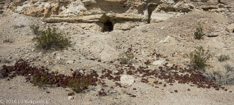
Harmony Borax Works

Borax was discovered near Furnace Creek in 1881 and by 1884 the Harmony Borax Works was processing the ore.  The greatest obstacle to this venture was the 165 mile distance to Mojave, the nearest railhead.  Wagons weighing 7,800 pounds empty were constructed to haul the ore.  A “train” of two of these wagons plus a metal water tank where hitched to a team of 18 mules and 2 horses.  When loaded it weighed in at 73,200 lbs, (36.5 tons) and it took ten days to haul the ore from the mine to the rail yard.  Although only operating for 6 years, the 20 Mule Team is still Death Valley’s most famous symbol.

20160126-_EKP5640

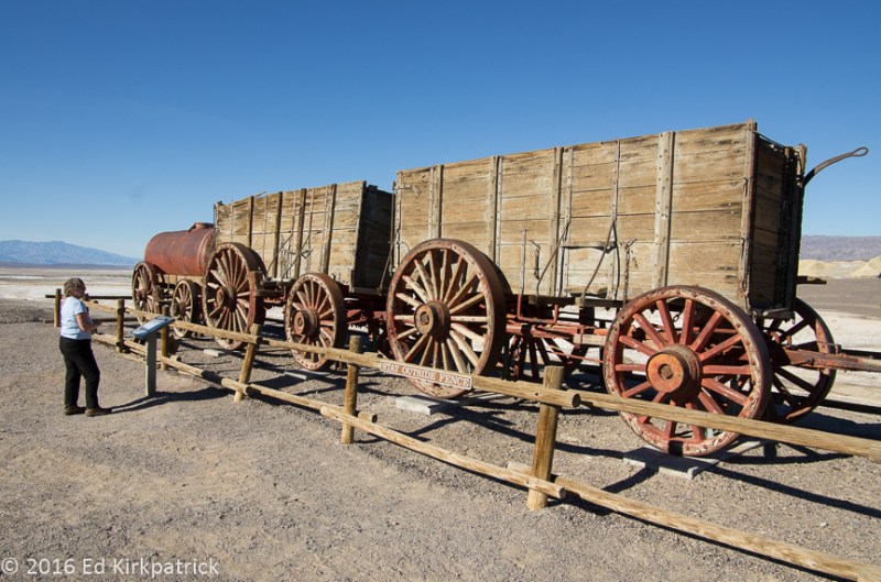
The two wagons and the water tank pulled by the twenty mule teams.

20160126-20160126_131700

At Furnace Creek there is a wonderful little museum all about Death Valley and the people who lived and died here.  This borax wagon wheel is seven feet high and the iron tire is six inches wide.
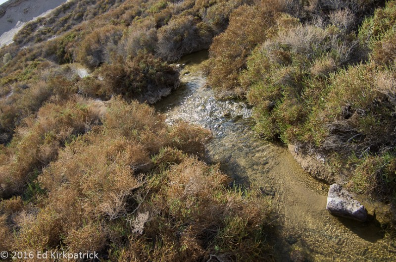
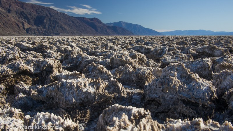
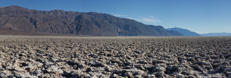
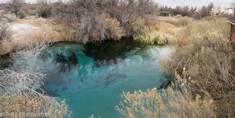
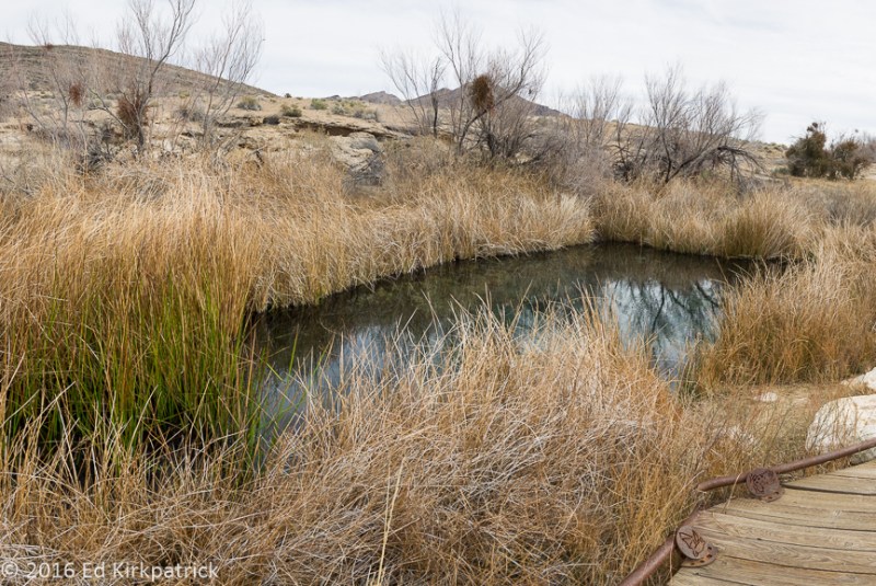
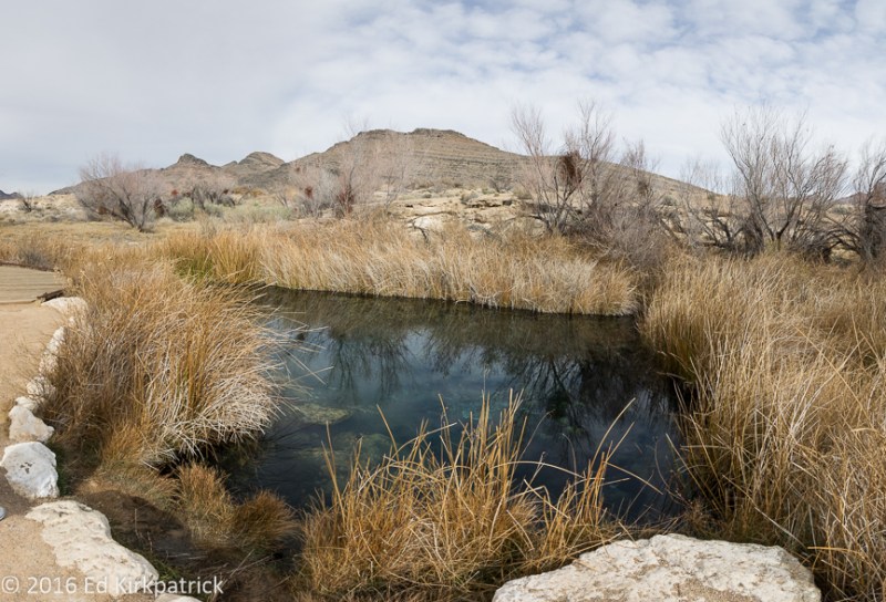
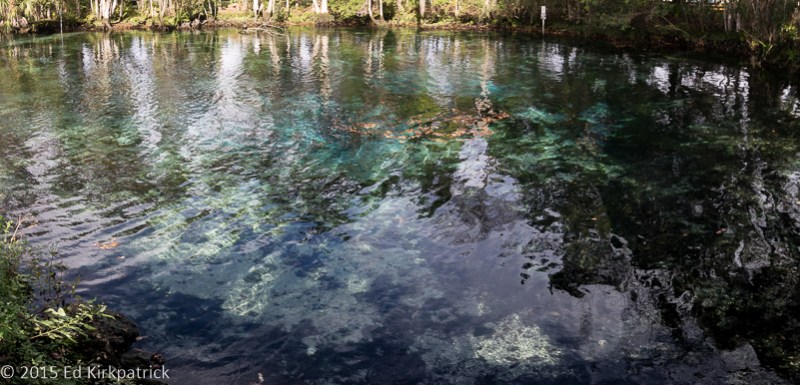
Salt Creek

A .8 mile boardwalk loop which affords an up close look at pickleweed and salt grass growing in  the salt marsh and along Salt Creek, which is also the only home to the Salt Creek Pupfish.

20160127-_EKP5791-Pano

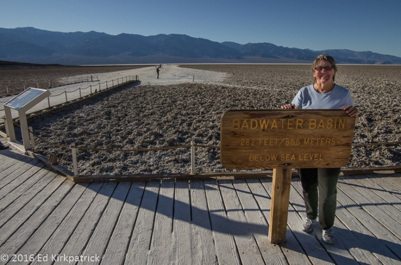
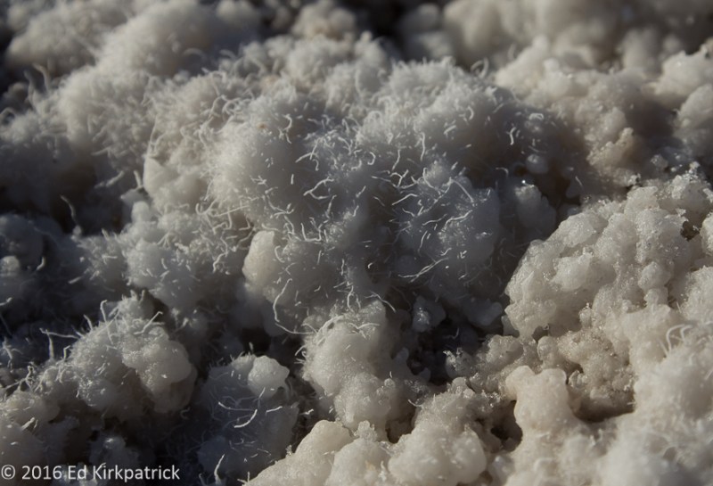
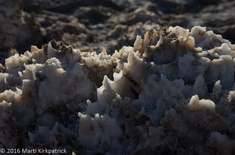
There IS water in Death Valley and Salt Creek is proof of that.  However it is so salty precious little, animal or plant can survive in it or near it. 

20160127-_EKP5805

Salt Creek Pupfish can and do survive even though some summers there is only a small bit of water left after evaporating in the heat.

20160127-_EKP5802

Pickleweed thrives in this salty soil.

20160127-_EKP5796

A harsh place but the sound of streams is nice and the same anywhere.
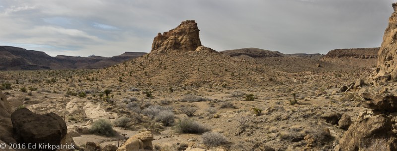
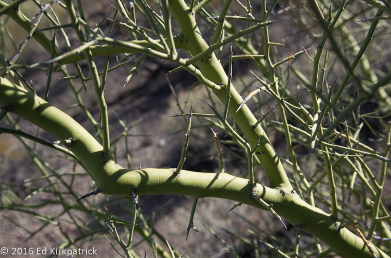
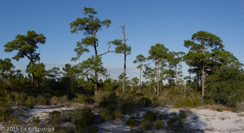
Devil’s Corn Field

Near the Mesquite Flat Dunes, Devil’s Corn Field is a flat plain covered with large clumps of salt tolerant Arrowweed.  Catching and holding windblown sand at their base, these tall straight stalked grasses look very much like sheaves of harvested corn.
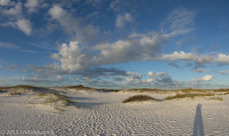
20160127-_EKP5811-Pano

Mesquite Flat Dunes

20160128-_EKP5994-Pano

The best known and most easily accessible sand dunes in Death Valley, Mesquite Flat Sand Dunes while not particularly high, the tallest is 100 feet, they do cover a vast area.
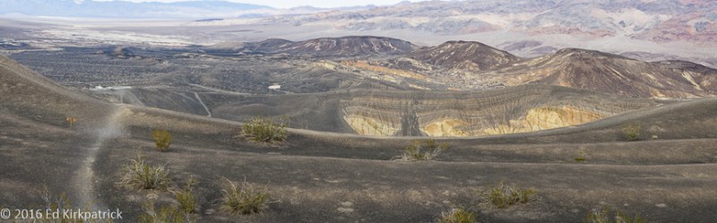
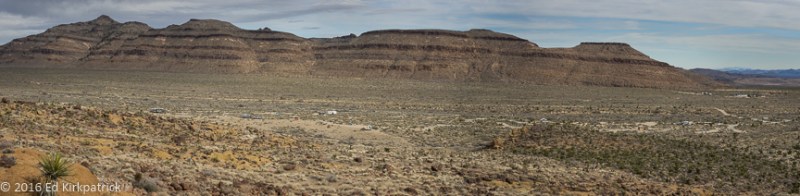
Ubehebe Crater

The Ubehebe (YOO-bee-HEE-bee) Crater and the smaller Little Hebe Crater and several other small craters in the area, are known as Maar volcanos.  They are created when hot magna rising through a fault flashes ground water into steam which expands with incredible pressure releasing in a tremendous explosion called a hydrovolcanic eruption.

20160127-_EKP5840-Pano

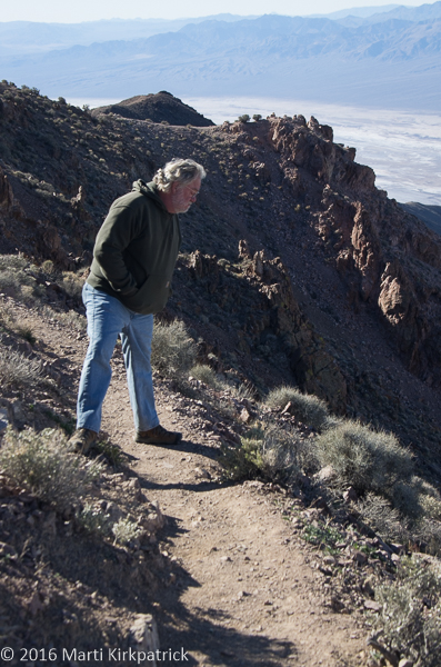
Ubehebe Crater is over a half mile wide and 400 feet deep.

20160127-_EKP5855

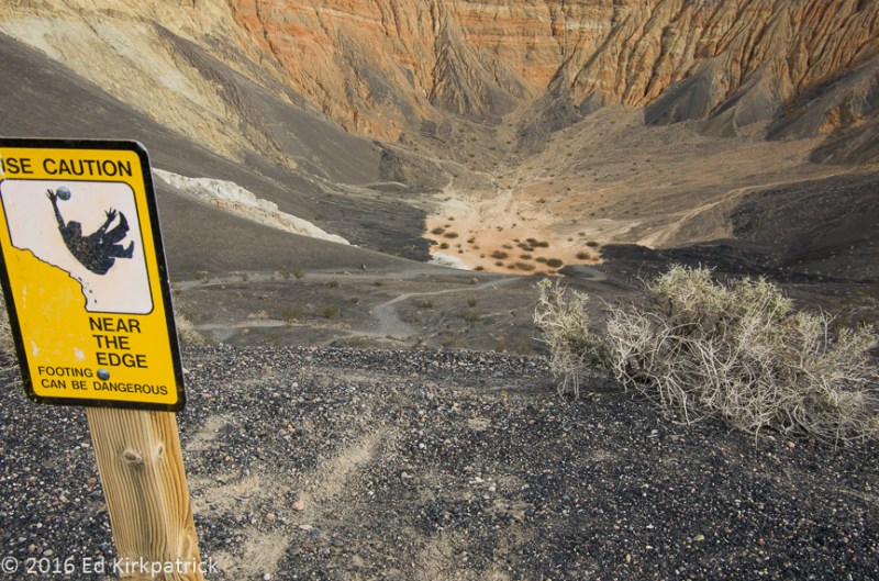
You should have heard Marti saying, “Edward!” as I kept inching closer to this 400 foot tumble.

20160127-_EKP5857-Pano

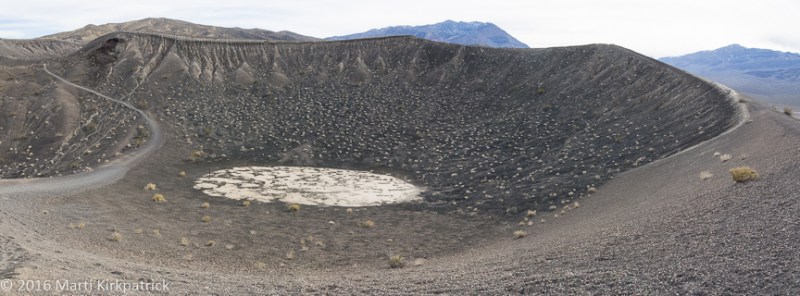
We circumnavigated the larger Ubehebe and a small unnamed crater next to it and in front of Little Hebe crater.

20160127-_EKP5899

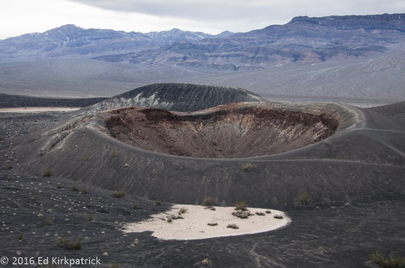
Little Hebe has the distinction of its entire rim being intact thus indicating it may be the youngest crater.

20160127-_EKP5892-Pano

From Little Hebe looking back to Ubehebe note our RV there on the far left edge for scale.

20160127-_EKP5922

I be, you be, we be at Ubehebe Crater!  Note again the RV a half mile away across the crater.

20160127-_EKP5931

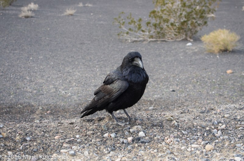
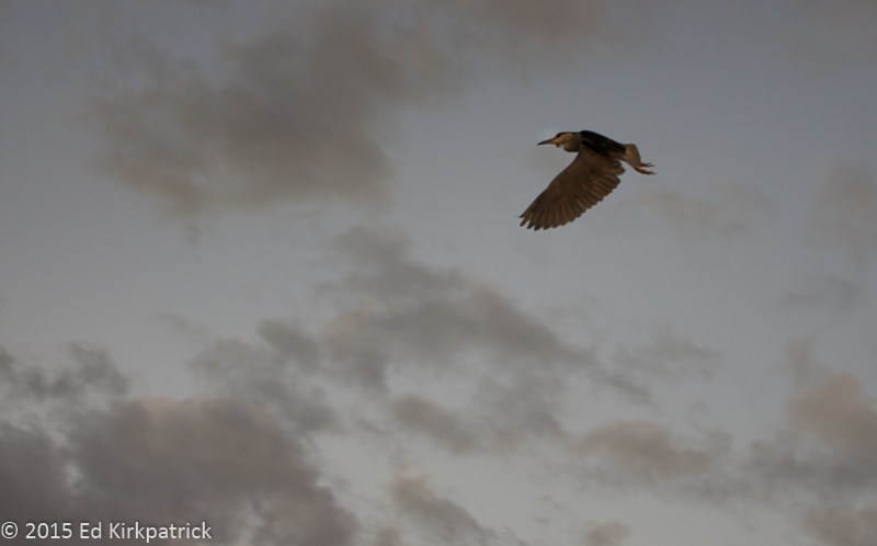
This raven and his missus followed us nearly all the way around the crater until they realized there was no treats coming and another carload of tourists pulled into the parking lot.  Off they went. At one point we watched him dig up an anthill and eat ants. Yummers.

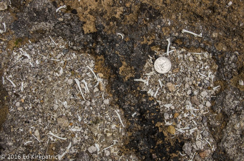
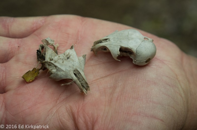
NOTE: Several postings ago I mentioned more research needed to be done about the bones we found in Banshee Canyon at Hole In The Wall.  I did more investigating and we are now 99% sure the bones and certainly the two skulls are Harris Antelope Squirrels which we also saw playing on the rocks there. That being the case, the feasting almost had to be by owls.  Hawks might also partake, but we believe owls would be more likely to live in the holes in the rock walls.

The third and last photo collection of Death Valley is coming real soon!


Death Valley ~ Amazing!

20 Saturday Feb 2016

Posted by Ed and Marti Kirkpatrick in Travels

≈ 9 Comments

Tags

Artists Drive, Badwater Basin, California, Dantes View, Death Valley, Desert, Devils Golf Course

During the summer of 1962 my Dad loaded us up in the station wagon for a sightseeing trip across country.  Among the many places he took us was the desert southwest where he had worked in the 1930s and he and Mom started their married life.  The idea of a place called Death Valley fascinated me and I wanted to go see, but my father said no, there was nothing there worth seeing.   Sorry Dad but WOW you were SOOOO wrong!  In fact, now that Ed and I have been to Death Valley, it is solidly on my top 5 favorite places list!

Covering over 3.3 million acres Death Valley is a place of extremes.  Bordered on the west by the Panamint Range, the highest peak being Telescope at 11,049 ft. and on the east by the Amargosa Range made up of the Grapevine, Funeral and Black Mountains, nearly 550 square miles of the Death Valley basin is below sea level.  In fact at 282 ft below sea level, Badwater Basin is the lowest elevation in North America and the 8th lowest in the world.  It is this valley depth, steep mountain height and relatively narrow shape of the basin that influences the temperatures where HOT does not begin to describe it.

As we all know warm air rises and cool falls.  Here at these extreme low elevations as the soil and rock get very hot and as this hot air rises back from the heated surface it is trapped by the mountain walls and only cooled slightly more than the air temperature. Then this descending air is compressed and heated even more due to the low elevation air pressure. This super heated air cycles though the valley as the ground temperature climbs ever higher adding “fuel to the fire” so to speak. 🙂  The highest temperature in the world was recorded here on July 10, 1913 at a whopping 134°, (disputed by some weather historians, they do still claim Death Valley has the highest temperature ever reliably recorded) and that’s just air temperature.  The highest ground temperature is an incredible 201°!

NOTE:  Perhaps Dad was right to not bring his family here during the month of August 🙂

There are four major mountain ranges between the Pacific and Death Valley, each depleting the amount of rain-fall advancing eastward.  These rainshadows cumulatively rob pretty much all the moisture before it can fall here, consequently the average rain for an entire year is only 1.94 inches!  Last October however there were back to back storms followed then on the 18th by an incredible storm where 2.7 inches of rain fall in just five hours!  From the Los Angeles Times news article, Death Valley District Ranger Paul Forward, trapped near Grapevine Canyon and Scotty’s Castle, “It started with heavy hail,” he recalled. “Three hours later, the dry wash was transformed into floodwaters 100 feet wide with 20 foot waves. The air was filled with the sounds of massive boulders grinding against each other as they rolled down the canyon.”

This 1,000 year flood destroyed roads and caused extensive damage that will take perhaps two years to repair.   Consequently, there are a number of places now closed to visitors.  There are also a number of places where we would have liked to have gone, but they are only accessible by high clearance and/or 4 wheel drive vehicles.  Even so, over five days we had a fabulous time exploring.

Badwater Basin

All the rain that falls on the surrounding mountains and the valley carries with it dissolved minerals and salts which can not flow out because Death Valley is an enclosed basin.  Badwater, being the lowest place in the valley, is where all this mineral rich water flows to and evaporates leaving behind this layer of salt.

Badwater-1

282 feet BELOW sea level.

Badwater-2

The pool comes and goes.  Look carefully at the red arrow to see the big sign on the mountain side that marks sea level.

Badwater-4

The salt layer is quite thin and the crystals are constantly growing and changing.   Most of the salt is sodium chloride (table salt). Calcite, gypsum and borax make up the remainder.  The crystals are constantly changing with rainfall and evaporation and the tiny hairlike crystals are shaped by the winds as they grow.

Badwater-3

We were there.

Devil’s Golf Course

Devil’s Golf Course is several feet higher than Badwater Basin and consequently it stays dry which allows the weathering processes of wind and rain to sculpt the salts, minerals and mud into a crazy landscape of rough, complicated and beautiful formations.

Devils_Golf_Course-2

Devils Golf Course.  These formations vary from about six inches to knee high.

Devils_Golf_Course-1

Badwater Basin and Mormon Point are to the south of Devils Golf Course.

Devils_Golf_Course-4

The salt spire’s edges are very sharp. Do not fall down in this place.

Dante’s View

Considered one of the most breathtaking views in the park, Dante’s View overlooks Badwater Basin 5757 feet below.

20160126-_EKP5619

Looking down on Badwater Basin and eight miles across the valley floor to the alluvial fans of the Panamint Range.

20160126-_EKP5607-Pano

Looking North towards Furnace Creek.

20160126-_EKP5628

and looking South. Note the salt pools which are green and can be quite deep.

20160126-_EKP5633

Looking back to Dante’s View (see the RV?) and beyond, the high point is Dante’s Peak. 

20160126-_EKP5626

Contemplating the fall…  Hiking up to Dante’s Peak.

20160126-_EKP5605

Marti summits the peak!

Artist’s Drive

Artist’s Drive  is a nine mile loop drive back against the face of the Black Mountains noted for its astonishing variety of rock colors.  White, pink, green, yellow, mauve, purple, orange and browns, these colors are caused by the oxidation of the different metals in the rock.

Artist_Drive_-1

Heading up the alluvial fan of Artist’s Drive.

Artist_Drive_2

During very occasional rains over thousands of years, the water floods so forcefully down the mountains shooting over the cliff face carrying the stones and sediment away from the wall creating the piles of sand and rock.

Artist_Drive-4

The “Artist’s Palette” on Artist’s Drive.

Artist_Drive_-3

Looking back at the end of the drive.

Part Two of Death Valley is coming soon!


Shoshone, California and Ash Meadows NWR

02 Tuesday Feb 2016

Posted by Ed and Marti Kirkpatrick in Travels

≈ 7 Comments

Tags

Ash Meadows NWR, Devils Hole, Dublin Gulch, Pupfish, Shoshone California

We left our lovely spot at Hole In The Wall in the Mojave National Preserve, continuing north on the pretty good dirt Black Canyon Rd to Cedar Canyon, which becomes paved and eventually out to I-15S.  We exited at Baker just before noon and stopped at Mad Greek Café, which had a lot of cars and trucks parked outside, always a good sign!  The place is a bit crazy, very busy but service is fast, and our “authentic” Greek pork gyros were really good! The side rice was lukewarm, almost cold but tasty.  We recommend stopping in if you’re in the area at meal time.

We drove on out Hwy 127N to the tiny town of Shoshone just outside of Death Valley, where we were camping at the Shoshone RV Park.  While certainly nothing to write home about, it was quiet and adequate.  We walked into town and had a seat at the bar of the Crowbar Café & Saloon for a drink, wings and chicken quesadillas.  Like the RV park, just adequate, but fun as the two waitresses were trying to fix a broken beer keg and in the process blowing beer all over themselves and nearly us!

20160118-_EKP5377-Pano

Downtown Shoshone, California

Next day we headed out to Ash Meadows National Wildlife Refuge, the largest remaining oasis in the Mojave Desert.  Wetlands, small streams and seven major springs of 92* warm water bubble up to the surface here creating the greatest concentration of endemic life in the US!  There are two entrances, and not knowing any better I directed Ed to the closest.  This requires driving just shy of four miles over very washboarded dirt road before getting to anything of interest.  Ed HATES washboard roads, but our first stop put him in a better mood. The Point of Rocks boardwalk, a half mile loop trail, wanders over and beside a fast running stream flowing from Kings Pool spring.

20160116-_EKP5183

Notice the beautiful cut ironwork and railings.  We love this sort of art that augments the natural beauty of a place.

Ash Meadows is home to four threatened or endangered native fish species, the Ash Meadows speckled dace and 3 different species of pupfish. We had fun watching these very small blue (males only) fish darting about.

Not too far down the still washboarded road is Devil’s Hole, where a vast underground aquifer fills a cavern so deep the bottom has not been found.  Home to the Devil’s Hole pupfish (found nowhere else) earthquakes from as far away as Japan and Chile have caused the water to wave/slosh video here!  Surrounded by a fence to keep folks out of the water and away from the endangered pupfish as well as scientific equipment, even from a distance we could feel the warmth rising from the water!

20160116-_EKP5205

Devil’s Hole – The funnels at the bottom are set to catch airborne dust and debris so the scientists can measure what goes into the cavern.

Next stop was the visitor center and the boardwalk out to the lovely Crystal Spring.  We had noted at Point of Rocks and again here the boardwalks were very well done and beautifully decorated with laser cut iron work and decorative sculptures.  The visitor center itself was artistically designed and quite lovely, so we asked the obvious question of the volunteers Kelly and Dave where did the money come from? NOTE: they are full-time RVers like us and write this blog.    Turns out BLM (Bureau of Land Management) owned some property outside of Vegas that folks there wanted, so BLM sold it and used those funds to build Ash Meadows!  WELL DONE!   🙂  While we were disappointed to not be able to see the other parts of the refuge due to flood caused road closures, we do recommend you put this interesting place on your MVL (Must Visit List).

20160116-_EKP5208-Pano

This is Crystal Spring.  Over 10,000 gallons per minute flows year round,  most of which comes from the seven major springs in the refuge.


After one last night in Shoshone we took the time to visit the town museum and Dublin Gulch.  Filled inside and out with mining equipment, all kinds of rocks, old photos, newspaper clippings, stories of bootlegging and brothels, Indian cultural items, fossilized animal tracks and local mammoth bones this free museum was great fun!

20160118-_EKP5383-Pano

The Shoshone Museum.  Yes, it is in an old gas station.

Just across the road and down a bit on the edge of town is Dublin Gulch, where miners in the 1920’s carved out homes in the caliche (ka LEE’ chee)  clay hillside.  Some just rudimentary others have levels and window openings, the last being occupied until 1970.

20160118-_EKP5398-Pano

The fanciest home in Dublin Gulch!

Down closer to town right along the road is the old cemetery where either 33 or 55 people (depending on who you ask) have been buried beginning in 1924.  Many of the graves are just lined with stones or completely unmarked.  All in all, a pretty sad sight.

20160118-_EKP5411

There are at least six graves in this picture.

Even so, I sort of liked Shoshone.

Oh, by the way, Kelly told us that Shoshone is the only place for miles around where you can buy a Powerball ticket.  They were in town the weekend before the big $1.6 billion drawing and there was not a parking place to be had and the line for tickets was a third of a mile long.  Apparently, you can’t buy a ticket in Nevada so they all come across the border to here. Go figure.

As I type this up Ed is working on the photos from our last adventures.  We give fair warning now…..it might have to be 3 posts, it’s that AWESOME!! 🙂


20160118-_EKP5403-Pano

Dublin Gulch, they just tossed the trash out the door… and nothing metallic decays in the desert.

20160118-_EKP5406

More cans from who knows when…

20160116-_EKP5194-Pano

Point of Rocks.

20160116-_EKP5184-Pano

Point of Rocks from another angle.

20160116-_EKP5206

Neat rocks at Devil’s Hole.

20160116-_EKP5207

We need a geologist to travel with us…

20160116-_EKP5181

Amazing fault line on the road up to the nearby town of Pahrump, NV.  We like rocks.

20160118-_EKP5391-Pano

One more of the Dublin Gulch neighborhood.


3:10 To Yuma ~Desert Figures ~ Mojave

23 Saturday Jan 2016

Posted by Ed and Marti Kirkpatrick in Travels

≈ 14 Comments

Tags

Arizona, Blythe Intaglios, boondocking, California, KOFA Wildlife Refuge, Mojave Preserve, Spiral Labyrinth, Yuma Territorial Prison

Leaving Ajo, Arizona we headed north to Gila Bend and I-8W towards Yuma which is located on the Colorado River in the southwest corner of Arizona.  There’s precious little on this stretch of highway but there is a place named Dateland where surprise! there’s a date grove!  We like dates, and so we stopped, sampled seven kinds (Honey Dates were the best) and bought some of these sweet healthy treats.  We also tried their “world famous” date milkshake…okay dokey, we can scratch that off the list now 🙂

As you’ll note in the title above, we had a mission on this leg of our adventure.  Having been to Bisbee we know the 3:10 to Yuma movie had that location all wrong.  However, since the movie ends with the train just leaving Contention City we wanted to actually see the notorious prison Ben Wade implies he will once again escape from.  The first seven inmates entered the Territorial Prison at Yuma on July 1, 1876 ( five days after Custer had his last stand at Little Big Horn in Montana and the year my grandfather Deppa was born) where they were locked into the cells they had built themselves.

20160111-_EKP4877

Cell block walk used to be covered with a second story that was the infirmary and offices.

Over the course of 33 years 3,069 prisoners including 29 women (many incarcerated for adultery) were held here.  Although there were many attempted escapes only 2 from within the prison confines were successful.  While we’re not sure it’s worth a trip to Yuma, do put it on your MVL (Must Visit List) if you’re in the area.


While plotting our travels on Google Maps I had noted something marked Spiral Labyrinth outside the Kofa National Wildlife Refuge 6 miles down a dirt road off US Hwy. 95 in Arizona.  I was curious, so I did a little searching and found next to nothing about this, but what I did find was interesting so of course we went looking.  Of unknown origin, but not old, this very carefully built stone labyrinth is amazing and fun.  Someone worked really hard and near as I can find it’s almost a secret.  Put it on your MVL…but….you have to find it yourself 🙂

20160112-_EKP4909-Pano

Marti went in the entrance and it took her about 20 minutes to hit the center.  Then she turned around and walked back out…  another 20 minutes.

From the labyrinth, we headed for California’s US Hwy 95 and Blythe where we were looking for the very ancient Blythe Intaglios.  I have known of these geoglyphs for most of my life and was very excited to see them.  The road they are off of went quickly from bad to nope, so we only managed to see 3 of them.  They are behind ugly protective fencing (why can’t people behave?) so some of the magic feeling is gone.  Even so, one can’t help but wonder… why?  Put them on your MVL.

20160112-Intaglio-

The image is created by scratching away the darker surface stones which reveals the lighter colored soil underneath.  Unlike the labyrinth, there is no ridge of stones because they removed them. 

After spending the night back at Arizona’s Cattail Cove State Park we headed out for our next California destination, dry camping at Hole In The Wall.  Sandwiched between two interstates, 15 & 40, the Mojave National Preserve and indeed the area leading to it, is incredibly vast and empty…and beautiful.  We found a lovely spot in the almost empty campground and settled in for several days.

20160113-_EKP4966-Pano

Looking down on our home for a few days.  Note the stratification in the mountains across the valley.  It became very, very windy at night with gusts near 50 mph but this stopped after dawn every day. We asked the volunteer camp host if it was always this windy and he said, “No, only when it’s windier.”

There are a couple of stories about how this spot got named Hole in the Wall.  One is because of all the holes in the rock, but my favorite is because a former gun-slinger finally settled down in the area and named it for his former hide out 🙂

20160114-_EKP5084-Pano

Looking up Banshee Canyon. See the holes?  The holes are in volcanic ash which is softer than other rock and the wind and water erodes the holes.

The first day we hiked all around behind our site enjoying the views and rock formations.   On day two we did the Ring Loop Trail into Banshee Canyon.  It is so named because early settlers said the wind blowing through sounded like a banshee!  It is an incredibly neat place and I highly recommend it go on your MVL.

20160113-_EKP4963

From our first night’s walk this scene is just uphill from our campsite.  The yellow lichens are really pretty.

We are currently doing chores in Pahrump NV, not a garden spot but they have real stores, gas stations and a very nice Escapee’s RV park not to mention the Chicken Ranch Brothel just down the road.  It’s Nevada, what can we say?  On Monday we head for Death Valley.  We’ve seen it a bit and WOW…..can’t wait to show & tell you all about it!


20160111-_EKP4878

This shows a cell with the iron work that surrounded each cell; doors, floors, walls and ceilings.  All the iron work, welding and shaping was done by inmates.  In fact, everything in the prison was made by the inmates.

20160111-_EKP4875

This shows two cell doors. 1/4″ thick welded and riveted steel that are connected together to prevent one door breaking without the other.  Note that the locks are a good three feet away from the opening on each side.

20160111-_EKP4874

Ahhh… the dark cell.  Solitary confinement in a steel cage.  These cells were hand dug into the caliche hillside.  Caliche is a type of clay/rock that is very, very hard.

20160111-_EKP4871

Inside the Dark Cell, only the floor of the cage remains.  There is a ghost story for this cell and while we were in there Marti saw something flit by! She looked again and to her relief it was just bats.

20160112-_EKP4889-Pano

It’s really magical, especially with the wind blowing.

20160112-_EKP4917

About 2/3’s of the way in an optical illusion occurs that makes the ridges turn into waves rolling towards the center. Amazingly cool…!

20160112-_EKP4918-Pano

Ed at the center of the universe.  I walked in but took the short way out…

20160112-_EKP4922-Pano

The fence is ugly.  BUT if it was not here ATV tracks would obliterate the figure.  In their defense, these figures are hard to see just walking across the desert.

20160112-_EKP4932-Pano

People say this is a horse.  They are very hard to photograph from the ground and we took a ladder in.

20160114-_EKP5045

Anybody who knows Ed, knows this is a big adventure for him.  These are the first set of rings down to the bottom of Banshee Canyon.

20160114-_EKP5048

Marti on the other hand….

20160114-_EKP5079-Pano

Marti looking up at bat caves, we think, in the bottom of Banshee Canyon.

20160114-_EKP5082

We found thousands and thousands of these little bones scattered around this one section of the canyon below what appeared to be bat homes/caves in some of the holes high up.  Note the two femur bones above the quarter.

20160114-_EKP5083

and these skulls were there in the bone yard… Birds? Bats? Lizards? Tourists?  We have to do some research.

20160114-_EKP5091-Pano

From the mouth of Banshee Canyon the valley below.

20160114-_EKP5126

This crew joined us for our picnic lunch.  11 horses branded with a W inside a square.  Their meal was not what our horses back home get.

20160114-_EKP5100

The astonishing variety of colors in the lichens on the rocks here is beautiful.  Marti counted seven different colors. An artist’s palette.

20160114-_EKP4995

Mojave Dawn.  Marti does the before sunrise stuff…

20160114-_EKP5029

Barrel and Hedgehog Cactus in morning sun.

20160114-_EKP5012

Lovely grasses surround rock and a barrel cactus.

20160114-_EKP5031

Hole In The Wall Morning.  

20160114-_EKP5003-Pano

Directly behind our campsite at Hole In The Wall.

Arizona and Unfriendly Weather

20 Wednesday Jan 2016

Posted by Ed and Marti Kirkpatrick in Bushes and Blooms, Travels

≈ 6 Comments

Tags

Ajo, Arizona, Bisbee Arizona, Catalina State Park, Mt. Lemmon, Organ Pipe Cactus, Picacho Peak

Ed and I have joked for years that we’re a bad/weird weather magnet.  Back in the 70’s when we tent camped a lot it always seemed to rain or snow on us and last year we often seemed to drag rain and snow along with us, but of course southern California loved us.  This year it seems abnormally cold temperatures are the camping surprise we’re dealing with.  In fact the temps were so cold and windy heading out of Texas into New Mexico and Arizona that we fled to the border with California in a 3 day hard driving marathon. Landing on Christmas Eve at Cattail Cove State Park just outside Lake Havasu City, AZ we settled in for a few days of wind and cold nights.  While like all the Arizona State Parks we’ve stayed at, Cattail Cove is very nice and we did see a Big Horn Sheep, neither of us sees much point in making this area a destination. 20151227-_EKP4670 Lake Havasu City was developer Robert McCulloch’s dream based on the recreational draw of the dammed Colorado River and The London Bridge which he purchased, disassembled, shipped and reassembled here as a tourist attraction in 1971. I remember we laughed about this when it happened, and now that we’ve seen it we’re still shaking our heads.20151227-_EKP4665-Pano

We had a looming problem in that our little home’s engine was way overdue for its 40,000 mile check-up and being a Mercedes Benz with each additional 20 miles it beeped and sent us a “HEY” message.  We contacted the nearest California MB Sprinter dealers and they said nope, no RV’s can’t help you or sure, in a month. So even though night time temperatures were still in the low 30’s and high 20’s we headed back to Chandler, AZ to get the work done.  Got there for our appointment and the guy says, sorry our lift broke when we off-loaded the RV before you, all we can do is the oil change!  So, after they did that, we headed for our favorite AZ state park Catalina outside of Tucson where we are familiar with the MB dealer in town.  Loving this area that we consider a MVL (must visit list) place (last year’s Catalina blog) we settled in to do some hiking, do the drive up Mt.Lemmon and welcome in the New Year. Our water line only froze twice 🙂

20160101-_EKP4727

See us having fun on our hike?

20160102-_EKP4755-Pano

Windy Point Overlook on the Mt. Lemmon summit drive.

BTW, to our Sprinter Skinny Winnie friends, we were impressed with Chandler MB and we’ve dealt with Tucson MB twice now and trust them although so far they are the most expensive MB dealer we’ve ever encountered.  😦

Braving the cold we decided to visit some or our favorite MVL places from last winter.  We popped down to Bisbee (where it poured cold rain) planning on dinner and drinks at the wonderful Santiago’s only to find them closed due to a water main break outside their door. We did however have a delightful afternoon (beer was involved) at the Old Bisbee Brewing Company and of course breakfast at the Bisbee Breakfast Club.

20160107-Picacho_Clearing_Storm_Rainbow_2-

From our Picacho Peak State Park campsite looking across the valley, a clearing storm over the Picacho Mountains gave us a wonderful gift.

We revisited another one of Arizona’s wonderful state parks Picacho Peak State Park where I went on a steep, rocky, wonderful hike up the mountain without Ed who was suffering from a weak knee problem.

20160106-Marti_self_3

Marti on her solo hike…

From there down to quiet little Ajo and the Shadow Ridge RV Resort (resort, no, but nice and a good laundry) where part of the fun is hearing and seeing the “boys out to play” in their A10 Warthogs and other really cool jets over the Barry Goldwater Air Force Range.

With the temps once more heading down into the high 20’s we’ve packed up again heading west where it’s a bit better.  Next post will be coming soon…..really….you’ll be surprised 🙂


20151231-_EKP4674

Pusch Ridge Wilderness Area from Catalina State Park.


20160101-_EKP4702

Saguaro Cactus family portrait.

20160101-_EKP4711

Bird’s nest in a saguaro cactus arm.

20151231-_EKP4686-Pano

Sutherland Wash in Catalina State Park.

20151231-_EKP4675

That’s a big Barrel Cactus…

20160102-_EKP4766

Hoodoos on the Mt. Lemmon summit drive.

20160106-Picacho_Peak_Marti_2

Picacho Mountains on Marti’s hike up the Peak trail.

20160107-_EKP4833

We always have gorgeous sunsets at Picacho Peak State Park.

20160110-_EKP4858-Pano

Tillotson Peak in Organ Pipe Cactus National Monument south of Ajo, Arizona.

20160110-_EKP4842

Lots of very sticky sharp things on a Saguaro Cactus.

20160110-_EKP4855

Palo Verde trees have green bark which does the photosynthesis usually done by leaves. They also have leaves which drop in winter.

20160110-_EKP4853

Does this rock make me look fat?

20160103-_EKP4799

Gniess rock.

20160101-_EKP4714

Nice flower.

20160107-_EKP4834-Pano

One last photo of the Picacho Mountains with I-10.

.


LBJ & San Antonio, Texas ~ Bits of History

30 Wednesday Dec 2015

Posted by Ed and Marti Kirkpatrick in Travels

≈ 12 Comments

Tags

Alamo, Concepcion, Espada, Fredericksburg Texas, LBJ, Missions, River Walk, San Antonio, San Jose

As I mentioned in the last post we were in San Antonio, Texas, but before we got there we had to see “our kids”. So, after a delightful but short visit including the Bastrop Christmas parade with our “adopted” granddaughter Lily (and her mom & dad) we spent a couple of wonderful days with our daughter-in-law Christy in Austin.

20151212-Christmas Parade 4

Lily and Michelle

We have posted before about Bastrop & Austin and recommend them both, especially Austin. For you RVers, although we avoid them generally, the Bastrop KOA right on the Colorado River is very good if it’s not in flood 🙂 . In Austin while tight and really basic, you can’t beat Pecan Grove RV Park for convenience, but spaces can be hard to come by and they have no website.

20151212-Christmas Parade 3

Only in Texas would you ride a longhorn steer decorated in Christmas lights. Bastrop Christmas Parade.

West into Texas Hill Country on our way to Fredericksburg via US 290 we stopped at the Lyndon B. Johnson National Historical Park. Actually two different locations, the first is the Johnson City District where there is an excellent exhibit detailing Johnson’s Presidency. The Vietnam War so overshadowed his presidency especially in the end that we tend to forget the amazing amount of good he accomplished. The list of major and important legislation signed by this man is staggering. There is also an exhibit about his pioneering family and their home site is on the grounds. A few miles down the road is the second district, the LBJ Ranch, or as it was called The Texas White House, where we took the house tour. While both places are interesting, if your time is limited I suggest skipping the ranch in favor of the exhibit covering the details of this political giant, in fact it should be on your MVL (Most Visit List).

20151215-_EKP4471-Pano

The Texas White House/LBJ Ranch. The large Live Oak is known as the Cabinet Oak because LBJ liked to hold his Cabinet meetings under it.

Fredericksburg on down US290 is a town of German ancestry and we camped at the Fredericksburg RV Park which was nice. The town is chock-a-block full of shops and restaurants and it’s a fun way to spend a day. I saw a kitchen store right off and we popped in. While they do NOT do online sales, and in fact don’t have a “true” website, Ed & I both agree Der Kuchen Laden is the best kitchen store we have ever been in period!! We were just lusting over item after item we had to have. If you have any interest in cooking, put it on your MVL!

Heading south we drove the short (little over & hour) drive to San Antonio where we stayed at the Traveler’s World Carefree RV Resort. For just a $1.20, the 42 bus stops right at the RV park and runs about every 20 minutes, very convenient for going in to see the Alamo and do the River Walk. Riding the bus as far as W. Crockett St. we walked over to Alamo Plaza.

20151218-_EKP4539

The Alamo has been declared a shrine in Texas and you are requested to remove your hat and take no pictures inside.  However, they can’t seem to control the local Crockett Hotel sign…

San Antonio de Valero, commonly called the Alamo, was the first Spanish Mission on the San Antonio River. Over the course of time the Alamo became a military outpost and when Mexico declared independence from Spain it remained a Mexican outpost. As Mexican politics shifted from a federalist government with extensive individual rights, to a centralist government the displeasure of those native born to Texas and the emigrants from the United States who were now the majority, began to push back. In a nutshell (you didn’t sign up for a history lesson and it’s a little complicated) this interference with Mexico’s rule lead to fighting and eventually the battle at the Alamo. Against overwhelming odds 212 of the 256 (these numbers are still in dispute) combatants were killed at the siege but the “Cradle of Texas Liberty” was firmly established along with the cry, “Remember the Alamo!”

20151218-_EKP4538

“The Spirit Of Sacrifice” by Pompeo Coppini 1940

The chain of missions established along the San Antonio River date back to the 1700’s and besides the Alamo, we visited three more of the five. Financed by the Spanish Crown, Franciscan monks served both Church and State. The missions were communities where the Franciscans not only converted the Indians to Catholicism, they taught them the skills needed to build the churches and shelters, to plant the crops and make all other necessities of living a settled existence rather than as hunter/gatherers. They taught them to be good citizens of Spain. Since the 1920’s the city of San Antonio has worked to protect and maintain these historic missions and we found each different from the other and all fascinating. Put them on your MVL! By the way, Mass is still held at all of these missions.

20151217-_EKP4522

Mission San Jose founded 1720 by Fray. Antonio Margil de Jesus.

20151219-_EKP4618

Mission Concepcion famous for its well preserved frescoes.

20151219-_EKP4629-Pano

Mission San Francisco de la Espada

We also spent an entire afternoon and evening wandering all over San Antonio’s famous River Walk. This walk below street level and along the San Antonio River is lined mostly with restaurants. The prettiest, best flood control, save the river, attract business, encourage exercise and well done city park we’ve seen yet! A delight and especially lovely after dark at Christmas time, put this on your MVL! Oh, and when you get hungry from all that walking, Biga on the Banks is very good!

20151218-_EKP4544

River Walk, San Antonio


20151215-_EKP4453

LBJ’s grandparents’ home in Johnson City, Texas

20151215-_EKP4459-Pano

President and Lady Bird Johnson’s burial site in family cemetery on the LBJ Ranch

20151215-_EKP4469

President Johnson preferred this smaller jet to the regular Air Force One.  He called this plane Air Force One and a Half.  There happened to be two other RV’s just like ours lined up in the parking lot at the Texas White House/LBJ Ranch.  We’re on the right.

20151217-_EKP4530-Pano

Mission San Jose.

20151217-_EKP4491-Pano

Arched walkway at Mission San Jose

20151217-_EKP4507

Sanctuary at Mission San Jose.

20151219-_EKP4599

Walkway at Mission Concepcion

20151219-_EKP4591

Interior frescoes at Mission Concepcion.  All of the missions were finished in fresco inside and out but few remain.  These are some of the best preserved.

20151219-_EKP4604-Pano-2

Sanctuary at Concepcion

20151219-_EKP4632

We waited outside Espada while this couples wedding Mass was taking place.  

20151219-_EKP4642

The smallest of the missions is Espada and it is very popular for weddings such as we were lucky to see.

20151218-_EKP4549

Along San Antonio’s River Walk

20151218-_EKP4574

Over 3000 luminarias with real candles are placed along the River Walk for two weekends before Christmas.

20151222-_EKP4656

Welcome to Texas!  It is a big state…

Florida and the Gulf of Mexico

20 Sunday Dec 2015

Posted by Ed and Marti Kirkpatrick in Travels

≈ 7 Comments

Tags

Blue Angels, Crystal River Springs, Fort Pickens, Gulf Islands National Seashore, Homasassa Springs, Myakka River State Park, Pensacola, Sarasota


20151125-_EKP3933

Full Moon set on Lido Key, Sarasota.

Moving on down into Florida we landed in Sarasota, a place we’ve been visiting for 43 years! Ed’s Grandparents wintered there and his grandmother settled there permanently in her later years and Ed’s Aunt Lois is still there. Although it has grown tremendously in that time it is still a place we love. The Gulf of Mexico is my favorite place to swim and if I ever win the lottery, a house right on it would be something I would love. We camped at the Fun ‘n Sun RV Park out Fruitville Road for you RV readers, while crowded, it’s nice and has a great pool and good laundry.

This visit we mostly lazed about but one day we did drive out to Myakka River State Park. We’d not been there for years and were pleased to see it now has a brand new RV campsite and a Canopy Walkway & Tower that allows one to walk a short distance in the tree tops and then climb above them. Kids especially seemed to be having lots of fun exploring at the new level! Full of birds, deer and big alligators the park is well worth a visit, especially early morning or evening. Be sure to have your camera with you.

20151129-_EKP4205-Pano

Myakka River State Park overlooking the canopy from the tower.

We highly recommend a visit to the Sarasota area where you’ll find beautiful white sand beaches, the wonderful Mote Marine Laboratory & Aquarium, lovely Marie Selby Botanical Gardens, interesting Ringling Museum, and great restaurants including one of our all time favorites, Ophelia’s on the Bay. If you only eat at one fine restaurant this is it and be sure to make your reservation for an hour before sundown to enjoy the dusk on the water.

20151129-_EKP4218

Myakka tree tangle.

Heading up I75 to 275 across the Skyway and around St. Petersburg/Tampa onto FL589 to US98 we stopped at Homosassa Springs & Wildlife State Park. Florida is full of natural springs where 70* water bubbles up from the aquifer and creates crystal clear springs that attract not only people but hundreds and hundreds of manatees needing the warm water to survive the winter months. Unfortunately for us it was still too warm for the manatees to have made the trek to the springs. We did however enjoy the short boat ride to the park past more Wood Ducks than we’ve ever seen combined. At the springs themselves, were large numbers of fish, some snook as large as 4 to 5 feet, clearly visible in the pristine waters.

20151201-_EKP4287

Snook congregate in the springs.

This particular park was at one time a small zoo and also home for animal actors. One, Lu, a hippopotamus, still resides here, having been made an honorary citizen of the State of Florida! The next day we also visited the Crystal River Springs in Crystal River. I want very much to visit more of Florida’s incredibly beautiful natural springs (hopefully during a time when the manatees are about) and suggest you put at least one on your own MVL (Must Visit List).

20151202-_EKP4323-Pano

The light turquoise color is where the spring is flowing up from the aquifer.

Driving on out US98 into the Florida panhandle along the Gulf of Mexico the first day’s drive was lovely. With almost no beach the area is all about fishing and the towns are not about tourists and are generally quiet and small. We stopped at the Ho-Hum RV Park in Carrabelle where we parked right on the shore and dumped our trash into a dumpster surrounded with electric fencing…. to keep the bears out!! Not something we expected. 🙂

Next morning our drive was not as nice because while the pretty white sand beach was back it was ruined by development. Lots of slow traffic, stop lights and strip mall after strip mall, for almost 100 miles before we finally were able to escape onto Santa Rosa Island via RT 399. On our way to Fort Pickens Campground on the Gulf Islands National Seashore, this protected shoreline is beautiful and at least when we were there, pretty empty of other folks. Sand dunes both large and small are pristine white and when storms wash sand over the road and plows push it back it looks so much like snow piles it could fool you! Oh, an interesting note about Florida’s world famous white sand beaches; they are powder fine quartz eroded over millennium from the Appalachian Mountains and carried by rivers and creeks to be deposited in the Gulf of Mexico!20151205-_EKP4356-Pano

White sand beach at the Gulf Islands National Seashore

A couple of days later on our way west we stopped at Pensacola (directly across the bay from Fort Pickens) and visited the National Naval Aviation Museum. Put this on your MVL! All kinds of airplanes and an impressive number of carrier models, plus, there aren’t too many places where one can walk underneath a few “flying” Blue Angles jets!

20151207-_EKP4445

The Blue Angels indoors.

The day we were there, December 7th, there was a remembrance of WWII including several naval survivors of Pearl Harbor! At the end of the program a very good high school band performed a new piece composed by Paul Murtha called “Arlington” accompanied by a corresponding slide show of that hallowed ground. We pretty much fell apart, but my goodness we were grateful to be there to hear it.

We are currently in San Antonio, Texas and Christmas is almost here. We don’t know where we’ll be celebrating but we do know we wish you all a most MERRY CHRISTMAS & HAPPY NEW YEAR…..hopefully filled with peace and good cheer!


20151129-_EKP4210-Pano-2

Myakka trail.

20151129-_EKP4182

Osprey at Myakka River.

20151129-_EKP4233

Myakka River at dusk.

20151129-_EKP4180

I bet he can swim faster than you….

20151129-_EKP4242

M.R. ducks…

20151129-_EKP4253

Flight.

20151201-_EKP4297

Mr. and Mrs. Wood Duck at Homasassa Springs.

20151202-_EKP4317-Pano

Three Sister’s Springs at Crystal River, Florida

20151202-_EKP4331

More Crystal River Springs…

20151206-_EKP4433-Pano

Walk to Ft. Pickens

20151206-_EKP4426-Pano

Fort Pickens

20151205-_EKP4370

Amphitrite’s Bridal Veil.

20151205-_EKP4391

Gulf Shore’s sunset.

20151207-_EKP4436

National Naval Aviation Museum WW I aerodrome display.

20151207-_EKP4441

That’s a big airplane…

20151207-Aircraft Carrier-4449

4 1/2 acres of sovereign U.S territory, anytime, anywhere. A poster on the wall at the museum.


Saltwater and Black Water ~ South Carolina, Georgia & Florida

09 Wednesday Dec 2015

Posted by Ed and Marti Kirkpatrick in Travels

≈ 14 Comments

Tags

Amelia Island, Ft. Clinch, Okefenokee Swamp, Pogo

20151103-_EKP3601

Drive into Ft. Clinch State Park, Florida.

In early November we poked around a tiny bit of South Carolina, Georgia and Florida visiting friends & family and just “hanging out”.   The weather was more often than not grey and or rainy but we had fun anyhow. We recommend Fort Clinch State Park on Amelia Island, Florida. For our RV friends the beach loop is very nice. There’s a very long fishing pier that affords not only the opportunity to cast a line (you have a good shot a catching a shark apparently) but also lots of ospreys to see.

20151102-20151102_155353

Looking back to shore from the fishing pier at Ft. Clinch State Park, Florida.

We also walked around the fort for which the park is named. Construction by the United States began in 1847 but with the beginning of the Civil War the fort was seized by the Confederates early in 1861. Needing troops in more important locations, a year later General Lee ordered the fort abandoned and the Federals took it over and held it for the remaining of the war. Restored in the 1930’s by the CCC and now a Florida State Park this was perhaps the best fort display we’ve ever been to, and we’ve done quite a few. Stocked with period pieces and replicas the barracks, kitchen, laundry, store rooms, etc are extensive and done very well clearly showing how life was lived. If you have any interest in this time period especially it should be on your MVL (Must Visit List).

20151103-_EKP3582-Pano

Ft. Clinch.

20151103-_EKP3570-HDR

Blacksmith’s shop, Ft. Clinch

We spent a couple of days at Edisto State Park, Edisto Island, SC where we meet a few other Minnie Winnie folks (owners of small Winnebagos like ours). Having chatted via Facebook with several of them, it was nice to actually get to know them in person. Edisto is an OK park but not a place we’d likely spend more than a night.

The highlight of this blog posting however was a place I have wanted to see every since I was a child, Pogo’s home, The Okefenokee Swamp in southern Georgia/northern Florida. 20151119-_EKP3685
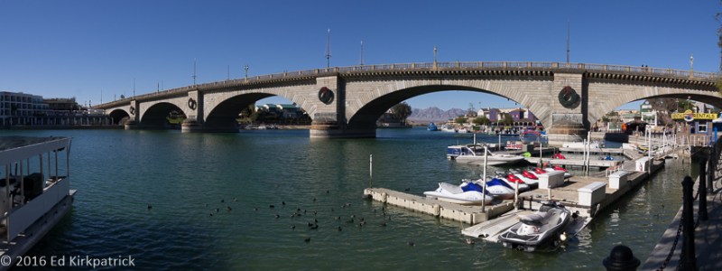
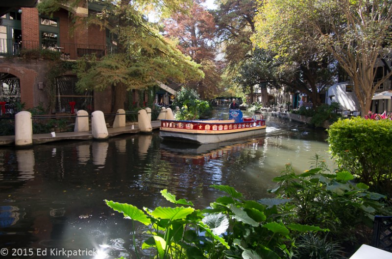
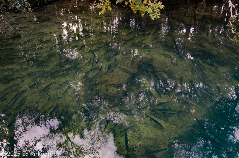
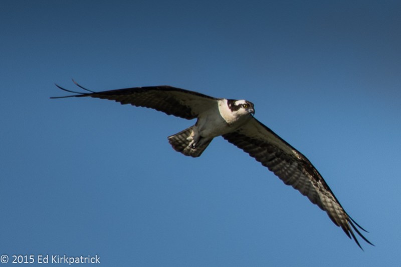
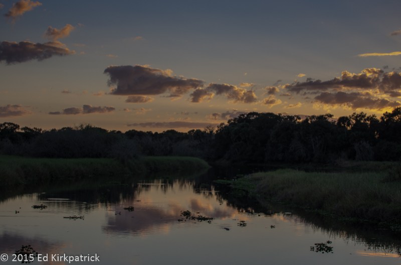
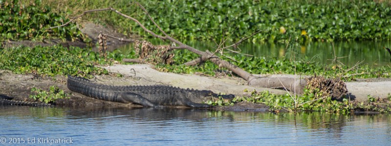
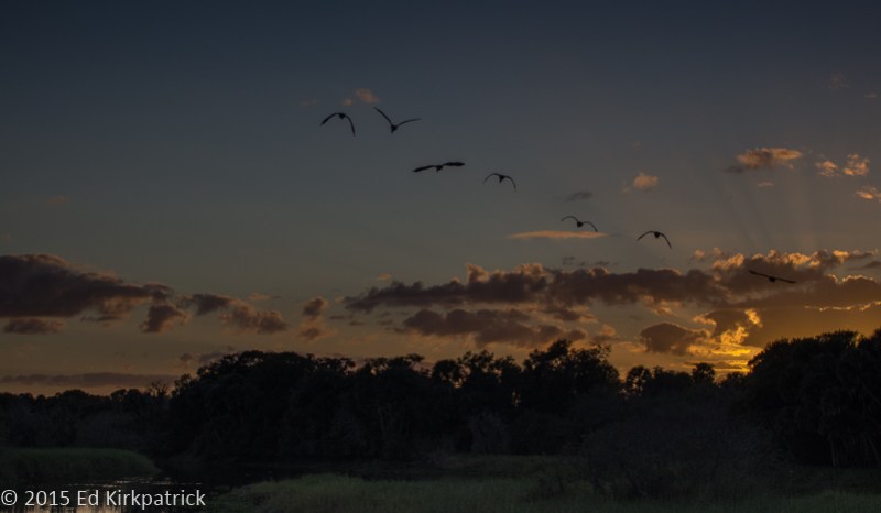
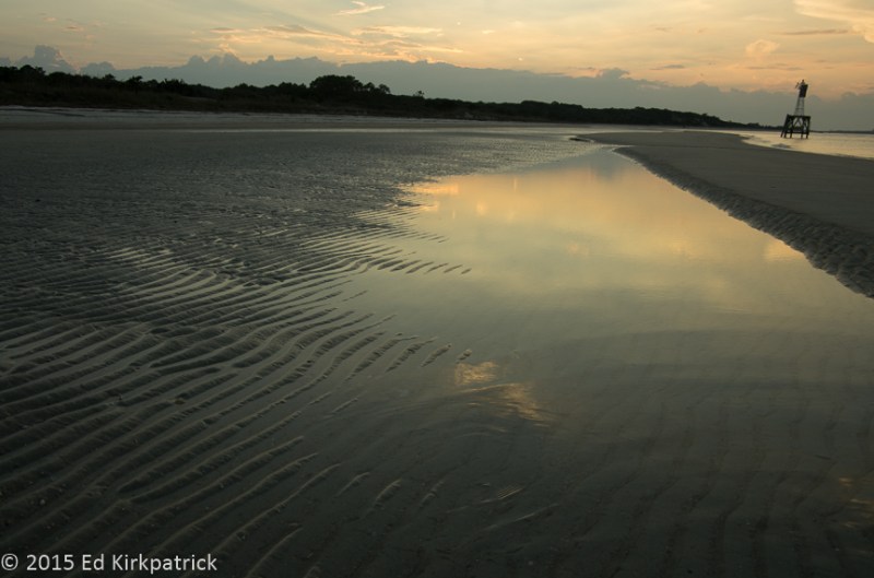
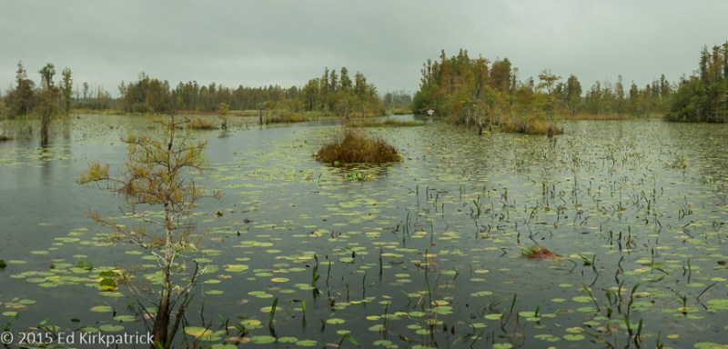
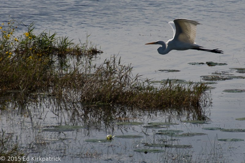
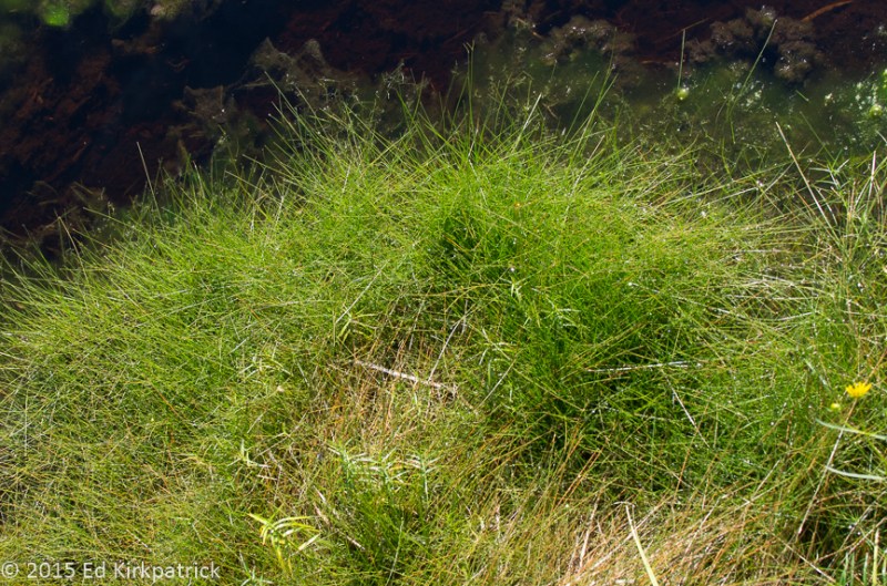
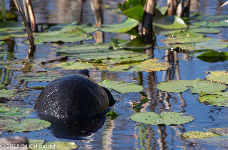
Directly across the road from the entrance on GA 121 is the Okefenokee Pastimes Campground, and we had it all to ourselves this time of year 🙂  Being the only tourists in the park, probably because it was a grey, on again off again rainy day, we took the short boat tour (90 minutes) with the cute and knowledgeable Jenn, who has lived there all her life.

20151119-_EKP3696

Jenn

Technically the Okefenokee is not a swamp but rather a bog and the source of both the St. Marys River and the Suwannee River. The majority of the area is protected as both a natural wildlife refuge and a wilderness area and in 1974 was declared a National Natural Landmark. While some might consider it forbidding and dangerous (and it is with 770 square miles of mostly unmarked waterways, Cyprus islands, peat mats, methane gas, alligators and black bears) the place is incredibly beautiful and I would love to spend a year exploring it. Maybe, someday…in the mean time put it on your MVL


20151103-_EKP3631

The beach sunset at Ft. Clinch State Park.

20151103-_EKP3589

Dining area for officers.

20151103-_EKP3592-Pano

Laundry and candle making.

20151102-_EKP3561

Sunset on the beach at Ft. Clinch State Park.

20151119-_EKP3704-Pano

Dug canal into the Okefenokee.

20151119-_EKP3649

He bite you…..

20151119-_EKP3690

Pitcher Plant

If you’re a bug these two plants will bite you too…

20151119-_EKP3678

Sundew

20151119-_EKP3691-Pano

Okefenokee Swamp

20151120-_EKP3873

3/4 mile boardwalk out to the observation tower in the swamp.  The Sun came out for us this morning.

20151120-White Egret Okefenokee-3837

From the tower…

20151120-_EKP3822

Marti calls this “Winged Victory”…

20151120-_EKP3867

Spanish Moss which is neither Spanish or moss…  it’s an epiphyte.

20151120-_EKP3857-Pano

From the tower again…

20151120-_EKP3908

Okefenokee

20151119-_EKP3752

Some kind of bird like a Cormorant, can’t remember his name. 

20151120-_EKP3911

Mr. Turtle…

20151120-_EKP3914

Need insurance?

20151120-_EKP3874

The observation tower.

Pogo_-_Earth_Day_1971_poster

and Pogo.  Walt Kelly was a genius.

History, Art, Photography, Baseball ~ Wahoo!!! Massachusetts & New York

27 Friday Nov 2015

Posted by Ed and Marti Kirkpatrick in Travels

≈ 3 Comments

Tags

Baseball Hall of Fame, Concord Mass, Cooperstown, James Fenimore Cooper, Lexington Mass, Norman Rockwell, Shelburne Falls Mass, Stockbridge Mass

After Maine we stopped for a wonderful visit with our dear friends DeWitt & Paula DeLawter in Hingham Mass. Each time we come to this lovely OLD town we’re more and more impressed.  Paula has the most civilized commute we know, about a 40 minute ferry ride into the heart of Boston, she can even have a glass of wine on the trip home! Hingham Massachusetts, on the South Shore, was incorporated in 1635 and is chock-a-block full of wonderful old homes tucked in amongst trees so thick many houses are hidden from their immediate neighbors. There is still a true New England small town feel to this delightful place, lovely walks to be had and lots of good restaurants to enjoy. We recommend a visit, oh and when you fall in love, after retirement DeWitt took up selling real estate 🙂

Saying our good-byes we headed out for Lexington and Concord to see where “the whole kerfluffle” started. Standing on the Lexington Common now know as the Battle Green, we remembered our elementary school lessons and as Emerson’s poem says “the shot heard ‘round the world”.

20151019-_EKP3463

Statue honoring the Minuteman Militia who stood up to the vaunted British Regulars on the Lexington Green on April 19, 1775.

Advancing in a much more relaxed fashion than those men long ago, we moved on to Concord and the Old North Bridge where the colonial militiamen and the British regulars actually sort of stumbled into the beginning of our war of independence. The rest as they say is history.

20151019-_EKP3478

The Old North Bridge location in Concord, Massachusetts where “the shot heard ’round the world” was fired.

For years Ed has wanted to see the Berkshires in western Mass and so even though our weather was not cooperating for a drive in these beautiful mountains

20151020-_EKP3498-Pano

The Berkshires on a rainy, foggy, misty day are still lovely.

and small towns, we headed out Rt. 2 for Shelburne Falls and Buckland. These charming towns where several movies have been shot, sit on the Deerfield River. A trolley bridge over the river connects the two communities. In 1927 the company who owned the bridge went bankrupt and it was soon a mess of weeds and neglect that couldn’t be torn down due to cost and the waterlines it carried. A Mrs. Antoinette Burnham had an idea, and with the sponsorship of the Shelburne Falls Women’s Club and all donated labor, the Bridge of Flowers was begun the spring of 1929.

20151020-_EKP3489

Marti really enjoyed the Bridge of Flowers even at the end of the season when a frost had just done in the last of the blooms.

Still maintained by the women’s club with donated labor and love this delightful garden is a wonderful example of imagination, cooperation and goodness.

On to Stockbridge and a nice B&B, The Inn at Stockbridge (RV parks were closed for the winter) we wanted to see the Norman Rockwell Museum. From an early age, just like Wyeth (see previous post) Rockwell’s paintings on each cover of the Saturday Evening Post enthralled me. Each told a clear story with perfection and humor. Lined up in rows three covers high and around three walls are 323 original tear sheet covers done from 1916 to 1963. Not only was it a delight to look at each painting but we both had a blast seeing who wrote which article about whom and the authors (C.S. Forester’s “Horatio Hornblower” stories for example) serializing their stories in the S.E.P. What a walk through history! The post covers are just the beginning of the Rockwell artwork here. Absolutely put this place on your MVL (Must Visit List).

20151020-_EKP3506

Nice camping at the Inn At Stockbridge.  We were inside…

We also visited Edith Wharton’s home The Mount and while impressed with the woman her home was a bit of a disappointment. It had next to nothing of hers in it and was only lightly decorated with some period pieces. It did however inspire me to read some of her books, well at least put them on my reading list.  We do however recommend two restaurants in Stockbridge, Once Upon A Table and The Red Lion Inn.

With the weather still rainy and grey next stop was Cooperstown, New York for one of Ed’s MVL places, The Baseball Hall of Fame, and I have to admit, especially if you love the game, this should be on your MVL too!

Ed at Cooperstown

Marti says, her sweetie at his hero Cal Ripken Jr.’s plaque in the Baseball Hall Of Fame Gallery.

I had seen on the internet that the Fenimore Museum was also in Cooperstown and suggested we go there too. It suddenly dawned on me as we parked in front of this large and lovely old home, now museum, that the name of it, in a place in New York called Cooperstown had to mean there was a “James” somewhere in there…..sure enough the home is built on the site of James Fenimore Copper’s farmhouse.   This is an excellent museum and for me the best part is the Eugene and Clare Thaw Collection of American Indian Art. Consisting of almost 850 items this collection makes the National Museum of the American Indian in Washington, D.C. pale in comparison. It is amazing! Put it on your MVL!

Last stop in New York was another place Ed’s wanted to go for years, the George Eastman House/Museum in Rochester. Located in a gorgeous part of town with huge wonderful houses on wide streets the collection of photographs and camera’s showing the history of photography is excellent. Oh, and when you go do it in the right order…counter-clockwise, oldest to newest… makes you appreciate the advancement much more 🙂 and so many seemed to go the other way around! There was also a 4 room exhibit of the work of Alvin Langdon Coburn from the late 1800”s to early 1900’s. We’d never heard of him which was almost our loss. Wonderful photographs! Put him and the Eastman House on your MVL!

Sorry for the long post, we did a lot in a short time frame and this doesn’t even cover the fun story of discovering Ed’s great, great, great, great grandparents Ziba & Lucy Newland’s graves, home and history in the small town of Hartwick just outside of Cooperstown!   Life’s an adventure!!


20151019-_EKP3470

Buckman’s Tavern was the gathering place for the militia on the morning of April 19th, 1775.

20151019-_EKP3464

Lexington Common, the site of the first skirmish with the British.

20151019-_EKP3477

The Old North Bridge in Concord, Massachusetts.

20151020-_EKP3490

The Bridge of Flowers on the left and the current bridge over the Deerfield River which we could not cross because we are too high and it’s too short…

20151020-_EKP3484

Glacial potholes formed in the granite riverbed on the Deerfield River in Shelburne Falls, Massachusetts.  These holes are 6″ to 39″ wide with the latter being some of the largest in the world.

20151020-_EKP3497

Street scene in Shelburne Falls, Mass.

20151022-_EKP3511-Pano

In the Catskill Mountains in New York looking for Rip van Winkle.

20151023-_EKP3516

Ziba and Lucy how we miss you….


Maine – Ahh Yep! You can get there from here.

29 Thursday Oct 2015

Posted by Ed and Marti Kirkpatrick in Travels

≈ 11 Comments

Tags

Andrew Wyeth, Belfast Maine, Campobello Island, Farnsworth Museum, Leaves, Lubec, Maine

For years one of our absolute favorite places is the State of Maine. In fact living there has been a serious consideration ever since our second visit (our first “visit” spring of 1978 was to stop on the side of the road so Ed could fry and eat the trout I’d caught in New Hampshire ~ long story). We’re still thinking about a six month rental there someday.

This trip we came from Quebec crossing the border (22 miles north of Jackman) at Canada’s 173 & US Route 201. This part of Maine and Canada is heavily wooded timber country and there were logging and lumber trucks going both directions. It’s great there’s shared commerce but it seems odd to us that both countries import/export what both have right in the same neck of their woods. The fall colors were lovely and at The Forks US Route 201 runs along the Kennebec River which just adds to the beauty.

Wyman Lake Maine on the Kennebec River

Wyman Lake Maine on the Kennebec River

We stopped for the night in Skowhegan and the next morning being a laundry day (Mr. Bubbles Laundromat is fine if you’re in need) we enjoyed this nice little town and highly recommend both the artist co-op River Roads Artisans Gallery and The Bankery a bakery in an old bank.

Heading for Down East we continued south (confused yet) on back roads until picking up US Rt. 1 and crossing at the Penobscot Narrows Bridge on our way to the Ellsworth/Trenton area for the night.

Penobscot Narrows Bridge

Penobscot Narrows Bridge

While we did not take the time this trip, put this bridge and its observation tower (on a clear day they say you can see Mt. Katahdin 94 miles to the north) and its neighbor Fort Knox on your MVL (must visit list). They are both excellent!

Most folks pretty much stop their Maine trips around Acadia National Park and Bar Harbor. We have spent many wonderful times there and it is absolutely an MVL. The views, the hiking, the views, the sounds of the Atlantic, the views/hiking….fabulous, but this time we were going back to another of our favorite places. REALLY Down East, the town of Lubec is the furthest east one can go in the USA, and surprisingly in the contiguous United States the closest spot to Africa! This quaint fishing village has good places to eat, a fun market day, friendly people, an impressive 17 foot tide that brings in seals and whales chasing huge schools of fish, a good campground and the border crossing to Campobello Island, New Brunswick. Oh, and Quoddy Head Light complete with a nice mile long walk through the balsam fir woods or a low tide walk on the rocky shoreline. We love Lubec and would suggest it for your MVL, but sorta want to keep it a secret 🙂

Incoming Lubec tide looking over to Campobello Island,New Brunswick, Canada

Incoming Lubec tide looking over to Campobello Island,New Brunswick, Canada. See the seals?

At the street fair on Saturday, Ed helps out making cider.  It was sour...

At the street fair on Saturday, Ed helps out making cider. It was sour…

Kids Fishing for Pollock in Cutler Harbor

Kids Fishing for Pollock in Cutler Harbor

Back down US 1 with a swing down St. Rt. 191 to Cutler another fishing village not on many folk’s radar we were headed to Belfast for a couple days visit with our good friend Susie Dexter and doggy Godfrey.  Belfast is on our short list of places to live… at least in the warmer months 🙂   It has good places to eat, history, several book stores, friendly folks, local town feel rather than tourist feel, and good proximity to many wonderful places to hike.

Belfast Harbor

Belfast Harbor

Back out on the road on our way south we stopped in Rockland at the Farnsworth Museum and their wonderful collection of Wyeth paintings. We have been here before and it should be on your MVL too. Andrew Wyeth is one of our favorite artists and his father N.C.’s illustrations for Treasure Island, Kidnapped, Robinson Crusoe etc. are some of the first artworks that I remember and loved. Andrew’s son Jamie’s beautiful art is also represented here.

This pretty much covers our Maine visit this time. We could write pages and pages about the state and fill a book with Ed’s gorgeous photographs from our trips over the years in this magnificent place.   Although we didn’t do it much this time, if you come Down East be sure to drive up and down as many “fingers” as possible. The extra time involved is well worth it!


Dining room at the Roosevelt Cottage on Campobello Island.  The summered here for many years.

Dining room at the Roosevelt Cottage on Campobello Island. They summered here for many years.

Light on Campobello Island

Light on Campobello Island and warning signs about the tidal swing at the stairs.

Quoddy Head Light is the closest point of the contiguous US to the African Continent.  It's true...

Quoddy Head Light is the closest point of the contiguous US to the African Continent. It’s true…

Wild blueberry fields are all across Maine.  44,000 acres of them. Yummm

Wild blueberry fields are all across Maine. 44,000 acres of them. Yummm

Fish chowder at Uncle Kippy's in Lubec.  It was ALL haddock...

Fish chowder at Uncle Kippy’s in Lubec. It was ALL haddock…

The beautiful twilight sky at our campsite in Lubec.

The beautiful twilight sky at our campsite in Lubec.

Fall colors in Maine

Fall colors in Maine

A riot of fall colors

A riot of fall colors

Walk along a tidal forest in Maine.

Walk along a tidal forest in Maine.

This is why we love Maine and lobster of course...

This is why we love Maine, this and lobster of course…

← Older posts
Newer posts →

Enter your email address to follow this blog and receive notifications of new posts by email.

Join 183 other subscribers

View Recent Posts

  • Cod Jigging and New Friends! March 2, 2020
  • Grand Tetons ~ Yellowstone October 11, 2019
  • Beauty & Bones ~ Dinosaur National Monument September 29, 2019
  • Wyoming ~ In the Medicine Bow Corner September 25, 2019
  • A Bit of Western Nebraska September 5, 2019

Get Caught Up

Blogs We Follow

  • john pavlovitz
  • Take To The Highway
  • Kelly Time
  • HowToRVgeeks
  • WANDERTOPIA
  • BoomerCafe ... it's your place
  • Island Girl Walkabout
  • Страничка Доброго Дяди
  • Technomadia
  • Wheeling It: Tales From a Nomadic Life

Categories

Blog Stats

  • 27,390 hits

Blog at WordPress.com.

john pavlovitz

Take To The Highway

Kelly Time

HowToRVgeeks

WANDERTOPIA

BoomerCafe ... it's your place

Island Girl Walkabout

Страничка Доброго Дяди

Technomadia

Adventures in Nomadic Serendipity

Wheeling It: Tales From a Nomadic Life

On the Road Since 2010, Traveling Across USA & Europe With Pets

  • Subscribe Subscribed
    • Whack-A-Mole Wheels
    • Join 183 other subscribers
    • Already have a WordPress.com account? Log in now.
    • Whack-A-Mole Wheels
    • Subscribe Subscribed
    • Sign up
    • Log in
    • Report this content
    • View site in Reader
    • Manage subscriptions
    • Collapse this bar
 

Loading Comments...